
Presidential Towers
555 W Madison St,
Chicago, IL 60661
$1,585 - $9,365
Studio - 2 Beds

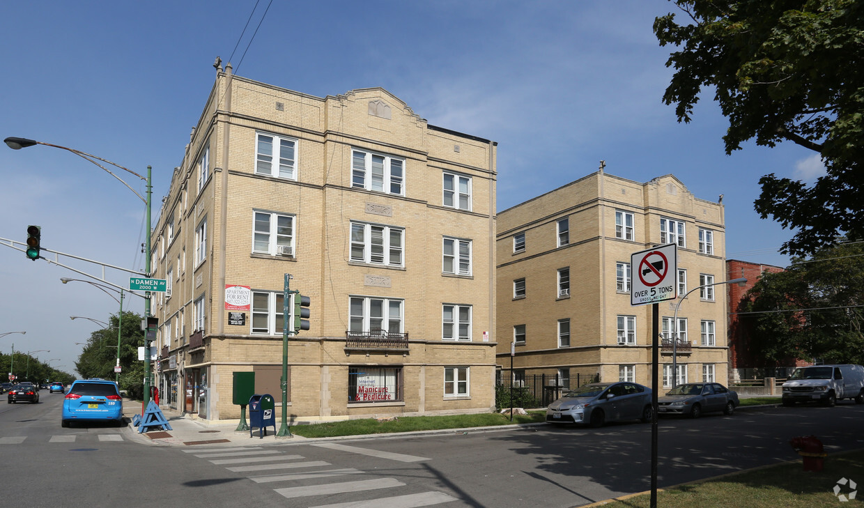
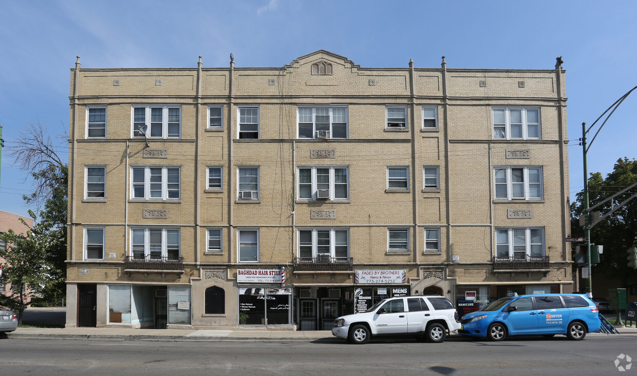

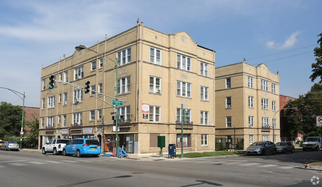
Experience your new apartment at 2000-2006 W Devon Ave in Chicago, IL. In Chicago's 60659 Zip code, living here gives you a wide variety of nearby experiences to check out. Come by to see the available floorplan options. Here at this community, the leasing staff is ready and waiting to help you find your perfect place. Experience a new standard at 2000-2006 W Devon Ave.
2000-2006 W Devon Ave is an apartment community located in Cook County and the 60659 ZIP Code. This area is served by the Chicago Public Schools attendance zone.
Refrigerator
Tub/Shower
Heating
Range
West Ridge Park is located on the far north side of Chicago, an upscale community encompassed with tree-lined streets, multicultural establishments, and historic homes.
Many diverse restaurants can be found along West Devon Avenue, which is a couple of blocks south of Robert A. Black Golf Course. Many green spaces make up West Rogers Park, including Mather Park and Indian Boundary Park.
Residents of this lush Chicago community enjoy proximity to Rogers Park Train Station, Loyola Beach, and Lincoln Town Center mall.
Learn more about living in West Rogers Park| Colleges & Universities | Distance | ||
|---|---|---|---|
| Colleges & Universities | Distance | ||
| Drive: | 3 min | 1.4 mi | |
| Drive: | 7 min | 3.2 mi | |
| Drive: | 7 min | 3.3 mi | |
| Drive: | 7 min | 3.5 mi |

Transportation options available in Chicago include Loyola Station, located 1.3 miles from 2000-2006 W Devon Ave. 2000-2006 W Devon Ave is near Chicago O'Hare International, located 13.5 miles or 24 minutes away, and Chicago Midway International, located 21.4 miles or 32 minutes away.
| Transit / Subway | Distance | ||
|---|---|---|---|
| Transit / Subway | Distance | ||
|
|
Drive: | 3 min | 1.3 mi |
|
|
Drive: | 3 min | 1.4 mi |
|
|
Drive: | 5 min | 1.8 mi |
|
|
Drive: | 4 min | 2.1 mi |
|
|
Drive: | 5 min | 2.3 mi |
| Commuter Rail | Distance | ||
|---|---|---|---|
| Commuter Rail | Distance | ||
| Walk: | 13 min | 0.7 mi | |
|
|
Drive: | 4 min | 1.4 mi |
|
|
Drive: | 6 min | 3.0 mi |
|
|
Drive: | 7 min | 3.1 mi |
|
|
Drive: | 7 min | 4.0 mi |
| Airports | Distance | ||
|---|---|---|---|
| Airports | Distance | ||
|
Chicago O'Hare International
|
Drive: | 24 min | 13.5 mi |
|
Chicago Midway International
|
Drive: | 32 min | 21.4 mi |
Time and distance from 2000-2006 W Devon Ave.
| Shopping Centers | Distance | ||
|---|---|---|---|
| Shopping Centers | Distance | ||
| Walk: | 6 min | 0.3 mi | |
| Walk: | 15 min | 0.8 mi | |
| Drive: | 4 min | 1.5 mi |
| Parks and Recreation | Distance | ||
|---|---|---|---|
| Parks and Recreation | Distance | ||
|
Warren Park
|
Walk: | 15 min | 0.8 mi |
|
Touhy Park
|
Drive: | 4 min | 1.9 mi |
|
Rogers Park
|
Drive: | 5 min | 2.1 mi |
|
Winnemac Park
|
Drive: | 6 min | 2.5 mi |
|
Chase Park
|
Drive: | 5 min | 2.6 mi |
| Hospitals | Distance | ||
|---|---|---|---|
| Hospitals | Distance | ||
| Drive: | 4 min | 2.1 mi | |
| Drive: | 5 min | 2.2 mi | |
| Drive: | 5 min | 2.6 mi |
| Military Bases | Distance | ||
|---|---|---|---|
| Military Bases | Distance | ||
| Drive: | 32 min | 21.1 mi |
What Are Walk Score®, Transit Score®, and Bike Score® Ratings?
Walk Score® measures the walkability of any address. Transit Score® measures access to public transit. Bike Score® measures the bikeability of any address.
What is a Sound Score Rating?
A Sound Score Rating aggregates noise caused by vehicle traffic, airplane traffic and local sources
2000-2006 W Devon Ave
Chicago, IL 60659


