$5,300 / Month
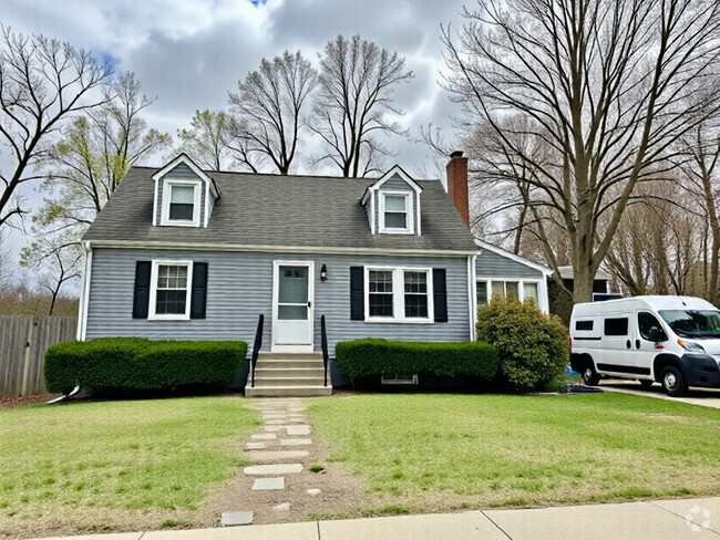
20 Tappan Rd
Wellesley, MA 02482
2 Weeks Ago
Favorites
20 Tappan Rd

Favorites
Check Back Soon for Upcoming Availability
| Beds | Baths | Average SF |
|---|---|---|
| 3 Bedrooms 3 Bedrooms 3 Br | 3 Baths 3 Baths 3 Ba | — |
About This Property
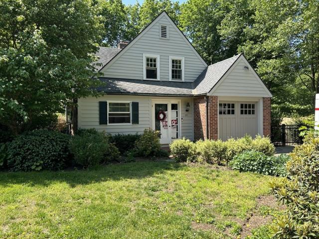
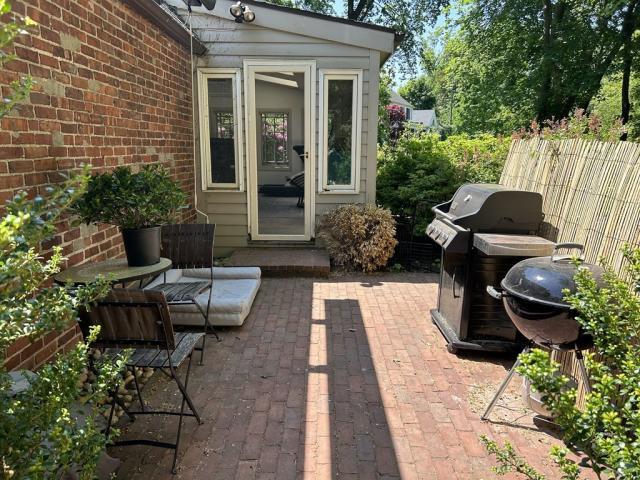
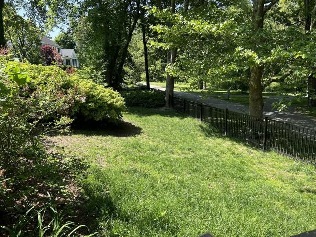
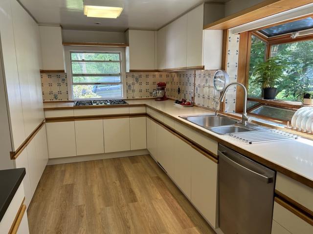
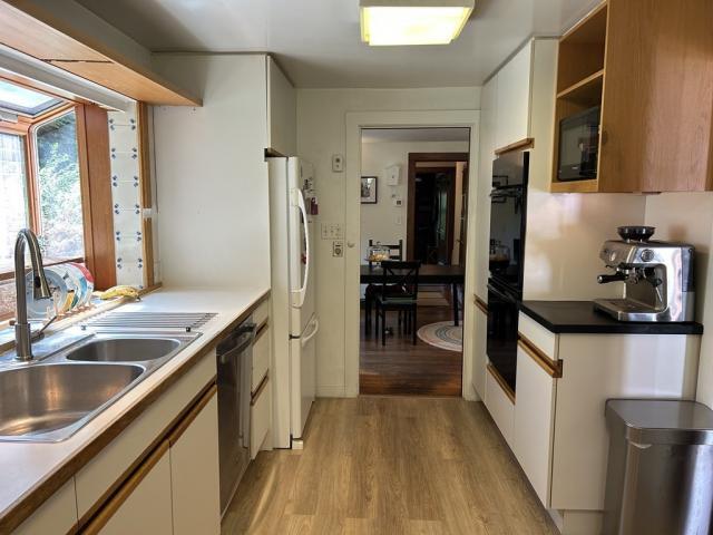
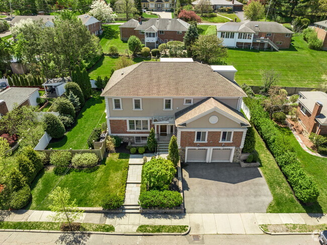
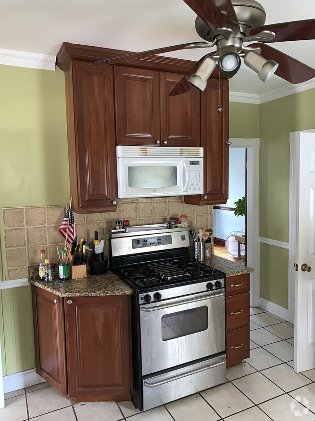
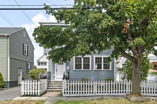
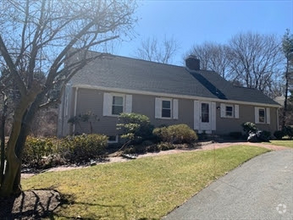
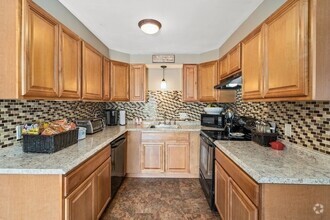
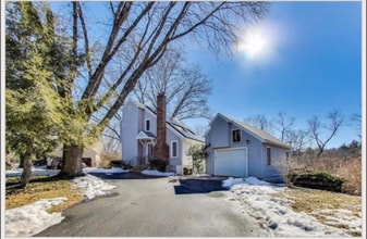
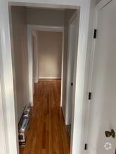
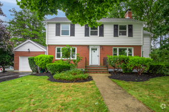
APS64400158 - The Brook Path will lead you home to this storybook Cape now available for Rent. Greet each day with coffee in the glorious sunroom with a wall of windows over looking the fenced in yard, brick patio & Brook Path. The flexible floor plan allows for first floor living with Living/Dining Rooms, kitchen, a full bath, bedroom and home office. The Second with 2 generous bedrooms, 1.5 baths and washer & dryer. 1 car attached garage and fantastic storage in the unfinished basement. Recent improvements include a new boiler, dishwasher, kitchen floor, washing machine and freshly painted exterior and interior rooms. Charming home in an excellent location, convenient to all the best Wellesley has to offer!
20 Tappan Rd is a house located in Norfolk County and the 02482 ZIP Code.
Location
Get Directions
Just west of Boston and East of Worcester sits Metro West, a region that houses a group of towns and cities with significant historical backgrounds. A total of 19 municipalities make up the core of this community, but other municipalities are considered to be a part of the Interstate 495/Metro West Corridor.
Learn more about living in Metro WestBelow are rent ranges for similar nearby apartments
| Beds | Average Size | Lowest | Typical | Premium |
|---|---|---|---|---|
| Studio Studio Studio | 525-528 Sq Ft | $895 | $2,558 | $7,250 |
| 1 Bed 1 Bed 1 Bed | 793-795 Sq Ft | $1,495 | $3,021 | $10,781 |
| 2 Beds 2 Beds 2 Beds | 1157-1159 Sq Ft | $1,850 | $3,654 | $15,521 |
| 3 Beds 3 Beds 3 Beds | 1614-1619 Sq Ft | $2,190 | $5,053 | $22,375 |
| 4 Beds 4 Beds 4 Beds | 3522 Sq Ft | $1,050 | $6,239 | $20,000 |
Education
| Colleges & Universities | Distance | ||
|---|---|---|---|
| Colleges & Universities | Distance | ||
| Drive: | 5 min | 1.3 mi | |
| Drive: | 5 min | 1.8 mi | |
| Drive: | 16 min | 7.1 mi | |
| Drive: | 18 min | 9.3 mi |
20 Tappan Rd is within 5 minutes or 1.3 miles from Wellesley College. It is also near Babson College and Brandeis University.
Transportation options available in Wellesley include Woodland Station, located 4.6 miles from 20 Tappan Rd. 20 Tappan Rd is near General Edward Lawrence Logan International, located 18.6 miles or 31 minutes away, and Worcester Regional, located 32.7 miles or 56 minutes away.
| Transit / Subway | Distance | ||
|---|---|---|---|
| Transit / Subway | Distance | ||
|
|
Drive: | 9 min | 4.6 mi |
|
|
Drive: | 11 min | 4.7 mi |
|
|
Drive: | 10 min | 5.3 mi |
|
|
Drive: | 12 min | 5.9 mi |
|
|
Drive: | 12 min | 6.1 mi |
| Commuter Rail | Distance | ||
|---|---|---|---|
| Commuter Rail | Distance | ||
|
|
Drive: | 3 min | 1.2 mi |
|
|
Drive: | 4 min | 2.1 mi |
|
|
Drive: | 8 min | 3.4 mi |
|
|
Drive: | 7 min | 3.5 mi |
|
|
Drive: | 8 min | 3.8 mi |
| Airports | Distance | ||
|---|---|---|---|
| Airports | Distance | ||
|
General Edward Lawrence Logan International
|
Drive: | 31 min | 18.6 mi |
|
Worcester Regional
|
Drive: | 56 min | 32.7 mi |
Time and distance from 20 Tappan Rd.
| Shopping Centers | Distance | ||
|---|---|---|---|
| Shopping Centers | Distance | ||
| Drive: | 3 min | 1.2 mi | |
| Drive: | 4 min | 1.4 mi | |
| Drive: | 4 min | 1.7 mi |
20 Tappan Rd has 3 shopping centers within 1.7 miles, which is about a 4-minute drive. The miles and minutes will be for the farthest away property.
| Parks and Recreation | Distance | ||
|---|---|---|---|
| Parks and Recreation | Distance | ||
|
Whitin Observatory
|
Drive: | 4 min | 1.2 mi |
|
Wellesley College Botanic Gardens
|
Drive: | 3 min | 1.5 mi |
|
Weezie's Garden for Children
|
Drive: | 8 min | 2.5 mi |
|
Elm Bank Reservation
|
Drive: | 8 min | 2.5 mi |
|
Horticultural Society at Elm Bank
|
Drive: | 8 min | 2.7 mi |
20 Tappan Rd has 5 parks within 2.7 miles, including Whitin Observatory, Wellesley College Botanic Gardens, and Horticultural Society at Elm Bank.
| Hospitals | Distance | ||
|---|---|---|---|
| Hospitals | Distance | ||
| Drive: | 8 min | 3.7 mi | |
| Drive: | 8 min | 4.3 mi | |
| Drive: | 16 min | 7.6 mi |
20 Tappan Rd has 3 hospitals within 7.6 miles, the nearest is Beth Israel Deaconess Hospital - Needham which is 3.7 miles away and a 8 minute drive.
| Military Bases | Distance | ||
|---|---|---|---|
| Military Bases | Distance | ||
| Drive: | 9 min | 4.4 mi | |
| Drive: | 26 min | 14.5 mi |
20 Tappan Rd is 4.4 miles from US Military Reservation, and is convenient to other military bases, including Hanscom Air Force Base.
You May Also Like
Similar Rentals Nearby
What Are Walk Score®, Transit Score®, and Bike Score® Ratings?
Walk Score® measures the walkability of any address. Transit Score® measures access to public transit. Bike Score® measures the bikeability of any address.
What is a Sound Score Rating?
A Sound Score Rating aggregates noise caused by vehicle traffic, airplane traffic and local sources

20 Tappan Rd
Wellesley, MA 02482