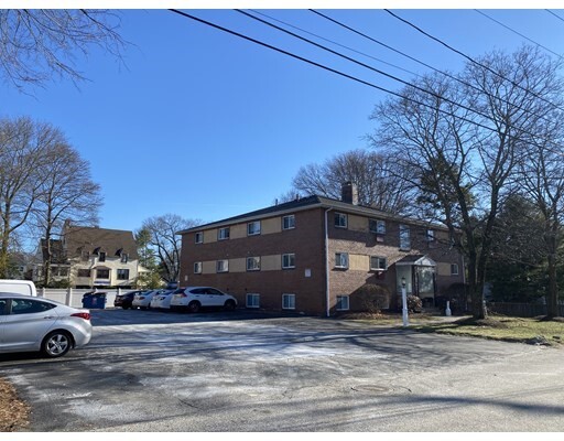
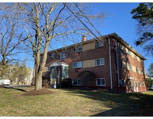
20 Stony Brook Rd Unit 5
Framingham, MA 01702
Check Back Soon for Upcoming Availability
| Beds | Baths | Average SF |
|---|---|---|
| 2 Bedrooms 2 Bedrooms 2 Br | 1 Bath 1 Bath 1 Ba | — |
Fees and Policies
The fees listed below are community-provided and may exclude utilities or add-ons. All payments are made directly to the property and are non-refundable unless otherwise specified.
Details
Utilities Included
-
Water
-
Heat
-
Trash Removal
-
Sewer
About This Property
Available NOW! Heat, hot water and water/sewer are all included in rent. Tenants pay for electric bill and cable/internet. Parking for 2 cars in the lot. Coin op laundry on lower level of building. Hardwood floors in living room and bedrooms. Eat in kitchen with plenty of room for table/chairs. Small apartment building located just off Route 9 Eastbound across from WholeFoods market. Sorry, no pets and no smoking.
20 Stony Brook Rd is a condo located in Middlesex County and the 01702 ZIP Code. This area is served by the Framingham attendance zone.
Condo Features
Air Conditioning
Dishwasher
Microwave
Refrigerator
- Air Conditioning
- Dishwasher
- Microwave
- Range
- Refrigerator
Just west of Boston and East of Worcester sits Metro West, a region that houses a group of towns and cities with significant historical backgrounds. A total of 19 municipalities make up the core of this community, but other municipalities are considered to be a part of the Interstate 495/Metro West Corridor.
Learn more about living in Metro WestBelow are rent ranges for similar nearby apartments
| Beds | Average Size | Lowest | Typical | Premium |
|---|---|---|---|---|
| Studio Studio Studio | 516-518 Sq Ft | $1,475 | $2,275 | $7,439 |
| 1 Bed 1 Bed 1 Bed | 840-842 Sq Ft | $975 | $2,733 | $10,477 |
| 2 Beds 2 Beds 2 Beds | 1177-1178 Sq Ft | $1,700 | $3,357 | $13,329 |
| 3 Beds 3 Beds 3 Beds | 1511-1514 Sq Ft | $2,400 | $4,682 | $18,517 |
| 4 Beds 4 Beds 4 Beds | 3498 Sq Ft | $1,010 | $6,319 | $32,681 |
- Air Conditioning
- Dishwasher
- Microwave
- Range
- Refrigerator
| Colleges & Universities | Distance | ||
|---|---|---|---|
| Colleges & Universities | Distance | ||
| Drive: | 5 min | 2.8 mi | |
| Drive: | 15 min | 7.7 mi | |
| Drive: | 15 min | 8.6 mi | |
| Drive: | 20 min | 12.1 mi |
The GreatSchools Rating helps parents compare schools within a state based on a variety of school quality indicators and provides a helpful picture of how effectively each school serves all of its students. Ratings are on a scale of 1 (below average) to 10 (above average) and can include test scores, college readiness, academic progress, advanced courses, equity, discipline and attendance data. We also advise parents to visit schools, consider other information on school performance and programs, and consider family needs as part of the school selection process.
View GreatSchools Rating Methodology
Data provided by GreatSchools.org © 2026. All rights reserved.
Transportation options available in Framingham include Woodland Station, located 10.0 miles from 20 Stony Brook Rd Unit 5. 20 Stony Brook Rd Unit 5 is near General Edward Lawrence Logan International, located 24.2 miles or 35 minutes away, and Worcester Regional, located 26.8 miles or 46 minutes away.
| Transit / Subway | Distance | ||
|---|---|---|---|
| Transit / Subway | Distance | ||
|
|
Drive: | 17 min | 10.0 mi |
|
|
Drive: | 18 min | 10.7 mi |
|
|
Drive: | 18 min | 11.1 mi |
| Commuter Rail | Distance | ||
|---|---|---|---|
| Commuter Rail | Distance | ||
|
|
Drive: | 5 min | 2.3 mi |
|
|
Drive: | 6 min | 2.5 mi |
|
|
Drive: | 8 min | 3.4 mi |
|
|
Drive: | 7 min | 4.5 mi |
|
|
Drive: | 19 min | 6.3 mi |
| Airports | Distance | ||
|---|---|---|---|
| Airports | Distance | ||
|
General Edward Lawrence Logan International
|
Drive: | 35 min | 24.2 mi |
|
Worcester Regional
|
Drive: | 46 min | 26.8 mi |
Time and distance from 20 Stony Brook Rd Unit 5.
| Shopping Centers | Distance | ||
|---|---|---|---|
| Shopping Centers | Distance | ||
| Drive: | 2 min | 1.3 mi | |
| Drive: | 4 min | 1.4 mi | |
| Drive: | 4 min | 2.3 mi |
| Parks and Recreation | Distance | ||
|---|---|---|---|
| Parks and Recreation | Distance | ||
|
Callahan State Park
|
Drive: | 9 min | 4.6 mi |
|
Hop Brook Natural Area
|
Drive: | 9 min | 4.9 mi |
|
Cowassock Woods and Ashland Town Forest
|
Drive: | 10 min | 5.0 mi |
|
Garden in the Woods
|
Drive: | 11 min | 5.5 mi |
|
Cochituate State Park
|
Drive: | 16 min | 10.5 mi |
| Hospitals | Distance | ||
|---|---|---|---|
| Hospitals | Distance | ||
| Drive: | 4 min | 1.3 mi | |
| Drive: | 18 min | 10.5 mi | |
| Drive: | 21 min | 11.5 mi |
| Military Bases | Distance | ||
|---|---|---|---|
| Military Bases | Distance | ||
| Drive: | 7 min | 4.1 mi | |
| Drive: | 31 min | 16.7 mi |
You May Also Like
Similar Rentals Nearby
-
3 Beds$4,000Total Monthly Price12 Month LeaseTotal Monthly Price NewPrices include all required monthly fees.
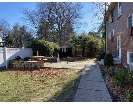
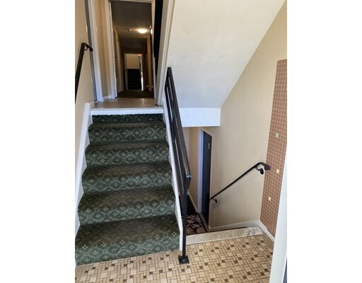
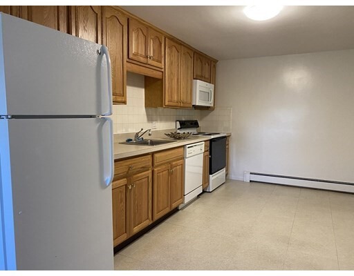
Condo for Rent
-
-
-
-
-
-
-
-
-
What Are Walk Score®, Transit Score®, and Bike Score® Ratings?
Walk Score® measures the walkability of any address. Transit Score® measures access to public transit. Bike Score® measures the bikeability of any address.
What is a Sound Score Rating?
A Sound Score Rating aggregates noise caused by vehicle traffic, airplane traffic and local sources.