

$5,200 / Month
20 Mayfield St
Boston, MA 02125
Today
Favorites
-
Bedrooms
5
-
Bathrooms
2
-
Square Feet
--
20 Mayfield St

Favorites
About This Home
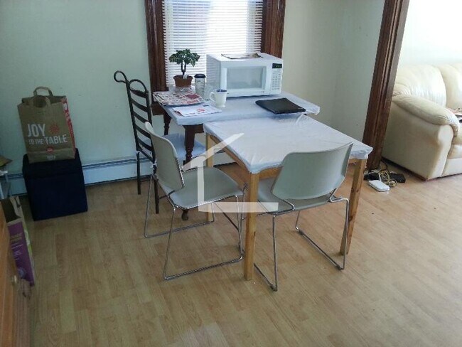
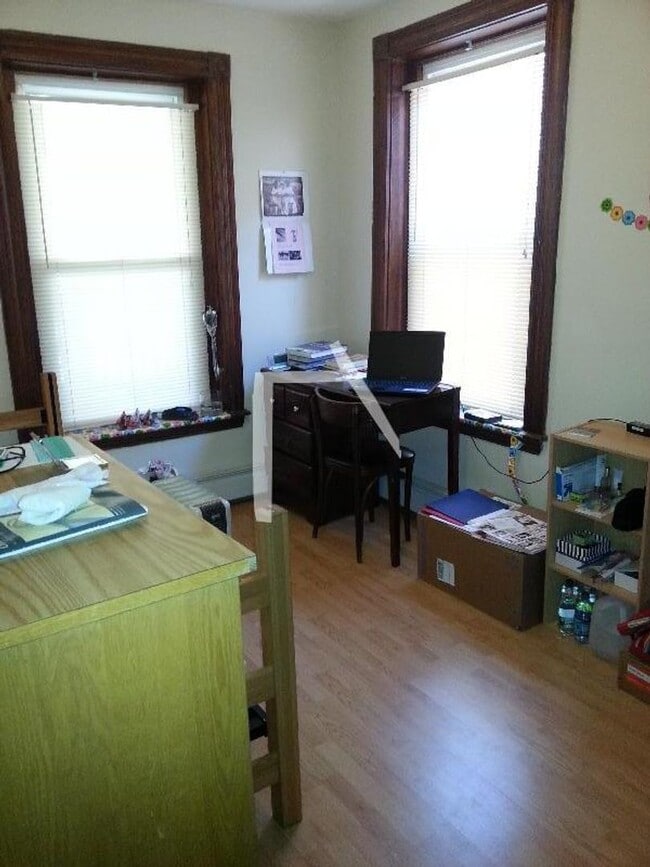
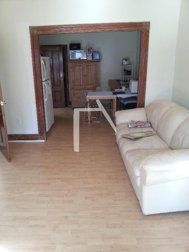
This large 5 bed 2 bath unit in Boston's beautiful Fort Hill neighborhood features -Hardwood floors -High Ceilings -Laundry in building Available 9/1
20 Mayfield St is a condo located in Suffolk County and the 02125 ZIP Code.
* Price shown is base rent and may not include non-optional fees and utilities.
Price, availability, fees, and any applicable rent special are subject to change without notice.
* Square footage definitions vary. Displayed square footage is approximate.
Contact
- Listed by Modern Real Estate (AD) | Modern Real Estate (AD)
Location
Get Directions
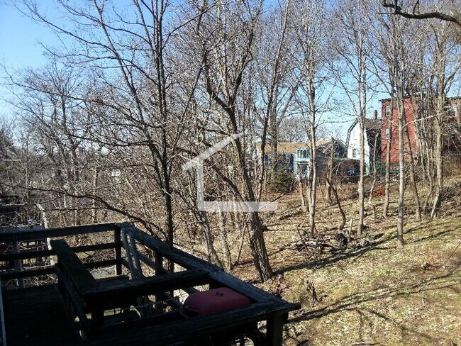
Twenty minutes southwest of downtown Boston sits Highland Park, a primarily- residential neighborhood full of beautiful historic homes and apartments along tree-lined streets. The community features over a dozen parks and public green spaces, giving all residents easy access to trails, playgrounds, and historic sites wherever they may live.
The local dining scene is quite unique, with several African and Middle Eastern restaurants and cafes around the neighborhood. MBTA rail service on the west side of the neighborhood makes it easy for folks to get around the city for or leisure.
Learn more about living in Highland Park
Education
| Colleges & Universities | Distance | ||
|---|---|---|---|
| Colleges & Universities | Distance | ||
| Drive: | 5 min | 1.6 mi | |
| Drive: | 7 min | 2.8 mi | |
| Drive: | 7 min | 3.1 mi | |
| Drive: | 7 min | 3.3 mi |
20 Mayfield St is within 5 minutes or 1.6 miles from UMass Boston. It is also near Northeastern University and Wentworth Inst. of Technology.
Transportation options available in Boston include Andrew Station, located 1.2 miles from 20 Mayfield St. 20 Mayfield St is near General Edward Lawrence Logan International, located 6.2 miles or 12 minutes away.
| Transit / Subway | Distance | ||
|---|---|---|---|
| Transit / Subway | Distance | ||
|
|
Drive: | 3 min | 1.2 mi |
|
|
Drive: | 2 min | 1.3 mi |
|
|
Drive: | 4 min | 1.3 mi |
|
|
Drive: | 5 min | 1.9 mi |
|
|
Drive: | 4 min | 2.2 mi |
| Commuter Rail | Distance | ||
|---|---|---|---|
| Commuter Rail | Distance | ||
|
|
Walk: | 11 min | 0.6 mi |
|
|
Walk: | 16 min | 0.8 mi |
| Walk: | 19 min | 1.0 mi | |
| Drive: | 4 min | 1.7 mi | |
| Drive: | 6 min | 2.5 mi |
| Airports | Distance | ||
|---|---|---|---|
| Airports | Distance | ||
|
General Edward Lawrence Logan International
|
Drive: | 12 min | 6.2 mi |
Time and distance from 20 Mayfield St.
| Shopping Centers | Distance | ||
|---|---|---|---|
| Shopping Centers | Distance | ||
| Walk: | 15 min | 0.8 mi | |
| Drive: | 3 min | 1.1 mi | |
| Drive: | 5 min | 1.8 mi |
20 Mayfield St has 3 shopping centers within 1.8 miles, which is about a 5-minute walk. The miles and minutes will be for the farthest away property.
| Parks and Recreation | Distance | ||
|---|---|---|---|
| Parks and Recreation | Distance | ||
|
Dorchester Shores Reservation
|
Drive: | 3 min | 1.3 mi |
|
Lower Neponset River Trail
|
Drive: | 5 min | 2.1 mi |
|
Franklin Park Zoo
|
Drive: | 4 min | 2.2 mi |
|
Roxbury Heritage State Park
|
Drive: | 5 min | 2.4 mi |
|
Squantum Point Park
|
Drive: | 12 min | 4.5 mi |
20 Mayfield St has 5 parks within 4.5 miles, including Dorchester Shores Reservation, Lower Neponset River Trail, and Franklin Park Zoo.
| Hospitals | Distance | ||
|---|---|---|---|
| Hospitals | Distance | ||
| Drive: | 4 min | 1.8 mi | |
| Drive: | 4 min | 2.0 mi | |
| Drive: | 6 min | 2.7 mi |
20 Mayfield St has 3 hospitals within 2.7 miles, the nearest is Boston Medical Center which is 1.8 miles away and a 4 minute drive.
You May Also Like
Similar Rentals Nearby


What Are Walk Score®, Transit Score®, and Bike Score® Ratings?
Walk Score® measures the walkability of any address. Transit Score® measures access to public transit. Bike Score® measures the bikeability of any address.
What is a Sound Score Rating?
A Sound Score Rating aggregates noise caused by vehicle traffic, airplane traffic and local sources
20 Mayfield St
Boston, MA 02125