
$4,200 / Month
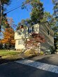
2 Marigold Ave
Wellesley, MA 02482
2 Weeks Ago
Favorites
2 Marigold Ave

Favorites
Check Back Soon for Upcoming Availability
| Beds | Baths | Average SF |
|---|---|---|
| 4 Bedrooms 4 Bedrooms 4 Br | 1.5 Baths 1.5 Baths 1.5 Ba | 1,400 SF |
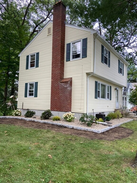
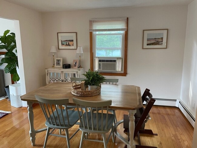
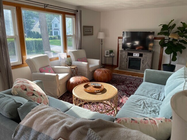
About This Property
Top condition 4 bed room,single family,1.5 bath on the corner of a cul-de- sac. Great location with easy access to Routes 9,16 & 30. Updated kitchen and baths. Insulated windows Finished basement with large laundry/storage room. Available Now
2 Marigold Ave is a house located in Norfolk County and the 02482 ZIP Code. This area is served by the Wellesley attendance zone.
Location
Get Directions
Just west of Boston and East of Worcester sits Metro West, a region that houses a group of towns and cities with significant historical backgrounds. A total of 19 municipalities make up the core of this community, but other municipalities are considered to be a part of the Interstate 495/Metro West Corridor.
Learn more about living in Metro WestBelow are rent ranges for similar nearby apartments
| Beds | Average Size | Lowest | Typical | Premium |
|---|---|---|---|---|
| Studio Studio Studio | 529-532 Sq Ft | $1,400 | $2,515 | $8,050 |
| 1 Bed 1 Bed 1 Bed | 832-834 Sq Ft | $1,250 | $3,017 | $10,268 |
| 2 Beds 2 Beds 2 Beds | 1210-1212 Sq Ft | $2,000 | $3,700 | $15,476 |
| 3 Beds 3 Beds 3 Beds | 1658-1662 Sq Ft | $2,000 | $4,746 | $15,246 |
| 4 Beds 4 Beds 4 Beds | 3308 Sq Ft | $1,075 | $6,753 | $20,000 |
Education
| Colleges & Universities | Distance | ||
|---|---|---|---|
| Colleges & Universities | Distance | ||
| Drive: | 8 min | 3.3 mi | |
| Drive: | 9 min | 4.2 mi | |
| Drive: | 14 min | 6.6 mi | |
| Drive: | 12 min | 6.8 mi |
2 Marigold Ave is within 8 minutes or 3.3 miles from Wellesley College. It is also near Babson College and Brandeis University.
Schools


Public Elementary School
Grades PK-3
320 Students
Nearby
Public Elementary School
Grades K-5
206 Students
Attendance Zone
Public Middle School
Grades 6-8
922 Students
Attendance Zone
Public High School
Grades 9-12
1,412 Students
Attendance Zone
Private Elementary & Middle School
Grades PK-8
185 Students
Nearby
Private Elementary School
Grades 5-6
11 Students
Nearby
Private Middle & High School
Grades 6-12
496 Students
Nearby
School data provided by
 The GreatSchools Rating helps parents compare schools within a state based on a variety of school quality indicators and provides a helpful picture of how effectively each school serves all of its students. Ratings are on a scale of 1 (below average) to 10 (above average) and can include test scores, college readiness, academic progress, advanced courses, equity, discipline and attendance data. We also advise parents to visit schools, consider other information on school performance and programs, and consider family needs as part of the school selection process.
View GreatSchools Rating Methodology
Data provided by GreatSchools.org © 2025. All rights reserved.
View GreatSchools Rating Methodology
Data provided by GreatSchools.org © 2025. All rights reserved.
Transportation options available in Wellesley include Riverside, located 5.7 miles from 2 Marigold Ave. 2 Marigold Ave is near General Edward Lawrence Logan International, located 19.6 miles or 32 minutes away, and Worcester Regional, located 30.8 miles or 52 minutes away.
| Transit / Subway | Distance | ||
|---|---|---|---|
| Transit / Subway | Distance | ||
| Drive: | 12 min | 5.7 mi | |
| Drive: | 10 min | 5.7 mi | |
| Drive: | 12 min | 6.4 mi | |
| Drive: | 13 min | 7.0 mi | |
| Drive: | 13 min | 7.3 mi |
| Commuter Rail | Distance | ||
|---|---|---|---|
| Commuter Rail | Distance | ||
| Drive: | 5 min | 2.5 mi | |
| Drive: | 8 min | 3.7 mi | |
| Drive: | 7 min | 3.7 mi | |
| Drive: | 8 min | 4.2 mi | |
| Drive: | 12 min | 6.2 mi |
| Airports | Distance | ||
|---|---|---|---|
| Airports | Distance | ||
|
General Edward Lawrence Logan International
|
Drive: | 32 min | 19.6 mi |
|
Worcester Regional
|
Drive: | 52 min | 30.8 mi |
Time and distance from 2 Marigold Ave.
| Shopping Centers | Distance | ||
|---|---|---|---|
| Shopping Centers | Distance | ||
| Drive: | 5 min | 2.1 mi | |
| Drive: | 4 min | 2.3 mi | |
| Drive: | 4 min | 2.4 mi |
2 Marigold Ave has 3 shopping centers within 2.4 miles, which is about a 4-minute drive. The miles and minutes will be for the farthest away property.
| Parks and Recreation | Distance | ||
|---|---|---|---|
| Parks and Recreation | Distance | ||
|
Whitin Observatory
|
Drive: | 6 min | 2.4 mi |
|
Wellesley College Botanic Gardens
|
Drive: | 5 min | 2.7 mi |
|
Hamlen Woods
|
Drive: | 8 min | 3.8 mi |
|
Horticultural Society at Elm Bank
|
Drive: | 12 min | 4.7 mi |
|
Cochituate State Park
|
Drive: | 17 min | 10.8 mi |
2 Marigold Ave has 5 parks within 10.8 miles, including Whitin Observatory, Wellesley College Botanic Gardens, and Hamlen Woods.
| Hospitals | Distance | ||
|---|---|---|---|
| Hospitals | Distance | ||
| Drive: | 10 min | 5.4 mi | |
| Drive: | 11 min | 6.1 mi | |
| Drive: | 13 min | 7.1 mi |
2 Marigold Ave has 3 hospitals within 7.1 miles, the nearest is Newton - Wellesley Hospital which is 5.4 miles away and a 10 minute drive.
| Military Bases | Distance | ||
|---|---|---|---|
| Military Bases | Distance | ||
| Drive: | 7 min | 3.8 mi | |
| Drive: | 25 min | 12.8 mi |
2 Marigold Ave is 3.8 miles from US Military Reservation, and is convenient to other military bases, including Hanscom Air Force Base.
You May Also Like
Similar Rentals Nearby


What Are Walk Score®, Transit Score®, and Bike Score® Ratings?
Walk Score® measures the walkability of any address. Transit Score® measures access to public transit. Bike Score® measures the bikeability of any address.
What is a Sound Score Rating?
A Sound Score Rating aggregates noise caused by vehicle traffic, airplane traffic and local sources

2 Marigold Ave
Wellesley, MA 02482