

$2,395 / Month

1966 Mark Trail

,

Decatur, GA 30032

Share Listing
Favorites
678-730-7200
  • Bedrooms

    2

  • Bathrooms

    2

  • Square Feet

    1,405 sq ft

  • Available

    Available Now

1966 Mark Trail
Share Listing
Favorites

About This Home

$2,495 deposit, Available Now

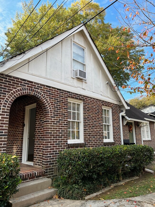
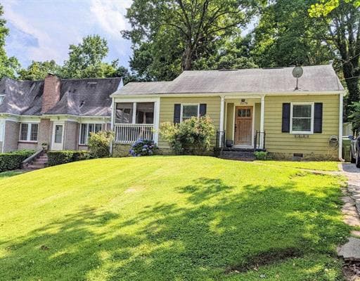
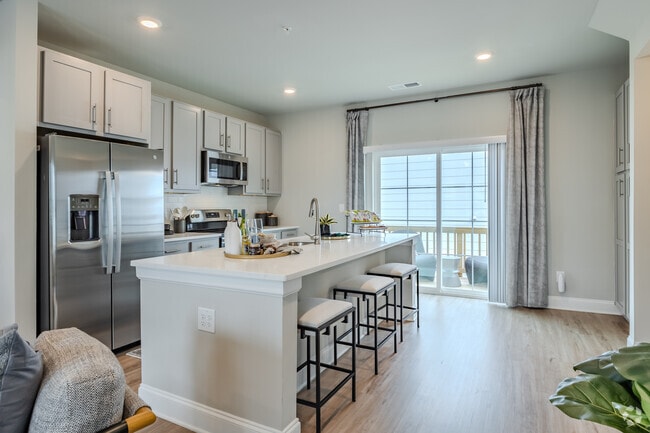
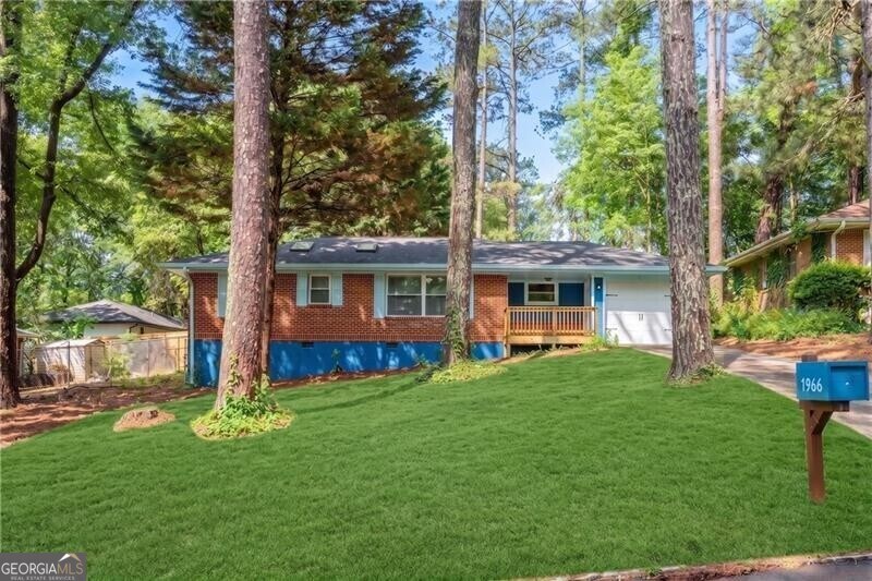
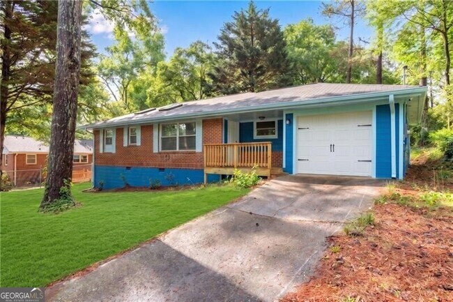
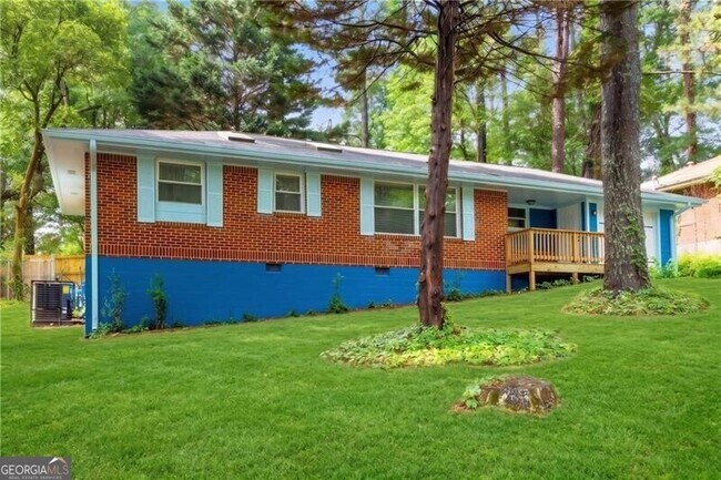
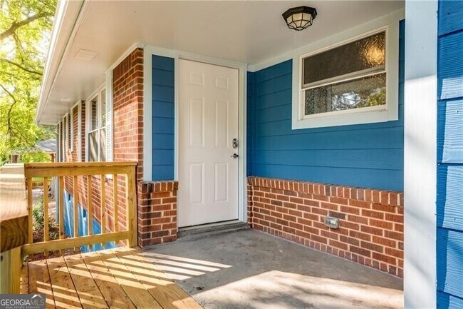
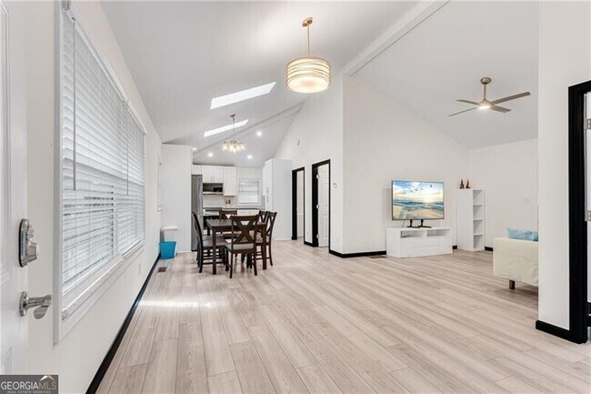
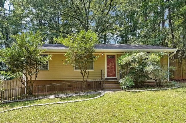
Complete renovation down to the studs - NEW CONSTRUCTION interior! 2BR/2BA + Bonus Room. Available FURNISHED or Unfurnished. Step inside to soaring vaulted ceilings. Wide-plank laminate flooring on the entire main level. White granite kitchen features SS appliance and plenty of storage. FRIDGE/WASHER/DRYER all included. Open concept dining/living area w/glass doors the large Sun Room leading to the patio overlooking the Private fenced backyard. Split-BR roommate style plan w/vaulted bedroom ceilings. Two full baths feature large tile showers. 2-Car Tandem garage w/laundry in back as well as a large mud sink. NO PETS. Lease includes TRASH. AVAILABLE FOR AS SHORT AS 3 MONTH TERMS ON FURNISHED ONLY. MLS ID 10755202

1966 Mark Trail is a house located in DeKalb County and the 30032 ZIP Code.

* Price shown is base rent. Excludes user-selected optional fees and variable or usage-based fees and required charges due at or prior to move-in or at move-out. Price, availability, fees, and any applicable rent special are subject to change without notice.
* Square footage definitions vary. Displayed square footage is approximate.

Fees and Policies

The fees listed below are community-provided and may exclude utilities or add-ons. All payments are made directly to the property and are non-refundable unless otherwise specified. Use the Cost Calculator to determine costs based on your needs.

  • One-Time Basics
    • Due at Application
      • Application Fee Per Applicant
        Charged per applicant.
        $55
    • Due at Move-In
      • Security Deposit - Refundable
        Charged per unit.
        $2,495

Property Fee Disclaimer: Based on community-supplied data and independent market research. Subject to change without notice. May exclude fees for mandatory or optional services and usage-based utilities.

House Features

Dishwasher

Microwave

Refrigerator

Pantry

  • Dishwasher
  • Pantry
  • Microwave
  • Refrigerator

Contact

  • Listed by Jason Moore | REMAX Around Atlanta
  • Phone Number
  • Contact
  • Source
    Georgia Multiple Listing Service
Copyright © 2026 Georgia Multiple Listing Service. All rights reserved. All information provided by the listing agent / broker is deemed reliable but is not guaranteed and should be independently verified.
| Edit

Under 30 minutes

Commute Time is calculated at rush hour.
Neighborhood

Situated between East Atlanta Village and I-285, Candler-McAfee is a laidback suburban community with a small-town feel. Residents enjoy access to a broad range of shops and restaurants stretched along Candler Road, the community’s main commercial thoroughfare.

Candler-McAfee is mostly residential, offering an overall peaceful atmosphere in addition to numerous apartments and houses available for rent along tree-lined streets. While the whole community touts a park-like environment, Candler-McAfee is home to several scenic parks like Glendale Park, NH Scott Park, and Misty Waters Park. Quick access to both I-20 and I-285 affords many Candler-McAfee residents short commute times to countless area employers and attractions.

Learn more about living in Candler-McAfee 
Amenities
  • Dishwasher
  • Pantry
  • Microwave
  • Refrigerator
Education
Colleges & Universities Distance
Drive: 10 min 4.1 mi
Drive: 11 min 4.3 mi
Drive: 15 min 6.8 mi
Drive: 16 min 7.1 mi
1966 Mark Trail is within 10 minutes or 4.1 miles from Agnes Scott College. It is also near Georgia Perim. Coll., Decatur and Emory University, Clairmont.
Transportation

Transportation options available in Decatur include East Lake, located 3.4 miles from 1966 Mark Trail. 1966 Mark Trail is near Hartsfield - Jackson Atlanta International, located 12.6 miles or 25 minutes away.

Transit / Subway Distance
Drive: 9 min 3.4 mi
Drive: 11 min 5.0 mi
Drive: 12 min 5.3 mi
Drive: 11 min 5.4 mi
Commuter Rail Distance
Drive: 19 min 10.5 mi
Airports Distance
Airports Distance
Hartsfield - Jackson Atlanta International
Drive: 25 min 12.6 mi
Getting Around
Fairly Walkable
Walkability
40 / 100
Limited Public Transit
Transit
20 / 100
Exceptionally Drivable
Drivability
90 / 100
Somewhat Bikeable
Bikeability
30 / 100

Scores provided by

What do Walkability, Transit, Drivability, and Bikeability mean? Walkability measures the walking distance to day-to-day needs. Transit measures access to public transportation. Drivability measures congestion, parking availability, and access to major roads. Bikeability measures the suitability for cycling. How It Works
-
Soundscore
- / 100

Traffic

-

Airport

-

Businesses

-

Scores provided by

HowLoud What is a Sound Score Rating? A Sound Score Rating aggregates noise caused by vehicle traffic, airplane traffic and local sources. How It Works
Points of Interest

Time and distance from 1966 Mark Trail.

Shopping Centers Distance
Drive: 4 min 1.2 mi
Drive: 4 min 1.3 mi
Drive: 4 min 1.5 mi
1966 Mark Trail has 3 shopping centers within 1.5 miles, which is about a 4-minute drive. The miles and minutes will be for the farthest away property.
Parks and Recreation Distance
Wylde Center and Oakhurst Community Garden
Drive: 9 min 3.9 mi
Ferns of the World Garden
Drive: 10 min 4.3 mi
Bradley Observatory
Drive: 9 min 4.4 mi
Fernbank Museum of Natural History
Drive: 12 min 4.5 mi
South River Watershed Alliance
Drive: 12 min 5.1 mi
1966 Mark Trail has 5 parks within 5.1 miles, including Wylde Center and Oakhurst Community Garden, Bradley Observatory, and Ferns of the World Garden.
Hospitals Distance
Hospitals Distance
Drive: 9 min 3.9 mi
Drive: 13 min 6.1 mi
Drive: 16 min 7.1 mi
1966 Mark Trail has 3 hospitals within 7.1 miles, the nearest is Georgia Regional Hospital Atlanta which is 3.9 miles away and a 9 minute drive.
Military Bases Distance
Drive: 22 min 10.3 mi
Drive: 20 min 10.9 mi
Drive: 40 min 24.1 mi
1966 Mark Trail has 3 military bases within 24.1 miles, the nearest is Fort Gillem which is 10.3 miles away and a 22 minute drive.

You May Also Like

Similar Rentals Nearby