
$6,500 / Month
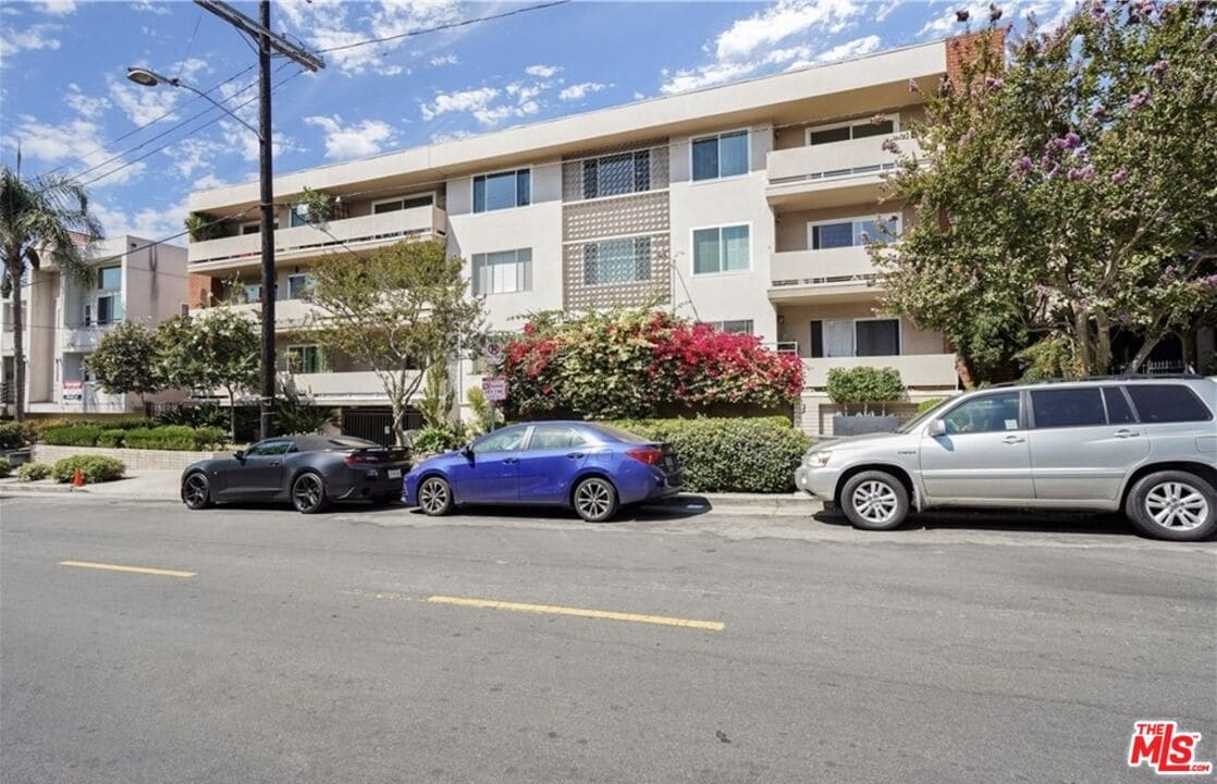
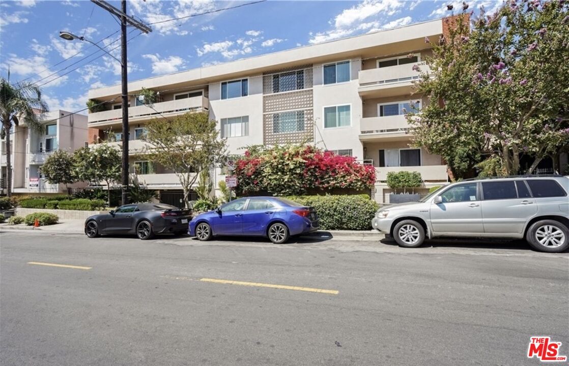
1955 Tamarind Ave Unit 24
Los Angeles, CA 90068
Today
Favorites
310-890-3864
-
Bedrooms
3
-
Bathrooms
3
-
Square Feet
1,414 sq ft
-
Available
Available Now
Highlights
- Midcentury Modern Architecture
- View of Hills
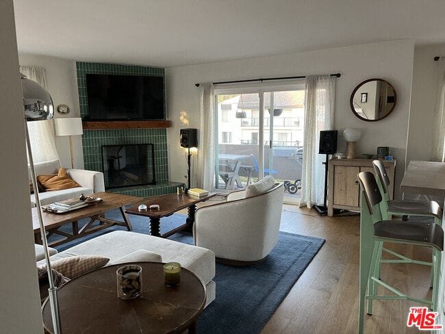
- Family Room with Fireplace
- Wood Flooring
- Covered patio or porch
- Subterranean Parking
1955 Tamarind Ave Unit 24

Favorites
About This Home
$6,500 deposit,
Available Now
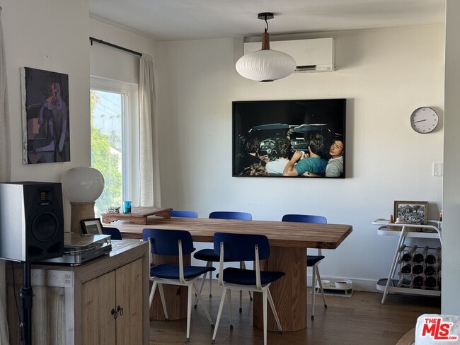
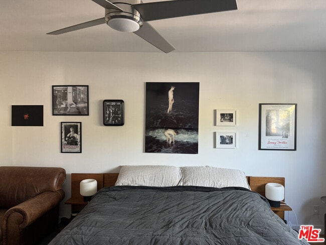
This gorgeously updated top floor corner condo with balcony is just steps away from the dining, shopping + entertainment of Franklin Village. The unit features a beautifully updated kitchen with Shaker cabinets, Subway tile, Samsung appliances + breakfast bar. The bright + airy open concept dining and spacious living room with gas fireplace leads to a spacious balcony with incredible views of the Hollywood Hills. The primary bedroom boasts dual closets plus ensuite bathroom with a custom walk-in shower with rain fall shower head + marble dual vanity. Tons of storage throughout, sizable bedrooms with plenty of closet space + a full bathroom with custom tiled tub off hallway. New dual pane windows + sliding glass door for added noise reduction and energy efficiency + LED lighting throughout. One assigned parking space in gated garage included. Close to Gelson's, Griffith Park & Freeway Access. MLS# 25566753
1955 Tamarind Ave is a condo located in Los Angeles County and the 90068 ZIP Code.
* Price shown is base rent and may not include non-optional fees and utilities.
Price, availability, fees, and any applicable rent special are subject to change without notice.
* Square footage definitions vary. Displayed square footage is approximate.
Home Details
Home Type
Condominium
Year Built
Built in 1965
Bedrooms and Bathrooms
2.5 Bathrooms
3 Bedrooms
Home Design
Midcentury Modern Architecture
Home Security
Carbon Monoxide Detectors
Security Lights
Interior Spaces
Family Room with Fireplace
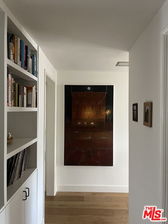
Wood Flooring
Built-In Features
Dining Room
Ceiling Fan
1,414 Sq Ft Home
1-Story Property
Kitchen
Oven or Range
Microwave
Dishwasher
Disposal
Recirculated Exhaust Fan
Laundry
Dryer
Laundry in unit
Washer
Listing and Financial Details
Security Deposit $6,500
Assessor Parcel Number 5586-014-053
Tenant pays for electricity
Rent includes association dues, water, trash collection
Lot Details
0.37 Acre Lot
Gated Home
Outdoor Features
Covered patio or porch
Parking
Subterranean Parking
Automatic Gate
1 Parking Space
Utilities
Forced Air Heating System
Views
Views of Hills
Community Details
Pet Policy
Call for details about the types of pets allowed
Fees and Policies
The fees below are based on community-supplied data and may exclude additional fees and utilities.
Pet policies are negotiable.
Contact
- Listed by Thomas Sisk | Compass
- Phone Number
- Contact
-
Source
 MLS(TM)/CLAW
Copyright 2025 TheMLS/CLAW. All rights reserved. Information is deemed reliable but not guaranteed.
Location
Get Directions
Amenities
- Washer/Dryer
- Air Conditioning
- Ceiling Fans
- Dishwasher
- Disposal
- Microwave
- Refrigerator
- Hardwood Floors
- Dining Room
- Views
In the rolling hills of Hollywood, you’ll discover no other than Hollywood Hills, one of the most affluent communities in Los Angeles, situated ten miles northwest of the city. Home to the infamous Hollywood Sign on Mount Lee, this neighborhood boasts significant landmarks, breathtaking views, and famous rolling hills, which are a part of the Santa Monica Mountains.
With attractions like Runyon Canyon Park, Lake Hollywood Park, Griffith Park, and the Hollywood Bowl, this neighborhood is one for the books. And directly south of town, you’ll find even more exquisite attractions like the Hollywood Wax Museum and Hollywood Pantages Theatre!
North of Hollywood Hills, you’ll find the some of the city’s greatest attractions in Universal City. Discover Universal Studios Hollywood and its famous sites like the Wizarding World of Harry Potter and Universal CityWalk, a vibrant area of shops, restaurants, bars, theaters, and so much more.
Learn more about living in Hollywood Hills
Education
| Colleges & Universities | Distance | ||
|---|---|---|---|
| Colleges & Universities | Distance | ||
| Drive: | 2 min | 1.1 mi | |
| Drive: | 3 min | 1.4 mi | |
| Drive: | 5 min | 3.0 mi | |
| Drive: | 8 min | 4.7 mi |
1955 Tamarind Ave Unit 24 is within 2 minutes or 1.1 miles from Los Angeles Film School. It is also near Musicians Institute and City College.
Transportation options available in Los Angeles include Hollywood/Vine Station, located 0.7 mile from 1955 Tamarind Ave Unit 24. 1955 Tamarind Ave Unit 24 is near Bob Hope, located 8.9 miles or 15 minutes away, and Los Angeles International, located 15.1 miles or 29 minutes away.
| Transit / Subway | Distance | ||
|---|---|---|---|
| Transit / Subway | Distance | ||
|
|
Walk: | 14 min | 0.7 mi |
|
|
Walk: | 17 min | 0.9 mi |
|
|
Drive: | 3 min | 1.5 mi |
|
|
Drive: | 4 min | 2.2 mi |
|
|
Drive: | 5 min | 2.7 mi |
| Commuter Rail | Distance | ||
|---|---|---|---|
| Commuter Rail | Distance | ||
|
|
Drive: | 8 min | 4.7 mi |
|
|
Drive: | 11 min | 6.4 mi |
|
|
Drive: | 13 min | 6.6 mi |
|
|
Drive: | 13 min | 6.8 mi |
|
|
Drive: | 14 min | 7.7 mi |
| Airports | Distance | ||
|---|---|---|---|
| Airports | Distance | ||
|
Bob Hope
|
Drive: | 15 min | 8.9 mi |
|
Los Angeles International
|
Drive: | 29 min | 15.1 mi |
Time and distance from 1955 Tamarind Ave Unit 24.
| Shopping Centers | Distance | ||
|---|---|---|---|
| Shopping Centers | Distance | ||
| Walk: | 4 min | 0.2 mi | |
| Walk: | 16 min | 0.8 mi | |
| Walk: | 16 min | 0.9 mi |
1955 Tamarind Ave Unit 24 has 3 shopping centers within 0.9 mile, which is about a 16-minute walk. The miles and minutes will be for the farthest away property.
| Parks and Recreation | Distance | ||
|---|---|---|---|
| Parks and Recreation | Distance | ||
|
Runyon Canyon
|
Drive: | 5 min | 2.0 mi |
|
Bird Sanctuary
|
Drive: | 6 min | 2.6 mi |
|
Griffith Observatory
|
Drive: | 10 min | 3.8 mi |
|
Los Angeles Zoo
|
Drive: | 14 min | 5.4 mi |
|
Griffith Park
|
Drive: | 20 min | 6.5 mi |
1955 Tamarind Ave Unit 24 has 5 parks within 6.5 miles, including Runyon Canyon, Griffith Observatory, and Griffith Park.
| Hospitals | Distance | ||
|---|---|---|---|
| Hospitals | Distance | ||
| Walk: | 21 min | 1.1 mi | |
| Drive: | 4 min | 2.0 mi | |
| Drive: | 4 min | 2.2 mi |
1955 Tamarind Ave Unit 24 has 3 hospitals within 2.2 miles, the nearest is Southern California Hospital at Hollywood which is 1.1 miles away and a 21 minute walk.
| Military Bases | Distance | ||
|---|---|---|---|
| Military Bases | Distance | ||
| Drive: | 29 min | 16.7 mi |
1955 Tamarind Ave Unit 24 is 16.7 miles and a 29 minute drive from Los Angeles Air Force Base.
You May Also Like
Similar Rentals Nearby


What Are Walk Score®, Transit Score®, and Bike Score® Ratings?
Walk Score® measures the walkability of any address. Transit Score® measures access to public transit. Bike Score® measures the bikeability of any address.
What is a Sound Score Rating?
A Sound Score Rating aggregates noise caused by vehicle traffic, airplane traffic and local sources
1955 Tamarind Ave
Los Angeles, CA 90068