$750
Total Monthly Price
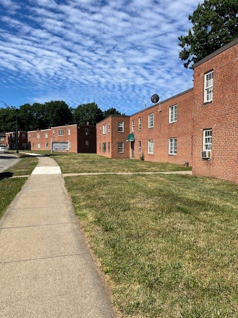
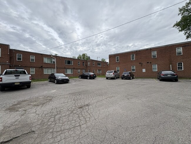
1950 Nelawood Rd
East Cleveland, OH 44112
Favorites
862-285-5093
-
Bedrooms
2
-
Bathrooms
1
-
Square Feet
800 - 820 sq ft
-
Available
Available Now
Highlight
- Pets Allowed
1950 Nelawood Rd

Favorites
2 Available Units
55-101
$750
Total Monthly Price
2 beds,
1 bath,
820 sq ft
12 Month Lease, $750 deposit,
Available Now
91-205
$750
Total Monthly Price
2 beds,
1 bath,
800 sq ft
12 Month Lease, $750 deposit,
Available Now
* Price shown is base rent. Excludes user-selected optional fees and variable or usage-based fees and required charges due at or prior to move-in or at move-out.
Price, availability, fees, and any applicable rent special are subject to change without notice.
* Square footage definitions vary. Displayed square footage is approximate.
About 1950 Nelawood Rd East Cleveland, OH 44112
12 Month Lease,
$750 deposit,
Available Now
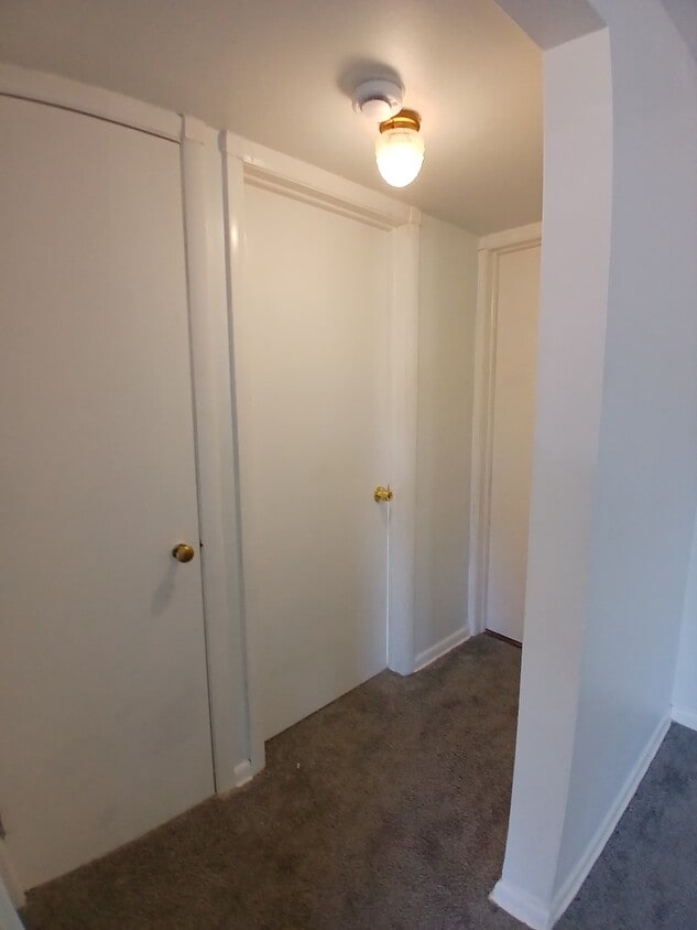
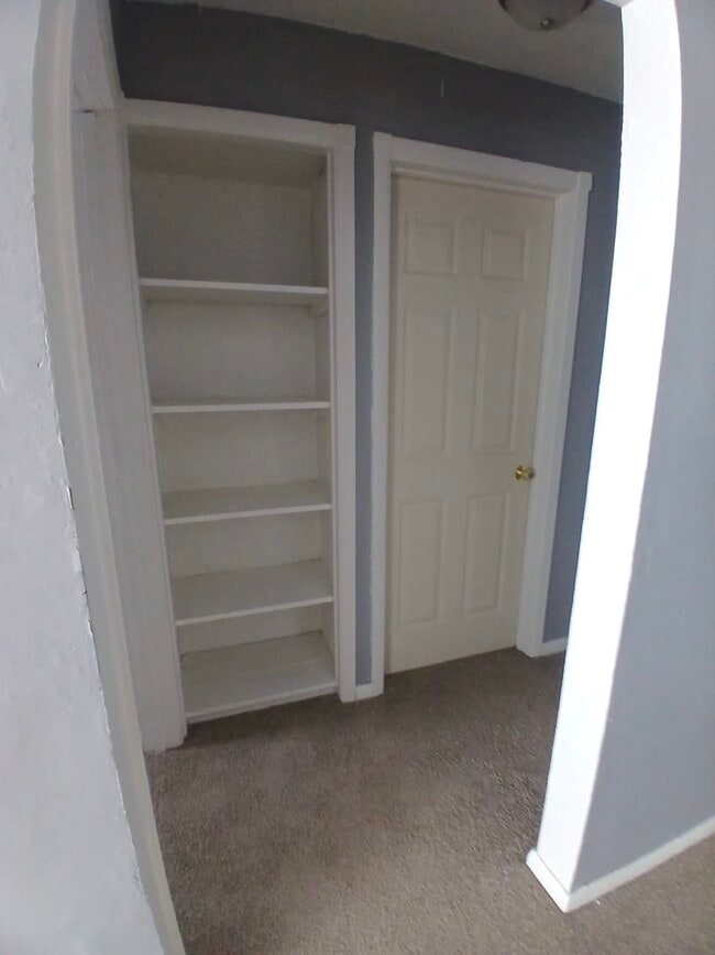
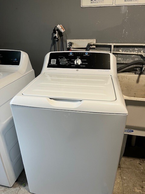
Freshly painted. New carpeting. Big closets. Garden style apartments. Conveniently located near RTA red bus lines 41 and 28. One block from Noble Rd. Apex Academy nearby. Shaw HS. Apartment is located on Nelacrest Road. Onsite laundry facilities. Maintenace staff 24/7 on site. Pet fee $35/month Application fee $35 Free Parking
1950 Nelawood Rd is an apartment community located in Cuyahoga County and the 44112 ZIP Code. This area is served by the East Cleveland City School District attendance zone.
* Price shown is total price based on community-supplied monthly required fees. Excludes user-selected optional fees and variable or usage-based fees and required charges due at or prior to move-in or at move-out. Price, availability, fees, and any applicable rent special are subject to change without notice.
* Square footage definitions vary. Displayed square footage is approximate.
Apartment Features
Refrigerator
Tub/Shower
Range
Carpet
- Tub/Shower
- Range
- Refrigerator
- Carpet
- Laundry Facilities
Fees and Policies
The fees listed below are community-provided and may exclude utilities or add-ons. All payments are made directly to the property and are non-refundable unless otherwise specified.
- Dogs Allowed
-
Fees not specified
- Cats Allowed
-
Fees not specified
- Parking
-
Surface Lot--
Details
Utilities Included
-
Water
-
Sewer
Contact
- Phone Number
- Contact
Location
Get Directions
East Cleveland sits just east of downtown Cleveland on about four square miles of land, making it one of the more compact cities in Cuyahoga County. Its identity is anchored by Nela Park, the world's first industrial park, which serves as the operating headquarters for GE Lighting and earned a spot on the National Register of Historic Places in 1975. The city also borders Forest Hill Park, a 235-acre green space that was once part of John D. Rockefeller's estate and offers tennis courts, ball fields, and nature trails. Euclid Avenue functions as the main commercial corridor, connecting residents to everyday essentials, local eateries, and bus routes that run toward downtown Cleveland. The Red Line rail provides direct access to Cleveland's core and Hopkins International Airport, making the city a practical base for those who work or study in the broader metro area.
Learn more about living in East Cleveland
Education
| Colleges & Universities | Distance | ||
|---|---|---|---|
| Colleges & Universities | Distance | ||
| Drive: | 8 min | 3.5 mi | |
| Drive: | 8 min | 3.6 mi | |
| Drive: | 9 min | 3.9 mi | |
| Drive: | 11 min | 4.0 mi |
1950 Nelawood Rd is within 8 minutes or 3.5 miles from Cleveland Institute of Art. It is also near Case Western Reserve and Cleveland Institute of Music.
Schools


Public Elementary & Middle School
Grades PK-8
144 Students
Nearby
Public Elementary School
Grades K-5
131 Students
Attendance Zone
Public Elementary School
Grades K-5
245 Students
Attendance Zone
Public Middle School
Grades 6-8
199 Students
Attendance Zone
Public High School
Grades 9-12
385 Students
Attendance Zone
Private Elementary, Middle & High School
Grades PK-12
19 Students
Nearby
Private Elementary & Middle School
Grades K-8
147 Students
Nearby
Private High School
Grades 9-12
320 Students
Nearby
School data provided by
 The GreatSchools Rating helps parents compare schools within a state based on a variety of school quality indicators and provides a helpful picture of how effectively each school serves all of its students. Ratings are on a scale of 1 (below average) to 10 (above average) and can include test scores, college readiness, academic progress, advanced courses, equity, discipline and attendance data. We also advise parents to visit schools, consider other information on school performance and programs, and consider family needs as part of the school selection process.
View GreatSchools Rating Methodology
Data provided by GreatSchools.org © 2026. All rights reserved.
View GreatSchools Rating Methodology
Data provided by GreatSchools.org © 2026. All rights reserved.
Transportation options available in East Cleveland include Louis Stokes Station At Windermere, located 1.9 miles from 1950 Nelawood Rd. 1950 Nelawood Rd is near Cleveland-Hopkins International, located 22.7 miles or 38 minutes away.
| Transit / Subway | Distance | ||
|---|---|---|---|
| Transit / Subway | Distance | ||
|
|
Drive: | 5 min | 1.9 mi |
|
|
Drive: | 5 min | 2.4 mi |
| Drive: | 8 min | 3.5 mi | |
|
|
Drive: | 10 min | 4.5 mi |
|
|
Drive: | 14 min | 5.7 mi |
| Commuter Rail | Distance | ||
|---|---|---|---|
| Commuter Rail | Distance | ||
|
|
Drive: | 19 min | 9.1 mi |
| Drive: | 30 min | 14.9 mi | |
| Drive: | 32 min | 16.6 mi | |
| Drive: | 40 min | 22.5 mi | |
|
Boston Mill
|
Drive: | 45 min | 25.0 mi |
| Airports | Distance | ||
|---|---|---|---|
| Airports | Distance | ||
|
Cleveland-Hopkins International
|
Drive: | 38 min | 22.7 mi |
Getting Around
 What do Walkability, Transit, Drivability, and Bikeability mean?
Walkability measures the walking distance to day-to-day needs.
Transit measures access to public transportation.
Drivability measures congestion, parking availability, and access to major roads.
Bikeability measures the suitability for cycling.
How It Works
What do Walkability, Transit, Drivability, and Bikeability mean?
Walkability measures the walking distance to day-to-day needs.
Transit measures access to public transportation.
Drivability measures congestion, parking availability, and access to major roads.
Bikeability measures the suitability for cycling.
How It Works
Fairly Walkable
Walkability
40
/ 100
Limited Public Transit
Transit
30
/ 100
Exceptionally Drivable
Drivability
90
/ 100
Fairly Bikeable
Bikeability
50
/ 100
Scores provided by
Active
Soundscore™
78
/ 100
Traffic
ActiveAirport
CalmBusinesses
ActiveScores provided by
HowLoud What is a Sound Score Rating? A Sound Score Rating aggregates noise caused by vehicle traffic, airplane traffic and local sources. How It WorksTime and distance from 1950 Nelawood Rd.
| Shopping Centers | Distance | ||
|---|---|---|---|
| Shopping Centers | Distance | ||
| Drive: | 4 min | 1.4 mi | |
| Drive: | 4 min | 1.7 mi | |
| Drive: | 5 min | 1.8 mi |
1950 Nelawood Rd has 3 shopping centers within 1.8 miles, which is about a 5-minute drive. The miles and minutes will be for the farthest away property.
| Parks and Recreation | Distance | ||
|---|---|---|---|
| Parks and Recreation | Distance | ||
|
Euclid Creek Reservation
|
Drive: | 8 min | 3.3 mi |
|
Cleveland Botanical Garden
|
Drive: | 9 min | 3.8 mi |
|
Children's Museum of Cleveland
|
Drive: | 10 min | 4.1 mi |
|
Cleveland Museum of Natural History
|
Drive: | 10 min | 4.2 mi |
|
Nature Center at Shaker Lakes
|
Drive: | 13 min | 5.4 mi |
1950 Nelawood Rd has 5 parks within 5.4 miles, including Euclid Creek Reservation, Cleveland Botanical Garden, and Children's Museum of Cleveland.
| Hospitals | Distance | ||
|---|---|---|---|
| Hospitals | Distance | ||
| Drive: | 8 min | 3.7 mi | |
| Drive: | 8 min | 3.7 mi | |
| Drive: | 11 min | 4.7 mi |
1950 Nelawood Rd has 3 hospitals within 4.7 miles, the nearest is Rainbow Babies and Childrens Hospital which is 3.7 miles away and a 8 minute drive.
| Military Bases | Distance | ||
|---|---|---|---|
| Military Bases | Distance | ||
| Drive: | 112 min | 91.5 mi |
1950 Nelawood Rd is 91.5 miles and a 112 minute drive from Mansfield Lahm Airport Air Guard Station.
Amenities
- Tub/Shower
- Range
- Refrigerator
- Carpet
- Laundry Facilities
1950 Nelawood Rd Photos

1950 Nelawood Rd
East Cleveland, OH 44112