


$2,385 / Month
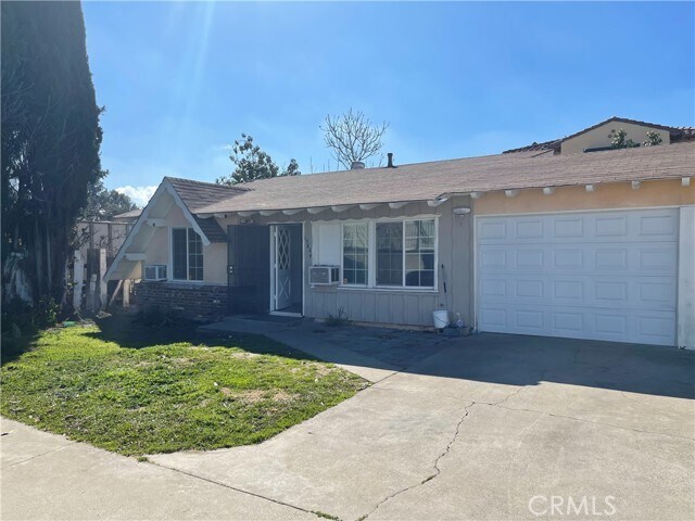
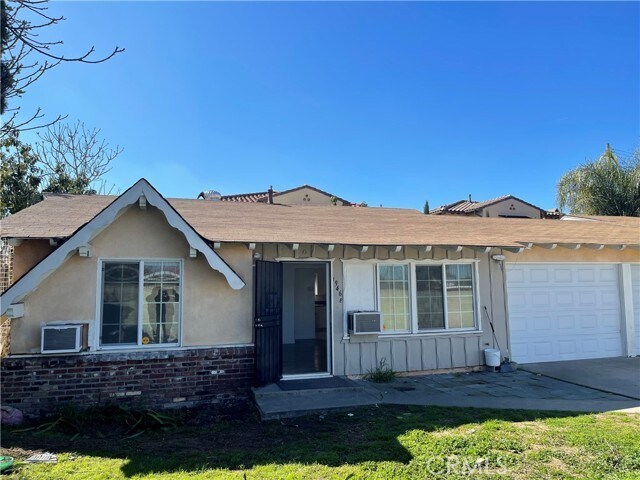
1946 California St
San Gabriel, CA 91776
2 Weeks Ago
Favorites
1946 California St

Favorites
Check Back Soon for Upcoming Availability
| Beds | Baths | Average SF |
|---|---|---|
| 2 Bedrooms 2 Bedrooms 2 Br | 1 Bath 1 Bath 1 Ba | 950 SF |
Fees and Policies
The fees below are based on community-supplied data and may exclude additional fees and utilities.
Details
Utilities Included
-
Water
-
Trash Removal
Lease Options
-
12 Months
About This Property
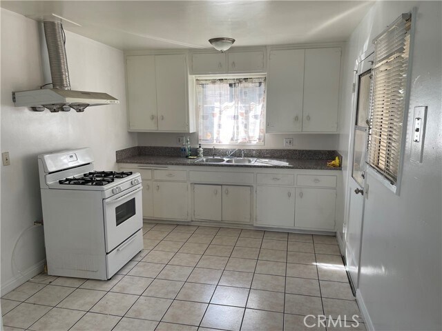
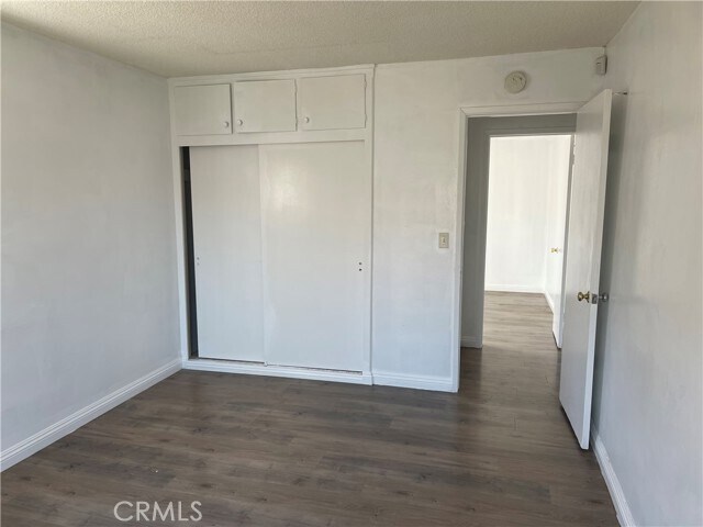
Nice Back Single house with private front and rear yard with one Car garage. 2 bedroom 1 bath with Laminated wood floor throughout.New Paint.
1946 California St is a house located in Los Angeles County and the 91776 ZIP Code. This area is served by the Garvey Elementary attendance zone.
House Features
- Heating
Location
Get Directions
Garvey is a predominantly residential neighborhood located in the heart of San Gabriel Valley. Complemented by cacti and palm trees, a variety of moderately-priced to upscale Mediterranean-style houses, and apartments dot the neighborhood. Garvey has several schools, parks, stores, authentic restaurants, and international grocery stores. Residents enjoy access to several roadways including Interstate 710, Interstate 10, and Highway 60. Downtown Los Angeles, which is just 10 miles away, and other major destinations are convenient to Garvey. If you’re looking for a family-oriented neighborhood or a quiet place convenient for commuting, Garvey is a great choice.
Learn more about living in GarveyBelow are rent ranges for similar nearby apartments
Amenities
- Heating
Expenses
Utilities Included
Water, Trash Removal
Included
Education
| Colleges & Universities | Distance | ||
|---|---|---|---|
| Colleges & Universities | Distance | ||
| Drive: | 9 min | 5.2 mi | |
| Drive: | 11 min | 5.8 mi | |
| Drive: | 15 min | 6.3 mi | |
| Drive: | 13 min | 7.2 mi |
1946 California St is within 9 minutes or 5.2 miles from Cal State Los Angeles. It is also near East Los Angeles College and Caltech.
Schools


Public Elementary School
Grades K-6
596 Students
Nearby
Public Elementary School
Grades K-6
372 Students
Attendance Zone
Public Middle School
Grades 7-8
591 Students
Attendance Zone
Public High School
Grades 9-12
1,814 Students
Attendance Zone
Private Elementary, Middle & High School
Grades K-12
Nearby
Private Elementary & Middle School
Grades PK-8
150 Students
Nearby
Private High School
Grades 10-12
Nearby
School data provided by
 The GreatSchools Rating helps parents compare schools within a state based on a variety of school quality indicators and provides a helpful picture of how effectively each school serves all of its students. Ratings are on a scale of 1 (below average) to 10 (above average) and can include test scores, college readiness, academic progress, advanced courses, equity, discipline and attendance data. We also advise parents to visit schools, consider other information on school performance and programs, and consider family needs as part of the school selection process.
View GreatSchools Rating Methodology
Data provided by GreatSchools.org © 2025. All rights reserved.
View GreatSchools Rating Methodology
Data provided by GreatSchools.org © 2025. All rights reserved.
Transportation options available in San Gabriel include Atlantic, located 6.1 miles from 1946 California St. 1946 California St is near Bob Hope, located 23.9 miles or 31 minutes away, and Long Beach (Daugherty Field), located 24.2 miles or 34 minutes away.
| Transit / Subway | Distance | ||
|---|---|---|---|
| Transit / Subway | Distance | ||
|
|
Drive: | 11 min | 6.1 mi |
|
|
Drive: | 13 min | 6.8 mi |
|
|
Drive: | 14 min | 7.4 mi |
| Drive: | 10 min | 7.5 mi | |
|
|
Drive: | 12 min | 8.0 mi |
| Commuter Rail | Distance | ||
|---|---|---|---|
| Commuter Rail | Distance | ||
|
|
Drive: | 8 min | 4.5 mi |
|
|
Drive: | 14 min | 6.7 mi |
|
|
Drive: | 14 min | 9.4 mi |
|
|
Drive: | 17 min | 11.8 mi |
| Drive: | 16 min | 13.2 mi |
| Airports | Distance | ||
|---|---|---|---|
| Airports | Distance | ||
|
Bob Hope
|
Drive: | 31 min | 23.9 mi |
|
Long Beach (Daugherty Field)
|
Drive: | 34 min | 24.2 mi |
Time and distance from 1946 California St.
| Shopping Centers | Distance | ||
|---|---|---|---|
| Shopping Centers | Distance | ||
| Walk: | 10 min | 0.6 mi | |
| Walk: | 12 min | 0.6 mi | |
| Walk: | 12 min | 0.7 mi |
1946 California St has 3 shopping centers within 0.7 mile, which is about a 12-minute walk. The miles and minutes will be for the farthest away property.
| Parks and Recreation | Distance | ||
|---|---|---|---|
| Parks and Recreation | Distance | ||
|
Whittier Narrows Recreation Area
|
Drive: | 10 min | 3.9 mi |
|
Huntington Botanical Gardens
|
Drive: | 14 min | 5.2 mi |
|
Whittier Narrows Nature Center
|
Drive: | 11 min | 6.2 mi |
|
Los Angeles County Arboretum
|
Drive: | 15 min | 6.9 mi |
|
Pio Pico State Historic Park
|
Drive: | 15 min | 7.2 mi |
1946 California St has 5 parks within 7.2 miles, including Whittier Narrows Recreation Area, Huntington Botanical Gardens, and Whittier Narrows Nature Center.
| Hospitals | Distance | ||
|---|---|---|---|
| Hospitals | Distance | ||
| Drive: | 5 min | 2.1 mi | |
| Drive: | 4 min | 2.6 mi | |
| Drive: | 6 min | 2.7 mi |
1946 California St has 3 hospitals within 2.7 miles, the nearest is BHC Alhambra Hospital which is 2.1 miles away and a 5 minute drive.
| Military Bases | Distance | ||
|---|---|---|---|
| Military Bases | Distance | ||
| Drive: | 35 min | 26.8 mi | |
| Drive: | 39 min | 27.9 mi |
1946 California St is 26.8 miles from Los Angeles Air Force Base, and is convenient to other military bases, including Los Alamitos Army Airfield.
You May Also Like
Similar Rentals Nearby


What Are Walk Score®, Transit Score®, and Bike Score® Ratings?
Walk Score® measures the walkability of any address. Transit Score® measures access to public transit. Bike Score® measures the bikeability of any address.
What is a Sound Score Rating?
A Sound Score Rating aggregates noise caused by vehicle traffic, airplane traffic and local sources
1946 California St
San Gabriel, CA 91776