$1,095
/ Month
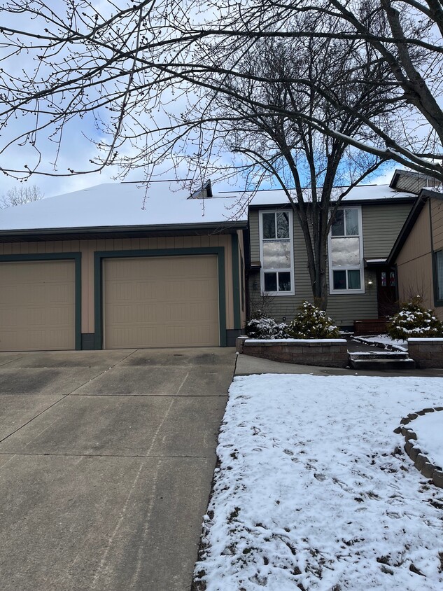
1944 Tennyson Ave NE
Massillon, OH 44646
2 Weeks Ago
|
Edit
Favorites
1944 Tennyson Ave NE

Favorites
Check Back Soon for Upcoming Availability
| Beds | Baths | Average SF |
|---|---|---|
| 2 Bedrooms 2 Bedrooms 2 Br | 1.25 Bath 1.25 Bath 1.25 Ba | — |
About This Property
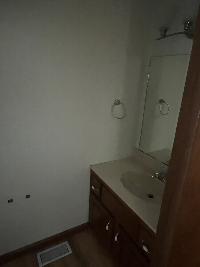
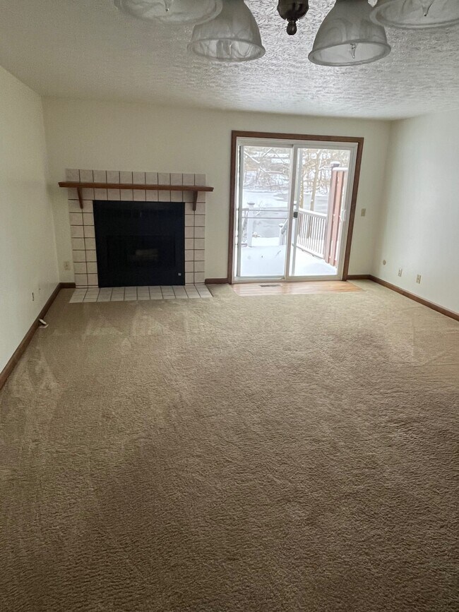
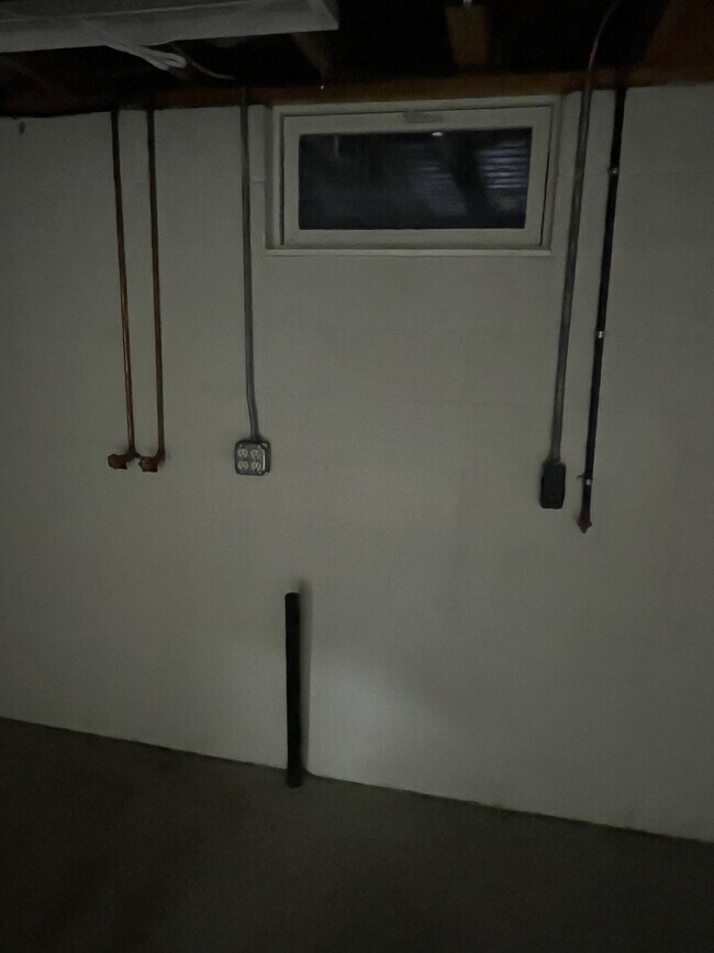
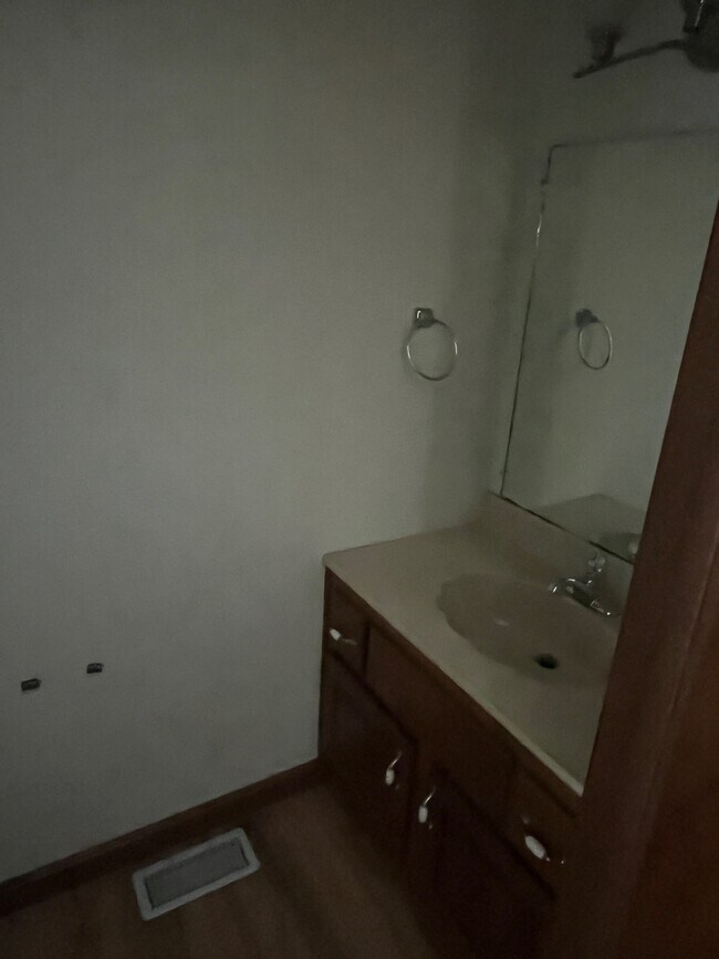
Amazing 2 bedroom, 1.5 bathroom townhouse in Massillon. Amenities included: Credit score of at least 650 with proof of credit report with monthly payments upon lease. Close to Kent Stark. Spacious modern kitchen, tile floor in kitchen, attached garage, laminate flooring , full view patio door opening to back yard, 1/2 finished basement, gas range with dishwasher and garbage disposal, large master with walk-in closet, wood burning fireplace, second floor has full bathroom with shower, half bath on first floor, both gas and electric washer/dryer hookups, Utilities included: electricity, heat, gas, air conditioning and water. Is not pet friendly. Date Available: Feb 1st 2024. $1,095/month rent. $1,095 security deposit required. Please submit the form on this page or contact Kari at to learn more. This property is managed by a responsible landlord using Avail landlord software.
1944 Tennyson Ave Ne is a townhome located in Stark County and the 44646 ZIP Code. This area is served by the Massillon City School District attendance zone.
1944 Tennyson Ave NE,
Massillon,
OH
44646
Massillon sits along the Tuscarawas River in western Stark County, about eight miles west of Canton and roughly 30 miles south of Akron, occupying a steady, grounded place in northeast Ohio's landscape. The city carries a strong sense of identity rooted in its industrial past and a high school football tradition that draws intense community pride each season at Paul Brown Tiger Stadium, named after the legendary coach who got his start here. Lincoln Way serves as the central commercial corridor, anchoring everyday life with local businesses, shops, and services within a walkable stretch of the historic downtown.
The surrounding area spans around 21 square miles, offering a range of neighborhoods from tree-lined residential streets near the river to quieter pockets on the city's edges. The Massillon Museum, free to the public, reflects the city's commitment to arts and local history.
Learn more about living in Massillon
Education
| Colleges & Universities | Distance | ||
|---|---|---|---|
| Colleges & Universities | Distance | ||
| Drive: | 13 min | 5.7 mi | |
| Drive: | 12 min | 6.1 mi | |
| Drive: | 17 min | 7.5 mi | |
| Drive: | 19 min | 9.4 mi |
1944 Tennyson Ave NE is within 13 minutes or 5.7 miles from Kent State University, Stark. It is also near Stark State College and Malone University.
Schools


Public Elementary School
Grades K-5
Nearby
Public Elementary School
Grades K-5
Attendance Zone
Public Elementary School
Grades K-5
Attendance Zone
Public Middle School
Grades 6-8
Attendance Zone
Public High School
Grades 9-12
Attendance Zone
Private Elementary, Middle & High School
Grades K-12
Nearby
Private Elementary & Middle School
Grades PK-8
Nearby
Private Elementary School
Grades PK-5
Nearby
School data provided by
 The GreatSchools Rating helps parents compare schools within a state based on a variety of school quality indicators and provides a helpful picture of how effectively each school serves all of its students. Ratings are on a scale of 1 (below average) to 10 (above average) and can include test scores, college readiness, academic progress, advanced courses, equity, discipline and attendance data. We also advise parents to visit schools, consider other information on school performance and programs, and consider family needs as part of the school selection process.
View GreatSchools Rating Methodology
Data provided by GreatSchools.org © 2026. All rights reserved.
View GreatSchools Rating Methodology
Data provided by GreatSchools.org © 2026. All rights reserved.
Walkability Near 1944 Tennyson Ave NE Massillon, OH 44646
Getting Around
 What do Walkability, Transit, Drivability, and Bikeability mean?
Walkability measures the walking distance to day-to-day needs.
Transit measures access to public transportation.
Drivability measures congestion, parking availability, and access to major roads.
Bikeability measures the suitability for cycling.
How It Works
What do Walkability, Transit, Drivability, and Bikeability mean?
Walkability measures the walking distance to day-to-day needs.
Transit measures access to public transportation.
Drivability measures congestion, parking availability, and access to major roads.
Bikeability measures the suitability for cycling.
How It Works
Fairly Walkable
Walkability
40
/ 100
Minimal Public Transit
Transit
10
/ 100
Very Drivable
Drivability
80
/ 100
Fairly Bikeable
Bikeability
50
/ 100
Scores provided by
Calm
Soundscore™
83
/ 100
Traffic
CalmAirport
CalmBusinesses
CalmScores provided by
HowLoud What is a Sound Score Rating? A Sound Score Rating aggregates noise caused by vehicle traffic, airplane traffic and local sources. How It WorksYou May Also Like
-
Redwood Orrville
1999 Redwood Dr
Orrville, OH 44667
$1,791 - $2,435
2 Br 15.6 mi
-
Spicer Village Townhomes and Apartments
401 Power St
Akron, OH 44311
$1,300 - $1,400
2 Br 17.2 mi
-
Akron U Townhomes - Student Housing
658 E Buchtel Ave
Akron, OH 44304
$415 - $2,275 Total Monthly Price
5 Br 12 Month Lease 17.7 mi
Similar Rentals Nearby
-
-
1 / 13

-
-
-
-
-
-
-
-


What Are Walk Score®, Transit Score®, and Bike Score® Ratings?
Walk Score® measures the walkability of any address. Transit Score® measures access to public transit. Bike Score® measures the bikeability of any address.
What is a Sound Score Rating?
A Sound Score Rating aggregates noise caused by vehicle traffic, airplane traffic and local sources.

1944 Tennyson Ave NE
Massillon, OH 44646