$1,290
/ Month
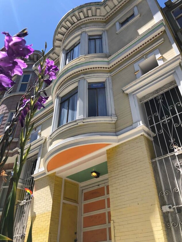
1944 Fell St
San Francisco, CA 94117
Today
|
Edit
Favorites
-
Bedrooms
4
-
Bathrooms
1.5
-
Square Feet
3,436 sq ft
-
Available
Available Jan 1, 2026
Highlights
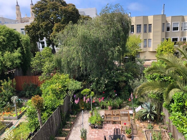
- Room for Rent
- Yard
1944 Fell St

Favorites
About This Home
12 Month Lease,
$1,290 deposit,
Available Jan 1, 2026
Live in one of San Francisco's most vibrant and central neighborhoods! We have a cozy, private bedroom available in our 4-bedroom flat, located directly across the street from the Panhandle at 1944 Fell Street. This is the perfect spot for someone who loves being outdoors, values walkability, and wants the ultimate SF experience. The Location (It Doesn't Get Better!) You are at the intersection of NOPA, Haight-Ashbury, and Cole Valley. Everything you need is a short walk away. Your Front Yard: The Panhandle (literally 30 seconds from your front door) and the eastern entrance to Golden Gate Park. Walk To: NOPA/Divisadero Corridor: Walk to The Mill, NOPA, 4505 BBQ, Souvla, and more (10 min). Haight Street: All the iconic shops, cafes, bars, and Amoeba Records (5 min). Cole Valley: A charming village with great restaurants and cafes (10 min). Groceries: Whole Foods (Haight St) and a new Trader Joe's (Masonic) are both just a few blocks away. Transit: Unbelievably easy. The 5, 21, and 7 MUNI lines are all within a block, giving you quick access downtown, to the Mission, or to the beach.
1944 Fell St is a townhome located in San Francisco County and the 94117 ZIP Code. This area is served by the San Francisco Unified attendance zone.
* Price shown is base rent. Excludes user-selected optional fees and variable or usage-based fees and required charges due at or prior to move-in or at move-out. Price, availability, fees, and any applicable rent special are subject to change without notice.
* Square footage definitions vary. Displayed square footage is approximate.
Townhome Features
- Grill
- Yard
Fees and Policies
The fees below are based on community-supplied data and may exclude additional fees and utilities.
Contact
- Contact
Location
Get Directions
Rent your apartment in the Panhandle neighborhood and enjoy San Francisco's Golden Gate Park any time you want. The neighborhood is only a block wide for much of its 10-block length, so most neighborhood rentals are within steps of Golden Gate Park's panhandle and the trails leading into the heart of that famous open space.
Find your neighbors at a picnic area in the panhandle or at a number of attractions at Golden Gate Park, such as the tranquil Japanese Gardens, the zoo, or the California Academy of Sciences. Explore the park's Spreckels Lake, where model boat lovers launch their creations. Head to the western edge of the park and find Ocean Beach roughly four miles away.
You'll find Tony's Cable Car Restaurant, a local burger hangout complete with old-style neon signs, less than a mile from the panhandle. The closest shopping malls include the Westfield San Francisco Centre and the Potrero Center, both about three miles east.
Learn more about living in Panhandle
Education
| Colleges & Universities | Distance | ||
|---|---|---|---|
| Colleges & Universities | Distance | ||
| Walk: | 9 min | 0.5 mi | |
| Drive: | 5 min | 1.7 mi | |
| Drive: | 5 min | 1.7 mi | |
| Drive: | 9 min | 3.2 mi |
1944 Fell St is within 9 minutes or 0.5 mile from University of San Francisco. It is also near UC San Francisco, Parnassus and UC San Francisco, Mount Zion.
Schools


Public Elementary School
Grades K-5
256 Students
Attendance Zone
Public Elementary School
Grades K-5
Nearby
Public Middle School
Grades 6-8
666 Students
Attendance Zone
Public High School
Grades 9-12
549 Students
Attendance Zone
Public High School
Grades 9-12
1,041 Students
Attendance Zone
Private Elementary & Middle School
Grades K-8
404 Students
Nearby
Private Elementary, Middle & High School
Grades 2-12
8 Students
Nearby
Private Middle & High School
Grades 6-12
23 Students
Nearby
School data provided by
 The GreatSchools Rating helps parents compare schools within a state based on a variety of school quality indicators and provides a helpful picture of how effectively each school serves all of its students. Ratings are on a scale of 1 (below average) to 10 (above average) and can include test scores, college readiness, academic progress, advanced courses, equity, discipline and attendance data. We also advise parents to visit schools, consider other information on school performance and programs, and consider family needs as part of the school selection process.
View GreatSchools Rating Methodology
Data provided by GreatSchools.org © 2025. All rights reserved.
View GreatSchools Rating Methodology
Data provided by GreatSchools.org © 2025. All rights reserved.
Transportation options available in San Francisco include Carl St & Cole St, located 0.5 mile from 1944 Fell St. 1944 Fell St is near San Francisco International, located 15.1 miles or 26 minutes away, and Metro Oakland International, located 22.6 miles or 36 minutes away.
| Transit / Subway | Distance | ||
|---|---|---|---|
| Transit / Subway | Distance | ||
| Walk: | 10 min | 0.5 mi | |
|
|
Walk: | 10 min | 0.6 mi |
|
|
Walk: | 12 min | 0.7 mi |
|
|
Walk: | 17 min | 0.9 mi |
|
|
Walk: | 18 min | 0.9 mi |
| Commuter Rail | Distance | ||
|---|---|---|---|
| Commuter Rail | Distance | ||
| Drive: | 9 min | 4.2 mi | |
| Drive: | 10 min | 4.3 mi | |
| Drive: | 11 min | 4.9 mi | |
| Drive: | 11 min | 5.0 mi | |
| Drive: | 15 min | 7.2 mi |
| Airports | Distance | ||
|---|---|---|---|
| Airports | Distance | ||
|
San Francisco International
|
Drive: | 26 min | 15.1 mi |
|
Metro Oakland International
|
Drive: | 36 min | 22.6 mi |
Time and distance from 1944 Fell St.
| Shopping Centers | Distance | ||
|---|---|---|---|
| Shopping Centers | Distance | ||
| Drive: | 3 min | 1.1 mi | |
| Drive: | 5 min | 2.0 mi | |
| Drive: | 5 min | 2.2 mi |
1944 Fell St has 3 shopping centers within 2.2 miles, which is about a 5-minute drive. The miles and minutes will be for the farthest away property.
| Parks and Recreation | Distance | ||
|---|---|---|---|
| Parks and Recreation | Distance | ||
|
Conservatory of Flowers
|
Walk: | 10 min | 0.6 mi |
|
California Academy of Sciences
|
Drive: | 4 min | 1.4 mi |
|
Steinhart Aquarium
|
Drive: | 4 min | 1.5 mi |
|
Buena Vista Park
|
Drive: | 4 min | 1.5 mi |
|
Randall Museum
|
Drive: | 4 min | 1.6 mi |
1944 Fell St has 5 parks within 1.6 miles, including Conservatory of Flowers, Buena Vista Park, and California Academy of Sciences.
| Hospitals | Distance | ||
|---|---|---|---|
| Hospitals | Distance | ||
| Walk: | 6 min | 0.4 mi | |
| Walk: | 18 min | 1.0 mi | |
| Walk: | 19 min | 1.0 mi |
1944 Fell St has 3 hospitals within 1.0 miles, the nearest is St. Mary's Medical Center which is 0.4 mile away and a 6 minute walk.
| Military Bases | Distance | ||
|---|---|---|---|
| Military Bases | Distance | ||
| Drive: | 10 min | 3.7 mi | |
| Drive: | 11 min | 4.3 mi | |
| Drive: | 19 min | 8.7 mi |
1944 Fell St has 3 military bases within 8.7 miles, the nearest is East Fort Miley which is 3.7 miles away and a 10 minute drive.
Amenities
- Grill
- Yard
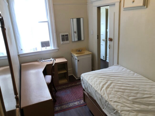
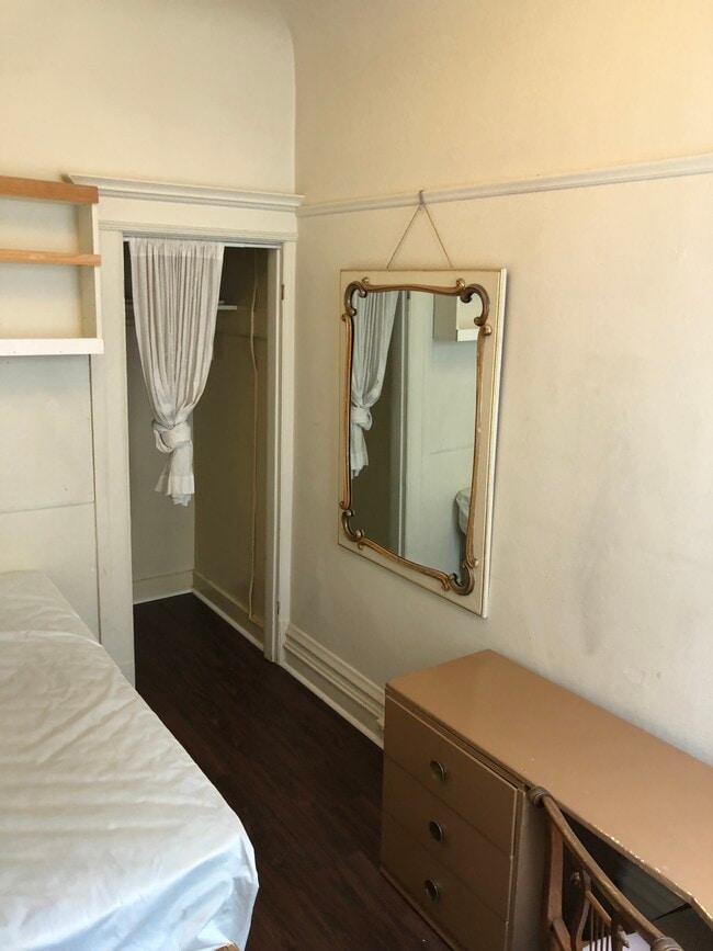
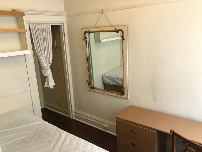
1944 Fell St Photos
What Are Walk Score®, Transit Score®, and Bike Score® Ratings?
Walk Score® measures the walkability of any address. Transit Score® measures access to public transit. Bike Score® measures the bikeability of any address.
What is a Sound Score Rating?
A Sound Score Rating aggregates noise caused by vehicle traffic, airplane traffic and local sources

1944 Fell St
San Francisco, CA 94117