


$1,195
Total Monthly Price
12 Month Lease
1939 Bryant Ave S Unit 29
Minneapolis, MN 55403
2 Weeks Ago
|
Edit
Favorites
1939 Bryant Ave S Unit 29

Favorites
Check Back Soon for Upcoming Availability
| Beds | Baths | Average SF |
|---|---|---|
| 1 Bedroom 1 Bedroom 1 Br | 1 Bath 1 Bath 1 Ba | 900 SF |
Fees and Policies
The fees listed below are community-provided and may exclude utilities or add-ons. All payments are made directly to the property and are non-refundable unless otherwise specified.
- Dogs Allowed
-
Fees not specified
-
Weight limit--
-
Pet Limit--
- Parking
-
Street--
Details
Utilities Included
-
Water
-
Heat
-
Trash Removal
-
Sewer
Property Information
-
36 units
About This Property
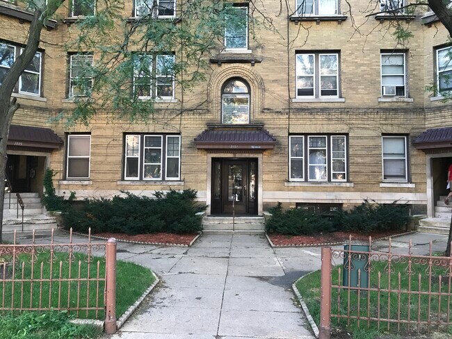
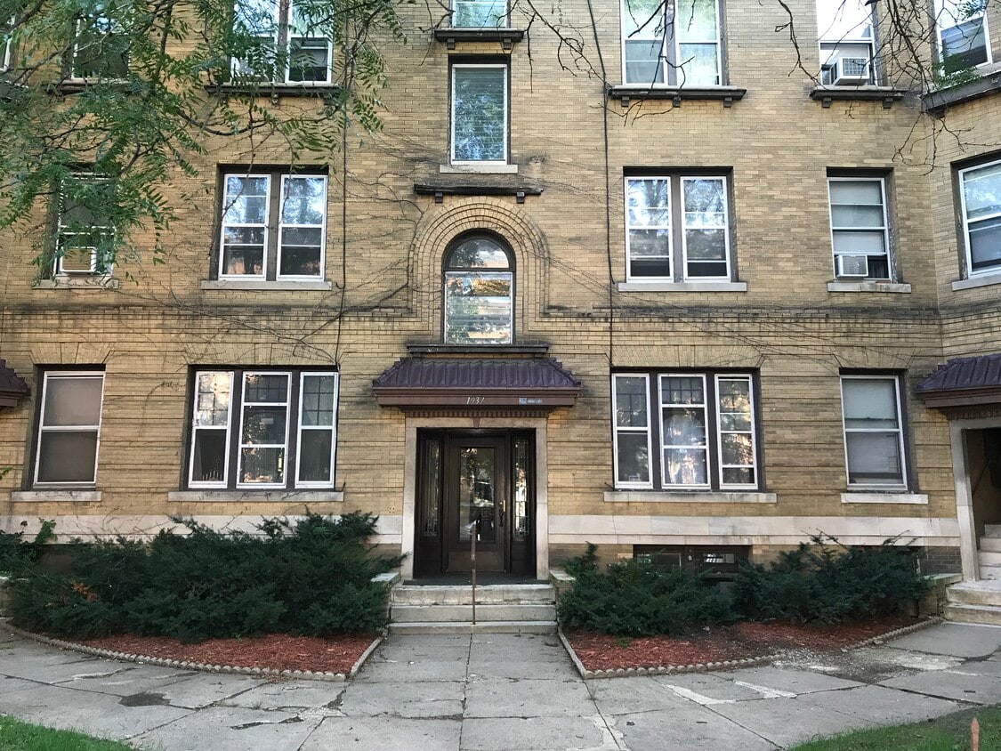
WOW.. this place is HUGE. It is located at where Franklin meets Hennepin Ave S in a great part of Uptown Minneapolis. Close to MCAD- U of MN and of course all the fun of Uptown. It is a bright and sunny unit with plenty of windows for natural light. Both a living room and dinning room. Built in Buffet Clawfoot tub Gas range stove. Check out the video of the unit. https://youtu.be/QrGXfI7JWJs It is ready for a December 1st move in. Rent is $1195 Heat , water and trash are included in your rent. Deposit $1195 Your dog is welcomed with some restrictions and fees's... sorry no other pets or smoking. Please be sure to check out our application and rental criteria here. irvingpropertiesinc.com/application Give IrvingProperties a call or email to set up a showing
1939 Bryant Ave S is an apartment community located in Hennepin County and the 55403 ZIP Code.
Apartment Features
- Smoke Free
- Laundry Facilities
1939 Bryant Ave S,
Minneapolis,
MN
55403
Within the Calhoun-Isles community, Lowry Hill sits just west of Downtown Minneapolis. The population of this area provides a close-knit community of approximately 4,000 residents. Defined by its historical architecture, Lowry Hill's houses display a Victorian style. However, other styles, such as Prairie and Romanesque, make appearances, too. There are upscale apartment communities available here as well, making Lowry Hill an increasingly popular option for those who want to remain close to the city center.
Learn more about living in Lowry HillBelow are rent ranges for similar nearby apartments
Amenities
- Smoke Free
- Laundry Facilities
Expenses
Utilities Included
Water, Heat, Trash Removal, Sewer
Included
Education
| Colleges & Universities | Distance | ||
|---|---|---|---|
| Colleges & Universities | Distance | ||
| Walk: | 17 min | 0.9 mi | |
| Drive: | 4 min | 1.4 mi | |
| Drive: | 5 min | 1.9 mi | |
| Drive: | 6 min | 3.2 mi |
1939 Bryant Ave S Unit 29 is within 17 minutes or 0.9 mile from Minneapolis College. It is also near University of St. Thomas and North Central University.
Transportation options available in Minneapolis include Warehouse District/Hennepin Avenue Station, located 1.7 miles from 1939 Bryant Ave S Unit 29. 1939 Bryant Ave S Unit 29 is near Minneapolis-St Paul International/Wold-Chamberlain, located 11.2 miles or 21 minutes away.
| Transit / Subway | Distance | ||
|---|---|---|---|
| Transit / Subway | Distance | ||
|
|
Drive: | 5 min | 1.7 mi |
|
|
Drive: | 6 min | 1.9 mi |
|
|
Drive: | 6 min | 1.9 mi |
| Drive: | 6 min | 2.2 mi | |
|
|
Drive: | 7 min | 3.4 mi |
| Commuter Rail | Distance | ||
|---|---|---|---|
| Commuter Rail | Distance | ||
|
|
Drive: | 6 min | 2.2 mi |
|
|
Drive: | 15 min | 9.1 mi |
|
|
Drive: | 16 min | 11.1 mi |
|
|
Drive: | 29 min | 20.2 mi |
|
|
Drive: | 31 min | 21.8 mi |
| Airports | Distance | ||
|---|---|---|---|
| Airports | Distance | ||
|
Minneapolis-St Paul International/Wold-Chamberlain
|
Drive: | 21 min | 11.2 mi |
Walkability Near 1939 Bryant Ave S Minneapolis, MN 55403
Getting Around
 What do Walkability, Transit, Drivability, and Bikeability mean?
Walkability measures the walking distance to day-to-day needs.
Transit measures access to public transportation.
Drivability measures congestion, parking availability, and access to major roads.
Bikeability measures the suitability for cycling.
How It Works
What do Walkability, Transit, Drivability, and Bikeability mean?
Walkability measures the walking distance to day-to-day needs.
Transit measures access to public transportation.
Drivability measures congestion, parking availability, and access to major roads.
Bikeability measures the suitability for cycling.
How It Works
Very Walkable
Walkability
80
/ 100
Exceptional Public Transit
Transit
90
/ 100
Moderately Drivable
Drivability
60
/ 100
Moderately Bikeable
Bikeability
70
/ 100
Scores provided by
-
Soundscore™
-
/ 100
Traffic
-Airport
-Businesses
-Scores provided by
HowLoud What is a Sound Score Rating? A Sound Score Rating aggregates noise caused by vehicle traffic, airplane traffic and local sources. How It WorksTime and distance from 1939 Bryant Ave S Unit 29.
| Shopping Centers | Distance | ||
|---|---|---|---|
| Shopping Centers | Distance | ||
| Walk: | 5 min | 0.3 mi | |
| Walk: | 11 min | 0.6 mi | |
| Walk: | 14 min | 0.8 mi |
1939 Bryant Ave S Unit 29 has 3 shopping centers within 0.8 mile, which is about a 14-minute walk. The miles and minutes will be for the farthest away property.
| Parks and Recreation | Distance | ||
|---|---|---|---|
| Parks and Recreation | Distance | ||
|
Thomas Lowry Park
|
Walk: | 7 min | 0.4 mi |
|
Mueller Park
|
Walk: | 8 min | 0.5 mi |
|
Minneapolis Sculpture Garden
|
Walk: | 11 min | 0.6 mi |
|
Cowles Conservatory
|
Walk: | 12 min | 0.6 mi |
|
Whittier Park
|
Walk: | 15 min | 0.8 mi |
1939 Bryant Ave S Unit 29 has 5 parks within 0.8 mile, including Thomas Lowry Park, Mueller Park, and Minneapolis Sculpture Garden.
| Hospitals | Distance | ||
|---|---|---|---|
| Hospitals | Distance | ||
| Drive: | 5 min | 1.9 mi | |
| Drive: | 6 min | 2.2 mi | |
| Drive: | 6 min | 2.2 mi |
1939 Bryant Ave S Unit 29 has 3 hospitals within 2.2 miles, the nearest is Children's Hospitals & Clinics of Minnesota which is 1.9 miles away and a 5 minute drive.
| Military Bases | Distance | ||
|---|---|---|---|
| Military Bases | Distance | ||
| Drive: | 16 min | 8.2 mi |
1939 Bryant Ave S Unit 29 is 8.2 miles and a 16 minute drive from Fort Snelling Military Reservation.
You May Also Like
-
Willows On France
8848 Goodrich Rd
Bloomington, MN 55437
$1,179 - $1,469 Plus Fees
1-2 Br 12 Month Lease 8.4 mi
-
Quinn at Plymouth
6110 Quinwood Ln N
Plymouth, MN 55442
$1,495 - $2,895 Plus Fees
1-3 Br 12 Month Lease 10.0 mi
-
Lake Place
11445-11447 Anderson Lakes Pky
Eden Prairie, MN 55344
$1,530 - $1,900 Plus Fees
1-2 Br 10.5 mi
Similar Rentals Nearby
-
-
1 Bed$1,012+Total Monthly PriceTotal Monthly Price NewPrices include required monthly fees of $67.Base Rent:1 Bed$945+
High-Speed Internet Laundry Facilities
-
1 Bed$2,209+2 Beds$2,809+3 Beds$5,708+Total Monthly PriceTotal Monthly Price NewPrices include required monthly fees of $4.Base Rent:1 Bed$2,205+2 Beds$2,805+3 Beds$5,704+1 Month Free
Pets Allowed Fitness Center Pool Dishwasher Refrigerator Clubhouse Maintenance on site
-
-
1 Bed$1,478+2 Beds$913+Total Monthly PriceTotal Monthly Price NewPrices include all required monthly fees.Specials
Pets Allowed Fitness Center Dishwasher Refrigerator Kitchen In Unit Washer & Dryer
-
-
-
-
-


What Are Walk Score®, Transit Score®, and Bike Score® Ratings?
Walk Score® measures the walkability of any address. Transit Score® measures access to public transit. Bike Score® measures the bikeability of any address.
What is a Sound Score Rating?
A Sound Score Rating aggregates noise caused by vehicle traffic, airplane traffic and local sources.
1939 Bryant Ave S
Minneapolis, MN 55403