
Groove Lofts
608 2nd Ave S,
Minneapolis, MN 55402
$1,351 - $2,311 Plus Fees
Studio - 4 Beds
Discover Your Dream Apartment in a Classic Brownstone If you're looking for a property that blends vintage charm with modern convenience, this classic brownstone is the perfect place for you. Located in the heart of the city, this home offers timeless elegance and easy access to everything you need. Property Highlights: Vintage Character: This stunning apartments features original hardwood floors, built-in buffets, and clawfoot tubs that evoke a sense of timeless beauty. Modern Comforts: Enjoy a mix of updated and vintage kitchens, providing both functionality and style. Bright & Spacious: Large windows and spacious rooms allow for plenty of natural light, creating a welcoming and cozy atmosphere. Convenient Location: Situated in one of the most desirable neighborhoods, you'll have access to countless stores, trendy restaurants, and bustling cafes just steps from your door. Major highways are just minutes away, making commuting a breeze whether you're headed downtown or out of the city. TOTAL MONTHLY PAYMENTS Monthly Apartment Rent: $995-$1700 Security Deposit: $995-$1700 Late Rent Charge: $50 after the 5th of the month NSF Charge: $20 Pet Fee: $40 Pet Deposit: $300 Card Processing Fee*: Varies by vendor Renters Insurance*: Varies by plan Utilities Paid by Resident: Varies by usage Month-to-Month Fee: $35 if applicable Application Fee: $40.00/person Rent Includes: Heat, Water, Trash Tenant Pays For: Electric, Cable/Internet No Smoking
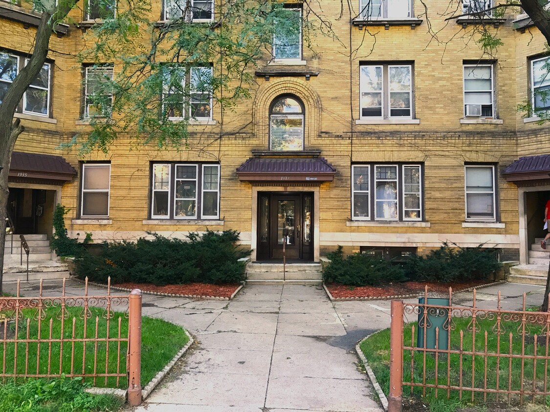
1935-1939 Bryant Ave S is an apartment community located in Hennepin County and the 55403 ZIP Code. This area is served by the Minneapolis Public School Dist. attendance zone.
Dishwasher
Hardwood Floors
Refrigerator
Tub/Shower
Within the Calhoun-Isles community, Lowry Hill sits just west of Downtown Minneapolis. The population of this area provides a close-knit community of approximately 4,000 residents. Defined by its historical architecture, Lowry Hill's houses display a Victorian style. However, other styles, such as Prairie and Romanesque, make appearances, too. There are upscale apartment communities available here as well, making Lowry Hill an increasingly popular option for those who want to remain close to the city center.
Learn more about living in Lowry HillCompare neighborhood and city base rent averages by bedroom.
| Lowry Hill | Minneapolis, MN | |
|---|---|---|
| Studio | $954 | $1,141 |
| 1 Bedroom | $1,205 | $1,420 |
| 2 Bedrooms | $1,587 | $2,121 |
| 3 Bedrooms | $1,532 | $2,406 |
| Colleges & Universities | Distance | ||
|---|---|---|---|
| Colleges & Universities | Distance | ||
| Walk: | 17 min | 0.9 mi | |
| Drive: | 4 min | 1.4 mi | |
| Drive: | 5 min | 1.9 mi | |
| Drive: | 6 min | 3.2 mi |


Transportation options available in Minneapolis include Warehouse District/Hennepin Avenue Station, located 1.7 miles from 1935-1939 Bryant Ave S. 1935-1939 Bryant Ave S is near Minneapolis-St Paul International/Wold-Chamberlain, located 11.2 miles or 21 minutes away.
| Transit / Subway | Distance | ||
|---|---|---|---|
| Transit / Subway | Distance | ||
|
|
Drive: | 5 min | 1.7 mi |
|
|
Drive: | 6 min | 1.9 mi |
|
|
Drive: | 6 min | 1.9 mi |
| Drive: | 6 min | 2.2 mi | |
|
|
Drive: | 7 min | 3.4 mi |
| Commuter Rail | Distance | ||
|---|---|---|---|
| Commuter Rail | Distance | ||
|
|
Drive: | 6 min | 2.2 mi |
|
|
Drive: | 15 min | 9.1 mi |
|
|
Drive: | 16 min | 11.1 mi |
|
|
Drive: | 29 min | 20.2 mi |
|
|
Drive: | 31 min | 21.8 mi |
| Airports | Distance | ||
|---|---|---|---|
| Airports | Distance | ||
|
Minneapolis-St Paul International/Wold-Chamberlain
|
Drive: | 21 min | 11.2 mi |
Scores provided by
Traffic
-Airport
-Businesses
-Scores provided by
HowLoud What is a Sound Score Rating? A Sound Score Rating aggregates noise caused by vehicle traffic, airplane traffic and local sources. How It WorksTime and distance from 1935-1939 Bryant Ave S.
| Shopping Centers | Distance | ||
|---|---|---|---|
| Shopping Centers | Distance | ||
| Walk: | 5 min | 0.3 mi | |
| Walk: | 11 min | 0.6 mi | |
| Walk: | 14 min | 0.7 mi |
| Parks and Recreation | Distance | ||
|---|---|---|---|
| Parks and Recreation | Distance | ||
|
Thomas Lowry Park
|
Walk: | 7 min | 0.4 mi |
|
Mueller Park
|
Walk: | 8 min | 0.5 mi |
|
Minneapolis Sculpture Garden
|
Walk: | 11 min | 0.6 mi |
|
Cowles Conservatory
|
Walk: | 12 min | 0.6 mi |
|
Loring Park
|
Walk: | 17 min | 0.9 mi |
| Hospitals | Distance | ||
|---|---|---|---|
| Hospitals | Distance | ||
| Drive: | 5 min | 1.9 mi | |
| Drive: | 6 min | 2.2 mi | |
| Drive: | 6 min | 2.2 mi |
| Military Bases | Distance | ||
|---|---|---|---|
| Military Bases | Distance | ||
| Drive: | 16 min | 8.2 mi |
High-Speed Internet Laundry Facilities
Pets Allowed Fitness Center Pool Dishwasher Refrigerator Clubhouse Maintenance on site
Pets Allowed Fitness Center Pool Dishwasher Refrigerator Kitchen
Pets Allowed Fitness Center Pool Dishwasher Refrigerator Kitchen In Unit Washer & Dryer
Pets Allowed Pool Dishwasher Microwave Granite Countertops
What Are Walk Score®, Transit Score®, and Bike Score® Ratings?
Walk Score® measures the walkability of any address. Transit Score® measures access to public transit. Bike Score® measures the bikeability of any address.
What is a Sound Score Rating?
A Sound Score Rating aggregates noise caused by vehicle traffic, airplane traffic and local sources.

1935-1939 Bryant Ave S
Minneapolis, MN 55403


