
$2,050
/ Month
1928 36th Ave
Oakland, CA 94601
Today
Favorites
-
Bedrooms
2
-
Bathrooms
1
-
Square Feet
985 sq ft
1928 36th Ave

Favorites
About This Home
$2,050 deposit
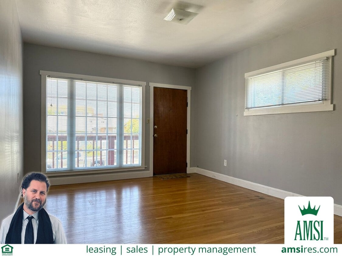
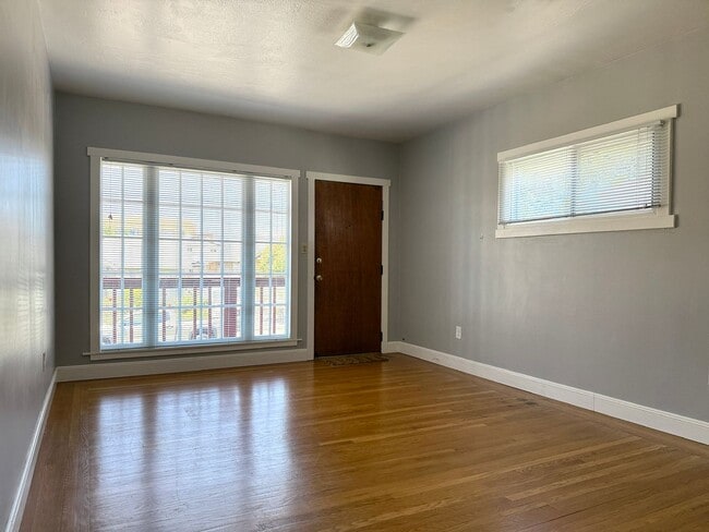
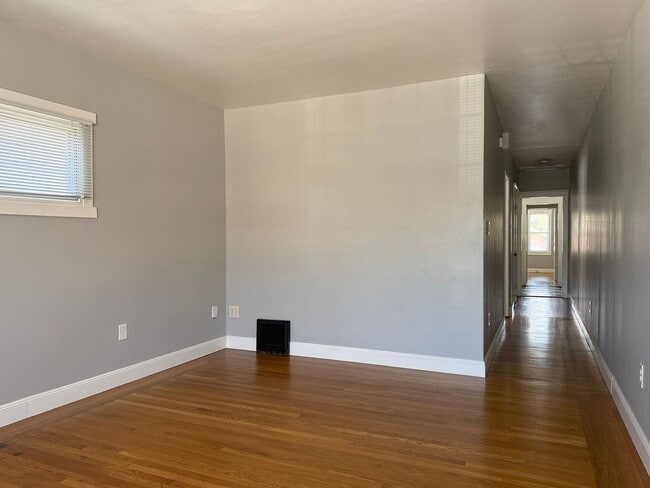
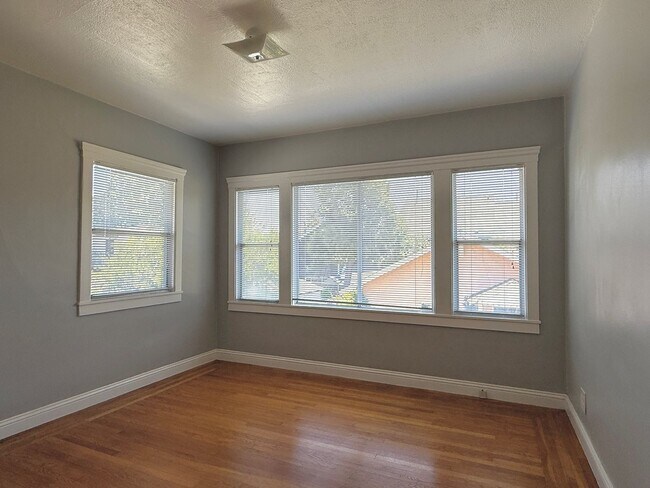
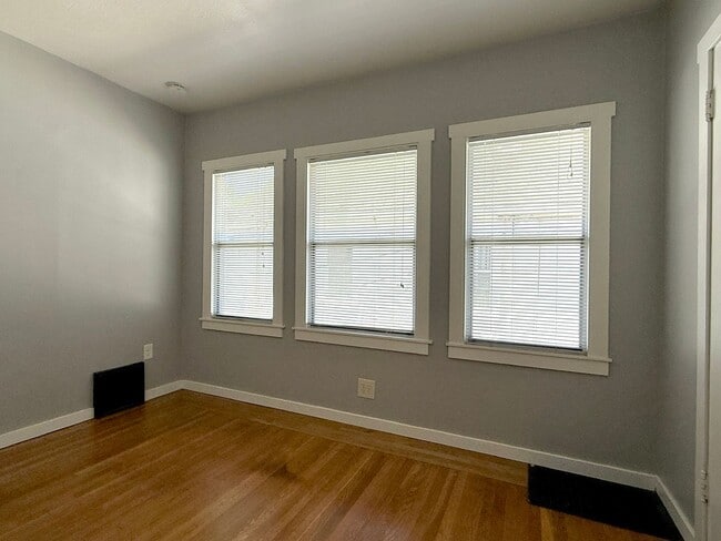
Welcome to your new home in Amazing Oakland! This spacious 2-bedroom, 1-bathroom apartment features both comfort and convenience. This property has a private garage, providing secure parking and additional storage space as well as a private washer/dryer. Inside, you'll find a gas range and New Tile/Cabinets/Countertops in the kitchen, perfect for those who love to cook. Features easy to maintain and beautiful hardwood floors. New mini blinds are installed throughout, ensuring privacy and control over natural light. This property offers a blend of functionality and style, making it a perfect place to call home. Convenient walk to Fruitvale BART (0.8mi)Access to 580 and 880 freeways. Owner pays Garbage. Eli Meyskens Realtor / Leasing / Relocation mobile AMSI Foundation DRE # 01902318
Unique Features
- new mini blinds
- garbage
- hardwood floors
- private garage
1928 36th Ave is a townhome located in Alameda County and the 94601 ZIP Code. This area is served by the Oakland Unified attendance zone.
* Price shown is base rent and may not include non-optional fees and utilities. Price, availability, fees, and any applicable rent special are subject to change without notice.
* Square footage definitions vary. Displayed square footage is approximate.
Contact
- Listed by AMSI | AMSI
Location
Get Directions
Amenities
- new mini blinds
- garbage
- hardwood floors
- private garage
Mostly a residential neighborhood, Harrington is brimming with family housing and apartments in addition to local businesses. Harrington is located within close proximity to a number of parks, entertainment venues, and higher learning institutions.
Nearby Cesar Chavez Park, Allendale Recreation Center, and Redwood Regional Park offer ample opportunities for engaging in outdoor activities. Peralta Hacienda Historical Park, Oracle Arena, Chabot Space and Science Center, and Children’s Fairyland are not too far from Harrington for a day of adventure. Patten University, Mills College, Merritt College, Holy Names University, and Laney College are all convenient to commute to from Harrington.
With access to the I-580 and I-880, Fruitvale BART station, and Downtown Oakland, Harrington allows for simple commutes and travels. Both Oakland International and San Francisco International Airports are short drives from the neighborhood as well.
Learn more about living in Harrington
Education
| Colleges & Universities | Distance | ||
|---|---|---|---|
| Colleges & Universities | Distance | ||
| Drive: | 8 min | 2.8 mi | |
| Drive: | 5 min | 3.1 mi | |
| Drive: | 7 min | 3.9 mi | |
| Drive: | 11 min | 5.4 mi |
1928 36th Ave is within 8 minutes or 2.8 miles from Mills College. It is also near Laney College and Lincoln University, Oakland.
Schools


Public Elementary School
Grades K-5
423 Students
Attendance Zone
Public Elementary & Middle School
Grades K-8
656 Students
Nearby
Public Middle School
Grades 6-8
370 Students
Attendance Zone
Public Middle School
Grades 6-8
367 Students
Attendance Zone
Public High School
Grades 9-12
1,146 Students
Attendance Zone
Private Elementary, Middle & High School
Grades K-12
180 Students
Nearby
Private Elementary, Middle & High School
Grades PK-12
Nearby
Private High School
Grades 9-12
154 Students
Nearby
School data provided by
 The GreatSchools Rating helps parents compare schools within a state based on a variety of school quality indicators and provides a helpful picture of how effectively each school serves all of its students. Ratings are on a scale of 1 (below average) to 10 (above average) and can include test scores, college readiness, academic progress, advanced courses, equity, discipline and attendance data. We also advise parents to visit schools, consider other information on school performance and programs, and consider family needs as part of the school selection process.
View GreatSchools Rating Methodology
Data provided by GreatSchools.org © 2025. All rights reserved.
View GreatSchools Rating Methodology
Data provided by GreatSchools.org © 2025. All rights reserved.
Transportation options available in Oakland include Fruitvale Station, located 0.8 mile from 1928 36th Ave. 1928 36th Ave is near Metro Oakland International, located 6.3 miles or 10 minutes away, and San Francisco International, located 26.8 miles or 40 minutes away.
| Transit / Subway | Distance | ||
|---|---|---|---|
| Transit / Subway | Distance | ||
|
|
Walk: | 14 min | 0.8 mi |
|
|
Drive: | 5 min | 2.6 mi |
|
|
Drive: | 7 min | 3.5 mi |
|
|
Drive: | 7 min | 3.9 mi |
|
|
Drive: | 7 min | 3.9 mi |
| Commuter Rail | Distance | ||
|---|---|---|---|
| Commuter Rail | Distance | ||
|
|
Drive: | 7 min | 4.1 mi |
|
|
Drive: | 12 min | 7.8 mi |
|
|
Drive: | 15 min | 9.9 mi |
| Drive: | 23 min | 15.6 mi | |
| Drive: | 23 min | 15.6 mi |
| Airports | Distance | ||
|---|---|---|---|
| Airports | Distance | ||
|
Metro Oakland International
|
Drive: | 10 min | 6.3 mi |
|
San Francisco International
|
Drive: | 40 min | 26.8 mi |
Time and distance from 1928 36th Ave.
| Shopping Centers | Distance | ||
|---|---|---|---|
| Shopping Centers | Distance | ||
| Walk: | 10 min | 0.5 mi | |
| Walk: | 11 min | 0.6 mi | |
| Walk: | 13 min | 0.7 mi |
1928 36th Ave has 3 shopping centers within 0.7 mile, which is about a 13-minute walk. The miles and minutes will be for the farthest away property.
| Parks and Recreation | Distance | ||
|---|---|---|---|
| Parks and Recreation | Distance | ||
|
Oakland Museum of California
|
Drive: | 6 min | 3.5 mi |
|
Lakeside Park
|
Drive: | 7 min | 4.2 mi |
|
Rotary Nature Center
|
Drive: | 8 min | 4.6 mi |
|
Martin Luther King Jr. Regional Shoreline
|
Drive: | 10 min | 5.3 mi |
|
Joaquin Miller Park
|
Drive: | 13 min | 6.1 mi |
1928 36th Ave has 5 parks within 6.1 miles, including Lakeside Park, Oakland Museum of California, and Rotary Nature Center.
| Hospitals | Distance | ||
|---|---|---|---|
| Hospitals | Distance | ||
| Drive: | 2 min | 1.2 mi | |
| Drive: | 5 min | 2.6 mi | |
| Drive: | 7 min | 3.1 mi |
1928 36th Ave has 3 hospitals within 3.1 miles, the nearest is Telecare Heritage Psychiatric Health Facility which is 1.2 miles away and a 2 minute drive.
| Military Bases | Distance | ||
|---|---|---|---|
| Military Bases | Distance | ||
| Drive: | 15 min | 6.9 mi | |
| Drive: | 16 min | 7.6 mi |
1928 36th Ave is 6.9 miles from Alameda/US Naval Air Station Alameda, and is convenient to other military bases, including Oakland Army Base.
You May Also Like
Similar Rentals Nearby


What Are Walk Score®, Transit Score®, and Bike Score® Ratings?
Walk Score® measures the walkability of any address. Transit Score® measures access to public transit. Bike Score® measures the bikeability of any address.
What is a Sound Score Rating?
A Sound Score Rating aggregates noise caused by vehicle traffic, airplane traffic and local sources

1928 36th Ave
Oakland, CA 94601