
$3,000 / Month
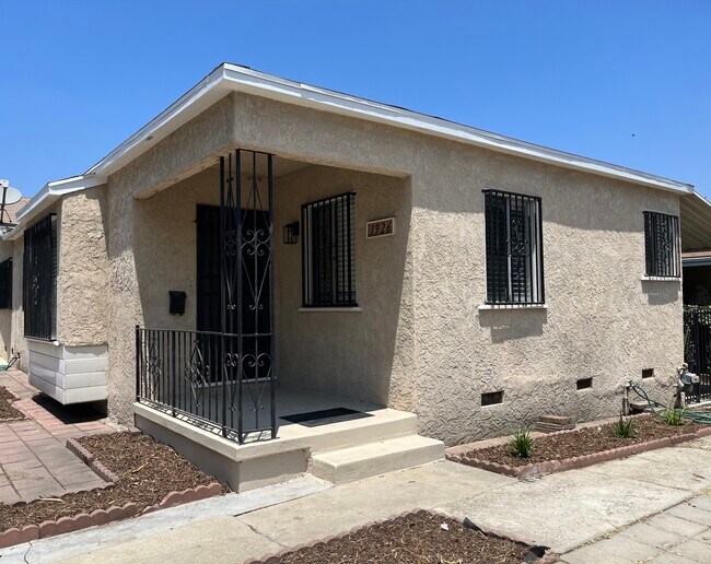
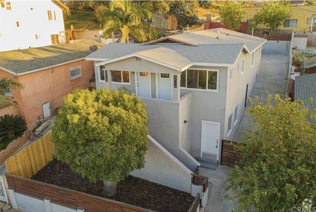
1926 Cyril Ave
Los Angeles, CA 90032
2 Weeks Ago
Favorites
1926 Cyril Ave

Favorites
Check Back Soon for Upcoming Availability
| Beds | Baths | Average SF |
|---|---|---|
| 2 Bedrooms 2 Bedrooms 2 Br | 1 Bath 1 Bath 1 Ba | 800 SF |
Fees and Policies
The fees below are based on community-supplied data and may exclude additional fees and utilities.
- Parking
-
Street--
Details
Utilities Included
-
Gas
-
Water
-
Electricity
-
Trash Removal
-
Sewer
About This Property
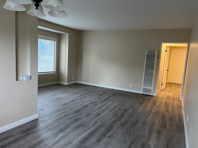
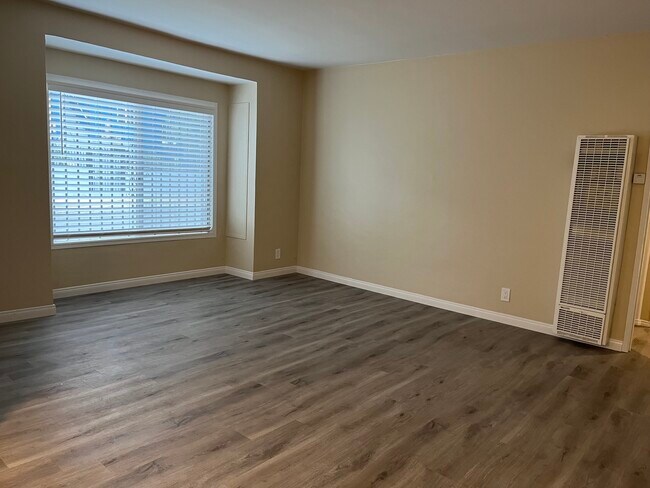
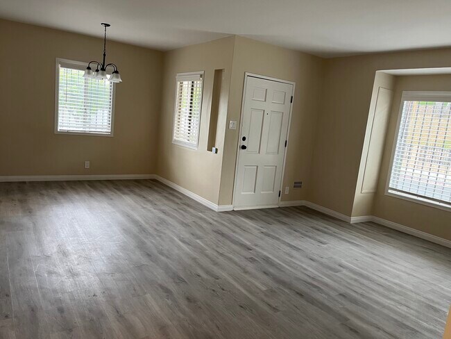
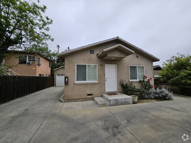
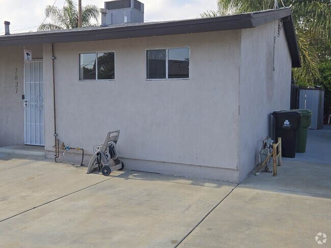
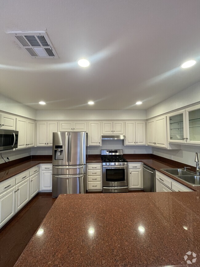
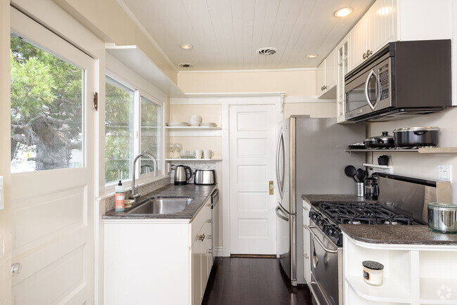
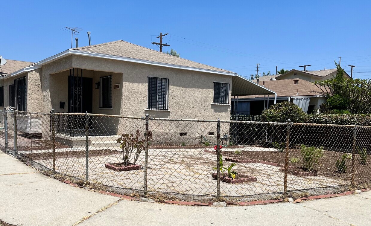
Charming front house in the heart of El Sereno available for rent! 2 Bedrooms, 1 bathroom and approximately 800 sq ft of living space. The house has just been fully renovated with new floorings, freshly painted throughout the house, renovated kitchen with new beautiful white cabinets, new stove and microwave, beautiful bathroom with new subway-tiled shower and reglazed bathtub, very spacious living room and dining room, a newly installed double sided wall heat unit. Large front and back yard. It is walking distance to schools, parks, restaurants, and shopping. Centrally located to Cal State Los Angeles, USC Medical Campus, Downtown Los Angeles, Alhambra, South Pasadena with easy access to major freeways (710, 10, 5). All utilities such as water, gas, electricity, sewage and trash are included in the rent. No A/C. No pets allowed.
1926 Cyril Ave is a house located in Los Angeles County and the 90032 ZIP Code.
House Features
Air Conditioning
Washer/Dryer Hookup
Microwave
Tub/Shower
- Washer/Dryer Hookup
- Air Conditioning
- Heating
- Tub/Shower
- Kitchen
- Microwave
- Dining Room
- Yard
Location
Get Directions
Southeast Los Angeles is directly south of the Fashion District and east of the University of Southern California (USC). This large neighborhood is minutes from downtown Los Angeles, Hollywood, and Beverly Hills, with easy access to the 110 Freeway. This great location places you near sunny beaches, nature trails, and a bevy of leading employers. Students can access both USC and California State University Long Beach from their Southeast LA apartment.
This densely populated, diverse neighborhood features everything from food trucks and corner markets to wide sidewalks and residential areas filled with bungalows, ranch, and Spanish Colonial architecture. Southeast LA features palm trees and mountain views, tampered with gritty undertones to give it a cool, funky vibe.
As for outdoor fun, take your pick between Catalina Island, Venus Beach, or the Santa Monica Pier. Nearby, you’ll find more sunny beaches like White Point, Cabrillo, and Long Beach.
Learn more about living in Southeast Los AngelesBelow are rent ranges for similar nearby apartments
Amenities
- Washer/Dryer Hookup
- Air Conditioning
- Heating
- Tub/Shower
- Kitchen
- Microwave
- Dining Room
- Yard
Expenses
Utilities Included
Gas, Water, Electricity, Trash Removal, Sewer
Included
Education
| Colleges & Universities | Distance | ||
|---|---|---|---|
| Colleges & Universities | Distance | ||
| Drive: | 4 min | 1.7 mi | |
| Drive: | 5 min | 2.4 mi | |
| Drive: | 8 min | 3.9 mi | |
| Drive: | 15 min | 8.0 mi |
1926 Cyril Ave is within 4 minutes or 1.7 miles from Cal State Los Angeles. It is also near USC, Health Sciences Campus and East Los Angeles College.
Transportation options available in Los Angeles include Soto, located 3.0 miles from 1926 Cyril Ave. 1926 Cyril Ave is near Bob Hope, located 18.0 miles or 26 minutes away, and Los Angeles International, located 20.0 miles or 33 minutes away.
| Transit / Subway | Distance | ||
|---|---|---|---|
| Transit / Subway | Distance | ||
|
|
Drive: | 5 min | 3.0 mi |
| Drive: | 7 min | 3.4 mi | |
|
|
Drive: | 6 min | 3.4 mi |
|
|
Drive: | 8 min | 3.5 mi |
|
|
Drive: | 7 min | 3.7 mi |
| Commuter Rail | Distance | ||
|---|---|---|---|
| Commuter Rail | Distance | ||
|
|
Drive: | 9 min | 3.9 mi |
|
|
Drive: | 8 min | 4.0 mi |
|
|
Drive: | 14 min | 7.6 mi |
| Drive: | 11 min | 7.9 mi | |
|
|
Drive: | 14 min | 8.5 mi |
| Airports | Distance | ||
|---|---|---|---|
| Airports | Distance | ||
|
Bob Hope
|
Drive: | 26 min | 18.0 mi |
|
Los Angeles International
|
Drive: | 33 min | 20.0 mi |
Time and distance from 1926 Cyril Ave.
| Shopping Centers | Distance | ||
|---|---|---|---|
| Shopping Centers | Distance | ||
| Drive: | 5 min | 2.3 mi | |
| Drive: | 4 min | 2.6 mi | |
| Drive: | 7 min | 3.3 mi |
1926 Cyril Ave has 3 shopping centers within 3.3 miles, which is about a 7-minute drive. The miles and minutes will be for the farthest away property.
| Parks and Recreation | Distance | ||
|---|---|---|---|
| Parks and Recreation | Distance | ||
|
Hollenbeck Lake
|
Drive: | 7 min | 3.6 mi |
|
Audubon Center at Debs Park
|
Drive: | 9 min | 4.4 mi |
|
Chavez Ravine Arboretum
|
Drive: | 10 min | 5.4 mi |
|
Elysian Park
|
Drive: | 13 min | 5.4 mi |
|
Elyria Canyon Park
|
Drive: | 11 min | 6.0 mi |
1926 Cyril Ave has 5 parks within 6.0 miles, including Audubon Center at Debs Park, Hollenbeck Lake, and Elysian Park.
| Hospitals | Distance | ||
|---|---|---|---|
| Hospitals | Distance | ||
| Drive: | 3 min | 1.7 mi | |
| Drive: | 5 min | 2.7 mi | |
| Drive: | 7 min | 3.3 mi |
1926 Cyril Ave has 3 hospitals within 3.3 miles, the nearest is Keck Hospital of USC which is 1.7 miles away and a 3 minute drive.
| Military Bases | Distance | ||
|---|---|---|---|
| Military Bases | Distance | ||
| Drive: | 30 min | 21.6 mi | |
| Drive: | 36 min | 24.5 mi |
1926 Cyril Ave is 21.6 miles from Los Angeles Air Force Base, and is convenient to other military bases, including Los Alamitos Army Airfield.
You May Also Like
Similar Rentals Nearby

What Are Walk Score®, Transit Score®, and Bike Score® Ratings?
Walk Score® measures the walkability of any address. Transit Score® measures access to public transit. Bike Score® measures the bikeability of any address.
What is a Sound Score Rating?
A Sound Score Rating aggregates noise caused by vehicle traffic, airplane traffic and local sources
1926 Cyril Ave
Los Angeles, CA 90032