
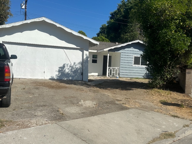
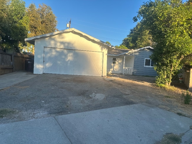
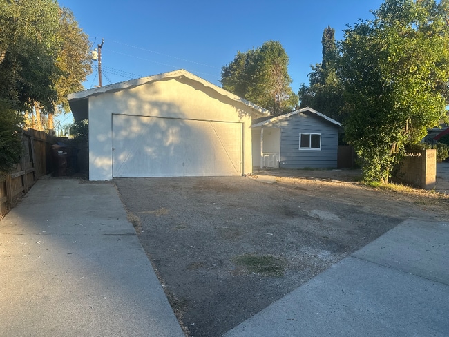
1918 Dunswell Ave
Hacienda Heights, CA 91745
-
Bedrooms
3
-
Bathrooms
2
-
Square Feet
1,300 sq ft
-
Available
Available Now
Highlights
- Pets Allowed
- Fenced Lot

About This Home
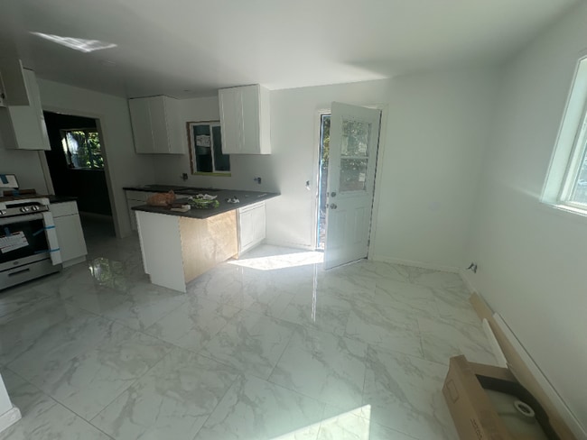
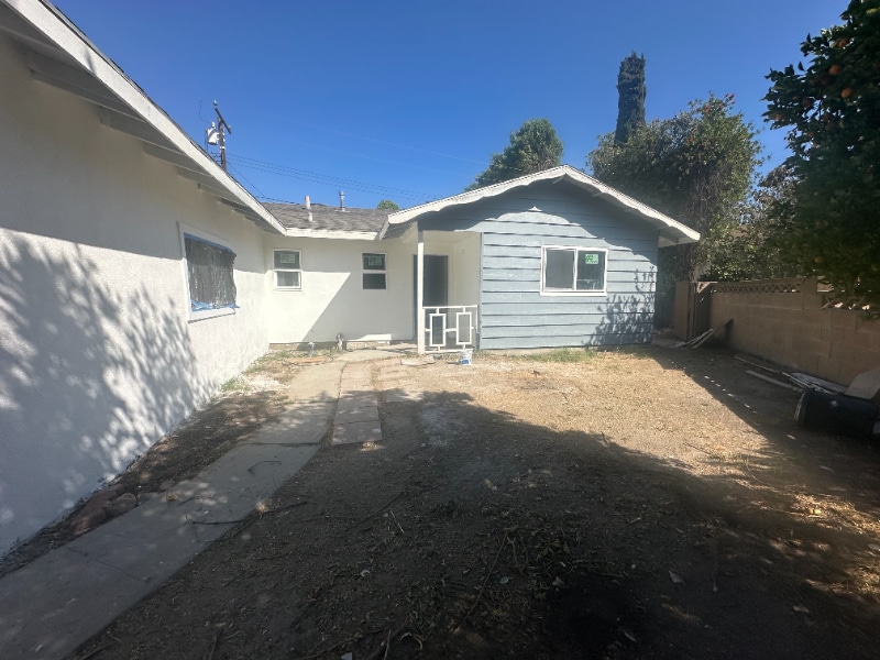
Property Id: 2090447 House for Rent - Fully Renovated Interior completely remodeled Updated bathrooms New kitchen cabinets Move-in ready! Casa en Renta - Completamente Remodelada, Baños remodelados con acabados modernos Gabinetes de cocina nuevos y elegantes Ambientes frescos, amplios y listos para estrenar Ubicación conveniente, lista para mudarse. Ideal para quienes buscan comodidad, estilo y un hogar recién renovado.
1918 Dunswell Ave is a house located in Los Angeles County and the 91745 ZIP Code. This area is served by the Hacienda la Puente Unified attendance zone.
House Features
- Disposal
- Oven
- Tile Floors
- Fenced Lot
Fees and Policies
The fees below are based on community-supplied data and may exclude additional fees and utilities.
- Dogs Allowed
-
Fees not specified
- Cats Allowed
-
Fees not specified
- Parking
-
Garage--
Contact
- Phone Number
- Contact
-
Source

- Disposal
- Oven
- Tile Floors
- Fenced Lot
Located 20 miles east of Downtown Los Angeles, Hacienda La Puente lie in Los Angeles County. Known simply to locals as “Hacienda,” the area is home to a vibrant culture. State Route 60 runs through an urban hub with a suburban feel in the San Gabriel Valley region. Hacienda stretches into the hills, drawing a culturally diverse demographic. The neighborhood parks have stunning panoramic views, and local grocery stores stock a wide range of foods. Affordable apartments in and around Hacienda and the Hacienda Heights area will put you just minutes from the heart of LA.
Learn more about living in Hacienda La Puente| Colleges & Universities | Distance | ||
|---|---|---|---|
| Colleges & Universities | Distance | ||
| Drive: | 13 min | 6.0 mi | |
| Drive: | 12 min | 7.3 mi | |
| Drive: | 16 min | 8.2 mi | |
| Drive: | 18 min | 10.3 mi |


View GreatSchools Rating Methodology
Data provided by GreatSchools.org © 2025. All rights reserved.
Transportation options available in Hacienda Heights include Irwindale Station, located 10.5 miles from 1918 Dunswell Ave. 1918 Dunswell Ave is near Ontario International, located 25.4 miles or 34 minutes away, and Long Beach (Daugherty Field), located 26.3 miles or 36 minutes away.
| Transit / Subway | Distance | ||
|---|---|---|---|
| Transit / Subway | Distance | ||
| Drive: | 20 min | 10.5 mi | |
| Drive: | 22 min | 14.5 mi | |
| Drive: | 21 min | 15.3 mi | |
|
|
Drive: | 22 min | 17.2 mi |
| Commuter Rail | Distance | ||
|---|---|---|---|
| Commuter Rail | Distance | ||
|
|
Drive: | 16 min | 8.5 mi |
|
|
Drive: | 14 min | 8.8 mi |
|
|
Drive: | 16 min | 9.3 mi |
|
|
Drive: | 18 min | 9.4 mi |
|
|
Drive: | 18 min | 10.0 mi |
| Airports | Distance | ||
|---|---|---|---|
| Airports | Distance | ||
|
Ontario International
|
Drive: | 34 min | 25.4 mi |
|
Long Beach (Daugherty Field)
|
Drive: | 36 min | 26.3 mi |
Time and distance from 1918 Dunswell Ave.
| Shopping Centers | Distance | ||
|---|---|---|---|
| Shopping Centers | Distance | ||
| Walk: | 9 min | 0.5 mi | |
| Walk: | 9 min | 0.5 mi | |
| Walk: | 13 min | 0.7 mi |
| Parks and Recreation | Distance | ||
|---|---|---|---|
| Parks and Recreation | Distance | ||
|
Schabarum Regional Park
|
Drive: | 10 min | 4.5 mi |
|
La Habra Historical Museum
|
Drive: | 12 min | 6.7 mi |
|
Children's Museum at La Habra
|
Drive: | 13 min | 6.8 mi |
|
Whittier Narrows Nature Center
|
Drive: | 11 min | 6.9 mi |
|
Galster Wilderness Park Nature Center
|
Drive: | 14 min | 7.7 mi |
| Hospitals | Distance | ||
|---|---|---|---|
| Hospitals | Distance | ||
| Drive: | 9 min | 4.8 mi | |
| Drive: | 12 min | 6.5 mi | |
| Drive: | 12 min | 6.5 mi |
| Military Bases | Distance | ||
|---|---|---|---|
| Military Bases | Distance | ||
| Drive: | 31 min | 17.3 mi |
1918 Dunswell Ave Photos
Nearby Apartments
Within 50 Miles of 1918 Dunswell Ave Hacienda Heights, CA 91745
-
1825 Walnut Creek Ct
West Covina, CA 91791
$4,500
3 Br 6.0 mi
-
417 Benrud St
Duarte, CA 91010
$2,945
3 Br 8.4 mi
-
7519 Graves Ave
Rosemead, CA 91770
$3,850
3 Br 8.6 mi
-
4978 N. Maywood Ave
Los Angeles, CA 90041
$5,995
4 Br 16.7 mi
-
822 E Kensington Rd
Los Angeles, CA 90026
$4,995
3 Br 16.8 mi
-
Student Housing Near USC Univ Southern Calif
1155 W 24th St
Los Angeles, CA 90007
$3,395 - $6,995
3-6 Br 18.1 mi
What Are Walk Score®, Transit Score®, and Bike Score® Ratings?
Walk Score® measures the walkability of any address. Transit Score® measures access to public transit. Bike Score® measures the bikeability of any address.
What is a Sound Score Rating?
A Sound Score Rating aggregates noise caused by vehicle traffic, airplane traffic and local sources
1918 Dunswell Ave
Hacienda Heights, CA 91745