
Hills at Hacienda Heights
2401 S Hacienda Blvd,
Hacienda Heights, CA 91745
$2,195 - $3,100
1-3 Beds

The best is yet to come, and with Sagewood Gardens Apartments, you can start the next chapter on the right foot. Your first step is to pick your favorite out of our one, two, and four-bedroom floor plans ranging from 560 to 1,930 square feet. Regardless of your choice, these 55+ Hacienda Heights apartments are sure to delight you each day.Find out more on the Floor Plans page!
Sagewood Gardens Senior Apartments is an apartment community located in Los Angeles County and the 91745 ZIP Code. This area is served by the Hacienda La Puente Unified School District attendance zone.
Unique Features
Fitness Center
Laundry Facilities
Clubhouse
Controlled Access
Air Conditioning
High Speed Internet Access
Hardwood Floors
Microwave
Located 20 miles east of Downtown Los Angeles, Hacienda La Puente lie in Los Angeles County. Known simply to locals as “Hacienda,” the area is home to a vibrant culture. State Route 60 runs through an urban hub with a suburban feel in the San Gabriel Valley region. Hacienda stretches into the hills, drawing a culturally diverse demographic. The neighborhood parks have stunning panoramic views, and local grocery stores stock a wide range of foods. Affordable apartments in and around Hacienda and the Hacienda Heights area will put you just minutes from the heart of LA.
Learn more about living in Hacienda La PuenteCompare neighborhood and city base rent averages by bedroom.
| Hacienda La Puente | Hacienda Heights, CA | |
|---|---|---|
| Studio | $1,323 | - |
| 1 Bedroom | $1,717 | $2,098 |
| 2 Bedrooms | $2,116 | $2,533 |
| 3 Bedrooms | $2,748 | $3,027 |
| Colleges & Universities | Distance | ||
|---|---|---|---|
| Colleges & Universities | Distance | ||
| Drive: | 9 min | 4.8 mi | |
| Drive: | 17 min | 8.1 mi | |
| Drive: | 20 min | 10.3 mi | |
| Drive: | 18 min | 10.5 mi |


Transportation options available in Hacienda Heights include Irwindale Station, located 9.2 miles from Sagewood Gardens Senior Apartments. Sagewood Gardens Senior Apartments is near Long Beach (Daugherty Field), located 23.8 miles or 33 minutes away, and Ontario International, located 26.6 miles or 35 minutes away.
| Transit / Subway | Distance | ||
|---|---|---|---|
| Transit / Subway | Distance | ||
| Drive: | 17 min | 9.2 mi | |
| Drive: | 19 min | 11.1 mi | |
| Drive: | 18 min | 11.9 mi | |
| Drive: | 17 min | 12.8 mi | |
| Drive: | 22 min | 16.2 mi |
| Commuter Rail | Distance | ||
|---|---|---|---|
| Commuter Rail | Distance | ||
|
|
Drive: | 13 min | 6.6 mi |
|
|
Drive: | 13 min | 6.8 mi |
|
|
Drive: | 16 min | 9.2 mi |
|
|
Drive: | 15 min | 10.0 mi |
|
|
Drive: | 18 min | 10.8 mi |
| Airports | Distance | ||
|---|---|---|---|
| Airports | Distance | ||
|
Long Beach (Daugherty Field)
|
Drive: | 33 min | 23.8 mi |
|
Ontario International
|
Drive: | 35 min | 26.6 mi |
Scores provided by
Traffic
BusyAirport
CalmBusinesses
CalmScores provided by
HowLoud What is a Sound Score Rating? A Sound Score Rating aggregates noise caused by vehicle traffic, airplane traffic and local sources. How It WorksTime and distance from Sagewood Gardens Senior Apartments.
| Shopping Centers | Distance | ||
|---|---|---|---|
| Shopping Centers | Distance | ||
| Walk: | 13 min | 0.7 mi | |
| Drive: | 3 min | 1.3 mi | |
| Drive: | 3 min | 1.3 mi |
| Parks and Recreation | Distance | ||
|---|---|---|---|
| Parks and Recreation | Distance | ||
|
Whittier Narrows Nature Center
|
Drive: | 8 min | 4.4 mi |
|
Schabarum Regional Park
|
Drive: | 12 min | 5.7 mi |
|
Whittier Narrows Recreation Area
|
Drive: | 11 min | 6.0 mi |
|
Pio Pico State Historic Park
|
Drive: | 10 min | 7.0 mi |
|
Galster Wilderness Park Nature Center
|
Drive: | 14 min | 7.7 mi |
| Hospitals | Distance | ||
|---|---|---|---|
| Hospitals | Distance | ||
| Drive: | 9 min | 4.8 mi | |
| Drive: | 9 min | 5.2 mi | |
| Drive: | 8 min | 5.2 mi |
| Military Bases | Distance | ||
|---|---|---|---|
| Military Bases | Distance | ||
| Drive: | 34 min | 25.8 mi | |
| Drive: | 38 min | 30.3 mi | |
| Drive: | 48 min | 33.6 mi |
Pets Allowed Fitness Center Pool In Unit Washer & Dryer Clubhouse Balcony
Pets Allowed Fitness Center Pool Dishwasher Refrigerator Kitchen
What Are Walk Score®, Transit Score®, and Bike Score® Ratings?
Walk Score® measures the walkability of any address. Transit Score® measures access to public transit. Bike Score® measures the bikeability of any address.
What is a Sound Score Rating?
A Sound Score Rating aggregates noise caused by vehicle traffic, airplane traffic and local sources.
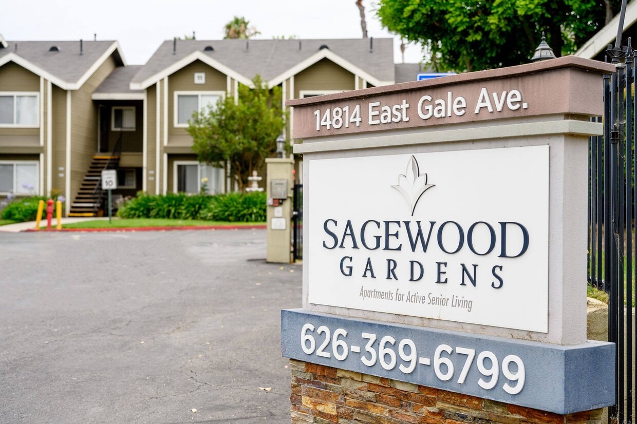
14814 Gale Ave
Hacienda Heights, CA 91745


