$2,695
/ Month
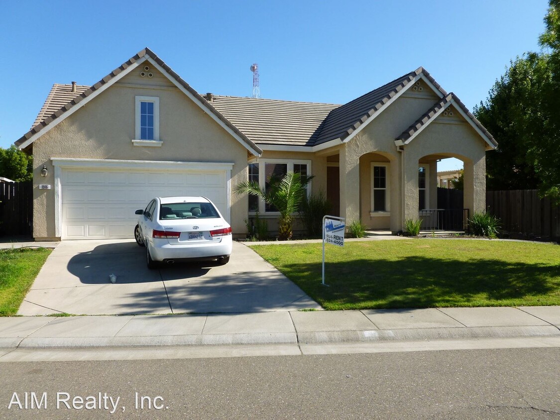
1916 Santa Ines St
Roseville, CA 95747
Favorites
1916 Santa Ines St

Favorites
Check Back Soon for Upcoming Availability
| Beds | Baths | Average SF |
|---|---|---|
| 3 Bedrooms 3 Bedrooms 3 Br | 2 Baths 2 Baths 2 Ba | 1,811 SF |
About This Property
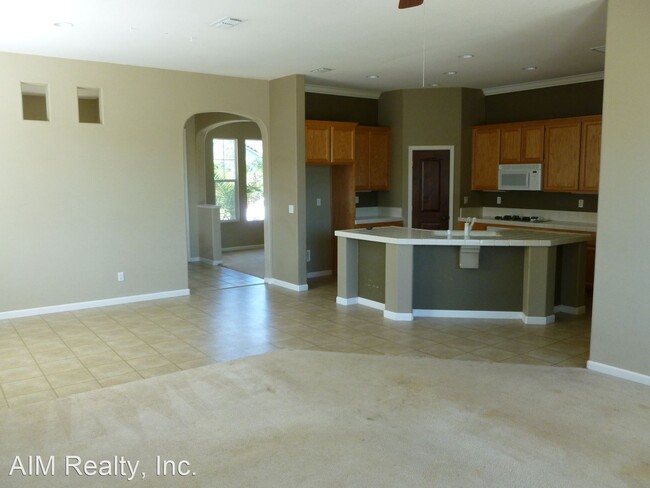
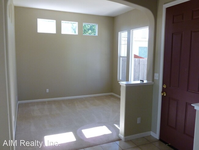
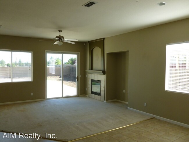
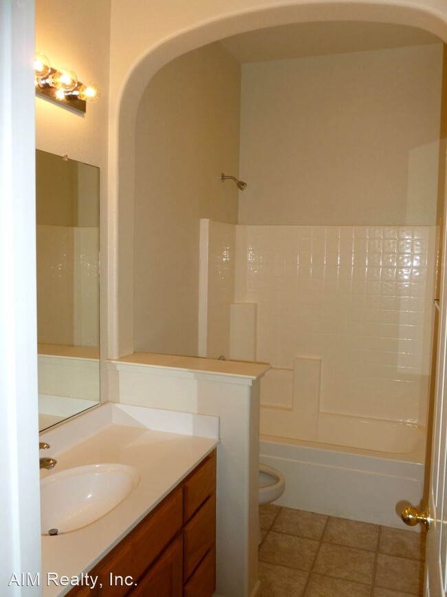
- Nice 3 Bedroom 2 Bath home in Roseville - Nice house with tile entry opens into formal dining room and separate den facing the street. Kitchen and dining area with wood floors (photo's to follow), tile counter tops, gas stove,built in microwave, sink/breakfast bar island. gas fire place in living room, slider door to outside. Ceiling fans in most rooms, master bathroom has double sinks and glass shower stall, large tub, and walk in closet. Very large backyard with dog run. Pets negotiable. Close to Schools, shopping and Entertainment. Surrounding cities are Granite Bay, Rocklin, Sun city, Lincoln and Sacramento. Just 2 hours from Reno, Tahoe or San Francisco Contact: Ph: (RLNE7205394)
1916 Santa Ines St is a house located in Placer County and the 95747 ZIP Code. This area is served by the Dry Creek Joint Elementary School District attendance zone.
1916 Santa Ines St,
Roseville,
CA
95747
Located in the Sacramento Valley, Roseville combines residential comfort with city conveniences. The city offers diverse housing options throughout its neighborhoods, from newer developments near Westfield Galleria to historic properties in Old Town. Current rental trends show steady market conditions, with one-bedroom apartments averaging $1,921 per month, while larger three-bedroom units typically rent for $2,780. The city's rental market has remained relatively stable, with modest year-over-year increases ranging from 0.9% to 2.3% across different unit sizes.
What began as a railroad town has evolved into a shopping and entertainment hub that maintains its small-town atmosphere. The Fountains at Roseville and Westfield Galleria provide extensive retail options, while Maidu Regional Park and Royer Park offer recreational spaces. Major employers like Kaiser Permanente and Hewlett Packard Enterprise contribute to local employment opportunities.
Learn more about living in RosevilleBelow are rent ranges for similar nearby apartments
Education
| Colleges & Universities | Distance | ||
|---|---|---|---|
| Colleges & Universities | Distance | ||
| Drive: | 19 min | 9.1 mi | |
| Drive: | 19 min | 10.6 mi | |
| Drive: | 30 min | 16.8 mi | |
| Drive: | 38 min | 19.2 mi |
1916 Santa Ines St is within 19 minutes or 9.1 miles from American River College. It is also near Sierra College, Rocklin Campus and Sacramento State.
Schools


Public Elementary School
Grades K-5
450 Students
Nearby
Public Elementary School
Grades K-5
815 Students
Attendance Zone
Public Middle School
Grades 6-8
1,010 Students
Attendance Zone
Public High School
Grades 9-12
1,940 Students
Attendance Zone
Private Elementary & Middle School
Grades PK-8
Nearby
Private Elementary, Middle & High School
Grades K-12
Nearby
School data provided by
 The GreatSchools Rating helps parents compare schools within a state based on a variety of school quality indicators and provides a helpful picture of how effectively each school serves all of its students. Ratings are on a scale of 1 (below average) to 10 (above average) and can include test scores, college readiness, academic progress, advanced courses, equity, discipline and attendance data. We also advise parents to visit schools, consider other information on school performance and programs, and consider family needs as part of the school selection process.
View GreatSchools Rating Methodology
Data provided by GreatSchools.org © 2026. All rights reserved.
View GreatSchools Rating Methodology
Data provided by GreatSchools.org © 2026. All rights reserved.
Transportation options available in Roseville include Watt/I-80, located 8.8 miles from 1916 Santa Ines St. 1916 Santa Ines St is near Sacramento International, located 20.4 miles or 30 minutes away.
| Transit / Subway | Distance | ||
|---|---|---|---|
| Transit / Subway | Distance | ||
|
|
Drive: | 16 min | 8.8 mi |
|
|
Drive: | 18 min | 10.4 mi |
|
|
Drive: | 18 min | 10.4 mi |
| Drive: | 19 min | 11.0 mi | |
|
|
Drive: | 22 min | 12.6 mi |
| Commuter Rail | Distance | ||
|---|---|---|---|
| Commuter Rail | Distance | ||
|
|
Drive: | 10 min | 4.5 mi |
|
|
Drive: | 17 min | 9.6 mi |
| Drive: | 27 min | 17.6 mi | |
| Drive: | 30 min | 22.0 mi | |
|
|
Drive: | 31 min | 22.0 mi |
| Airports | Distance | ||
|---|---|---|---|
| Airports | Distance | ||
|
Sacramento International
|
Drive: | 30 min | 20.4 mi |
Walkability Near 1916 Santa Ines St Roseville, CA 95747
Getting Around
 What do Walkability, Transit, Drivability, and Bikeability mean?
Walkability measures the walking distance to day-to-day needs.
Transit measures access to public transportation.
Drivability measures congestion, parking availability, and access to major roads.
Bikeability measures the suitability for cycling.
How It Works
What do Walkability, Transit, Drivability, and Bikeability mean?
Walkability measures the walking distance to day-to-day needs.
Transit measures access to public transportation.
Drivability measures congestion, parking availability, and access to major roads.
Bikeability measures the suitability for cycling.
How It Works
Somewhat Walkable
Walkability
20
/ 100
Minimal Public Transit
Transit
0
/ 100
Exceptionally Drivable
Drivability
90
/ 100
Fairly Bikeable
Bikeability
50
/ 100
Scores provided by
-
Soundscore™
-
/ 100
Traffic
-Airport
-Businesses
-Scores provided by
HowLoud What is a Sound Score Rating? A Sound Score Rating aggregates noise caused by vehicle traffic, airplane traffic and local sources. How It WorksTime and distance from 1916 Santa Ines St.
| Shopping Centers | Distance | ||
|---|---|---|---|
| Shopping Centers | Distance | ||
| Walk: | 12 min | 0.7 mi | |
| Drive: | 3 min | 1.4 mi | |
| Drive: | 3 min | 1.7 mi |
1916 Santa Ines St has 3 shopping centers within 1.7 miles, which is about a 3-minute drive. The miles and minutes will be for the farthest away property.
| Parks and Recreation | Distance | ||
|---|---|---|---|
| Parks and Recreation | Distance | ||
|
Mahan Park
|
Drive: | 4 min | 1.9 mi |
|
Luken Park
|
Drive: | 4 min | 2.0 mi |
|
Mahany Park
|
Drive: | 5 min | 2.5 mi |
|
Roccucci Park
|
Drive: | 6 min | 3.2 mi |
|
Astill Family Park
|
Drive: | 7 min | 3.6 mi |
1916 Santa Ines St has 5 parks within 3.6 miles, including Luken Park, Mahan Park, and Mahany Park.
| Hospitals | Distance | ||
|---|---|---|---|
| Hospitals | Distance | ||
| Drive: | 15 min | 7.9 mi | |
| Drive: | 16 min | 8.4 mi | |
| Drive: | 16 min | 8.6 mi |
1916 Santa Ines St has 3 hospitals within 8.6 miles, the nearest is Sutter Roseville Medical Center which is 7.9 miles away and a 15 minute drive.
| Military Bases | Distance | ||
|---|---|---|---|
| Military Bases | Distance | ||
| Drive: | 22 min | 8.8 mi | |
| Drive: | 54 min | 32.1 mi | |
| Drive: | 77 min | 57.2 mi |
1916 Santa Ines St has 3 military bases within 57.2 miles, the nearest is McClellan Air Force Base which is 8.8 miles away and a 22 minute drive.
You May Also Like
Similar Rentals Nearby
-
-
3 Beds$3,0564 Beds$3,256+Total Monthly PriceTotal Monthly Price NewPrices include base rent and required monthly fees of $60. Variable costs based on usage may apply.Base Rent:3 Beds$2,9954 Beds$3,195+Specials
Pets Allowed Fitness Center Pool In Unit Washer & Dryer Clubhouse Stainless Steel Appliances Package Service
-
-
-

-
-

-

-
-


What Are Walk Score®, Transit Score®, and Bike Score® Ratings?
Walk Score® measures the walkability of any address. Transit Score® measures access to public transit. Bike Score® measures the bikeability of any address.
What is a Sound Score Rating?
A Sound Score Rating aggregates noise caused by vehicle traffic, airplane traffic and local sources.

1916 Santa Ines St
Roseville, CA 95747