


$1,600
/ Month
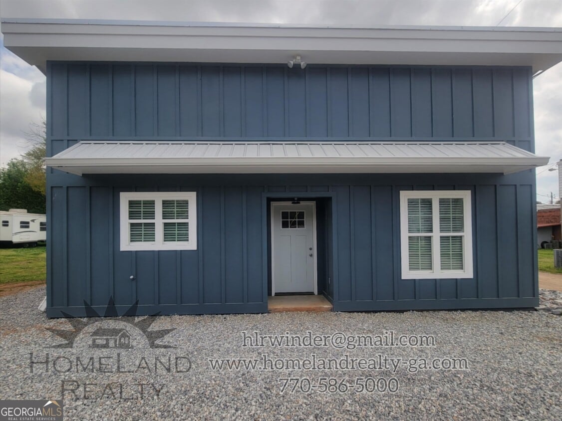
1912 Lucille St
Statham, GA 30666
Favorites
1912 Lucille St

Favorites
Check Back Soon for Upcoming Availability
| Beds | Baths | Average SF |
|---|---|---|
| 2 Bedrooms 2 Bedrooms 2 Br | 4 Baths 4 Baths 4 Ba | 900 SF |
Fees and Policies
The fees listed below are community-provided and may exclude utilities or add-ons. All payments are made directly to the property and are non-refundable unless otherwise specified.
- One-Time Move-In Fees
-
Application Fee$50
About This Property
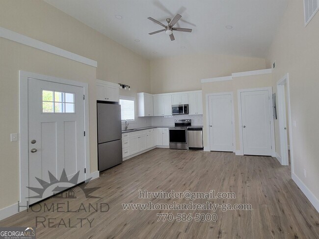
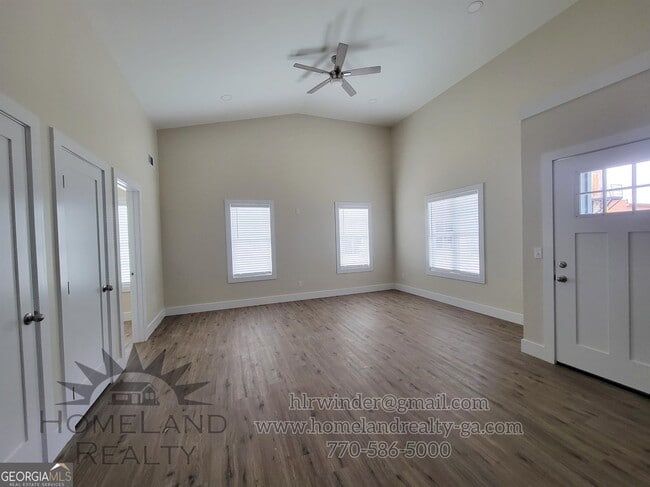
Brand New home in the city of Statham. Walk to shopping, schools, restaurants, etc. All stainless steel appliances, Lvp flooring. 2 bedrooms, 2 baths
1912 Lucille St is a house located in Barrow County and the 30666 ZIP Code. This area is served by the Barrow County School District attendance zone.
House Features
Dishwasher
Microwave
Refrigerator
Range
- Dishwasher
- Microwave
- Range
- Refrigerator
1912 Lucille St,
Statham,
GA
30666
Amenities
- Dishwasher
- Microwave
- Range
- Refrigerator
Education
| Colleges & Universities | Distance | ||
|---|---|---|---|
| Colleges & Universities | Distance | ||
| Drive: | 23 min | 13.6 mi | |
| Drive: | 23 min | 16.4 mi | |
| Drive: | 26 min | 17.1 mi | |
| Drive: | 35 min | 25.6 mi |
1912 Lucille St is within 23 minutes or 13.6 miles from Piedmont College, Athens. It is also near University of Georgia and Athens Technical College.
Schools


Public Elementary School
Grades PK-5
754 Students
Attendance Zone
Public High School
Grades 9-12
1,821 Students
Attendance Zone
Private Elementary, Middle & High School
Grades PK-12
757 Students
Nearby
School data provided by
 The GreatSchools Rating helps parents compare schools within a state based on a variety of school quality indicators and provides a helpful picture of how effectively each school serves all of its students. Ratings are on a scale of 1 (below average) to 10 (above average) and can include test scores, college readiness, academic progress, advanced courses, equity, discipline and attendance data. We also advise parents to visit schools, consider other information on school performance and programs, and consider family needs as part of the school selection process.
View GreatSchools Rating Methodology
Data provided by GreatSchools.org © 2026. All rights reserved.
View GreatSchools Rating Methodology
Data provided by GreatSchools.org © 2026. All rights reserved.
Walkability Near 1912 Lucille St Statham, GA 30666
Getting Around
 What do Walkability, Transit, Drivability, and Bikeability mean?
Walkability measures the walking distance to day-to-day needs.
Transit measures access to public transportation.
Drivability measures congestion, parking availability, and access to major roads.
Bikeability measures the suitability for cycling.
How It Works
What do Walkability, Transit, Drivability, and Bikeability mean?
Walkability measures the walking distance to day-to-day needs.
Transit measures access to public transportation.
Drivability measures congestion, parking availability, and access to major roads.
Bikeability measures the suitability for cycling.
How It Works
Somewhat Walkable
Walkability
30
/ 100
Exceptionally Drivable
Drivability
100
/ 100
Somewhat Bikeable
Bikeability
20
/ 100
Scores provided by
-
Soundscore™
-
/ 100
Traffic
-Airport
-Businesses
-Scores provided by
HowLoud What is a Sound Score Rating? A Sound Score Rating aggregates noise caused by vehicle traffic, airplane traffic and local sources. How It WorksYou May Also Like
Similar Rentals Nearby


What Are Walk Score®, Transit Score®, and Bike Score® Ratings?
Walk Score® measures the walkability of any address. Transit Score® measures access to public transit. Bike Score® measures the bikeability of any address.
What is a Sound Score Rating?
A Sound Score Rating aggregates noise caused by vehicle traffic, airplane traffic and local sources.
1912 Lucille St
Statham, GA 30666