

$1,250
/ Month
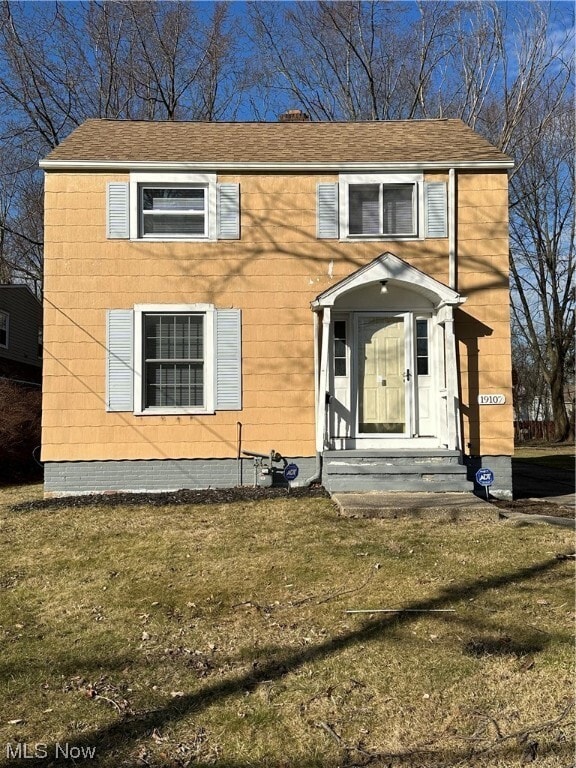
19107 Gladstone Rd
Warrensville Heights, OH 44122
2 Weeks Ago
Favorites
19107 Gladstone Rd

Favorites
Check Back Soon for Upcoming Availability
| Beds | Baths | Average SF |
|---|---|---|
| 2 Bedrooms 2 Bedrooms 2 Br | 1.5 Baths 1.5 Baths 1.5 Ba | — |
About This Property
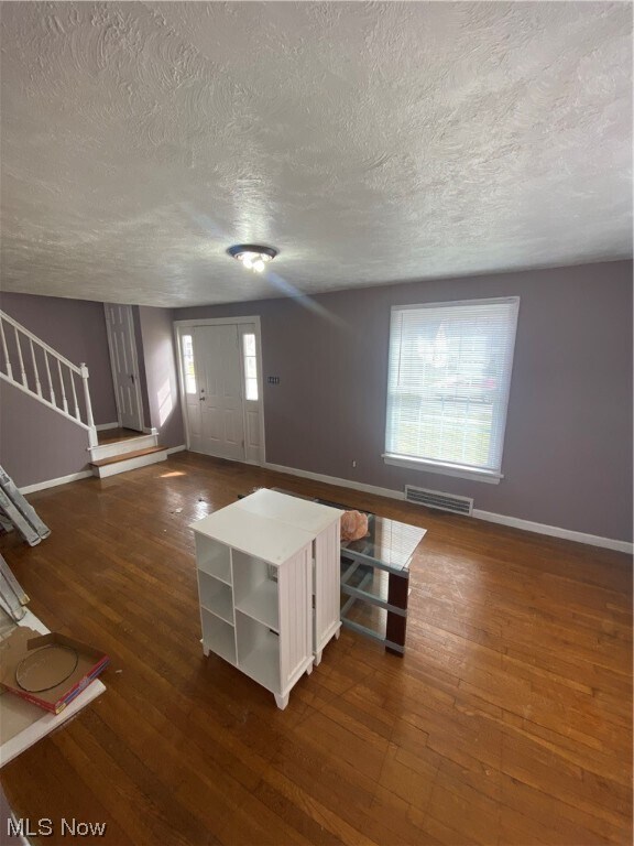
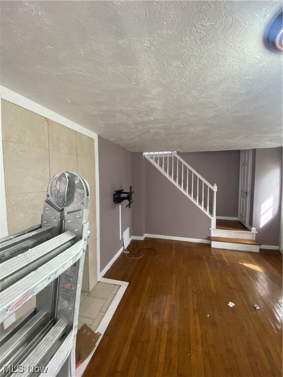
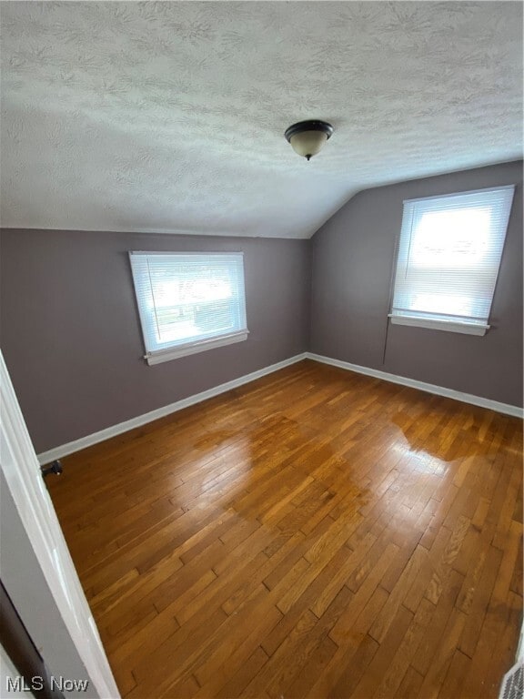
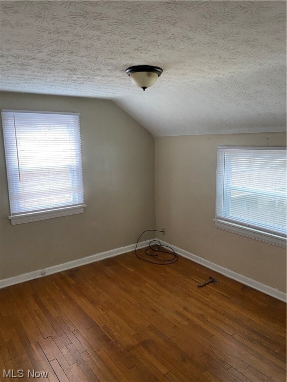
Looking for a nice renatal home! This home is waiting for you! A well maintained Colonial.... 2 bedroom 1.5 bath home in the historic Shakerwood Estates District of Warrensville Heights Ohio. This home features natural hardwood floors throughout,cozy kitchen,livingroom and dining room just watiing for your personal touches. New vinyl windows throughout and a bonus room that can be used as an office. The basement is finished and perfect for family gatehrings.
19107 Gladstone Rd is a house located in Cuyahoga County and the 44122 ZIP Code. This area is served by the Warrensville Heights City attendance zone.
Location
Get Directions
Warrensville Heights is a southeastern suburb of Cleveland surrounded by the neighboring cities of Shaker Heights, Bedford Heights, and Maple Heights. Nicknamed “The Friendly City,” Warrensville Heights touts a community-oriented atmosphere along with quiet residential neighborhoods brimming with apartments and houses available for rent.
Warrensville Heights offers residents easy access to shopping opportunities at Harvard Park Shopping Center and Eton Chagrin Boulevard. Exciting entertainment options abound at JACK Thistledown Racino, where guests enjoy horseracing, dining, and much more.
Quick access to I-271 and I-480 makes commuting and traveling to Downtown Cleveland from Warrensville Heights easy.
Learn more about living in Warrensville Heights
Education
| Colleges & Universities | Distance | ||
|---|---|---|---|
| Colleges & Universities | Distance | ||
| Drive: | 5 min | 2.8 mi | |
| Drive: | 10 min | 3.7 mi | |
| Drive: | 8 min | 3.8 mi | |
| Drive: | 11 min | 5.5 mi |
19107 Gladstone Rd is within 5 minutes or 2.8 miles from Cuyahoga C.C., Eastern Campus. It is also near Cuyahoga C.C., East and John Carroll University.
Schools


Public Elementary School
Grades PK-5
876 Students
Attendance Zone
Public Elementary School
Grades 3-5
255 Students
Attendance Zone
Public Middle School
Grades 6-8
374 Students
Attendance Zone
Public High School
Grades 9-12
547 Students
Attendance Zone
Private Elementary, Middle & High School
Grades PK-12
796 Students
Nearby
Private Elementary & Middle School
Grades K-8
194 Students
Nearby
Private Elementary School
Grades K-4
295 Students
Nearby
School data provided by
 The GreatSchools Rating helps parents compare schools within a state based on a variety of school quality indicators and provides a helpful picture of how effectively each school serves all of its students. Ratings are on a scale of 1 (below average) to 10 (above average) and can include test scores, college readiness, academic progress, advanced courses, equity, discipline and attendance data. We also advise parents to visit schools, consider other information on school performance and programs, and consider family needs as part of the school selection process.
View GreatSchools Rating Methodology
Data provided by GreatSchools.org © 2025. All rights reserved.
View GreatSchools Rating Methodology
Data provided by GreatSchools.org © 2025. All rights reserved.
Transportation options available in Warrensville Heights include Warrensville (Blue Line), located 1.4 miles from 19107 Gladstone Rd. 19107 Gladstone Rd is near Cleveland-Hopkins International, located 20.2 miles or 31 minutes away.
| Transit / Subway | Distance | ||
|---|---|---|---|
| Transit / Subway | Distance | ||
|
|
Drive: | 4 min | 1.4 mi |
|
|
Drive: | 4 min | 1.9 mi |
|
|
Drive: | 5 min | 2.2 mi |
|
|
Drive: | 5 min | 2.3 mi |
|
|
Drive: | 5 min | 2.6 mi |
| Commuter Rail | Distance | ||
|---|---|---|---|
| Commuter Rail | Distance | ||
| Drive: | 17 min | 9.7 mi | |
| Drive: | 20 min | 11.4 mi | |
|
|
Drive: | 27 min | 12.0 mi |
| Drive: | 29 min | 15.8 mi | |
|
Boston Mill
|
Drive: | 30 min | 18.7 mi |
| Airports | Distance | ||
|---|---|---|---|
| Airports | Distance | ||
|
Cleveland-Hopkins International
|
Drive: | 31 min | 20.2 mi |
Time and distance from 19107 Gladstone Rd.
| Shopping Centers | Distance | ||
|---|---|---|---|
| Shopping Centers | Distance | ||
| Drive: | 4 min | 1.3 mi | |
| Drive: | 4 min | 1.4 mi | |
| Drive: | 4 min | 1.4 mi |
19107 Gladstone Rd has 3 shopping centers within 1.4 miles, which is about a 4-minute drive. The miles and minutes will be for the farthest away property.
| Parks and Recreation | Distance | ||
|---|---|---|---|
| Parks and Recreation | Distance | ||
|
Nature Center at Shaker Lakes
|
Drive: | 9 min | 4.3 mi |
|
Garfield Park Nature Center
|
Drive: | 11 min | 6.4 mi |
|
Children's Museum of Cleveland
|
Drive: | 15 min | 7.1 mi |
|
Cleveland Botanical Garden
|
Drive: | 16 min | 7.5 mi |
|
Acacia Reservation
|
Drive: | 13 min | 8.2 mi |
19107 Gladstone Rd has 5 parks within 8.2 miles, including Nature Center at Shaker Lakes, Garfield Park Nature Center, and Children's Museum of Cleveland.
| Hospitals | Distance | ||
|---|---|---|---|
| Hospitals | Distance | ||
| Walk: | 13 min | 0.7 mi | |
| Drive: | 3 min | 1.6 mi | |
| Drive: | 5 min | 3.1 mi |
19107 Gladstone Rd has 3 hospitals within 3.1 miles, the nearest is South Pointe Hospital which is 0.7 mile away and a 13 minute walk.
| Military Bases | Distance | ||
|---|---|---|---|
| Military Bases | Distance | ||
| Drive: | 100 min | 83.5 mi |
19107 Gladstone Rd is 83.5 miles and a 100 minute drive from Mansfield Lahm Airport Air Guard Station.
You May Also Like
Similar Rentals Nearby


What Are Walk Score®, Transit Score®, and Bike Score® Ratings?
Walk Score® measures the walkability of any address. Transit Score® measures access to public transit. Bike Score® measures the bikeability of any address.
What is a Sound Score Rating?
A Sound Score Rating aggregates noise caused by vehicle traffic, airplane traffic and local sources
19107 Gladstone Rd
Warrensville Heights, OH 44122