
Presidential Towers
555 W Madison St,
Chicago, IL 60661
$1,631 - $6,387
Studio - 2 Beds

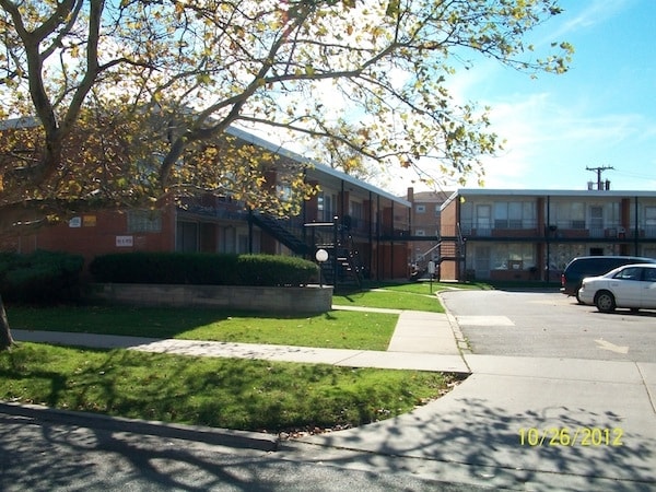
Come enjoy Chicago living at 1901 W Pryor Ave. You'll find this community in the Morgan Park area of Chicago. Let the professional leasing staff show you everything this community has to offer. Make your move to 1901 W Pryor Ave. Contact us or stop by the leasing office to learn more about our community.
1901 W Pryor Ave is an apartment community located in Cook County and the 60643 ZIP Code. This area is served by the Chicago Public Schools attendance zone.
High Speed Internet Access
Refrigerator
Smoke Free
Oven
On the far south side of Chicago is the community-centered neighborhood of Morgan Park. Schools, churches, conveniences stores, and popular chain dining permeate this small town. There’s an abundance of public parks for community enjoyment such as Ada Park, Kennedy Park, and Crescent Park. Ada Park offers residents baseball fields, tennis and basketball courts, and a public swimming pool. To keep the youth entertained, the park also offers seasonal sports, after-school programs, and a summer camp. The community hosts fun special events at the park year-round for the whole family. High-quality programs in dance, visual arts, film, and theater are taught at the Beverly Arts Center, a non-profit organization serving the Chicago metro area. Check off everything on your shopping list at Marshfield Plaza and enjoy popular restaurants and retail stores like Chili’s Grill & Bar, Petco, Marshalls, and Target.
Learn more about living in Morgan ParkCompare neighborhood and city base rent averages by bedroom.
| Morgan Park | Chicago, IL | |
|---|---|---|
| Studio | $422 | $1,644 |
| 1 Bedroom | $929 | $2,046 |
| 2 Bedrooms | $1,553 | $2,581 |
| 3 Bedrooms | $1,434 | $3,091 |
| Colleges & Universities | Distance | ||
|---|---|---|---|
| Colleges & Universities | Distance | ||
| Drive: | 10 min | 3.9 mi | |
| Drive: | 11 min | 4.8 mi | |
| Drive: | 13 min | 7.3 mi | |
| Drive: | 17 min | 8.9 mi |

Transportation options available in Chicago include 87Th Street Station, located 5.1 miles from 1901 W Pryor Ave. 1901 W Pryor Ave is near Chicago Midway International, located 11.4 miles or 20 minutes away, and Chicago O'Hare International, located 32.6 miles or 49 minutes away.
| Transit / Subway | Distance | ||
|---|---|---|---|
| Transit / Subway | Distance | ||
|
|
Drive: | 8 min | 5.1 mi |
|
|
Drive: | 11 min | 6.2 mi |
|
|
Drive: | 13 min | 6.7 mi |
|
|
Drive: | 12 min | 7.0 mi |
|
|
Drive: | 11 min | 7.4 mi |
| Commuter Rail | Distance | ||
|---|---|---|---|
| Commuter Rail | Distance | ||
|
|
Walk: | 2 min | 0.1 mi |
|
|
Walk: | 8 min | 0.4 mi |
|
|
Walk: | 11 min | 0.6 mi |
|
|
Drive: | 3 min | 1.1 mi |
|
|
Drive: | 3 min | 1.4 mi |
| Airports | Distance | ||
|---|---|---|---|
| Airports | Distance | ||
|
Chicago Midway International
|
Drive: | 20 min | 11.4 mi |
|
Chicago O'Hare International
|
Drive: | 49 min | 32.6 mi |
Scores provided by
Traffic
-Airport
-Businesses
-Scores provided by
HowLoud What is a Sound Score Rating? A Sound Score Rating aggregates noise caused by vehicle traffic, airplane traffic and local sources. How It WorksTime and distance from 1901 W Pryor Ave.
| Shopping Centers | Distance | ||
|---|---|---|---|
| Shopping Centers | Distance | ||
| Walk: | 13 min | 0.7 mi | |
| Drive: | 3 min | 1.1 mi | |
| Drive: | 3 min | 1.8 mi |
| Parks and Recreation | Distance | ||
|---|---|---|---|
| Parks and Recreation | Distance | ||
|
Prospect Gardens Park
|
Walk: | 3 min | 0.2 mi |
|
Munroe Park
|
Drive: | 4 min | 1.6 mi |
|
Graver Park
|
Drive: | 4 min | 1.7 mi |
|
Mt. Greenwood Park
|
Drive: | 5 min | 2.4 mi |
|
West Pullman Park
|
Drive: | 9 min | 3.5 mi |
| Hospitals | Distance | ||
|---|---|---|---|
| Hospitals | Distance | ||
| Drive: | 5 min | 2.6 mi | |
| Drive: | 6 min | 3.2 mi | |
| Drive: | 9 min | 5.3 mi |
| Military Bases | Distance | ||
|---|---|---|---|
| Military Bases | Distance | ||
| Drive: | 52 min | 35.1 mi | |
| Drive: | 63 min | 40.1 mi | |
| Drive: | 58 min | 40.3 mi |
What Are Walk Score®, Transit Score®, and Bike Score® Ratings?
Walk Score® measures the walkability of any address. Transit Score® measures access to public transit. Bike Score® measures the bikeability of any address.
What is a Sound Score Rating?
A Sound Score Rating aggregates noise caused by vehicle traffic, airplane traffic and local sources.
1901 W Pryor Ave
Chicago, IL 60643


