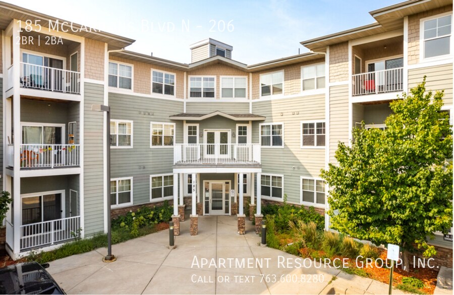
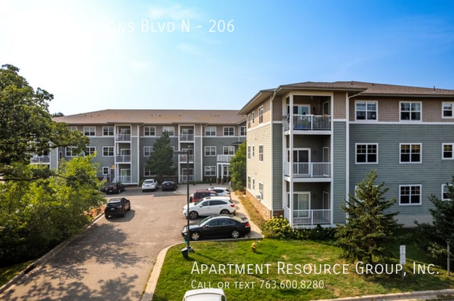
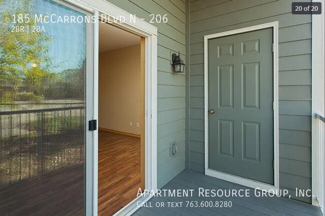
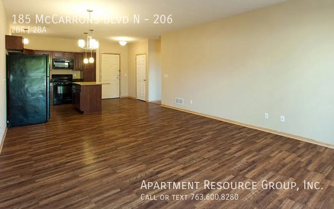
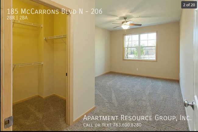
$1,495 Total Monthly Price

185 N McCarrons Blvd Unit 206

,

Roseville, MN 55113

2 Weeks Ago
| Edit

Under 30 minutes

Commute Time is calculated at rush hour.
Share Listing
Favorites
185 N McCarrons Blvd Unit 206
Share Listing
Favorites

Check Back Soon for Upcoming Availability

Beds Baths Average SF
2 Bedrooms 2 Bedrooms 2 Br 2 Baths 2 Baths 2 Ba 1,254 SF

Fees and Policies

The fees listed below are community-provided and may exclude utilities or add-ons. All payments are made directly to the property and are non-refundable unless otherwise specified.

  • Dogs Allowed
  • Fees not specified
  • Cats Allowed
  • Fees not specified

About This Property

---- SCHEDULE A SHOWING ONLINE AT: ---- 2 Bed/2 Bath Unit for Rent at McCarrons Ponds! Open living room and eat in kitchen with center island Custom cabinets with black appliances including dishwasher & disposal Primary suite with private bath Walk-in closets In unit washer and dryer Private Balcony Exercise Room Secured Entry with Elevator Off Street Parking Heated Underground Parking avail for $75/month Pets Welcome! Tenant pays all utilities. Close to schools and shopping and easy access to Hwy 36 and close commute to downtown St Paul Additional Information: Application Fee: $50/adult One Time Admin Fee: $125.00 owed at lease signing Non Refundable Pet Deposit: $250 (+ $100 additional pet) Security Deposit: One month's rent *This unit is security deposit free with Obligo! Please ask our leasing team for additional information. Total Monthly Rent (where applicable): Rent: $1495 Water, Sewer, Trash via RUBS: $64/month for household of 2 Tenant pays electric & gas direct to Xcel Pet Rent: $50/pet Indoor Garage Parking: $75/space

185 N McCarrons Blvd is an apartment community located in Ramsey County and the 55113 ZIP Code.

Location
185 N McCarrons Blvd, Roseville,
MN 55113
Get Directions
City - Roseville

Roseville holds a rare geographic distinction as one of only two Twin Cities suburbs that share borders with both Minneapolis and Saint Paul, making it a natural landing spot for renters who want easy access to two major cities without paying downtown prices. Sitting in Ramsey County across 14 square miles, this city of roughly 36,000 carries a settled, self-sufficient character built around a strong retail corridor, well-maintained parks, and a steady local economy.

The city's layout offers a mix of quiet residential pockets and busier commercial stretches along roads like Snelling Avenue and County Road B. Rosedale Center anchors much of the retail energy, drawing shoppers from across the metro. Every September, the Wild Rice Festival celebrates Minnesota's Indigenous heritage through traditional dancing, storytelling, and food rooted in Ojibwe and Dakota culture.

Learn more about living in Roseville 
Education
Colleges & Universities Distance
Drive: 8 min 4.0 mi
Drive: 11 min 4.8 mi
Drive: 8 min 5.2 mi
Drive: 13 min 5.9 mi
185 N McCarrons Blvd Unit 206 is within 8 minutes or 4.0 miles from Saint Paul College. It is also near Metropolitan State University and Univ. of Minnesota, Saint Paul.
Transportation

Transportation options available in Roseville include Capitol / Rice St Station, located 3.2 miles from 185 N McCarrons Blvd Unit 206. 185 N McCarrons Blvd Unit 206 is near Minneapolis-St Paul International/Wold-Chamberlain, located 12.8 miles or 22 minutes away.

Transit / Subway Distance
Drive: 6 min 3.2 mi
Drive: 7 min 3.7 mi
Drive: 7 min 3.7 mi
Drive: 9 min 4.7 mi
Drive: 10 min 5.2 mi
Commuter Rail Distance
Drive: 8 min 4.6 mi
Drive: 19 min 11.2 mi
Drive: 19 min 12.8 mi
Drive: 29 min 20.9 mi
Drive: 31 min 22.6 mi
Airports Distance
Airports Distance
Minneapolis-St Paul International/Wold-Chamberlain
Drive: 22 min 12.8 mi

Walkability Near 185 N McCarrons Blvd Roseville, MN 55113

Getting Around
Fairly Walkable
Walkability
40 / 100
Limited Public Transit
Transit
30 / 100
Exceptionally Drivable
Drivability
100 / 100
Moderately Bikeable
Bikeability
60 / 100

Scores provided by

What do Walkability, Transit, Drivability, and Bikeability mean? Walkability measures the walking distance to day-to-day needs. Transit measures access to public transportation. Drivability measures congestion, parking availability, and access to major roads. Bikeability measures the suitability for cycling. How It Works
Active
Soundscore
78 / 100

Traffic

Active

Airport

Calm

Businesses

Active

Scores provided by

HowLoud What is a Sound Score Rating? A Sound Score Rating aggregates noise caused by vehicle traffic, airplane traffic and local sources. How It Works
Points of Interest

Time and distance from 185 N McCarrons Blvd Unit 206.

Shopping Centers Distance
Walk: 12 min 0.6 mi
Walk: 13 min 0.7 mi
Walk: 16 min 0.8 mi
185 N McCarrons Blvd Unit 206 has 3 shopping centers within 0.8 mile, which is about a 16-minute walk. The miles and minutes will be for the farthest away property.
Parks and Recreation Distance
Harriet Alexander Nature Center
Drive: 4 min 2.2 mi
Arlington/Arkwright Park
Drive: 5 min 2.3 mi
Como Park Ski Center
Drive: 7 min 3.4 mi
Keller Regional Park
Drive: 8 min 3.7 mi
Como Park Zoo
Drive: 10 min 4.1 mi
185 N McCarrons Blvd Unit 206 has 5 parks within 4.1 miles, including Harriet Alexander Nature Center, Arlington/Arkwright Park, and Como Park Ski Center.
Hospitals Distance
Hospitals Distance
Drive: 7 min 3.7 mi
Drive: 7 min 3.7 mi
Drive: 7 min 3.9 mi
185 N McCarrons Blvd Unit 206 has 3 hospitals within 3.9 miles, the nearest is Regions Hospital which is 3.7 miles away and a 7 minute drive.
Military Bases Distance
Drive: 21 min 11.6 mi
185 N McCarrons Blvd Unit 206 is 11.6 miles and a 21 minute drive from Fort Snelling Military Reservation.

You May Also Like

Similar Rentals Nearby