4 Beds, 2 Baths, 1,560 sq ft
1841 S Floyd Ct
La Habra, CA 90631
-
Bedrooms
5
-
Bathrooms
4
-
Square Feet
3,742 sq ft
-
Available
Available Now
Highlight
- Gated

About This Home
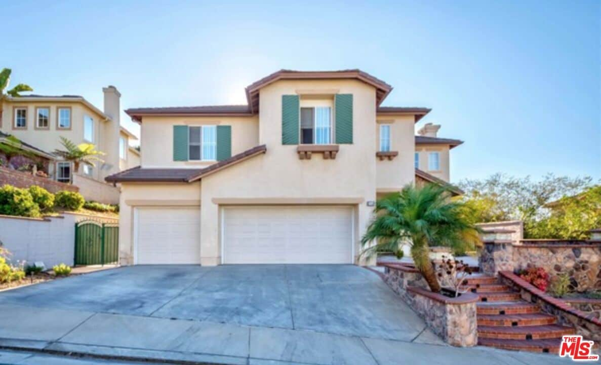
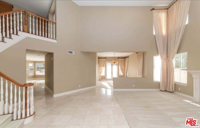
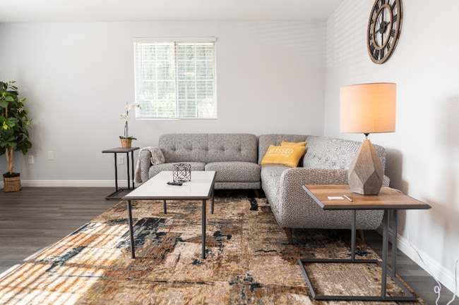
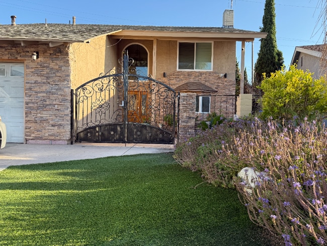
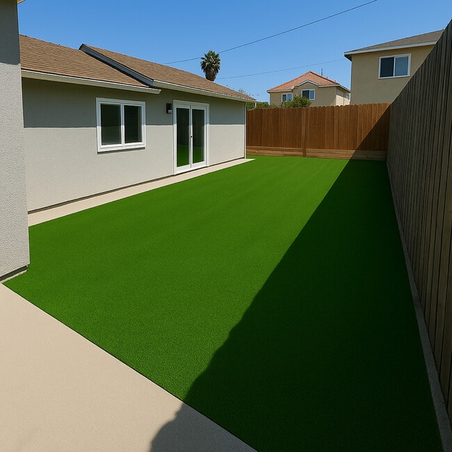
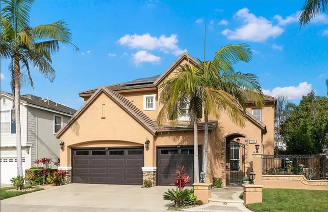
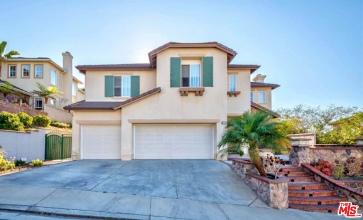
Largest floor plan in the highly desirable community The Summit At Westridge provides for luxurious living within a gated association. This property features a grand entryway with high ceiling, formal living room with fireplace, formal dining room, large kitchen with center island that opens up into a casual dining area as well as the family room with fireplace. Down the hall on the main level is a bedroom and full bath. Upstairs the spacious primary suite offers a dual sided fireplace that separates the sleeping area from another generous area that can be used as an office, lounging area or an exercise room that leads to a deck. Additional features include a Jack and Jill bathroom ,direct access oversized 3-car garage, elegant hardscape that allows for a low maintenance yard, and located on a cul-de-sac. MLS# 25614055
1841 S Floyd Ct is a house located in Orange County and the 90631 ZIP Code. This area is served by the La Habra City Elementary attendance zone.
Fees and Policies
The fees listed below are community-provided and may exclude utilities or add-ons. All payments are made directly to the property and are non-refundable unless otherwise specified. Use the Cost Calculator to determine costs based on your needs.
-
One-Time Basics
-
Due at Move-In
-
Security Deposit - RefundableCharged per unit.$10,800
-
-
Due at Move-In
Property Fee Disclaimer: Based on community-supplied data and independent market research. Subject to change without notice. May exclude fees for mandatory or optional services and usage-based utilities.
House Features
Washer/Dryer
Dishwasher
Washer/Dryer Hookup
Tile Floors
- Washer/Dryer
- Washer/Dryer Hookup
- Dishwasher
- Carpet
- Tile Floors
- Dining Room
- Family Room
- Views
- Gated
Contact
- Listed by Julia Jae | Dream Realty & Investments Inc
- Phone Number
- Contact
-
Source
 MLS(TM)/CLAW
La Habra lies in the northwest corner of Orange County, off the Santa Ana Freeway and Highway 57. La Habra is well-connected to the rest of Orange County as well as to the greater Los Angeles area.
This community-driven neighborhood focuses on a comfortable and healthy lifestyle. Located in the foothills of Orange County, La Habra is a treasure trove of undiscovered natural wonders. Get out and enjoy the area’s sunny, mild weather while exploring one of the numerous parks throughout the area. La Habra provides residents with community spirit but also nurtures a thriving business center.
Learn more about living in La Habra City- Washer/Dryer
- Washer/Dryer Hookup
- Dishwasher
- Carpet
- Tile Floors
- Dining Room
- Family Room
- Views
- Gated
| Colleges & Universities | Distance | ||
|---|---|---|---|
| Colleges & Universities | Distance | ||
| Drive: | 10 min | 4.6 mi | |
| Drive: | 12 min | 5.2 mi | |
| Drive: | 15 min | 7.1 mi | |
| Drive: | 15 min | 7.6 mi |
 The GreatSchools Rating helps parents compare schools within a state based on a variety of school quality indicators and provides a helpful picture of how effectively each school serves all of its students. Ratings are on a scale of 1 (below average) to 10 (above average) and can include test scores, college readiness, academic progress, advanced courses, equity, discipline and attendance data. We also advise parents to visit schools, consider other information on school performance and programs, and consider family needs as part of the school selection process.
View GreatSchools Rating Methodology
Data provided by GreatSchools.org © 2026. All rights reserved.
Transportation options available in La Habra include Norwalk, located 9.6 miles from 1841 S Floyd Ct. 1841 S Floyd Ct is near Long Beach (Daugherty Field), located 18.2 miles or 31 minutes away, and John Wayne/Orange County, located 22.8 miles or 31 minutes away.
| Transit / Subway | Distance | ||
|---|---|---|---|
| Transit / Subway | Distance | ||
|
|
Drive: | 17 min | 9.6 mi |
| Commuter Rail | Distance | ||
|---|---|---|---|
| Commuter Rail | Distance | ||
|
|
Drive: | 9 min | 3.8 mi |
|
|
Drive: | 12 min | 5.2 mi |
|
|
Drive: | 14 min | 7.1 mi |
|
|
Drive: | 21 min | 11.8 mi |
|
|
Drive: | 22 min | 13.3 mi |
| Airports | Distance | ||
|---|---|---|---|
| Airports | Distance | ||
|
Long Beach (Daugherty Field)
|
Drive: | 31 min | 18.2 mi |
|
John Wayne/Orange County
|
Drive: | 31 min | 22.8 mi |
Time and distance from 1841 S Floyd Ct.
| Shopping Centers | Distance | ||
|---|---|---|---|
| Shopping Centers | Distance | ||
| Drive: | 4 min | 1.3 mi | |
| Drive: | 5 min | 1.7 mi | |
| Drive: | 5 min | 1.8 mi |
| Parks and Recreation | Distance | ||
|---|---|---|---|
| Parks and Recreation | Distance | ||
|
Children's Museum at La Habra
|
Drive: | 7 min | 2.9 mi |
|
La Habra Historical Museum
|
Drive: | 7 min | 3.1 mi |
|
Craig Regional Park
|
Drive: | 14 min | 6.4 mi |
|
Fullerton Arboretum
|
Drive: | 15 min | 7.1 mi |
|
Schabarum Regional Park
|
Drive: | 20 min | 10.5 mi |
| Hospitals | Distance | ||
|---|---|---|---|
| Hospitals | Distance | ||
| Drive: | 9 min | 4.5 mi | |
| Drive: | 12 min | 5.8 mi | |
| Drive: | 13 min | 6.0 mi |
| Military Bases | Distance | ||
|---|---|---|---|
| Military Bases | Distance | ||
| Drive: | 23 min | 12.0 mi |
You May Also Like
Similar Rentals Nearby
-
$3,600Total Monthly PriceTotal Monthly Price NewPrices include all required monthly fees.House for Rent
-
-
-
-
-
-
-
-
-
What Are Walk Score®, Transit Score®, and Bike Score® Ratings?
Walk Score® measures the walkability of any address. Transit Score® measures access to public transit. Bike Score® measures the bikeability of any address.
What is a Sound Score Rating?
A Sound Score Rating aggregates noise caused by vehicle traffic, airplane traffic and local sources
