
$2,500
/ Month
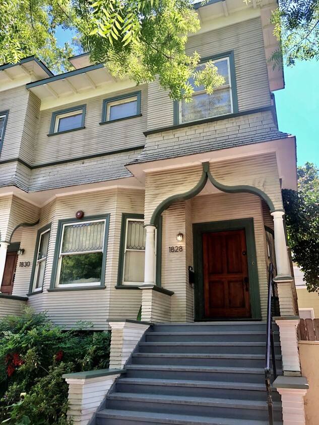
1828 H St
Sacramento, CA 95811
2 Weeks Ago
|
Edit
Favorites
1828 H St

Favorites
Check Back Soon for Upcoming Availability
| Beds | Baths | Average SF |
|---|---|---|
| 3 Bedrooms 3 Bedrooms 3 Br | 1.5 Baths 1.5 Baths 1.5 Ba | 1,500 SF |
About This Property
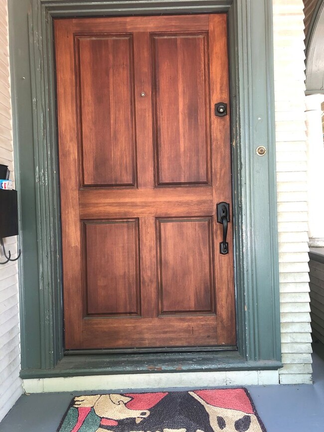
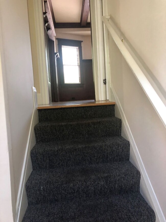
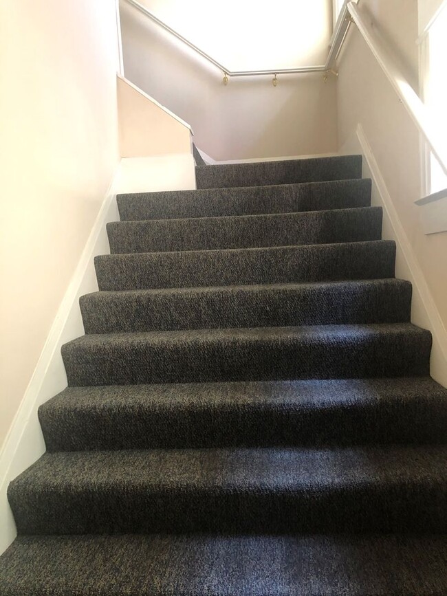
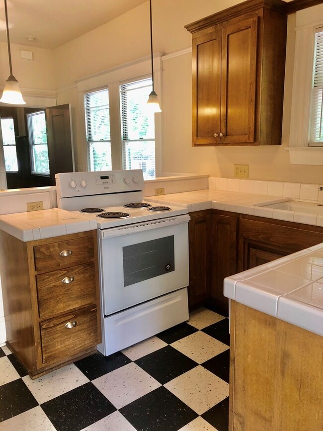
This beautiful, spacious Duplex, upper unit 3/11/4 bath, 1500 Sq. Ft. Living room, Formal Dining Room. Kitchen W/ Dining area, hardwood floors & carpet, blinds, electric stove, dishwasher, 1 car garage. Sorry no yard. To view our qualifications or to apply go to For a showing please call Sherry @
1828 H St is a house located in Sacramento County and the 95811 ZIP Code. This area is served by the Sacramento City Unified attendance zone.
House Features
- Dishwasher
1828 H St,
Sacramento,
CA
95811
East of Downtown and north of Midtown, Sacramento’s Boulevard Park is a popular in-city neighborhood known for its delicious local restaurants and charming residential streets. If you cross over 16th Street, you’ll find yourself at the Governor’s Mansion State Historic Park! This beautiful Victorian mansion features landscaped gardens that have been around since 1877. Historic architecture is a unique appeal to Boulevard Park.
After you’ve found your urban rental in the neighborhood, check out popular local spots like Old Soul at the Weatherstone, known for its java drinks and industrial vibe. Lucca serves up the best Mediterranean cuisine in town, while Capital Stage is the best place to enjoy local theater. Even more restaurants and entertainment options can be found on the south side of J Street like the Old Spaghetti Factory and the Porch Restaurant and Bar.
Learn more about living in Boulevard ParkBelow are rent ranges for similar nearby apartments
Amenities
- Dishwasher
Education
| Colleges & Universities | Distance | ||
|---|---|---|---|
| Colleges & Universities | Distance | ||
| Drive: | 6 min | 3.0 mi | |
| Drive: | 8 min | 3.9 mi | |
| Drive: | 16 min | 10.5 mi | |
| Drive: | 17 min | 10.8 mi |
1828 H St is within 6 minutes or 3.0 miles from Sacramento City College. It is also near Sacramento State and American River College.
Schools


Public Elementary School
Grades K-3
450 Students
Nearby
Public Elementary School
Grades K-6
376 Students
Attendance Zone
Public Middle School
Grades 7-8
1,181 Students
Attendance Zone
Public High School
Grades 9-12
2,569 Students
Attendance Zone
Private Elementary & Middle School
Grades PK-8
46 Students
Nearby
Private Elementary & Middle School
Grades 1-8
327 Students
Nearby
Private Middle & High School
Grades 6-12
Nearby
School data provided by
 The GreatSchools Rating helps parents compare schools within a state based on a variety of school quality indicators and provides a helpful picture of how effectively each school serves all of its students. Ratings are on a scale of 1 (below average) to 10 (above average) and can include test scores, college readiness, academic progress, advanced courses, equity, discipline and attendance data. We also advise parents to visit schools, consider other information on school performance and programs, and consider family needs as part of the school selection process.
View GreatSchools Rating Methodology
Data provided by GreatSchools.org © 2026. All rights reserved.
View GreatSchools Rating Methodology
Data provided by GreatSchools.org © 2026. All rights reserved.
Transportation options available in Sacramento include 12Th & I, located 0.6 mile from 1828 H St. 1828 H St is near Sacramento International, located 11.9 miles or 18 minutes away.
| Transit / Subway | Distance | ||
|---|---|---|---|
| Transit / Subway | Distance | ||
|
|
Walk: | 10 min | 0.6 mi |
|
|
Walk: | 15 min | 0.8 mi |
|
|
Walk: | 16 min | 0.8 mi |
|
|
Drive: | 2 min | 1.1 mi |
|
|
Drive: | 2 min | 1.4 mi |
| Commuter Rail | Distance | ||
|---|---|---|---|
| Commuter Rail | Distance | ||
| Drive: | 3 min | 1.2 mi | |
| Drive: | 20 min | 15.8 mi | |
|
|
Drive: | 26 min | 19.1 mi |
|
|
Drive: | 26 min | 21.2 mi |
|
|
Drive: | 40 min | 33.5 mi |
| Airports | Distance | ||
|---|---|---|---|
| Airports | Distance | ||
|
Sacramento International
|
Drive: | 18 min | 11.9 mi |
Time and distance from 1828 H St.
| Shopping Centers | Distance | ||
|---|---|---|---|
| Shopping Centers | Distance | ||
| Walk: | 8 min | 0.4 mi | |
| Walk: | 8 min | 0.5 mi | |
| Walk: | 11 min | 0.6 mi |
1828 H St has 3 shopping centers within 0.6 mile, which is about a 11-minute walk. The miles and minutes will be for the farthest away property.
| Parks and Recreation | Distance | ||
|---|---|---|---|
| Parks and Recreation | Distance | ||
|
Governor's Mansion State Historic Park
|
Walk: | 5 min | 0.3 mi |
|
Sutter's Fort State Historical Monument
|
Drive: | 3 min | 1.1 mi |
|
California State Capitol Museum
|
Drive: | 3 min | 1.1 mi |
|
Leland Stanford Mansion State Historic Park
|
Drive: | 3 min | 1.2 mi |
|
Old Sacramento Historic District
|
Drive: | 4 min | 1.5 mi |
1828 H St has 5 parks within 1.5 miles, including Governor's Mansion State Historic Park, Leland Stanford Mansion State Historic Park, and California State Capitol Museum.
| Hospitals | Distance | ||
|---|---|---|---|
| Hospitals | Distance | ||
| Drive: | 2 min | 1.2 mi | |
| Drive: | 4 min | 1.8 mi | |
| Drive: | 5 min | 2.7 mi |
1828 H St has 3 hospitals within 2.7 miles, the nearest is Sutter Medical Center, Sacramento which is 1.2 miles away and a 2 minute drive.
| Military Bases | Distance | ||
|---|---|---|---|
| Military Bases | Distance | ||
| Drive: | 22 min | 9.7 mi |
1828 H St is 9.7 miles and a 22 minute drive from McClellan Air Force Base.
You May Also Like
Similar Rentals Nearby
-
-
3 Beds$3,1054 Beds$3,280+Total Monthly PriceTotal Monthly Price NewPrices include base rent and required monthly fees of $60. Variable costs based on usage may apply.Base Rent:3 Beds$3,0454 Beds$3,220+Specials
Pets Allowed Fitness Center In Unit Washer & Dryer Clubhouse Stainless Steel Appliances
-
-

-
-
-
-

-

-


What Are Walk Score®, Transit Score®, and Bike Score® Ratings?
Walk Score® measures the walkability of any address. Transit Score® measures access to public transit. Bike Score® measures the bikeability of any address.
What is a Sound Score Rating?
A Sound Score Rating aggregates noise caused by vehicle traffic, airplane traffic and local sources
1828 H St
Sacramento, CA 95811