
$1,595
/ Month
1824 T St Unit 1824-D
Sacramento, CA 95811
Favorites
916-568-1800
-
Bedrooms
1
-
Bathrooms
1
-
Square Feet
525 sq ft
-
Available
Available Now
1824 T St Unit 1824-D

Favorites
About This Home
$1,000 deposit,
Available Now
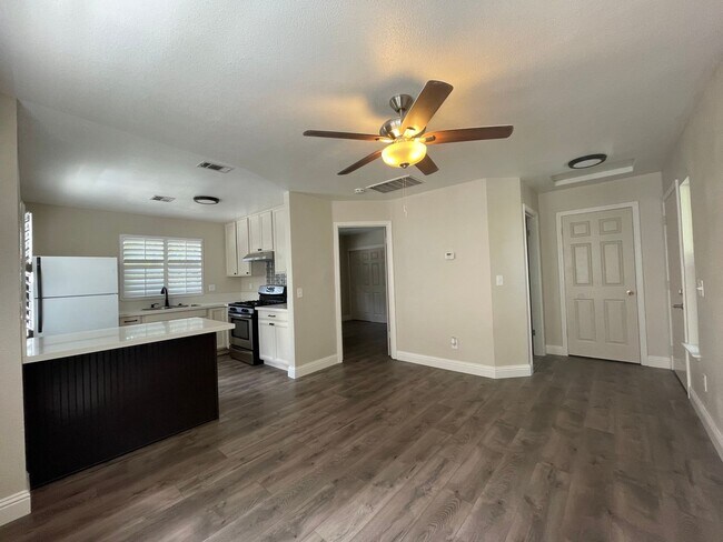
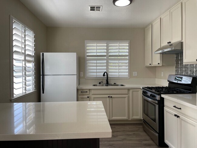
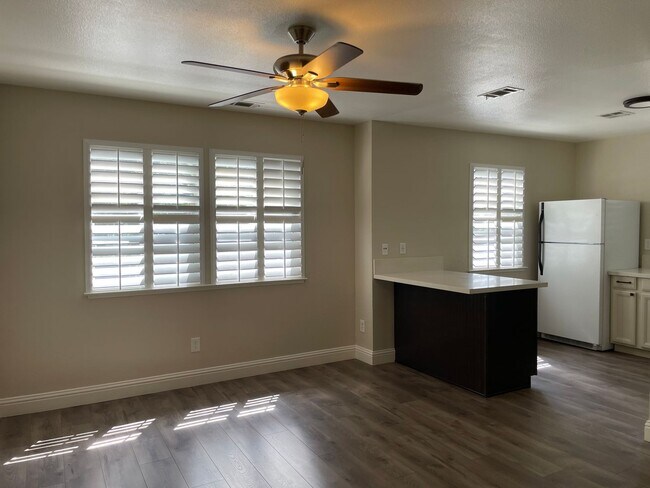
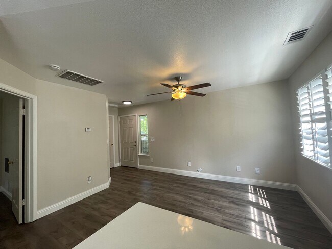
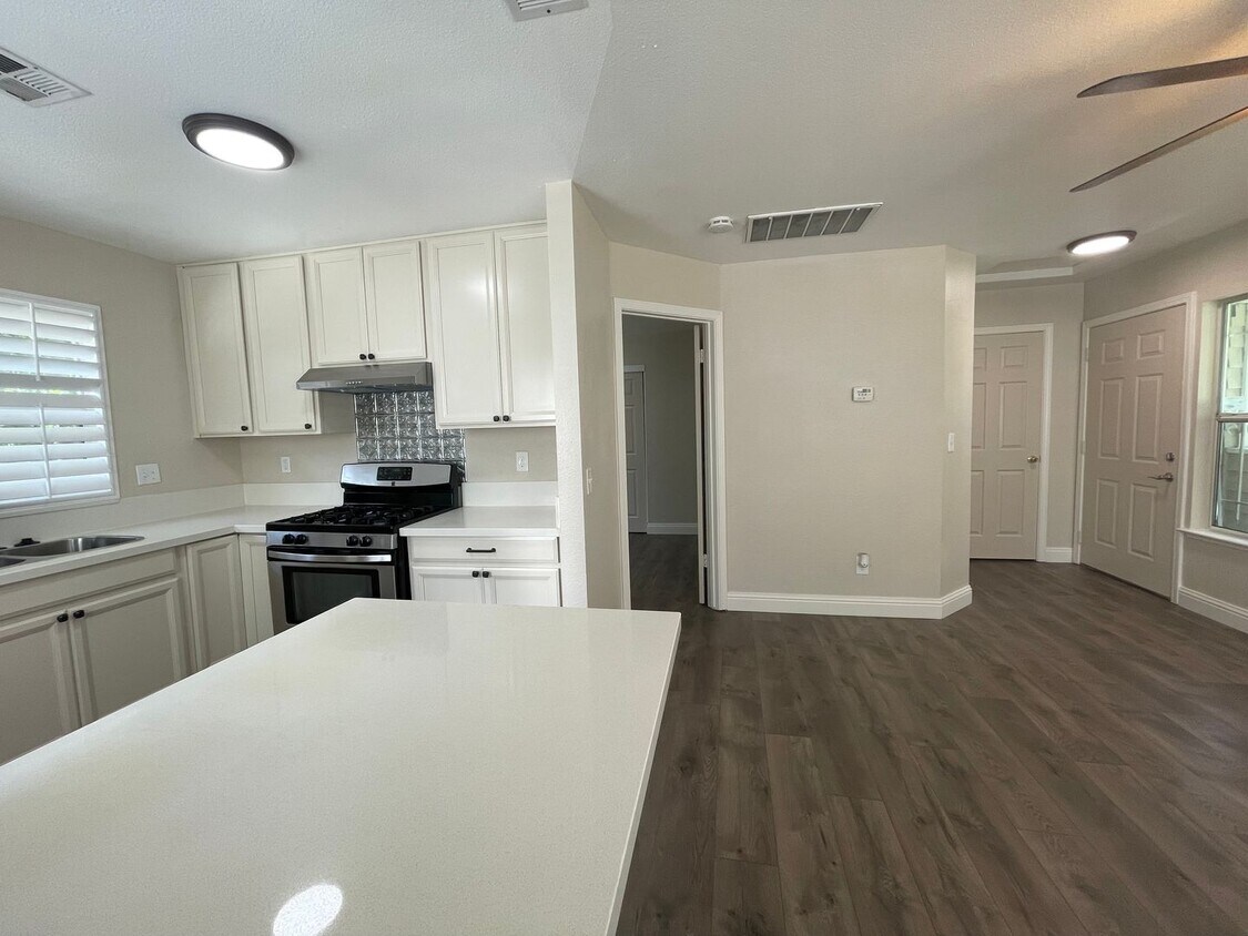
Ideally located about 2 blocks from the Historic District and R Street Coordinator, you will find this little hidden gem. It is so charming with wood inspired flooring, modern fixtures, fresh warm interior paint, a ceiling fan in the living room, central heating and air, open kitchen design with a kitchen island, quartz countertops, large closet in the bedroom, lots of windows and a washer dryer too! This upstairs apartment is located in a small community on 18th and T, with only 4 other homes. This charming community is located just outside of the Midtown Sacramento grid, but still close enough to enjoy many different types of entertainment such as Golden 1 Arena, DOCO, Capitol State Park and Ace of Spades. Restaurants such as Ryujin Ramen House, Mendocino Farms, Journey to the Dumpling, and just blocks aware from places such as Sacramento Natural Foods Co-op, Scorpio Cafe, and Temple Coffee Roasters. There is easy freeway access, and this is a pet-friendly apartment, perfect for those looking for a stylish and comfortable living space in a prime and convenient location. Touring made easy! No appointment is needed to view. Stop by our office at 1435 River Park Drive, Suite 510, Sacramento, to check out keys. Key check out hours are Monday through Friday, from 8:00 a.m. to 3:30 p.m. We also offer self-guided tours 7 days a week and in person tours. Call today at ext. 203! Residents of this community contribute to common area maintenance fees which are $35.00 per month for this floorplan.
1824 T St is an apartment community located in Sacramento County and the 95811 ZIP Code.
* Price shown is base rent. Excludes user-selected optional fees and variable or usage-based fees and required charges due at or prior to move-in or at move-out. Price, availability, fees, and any applicable rent special are subject to change without notice.
* Square footage definitions vary. Displayed square footage is approximate.
Contact
- Listed by Brittain Commercial | Brittain Commercial
- Phone Number
- Contact
Location
Get Directions
A quaint community nearing Downtown and Midtown Sacramento, Richmond Grove is home to an array of small businesses, ranging from breweries and restaurants to markets and specialty shops. Locals can be found grabbing a meal at Hook & Ladder, enjoying a brew at Device Brewing Company, ordering at Ernesto’s Mexican Food, or getting a bite to eat at Ryujin Ramen House.
The nightlife scene is as good as the cuisine in Richmond Grove. Enjoy a drink at the Shady Lady Saloon after you catch a concert at Ace of Spades. Richmond Grove sits along Lincoln Highway, and on the other side of this roadway you’ll find even more conveniences including restaurants, public transit stops, breweries, department stores, and markets. Several light rail stations sit on the north end of town, taking you through Downtown towards the airport, or south towards Cosumnes River College.
Learn more about living in Richmond Grove
Education
| Colleges & Universities | Distance | ||
|---|---|---|---|
| Colleges & Universities | Distance | ||
| Drive: | 4 min | 2.0 mi | |
| Drive: | 9 min | 4.6 mi | |
| Drive: | 15 min | 9.9 mi | |
| Drive: | 17 min | 11.3 mi |
1824 T St Unit 1824-D is within 4 minutes or 2.0 miles from Sacramento City College. It is also near Sacramento State and Cosumnes River College.
Transportation options available in Sacramento include 16Th Street, located 0.4 mile from 1824 T St Unit 1824-D. 1824 T St Unit 1824-D is near Sacramento International, located 12.8 miles or 19 minutes away.
| Transit / Subway | Distance | ||
|---|---|---|---|
| Transit / Subway | Distance | ||
|
|
Walk: | 8 min | 0.4 mi |
|
|
Walk: | 10 min | 0.5 mi |
|
|
Walk: | 10 min | 0.5 mi |
|
|
Walk: | 12 min | 0.7 mi |
|
|
Walk: | 18 min | 1.0 mi |
| Commuter Rail | Distance | ||
|---|---|---|---|
| Commuter Rail | Distance | ||
| Drive: | 4 min | 2.0 mi | |
| Drive: | 18 min | 14.9 mi | |
|
|
Drive: | 27 min | 19.9 mi |
|
|
Drive: | 28 min | 22.0 mi |
|
|
Drive: | 41 min | 34.3 mi |
| Airports | Distance | ||
|---|---|---|---|
| Airports | Distance | ||
|
Sacramento International
|
Drive: | 19 min | 12.8 mi |
Getting Around
 What do Walkability, Transit, Drivability, and Bikeability mean?
Walkability measures the walking distance to day-to-day needs.
Transit measures access to public transportation.
Drivability measures congestion, parking availability, and access to major roads.
Bikeability measures the suitability for cycling.
How It Works
What do Walkability, Transit, Drivability, and Bikeability mean?
Walkability measures the walking distance to day-to-day needs.
Transit measures access to public transportation.
Drivability measures congestion, parking availability, and access to major roads.
Bikeability measures the suitability for cycling.
How It Works
Moderately Walkable
Walkability
70
/ 100
Good Public Transit
Transit
60
/ 100
Very Drivable
Drivability
80
/ 100
Moderately Bikeable
Bikeability
70
/ 100
Scores provided by
Busy
Soundscore™
67
/ 100
Traffic
BusyAirport
CalmBusinesses
BusyScores provided by
HowLoud What is a Sound Score Rating? A Sound Score Rating aggregates noise caused by vehicle traffic, airplane traffic and local sources. How It WorksTime and distance from 1824 T St Unit 1824-D.
| Shopping Centers | Distance | ||
|---|---|---|---|
| Shopping Centers | Distance | ||
| Walk: | 3 min | 0.2 mi | |
| Walk: | 7 min | 0.4 mi | |
| Walk: | 15 min | 0.8 mi |
1824 T St Unit 1824-D has 3 shopping centers within 0.8 mile, which is about a 15-minute walk. The miles and minutes will be for the farthest away property.
| Parks and Recreation | Distance | ||
|---|---|---|---|
| Parks and Recreation | Distance | ||
|
Leland Stanford Mansion State Historic Park
|
Walk: | 16 min | 0.9 mi |
|
California State Capitol Museum
|
Walk: | 17 min | 0.9 mi |
|
Governor's Mansion State Historic Park
|
Drive: | 2 min | 1.2 mi |
|
Sutter's Fort State Historical Monument
|
Drive: | 3 min | 1.3 mi |
|
California Native Plant Demonstration Garden
|
Drive: | 3 min | 1.3 mi |
1824 T St Unit 1824-D has 5 parks within 1.3 miles, including Leland Stanford Mansion State Historic Park, California State Capitol Museum, and California Native Plant Demonstration Garden.
| Hospitals | Distance | ||
|---|---|---|---|
| Hospitals | Distance | ||
| Drive: | 3 min | 1.3 mi | |
| Drive: | 4 min | 1.8 mi | |
| Drive: | 4 min | 2.0 mi |
1824 T St Unit 1824-D has 3 hospitals within 2.0 miles, the nearest is Sutter Medical Center, Sacramento which is 1.3 miles away and a 3 minute drive.
| Military Bases | Distance | ||
|---|---|---|---|
| Military Bases | Distance | ||
| Drive: | 24 min | 10.7 mi | |
| Drive: | 53 min | 40.7 mi | |
| Drive: | 68 min | 49.5 mi |
1824 T St Unit 1824-D has 3 military bases within 49.5 miles, the nearest is McClellan Air Force Base which is 10.7 miles away and a 24 minute drive.
You May Also Like
Similar Rentals Nearby


What Are Walk Score®, Transit Score®, and Bike Score® Ratings?
Walk Score® measures the walkability of any address. Transit Score® measures access to public transit. Bike Score® measures the bikeability of any address.
What is a Sound Score Rating?
A Sound Score Rating aggregates noise caused by vehicle traffic, airplane traffic and local sources.
1824 T St
Sacramento, CA 95811