
Presidential Towers
555 W Madison St,
Chicago, IL 60661
$1,635 - $6,528
Studio - 2 Beds

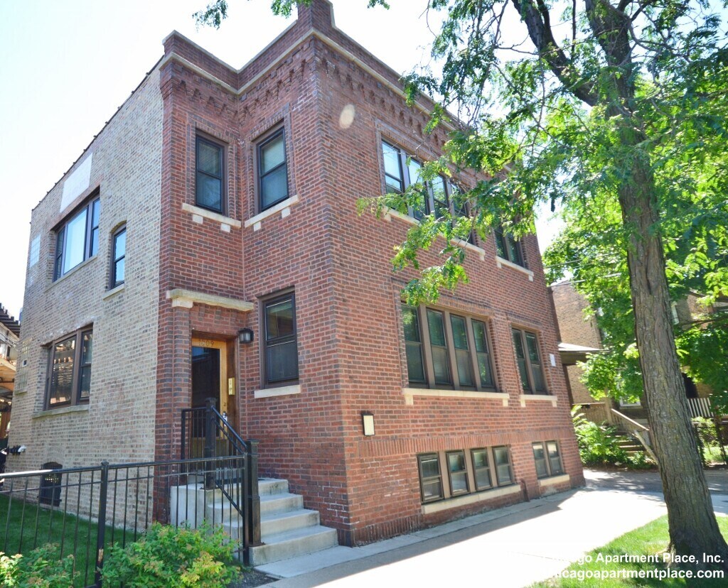
This charming prairie style building is nestled on a tree lined street. The Addison CTA Brown Line is just steps way. Wrigley Field and its surrounding bars, restaurants and theaters are within easy reach (eight blocks east). Other Chicago neighborhoods, full of diverse activities and establishments, are easily accessible via Lincoln Avenue, these include: Lincoln Park, Lakeview, North Center, and Lincoln Square to name a few. Roscoe Village’s colorful clubs and bars are also just three blocks south. Parking is available at this location. $150.00 Application Fee Per Person $125.00 Move-in Fee Per Bedroom NO DOGS, Cats ok! We are a property management company! Deal with us directly for a hassle-free process! Advertised rent prices are subject to change without notice! Chicago Apartment Place Inc.
1809 W. Patterson is an apartment community located in Cook County and the 60613 ZIP Code. This area is served by the Chicago Public Schools attendance zone.
Air Conditioning
Dishwasher
Hardwood Floors
Refrigerator
Situated in North Side Chicago, North Center is a small community about five miles from Downtown Chicago spanning to the west of the North Branch River. Most of the urban area is residential with a selection of apartments, condos, and single-family houses for rent at various price points. Everything from trendy lofts to cozy single-family homes is available in North Center’s rental market. The other parts of town are made up of shops, breweries, pizzerias, and an array of other dining options placed along Lincoln Avenue and Irving Park Road. For outdoor recreation in town, residents enjoy the two large community parks, Horner Park and Revere Park, equipped with playgrounds, sports fields, and walking paths.
Learn more about living in North CenterCompare neighborhood and city base rent averages by bedroom.
| North Center | Chicago, IL | |
|---|---|---|
| Studio | $1,452 | $1,645 |
| 1 Bedroom | $1,911 | $2,048 |
| 2 Bedrooms | $2,177 | $2,587 |
| 3 Bedrooms | $3,562 | $3,092 |
| Colleges & Universities | Distance | ||
|---|---|---|---|
| Colleges & Universities | Distance | ||
| Drive: | 4 min | 1.4 mi | |
| Drive: | 5 min | 2.2 mi | |
| Drive: | 5 min | 2.4 mi | |
| Drive: | 7 min | 3.3 mi |


Transportation options available in Chicago include Addison Station (Brown Line), located 0.1 mile from 1809 W. Patterson. 1809 W. Patterson is near Chicago O'Hare International, located 13.3 miles or 22 minutes away, and Chicago Midway International, located 15.7 miles or 26 minutes away.
| Transit / Subway | Distance | ||
|---|---|---|---|
| Transit / Subway | Distance | ||
|
|
Walk: | 1 min | 0.1 mi |
|
|
Walk: | 7 min | 0.4 mi |
|
|
Walk: | 11 min | 0.6 mi |
|
|
Walk: | 15 min | 0.8 mi |
|
|
Drive: | 3 min | 1.2 mi |
| Commuter Rail | Distance | ||
|---|---|---|---|
| Commuter Rail | Distance | ||
|
|
Drive: | 4 min | 1.8 mi |
|
|
Drive: | 4 min | 2.2 mi |
| Drive: | 7 min | 3.4 mi | |
|
|
Drive: | 6 min | 3.4 mi |
|
|
Drive: | 9 min | 4.4 mi |
| Airports | Distance | ||
|---|---|---|---|
| Airports | Distance | ||
|
Chicago O'Hare International
|
Drive: | 22 min | 13.3 mi |
|
Chicago Midway International
|
Drive: | 26 min | 15.7 mi |
Scores provided by
Traffic
-Airport
-Businesses
-Scores provided by
HowLoud What is a Sound Score Rating? A Sound Score Rating aggregates noise caused by vehicle traffic, airplane traffic and local sources. How It WorksTime and distance from 1809 W. Patterson.
| Shopping Centers | Distance | ||
|---|---|---|---|
| Shopping Centers | Distance | ||
| Walk: | 13 min | 0.7 mi | |
| Walk: | 14 min | 0.7 mi | |
| Walk: | 14 min | 0.8 mi |
| Parks and Recreation | Distance | ||
|---|---|---|---|
| Parks and Recreation | Distance | ||
|
Wrightwood Park
|
Drive: | 4 min | 1.7 mi |
|
Chase Park
|
Drive: | 4 min | 1.8 mi |
|
Winnemac Park
|
Drive: | 5 min | 2.2 mi |
|
Oz Park
|
Drive: | 7 min | 3.0 mi |
|
Notebaert Nature Museum
|
Drive: | 7 min | 3.1 mi |
| Hospitals | Distance | ||
|---|---|---|---|
| Hospitals | Distance | ||
| Drive: | 4 min | 1.8 mi | |
| Drive: | 4 min | 2.0 mi | |
| Drive: | 5 min | 2.3 mi |
| Military Bases | Distance | ||
|---|---|---|---|
| Military Bases | Distance | ||
| Drive: | 30 min | 20.9 mi | |
| Drive: | 43 min | 31.9 mi | |
| Drive: | 49 min | 32.3 mi |

What Are Walk Score®, Transit Score®, and Bike Score® Ratings?
Walk Score® measures the walkability of any address. Transit Score® measures access to public transit. Bike Score® measures the bikeability of any address.
What is a Sound Score Rating?
A Sound Score Rating aggregates noise caused by vehicle traffic, airplane traffic and local sources.
1809 W Patterson Ave
Chicago, IL 60613


