$2,250
Total Monthly Price
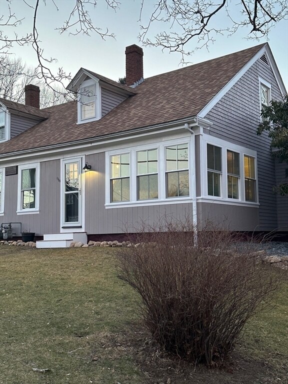
1790-1790 Elm St Unit 1788
Dighton, MA 02715
Favorites
1790-1790 Elm St Unit 1788

Favorites
Check Back Soon for Upcoming Availability
| Beds | Baths | Average SF |
|---|---|---|
| 2 Bedrooms 2 Bedrooms 2 Br | 1 Bath 1 Bath 1 Ba | 1,400 SF |
About This Property
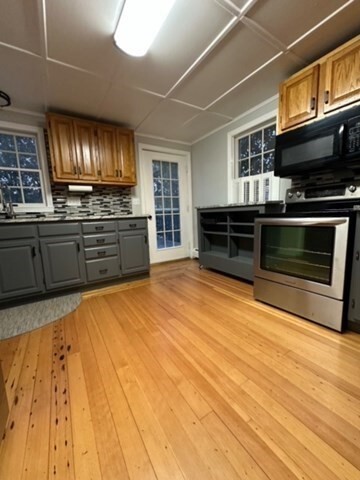
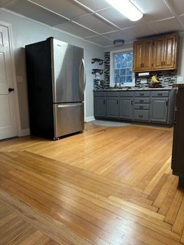
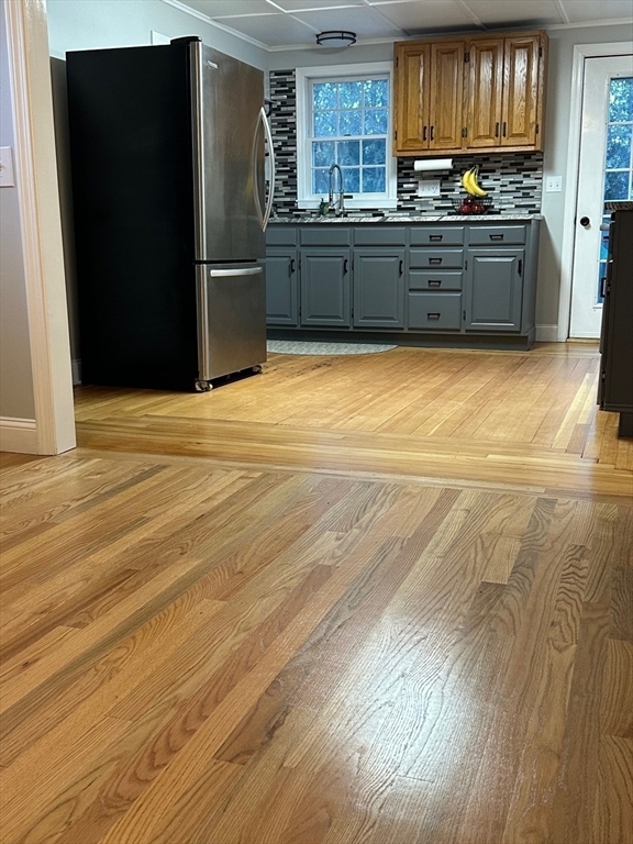
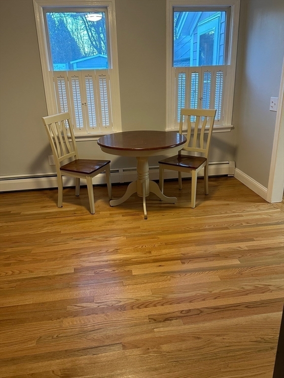
All utilities included less gas!!This sun drenched newly renovated 2 bedroom apartment,located in one of the most sought after towns has it all. Hardwood floors throughout,granite countertops,new appliances,new windows,and a new porches . The open floor plan allows you to make it your own. It sits on a beautiful 1.5 acre of piece of land where you can walk out from your kitchen door to the large privacy deck and enjoy spectacular views of the river,(which is great for kayaking,fishing,etc.) The driveway allows for 2 car parking. Laundry is located in the basement.
1790-1790 Elm St is an apartment community located in Bristol County and the 02715 ZIP Code.
1790-1790 Elm St,
Dighton,
MA
02715
Education
| Colleges & Universities | Distance | ||
|---|---|---|---|
| Colleges & Universities | Distance | ||
| Drive: | 23 min | 11.2 mi | |
| Drive: | 23 min | 12.6 mi | |
| Drive: | 33 min | 20.0 mi | |
| Drive: | 37 min | 21.6 mi |
1790-1790 Elm St Unit 1788 is within 23 minutes or 11.2 miles from Bristol Community College. It is also near Wheaton College, Norton and Johnson & Wales, Harborside.
Walkability Near 1790-1790 Elm St Dighton, MA 02715
Getting Around
 What do Walkability, Transit, Drivability, and Bikeability mean?
Walkability measures the walking distance to day-to-day needs.
Transit measures access to public transportation.
Drivability measures congestion, parking availability, and access to major roads.
Bikeability measures the suitability for cycling.
How It Works
What do Walkability, Transit, Drivability, and Bikeability mean?
Walkability measures the walking distance to day-to-day needs.
Transit measures access to public transportation.
Drivability measures congestion, parking availability, and access to major roads.
Bikeability measures the suitability for cycling.
How It Works
Somewhat Walkable
Walkability
20
/ 100
Minimal Public Transit
Transit
0
/ 100
Exceptionally Drivable
Drivability
90
/ 100
Somewhat Bikeable
Bikeability
20
/ 100
Scores provided by
-
Soundscore™
-
/ 100
Traffic
-Airport
-Businesses
-Scores provided by
HowLoud What is a Sound Score Rating? A Sound Score Rating aggregates noise caused by vehicle traffic, airplane traffic and local sources. How It WorksYou May Also Like
Similar Rentals Nearby
-
-
-
-
-
2 Beds$2,751+3 Beds$3,617Total Monthly PriceTotal Monthly Price NewPrices include required monthly fees of $155.Base Rent:2 Beds$2,596+3 Beds$3,4622 Months Free
Fitness Center Pool Refrigerator Kitchen In Unit Washer & Dryer Clubhouse
-
-
2 Beds$2,370+Total Monthly PriceTotal Monthly Price NewPrices include base rent and required monthly fees of $30. Variable costs based on usage may apply.Base Rent:2 Beds$2,225+1 Month Free
Pets Allowed Fitness Center Pool Walk-In Closets Clubhouse Hardwood Floors Tennis Court
-
-
-


What Are Walk Score®, Transit Score®, and Bike Score® Ratings?
Walk Score® measures the walkability of any address. Transit Score® measures access to public transit. Bike Score® measures the bikeability of any address.
What is a Sound Score Rating?
A Sound Score Rating aggregates noise caused by vehicle traffic, airplane traffic and local sources.

1790-1790 Elm St
Dighton, MA 02715