
$3,800 / Month
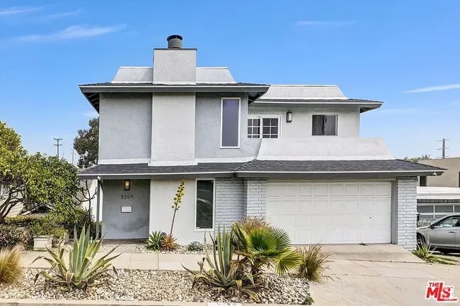
1751 W 244th St
Torrance, CA 90501
2 Weeks Ago
Favorites
1751 W 244th St

Favorites
Check Back Soon for Upcoming Availability
| Beds | Baths | Average SF |
|---|---|---|
| 3 Bedrooms 3 Bedrooms 3 Br | 1 Bath 1 Bath 1 Ba | 1,079 SF |
Fees and Policies
The fees below are based on community-supplied data and may exclude additional fees and utilities.
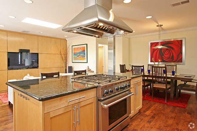
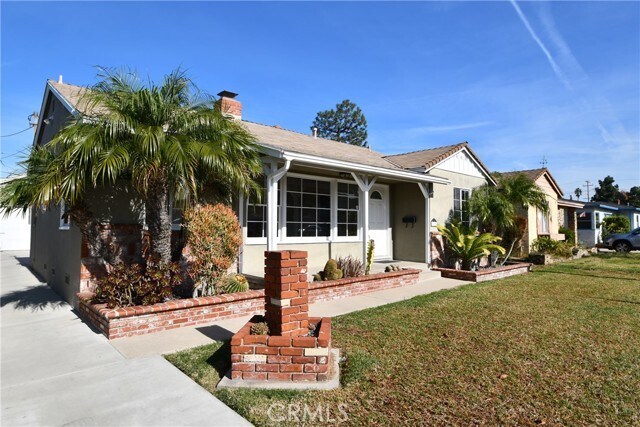
About This Property
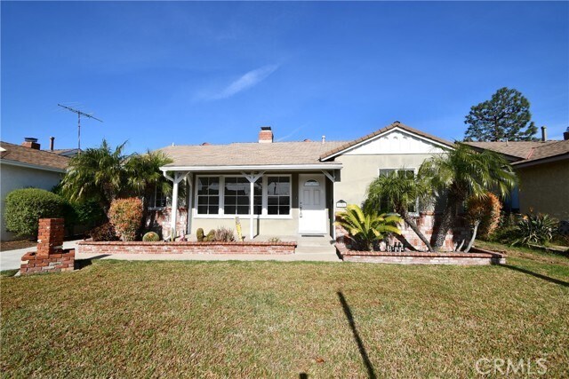
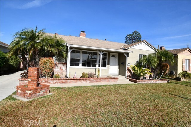
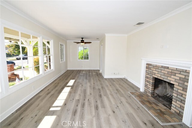
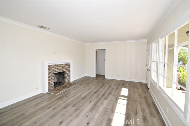
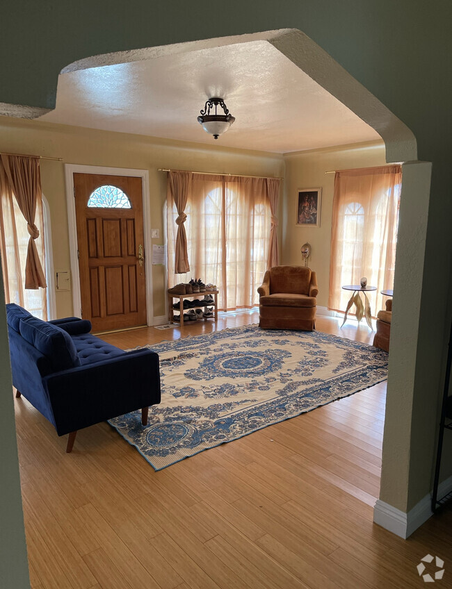
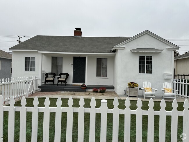
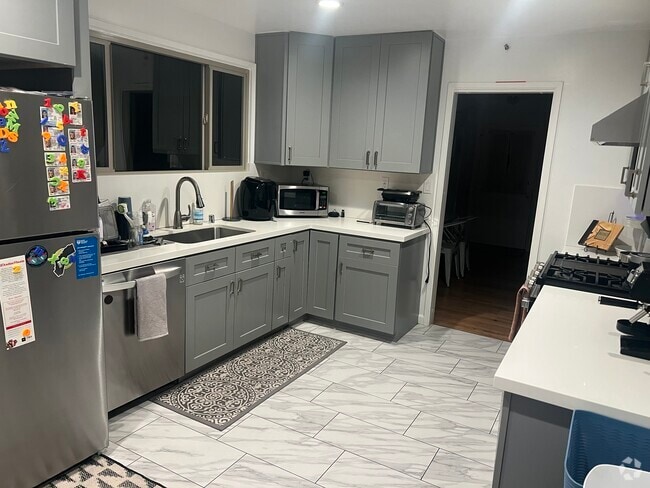
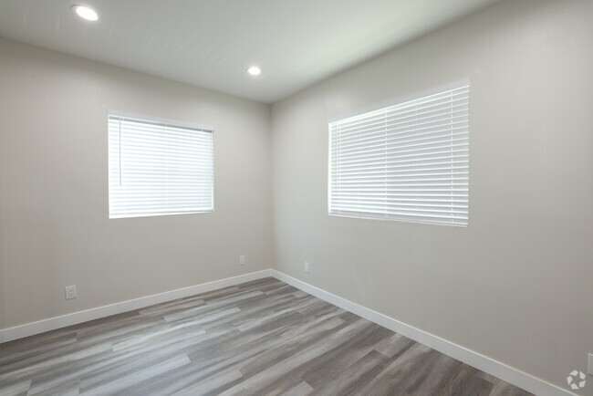
Welcome to your new home! This charming property boasts three cozy bedrooms and a beautifully renovated bathroom within its 1079 sqft. Embrace the spacious 5559 sqft lot featuring an incredible yard and garden, perfect for green-thumb enthusiasts or outdoor gatherings. Your vehicles will find a perfect home in the detached two-car garage, ensuring convenience and security. Inside, revel in the fresh ambiance with newly painted walls and updated flooring, complemented by brand-new blinds that accentuate the natural light throughout the house. This residence provides an ideal setting for raising a family, offering a serene and welcoming atmosphere. Discover comfort, style, and ample space in every corner of this wonderful home.
1751 W 244th St is a house located in Los Angeles County and the 90501 ZIP Code. This area is served by the Torrance Unified attendance zone.
House Features
- Heating
- Fireplace
Location
Get Directions
Southeast Torrance, located about 20 miles south of Los Angeles and only five miles from Southern California's beaches, provides a terrific neighborhood with easy access to the city and surf. Sur la Brea Park, located between West 236th Street and West 237th Street, features basketball and tennis courts, a softball diamond, horseshoe pits, and a walking trail. Just to the east of the neighborhood, locals can visit the Skating Edge ice arena, which offers public skate times, hockey leagues, and broomball.
Southeast Torrance is flanked by shopping plazas and is adjacent to Torrance Airport. The hip Del Amo Fashion Center is just a short drive outside the neighborhood on Sepulveda Boulevard. Your Southeast Torrance apartment will give you easy access to Charles H. Wilson Park, located directly north of the neighborhood. This park has a sports center, ball fields, walking trails, batting cages, and is the location of the Torrance Certified Farmers Market.
Learn more about living in Southeast TorranceBelow are rent ranges for similar nearby apartments
Amenities
- Heating
- Fireplace
Education
| Colleges & Universities | Distance | ||
|---|---|---|---|
| Colleges & Universities | Distance | ||
| Drive: | 8 min | 3.7 mi | |
| Drive: | 12 min | 6.9 mi | |
| Drive: | 15 min | 7.7 mi | |
| Drive: | 19 min | 11.1 mi |
1751 W 244th St is within 8 minutes or 3.7 miles from Harbor College. It is also near El Camino College, Torrance and Cal State Dominguez Hills.
Schools


Public Elementary & Middle School
Grades K-8
248 Students
Nearby
Public Elementary School
Grades K-5
357 Students
Attendance Zone
Public Middle School
Grades 6-8
622 Students
Attendance Zone
Public High School
Grades 9-12
1,999 Students
Attendance Zone
Private Elementary, Middle & High School
Grades PK-12
86 Students
Nearby
Private Elementary & Middle School
Grades PK-8
Nearby
Private Elementary School
Grades K-5
128 Students
Nearby
School data provided by
 The GreatSchools Rating helps parents compare schools within a state based on a variety of school quality indicators and provides a helpful picture of how effectively each school serves all of its students. Ratings are on a scale of 1 (below average) to 10 (above average) and can include test scores, college readiness, academic progress, advanced courses, equity, discipline and attendance data. We also advise parents to visit schools, consider other information on school performance and programs, and consider family needs as part of the school selection process.
View GreatSchools Rating Methodology
View GreatSchools Rating Methodology
Transportation options available in Torrance include Pacific Coast Hwy Station, located 8.2 miles from 1751 W 244th St. 1751 W 244th St is near Long Beach (Daugherty Field), located 10.7 miles or 19 minutes away, and Los Angeles International, located 14.6 miles or 23 minutes away.
| Transit / Subway | Distance | ||
|---|---|---|---|
| Transit / Subway | Distance | ||
|
|
Drive: | 16 min | 8.2 mi |
|
|
Drive: | 17 min | 8.3 mi |
|
|
Drive: | 17 min | 8.6 mi |
|
Del Amo Station
|
Drive: | 15 min | 8.6 mi |
|
|
Drive: | 16 min | 8.6 mi |
| Commuter Rail | Distance | ||
|---|---|---|---|
| Commuter Rail | Distance | ||
|
|
Drive: | 28 min | 20.8 mi |
|
|
Drive: | 32 min | 21.2 mi |
|
|
Drive: | 29 min | 21.2 mi |
|
|
Drive: | 32 min | 21.6 mi |
|
|
Drive: | 35 min | 22.6 mi |
| Airports | Distance | ||
|---|---|---|---|
| Airports | Distance | ||
|
Long Beach (Daugherty Field)
|
Drive: | 19 min | 10.7 mi |
|
Los Angeles International
|
Drive: | 23 min | 14.6 mi |
Time and distance from 1751 W 244th St.
| Shopping Centers | Distance | ||
|---|---|---|---|
| Shopping Centers | Distance | ||
| Walk: | 11 min | 0.6 mi | |
| Walk: | 17 min | 0.9 mi | |
| Drive: | 3 min | 1.3 mi |
1751 W 244th St has 3 shopping centers within 1.3 miles, which is about a 3-minute walk. The miles and minutes will be for the farthest away property.
| Parks and Recreation | Distance | ||
|---|---|---|---|
| Parks and Recreation | Distance | ||
|
George F. Canyon Preserve & Nature Center
|
Drive: | 6 min | 3.1 mi |
|
Madrona Marsh Preserve & Nature Center
|
Drive: | 7 min | 3.4 mi |
|
South Coast Botanic Garden
|
Drive: | 8 min | 3.6 mi |
|
Banning Residence Museum
|
Drive: | 9 min | 4.2 mi |
|
Forrestal Nature Reserve
|
Drive: | 16 min | 8.8 mi |
1751 W 244th St has 5 parks within 8.8 miles, including George F. Canyon Preserve & Nature Center, Madrona Marsh Preserve & Nature Center, and South Coast Botanic Garden.
| Hospitals | Distance | ||
|---|---|---|---|
| Hospitals | Distance | ||
| Drive: | 5 min | 2.3 mi | |
| Drive: | 5 min | 2.5 mi | |
| Drive: | 6 min | 2.6 mi |
1751 W 244th St has 3 hospitals within 2.6 miles, the nearest is Kaiser Foundation Hospital - South Bay which is 2.3 miles away and a 5 minute drive.
| Military Bases | Distance | ||
|---|---|---|---|
| Military Bases | Distance | ||
| Drive: | 16 min | 7.2 mi | |
| Drive: | 19 min | 9.5 mi |
1751 W 244th St is 7.2 miles from Fort MacArthur, and is convenient to other military bases, including Long Beach Naval Station.
You May Also Like
Similar Rentals Nearby
What Are Walk Score®, Transit Score®, and Bike Score® Ratings?
Walk Score® measures the walkability of any address. Transit Score® measures access to public transit. Bike Score® measures the bikeability of any address.
What is a Sound Score Rating?
A Sound Score Rating aggregates noise caused by vehicle traffic, airplane traffic and local sources
1751 W 244th St
Torrance, CA 90501