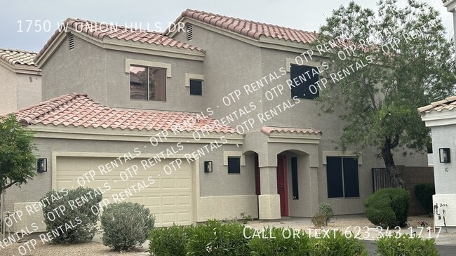
$2,500 / Month
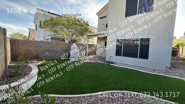
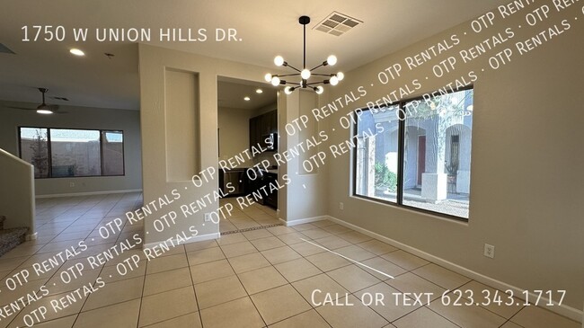
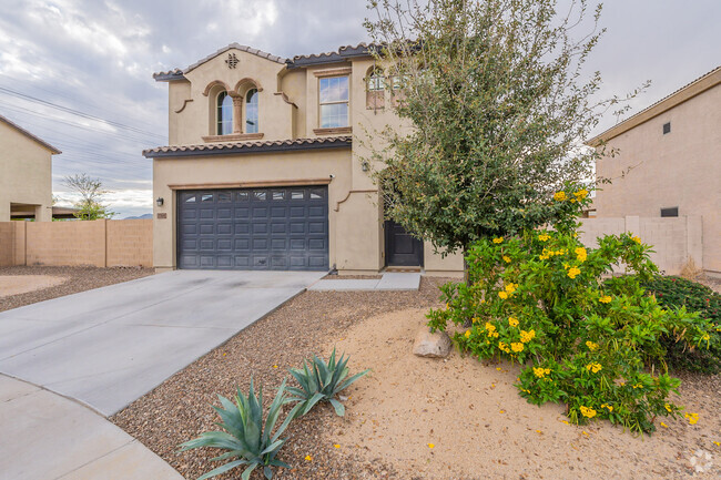
1750 W Union Hills Dr
Phoenix, AZ 85027
Today
Favorites
623-343-1717
-
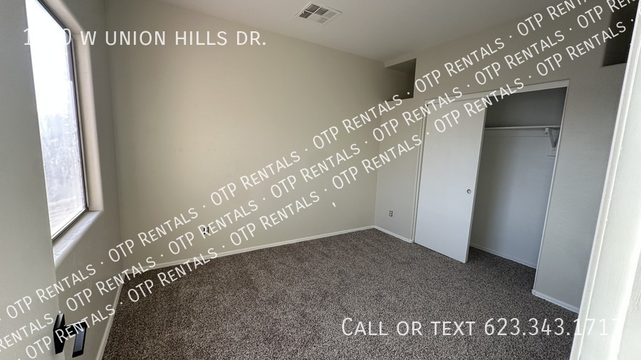
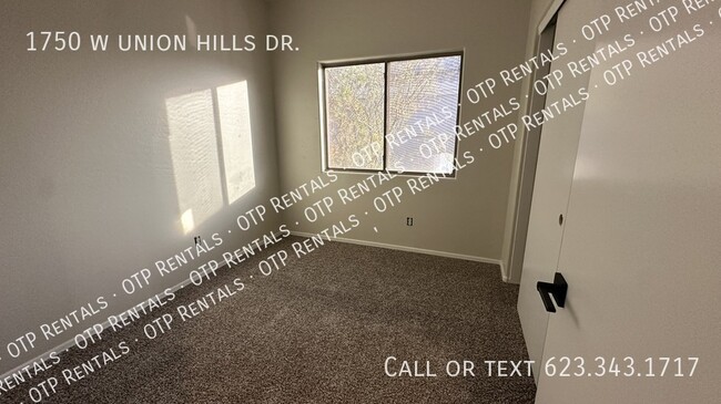
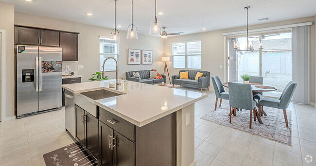
Bedrooms
4
-
Bathrooms
2.5
-
Square Feet
1,800 sq ft
-
Available
Available Now
1750 W Union Hills Dr

Favorites
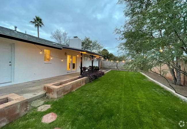
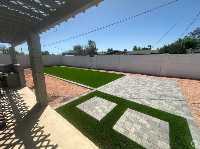
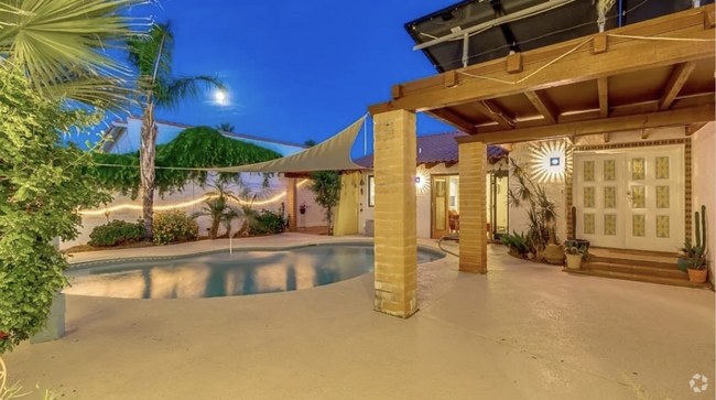
About This Home
Available Now
---- SCHEDULE A SHOWING ONLINE AT: ----
1750 W Union Hills Dr is a house located in Maricopa County and the 85027 ZIP Code. This area is served by the Deer Valley Unified District attendance zone.
* Price shown is base rent and may not include non-optional fees and utilities.
Price, availability, fees, and any applicable rent special are subject to change without notice.
* Square footage definitions vary. Displayed square footage is approximate.
Contact
- Listed by OTP Rentals Team
- Phone Number
- Contact
Location
Get Directions
Deer Valley is a family-friendly suburb and residential neighborhood that’s constantly evolving. There are abundant outdoor recreational opportunities in Deer Valley because of its proximity to several natural attractions like Deem Hills and Cave Buttes, both known for scenic hiking and mountain biking trails. Residents have easy access to abundant shopping opportunities without having to leave town at places like Deer Valley Towne Center and Bell Towne Plaza. Deer Valley is home to good public schools and is the ideal suburb for those commuting to Downtown Phoenix and beyond, located less than 20 miles south of town along Interstate 17.
Learn more about living in Deer Valley
Education
| Colleges & Universities | Distance | ||
|---|---|---|---|
| Colleges & Universities | Distance | ||
| Drive: | 10 min | 5.3 mi | |
| Drive: | 13 min | 7.0 mi | |
| Drive: | 13 min | 7.1 mi | |
| Drive: | 16 min | 7.8 mi |
1750 W Union Hills Dr is within 10 minutes or 5.3 miles from Paradise Valley Comm. Coll.. It is also near Midwestern University and Arizona State University, West.
Schools


Public Elementary School
Grades PK-6
671 Students
Attendance Zone
Public Middle School
Grades 7-8
537 Students
Attendance Zone
Public Middle & High School
Grades 7-12
1,641 Students
Attendance Zone
Private Elementary School
Grades K
Nearby
Private Elementary School
Grades PK-3
26 Students
Nearby
Private Elementary, Middle & High School
Grades K-12
177 Students
Nearby
School data provided by
 The GreatSchools Rating helps parents compare schools within a state based on a variety of school quality indicators and provides a helpful picture of how effectively each school serves all of its students. Ratings are on a scale of 1 (below average) to 10 (above average) and can include test scores, college readiness, academic progress, advanced courses, equity, discipline and attendance data. We also advise parents to visit schools, consider other information on school performance and programs, and consider family needs as part of the school selection process.
View GreatSchools Rating Methodology
View GreatSchools Rating Methodology
Transportation options available in Phoenix include 19Th Ave/Dunlap, located 6.5 miles from 1750 W Union Hills Dr. 1750 W Union Hills Dr is near Phoenix Sky Harbor International, located 22.7 miles or 33 minutes away, and Phoenix-Mesa Gateway, located 50.5 miles or 65 minutes away.
| Transit / Subway | Distance | ||
|---|---|---|---|
| Transit / Subway | Distance | ||
|
|
Drive: | 12 min | 6.5 mi |
|
|
Drive: | 14 min | 9.4 mi |
|
|
Drive: | 15 min | 10.1 mi |
|
|
Drive: | 16 min | 11.2 mi |
| Airports | Distance | ||
|---|---|---|---|
| Airports | Distance | ||
|
Phoenix Sky Harbor International
|
Drive: | 33 min | 22.7 mi |
|
Phoenix-Mesa Gateway
|
Drive: | 65 min | 50.5 mi |
Time and distance from 1750 W Union Hills Dr.
| Shopping Centers | Distance | ||
|---|---|---|---|
| Shopping Centers | Distance | ||
| Walk: | 4 min | 0.2 mi | |
| Walk: | 7 min | 0.4 mi | |
| Walk: | 18 min | 1.0 mi |
1750 W Union Hills Dr has 3 shopping centers within 1.0 mile, which is about a 18-minute walk. The miles and minutes will be for the farthest away property.
| Parks and Recreation | Distance | ||
|---|---|---|---|
| Parks and Recreation | Distance | ||
|
Turtle Rock Basin
|
Drive: | 5 min | 2.8 mi |
|
Conocido Park
|
Drive: | 5 min | 3.0 mi |
|
Grovers Basin
|
Drive: | 8 min | 4.0 mi |
|
Adobe Mountain Park
|
Drive: | 8 min | 4.4 mi |
|
Paseo Highlands Park
|
Drive: | 8 min | 5.3 mi |
1750 W Union Hills Dr has 5 parks within 5.3 miles, including Conocido Park, Turtle Rock Basin, and Grovers Basin.
| Hospitals | Distance | ||
|---|---|---|---|
| Hospitals | Distance | ||
| Drive: | 4 min | 2.1 mi | |
| Drive: | 6 min | 3.1 mi | |
| Drive: | 11 min | 6.4 mi |
1750 W Union Hills Dr has 3 hospitals within 6.4 miles, the nearest is Honorhealth Deer Valley Medical Center which is 2.1 miles away and a 4 minute drive.
| Military Bases | Distance | ||
|---|---|---|---|
| Military Bases | Distance | ||
| Drive: | 33 min | 22.6 mi | |
| Drive: | 31 min | 23.1 mi | |
| Drive: | 112 min | 86.1 mi |
1750 W Union Hills Dr has 3 military bases within 86.1 miles, the nearest is Phoenix Sky Harbor Airport Air Guard Station which is 22.6 miles away and a 33 minute drive.
You May Also Like
Similar Rentals Nearby

What Are Walk Score®, Transit Score®, and Bike Score® Ratings?
Walk Score® measures the walkability of any address. Transit Score® measures access to public transit. Bike Score® measures the bikeability of any address.
What is a Sound Score Rating?
A Sound Score Rating aggregates noise caused by vehicle traffic, airplane traffic and local sources

1750 W Union Hills Dr
Phoenix, AZ 85027