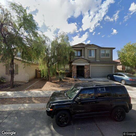
17385 W Lilac St
17385 W Lilac St
Goodyear, AZ 85338
Favorites
17385 W Lilac St
Favorites
Check Back Soon for Upcoming Availability
| Beds | Baths | Average SF |
|---|---|---|
| 5 Bedrooms 5 Bedrooms 5 Br | 3 Baths 3 Baths 3 Ba | — |
17385 W Lilac St,
Goodyear,
AZ
85338
Located in the Sonoran Desert, Goodyear sits 17 miles west of Phoenix, offering a mix of suburban living and outdoor recreation. The city, named after the Goodyear Tire and Rubber Company's historic cotton operations, has grown into an established community. Estrella Mountain Regional Park spans 20,000 acres with more than 30 miles of trails for outdoor enthusiasts, while baseball fans gather at Goodyear Ballpark during spring training to watch the Cleveland Guardians and Cincinnati Reds. Current rental rates range from $1,283 for studios to $2,821 for four-bedroom homes.
Goodyear features several distinct neighborhoods across its landscape. The Estrella community stretches across 20,000 acres near the Estrella Mountains, showcasing desert vistas, while Palm Valley, situated north of Interstate 10, offers established residential areas. PebbleCreek, a 55+ community, features 54 holes of golf and resort amenities.
Learn more about living in Goodyear
Education
| Colleges & Universities | Distance | ||
|---|---|---|---|
| Colleges & Universities | Distance | ||
| Drive: | 14 min | 8.6 mi | |
| Drive: | 33 min | 22.5 mi | |
| Drive: | 33 min | 22.6 mi | |
| Drive: | 37 min | 26.1 mi |
17385 W Lilac St is within 14 minutes or 8.6 miles from Estrella Mountain Comm. Coll.. It is also near Glendale Community College and Grand Canyon University.
Walkability Near 17385 W Lilac St Goodyear, AZ 85338
Getting Around
 What do Walkability, Transit, Drivability, and Bikeability mean?
Walkability measures the walking distance to day-to-day needs.
Transit measures access to public transportation.
Drivability measures congestion, parking availability, and access to major roads.
Bikeability measures the suitability for cycling.
How It Works
What do Walkability, Transit, Drivability, and Bikeability mean?
Walkability measures the walking distance to day-to-day needs.
Transit measures access to public transportation.
Drivability measures congestion, parking availability, and access to major roads.
Bikeability measures the suitability for cycling.
How It Works
Somewhat Walkable
Walkability
20
/ 100
Minimal Public Transit
Transit
0
/ 100
Exceptionally Drivable
Drivability
100
/ 100
Fairly Bikeable
Bikeability
40
/ 100
Scores provided by
-
Soundscore™
-
/ 100
Traffic
-Airport
-Businesses
-Scores provided by
HowLoud What is a Sound Score Rating? A Sound Score Rating aggregates noise caused by vehicle traffic, airplane traffic and local sources. How It WorksYou May Also Like
Similar Rentals Nearby
-
-
4 Beds$2,718+Total Monthly PriceTotal Monthly Price NewPrices include base rent and required monthly fees of $5. Variable costs based on usage may apply.Base Rent:4 Beds$2,712+2 Months Free
-

-

-

-

-

-

-

-


What Are Walk Score®, Transit Score®, and Bike Score® Ratings?
Walk Score® measures the walkability of any address. Transit Score® measures access to public transit. Bike Score® measures the bikeability of any address.
What is a Sound Score Rating?
A Sound Score Rating aggregates noise caused by vehicle traffic, airplane traffic and local sources.

17385 W Lilac St
Goodyear, AZ 85338