$650
/ Month
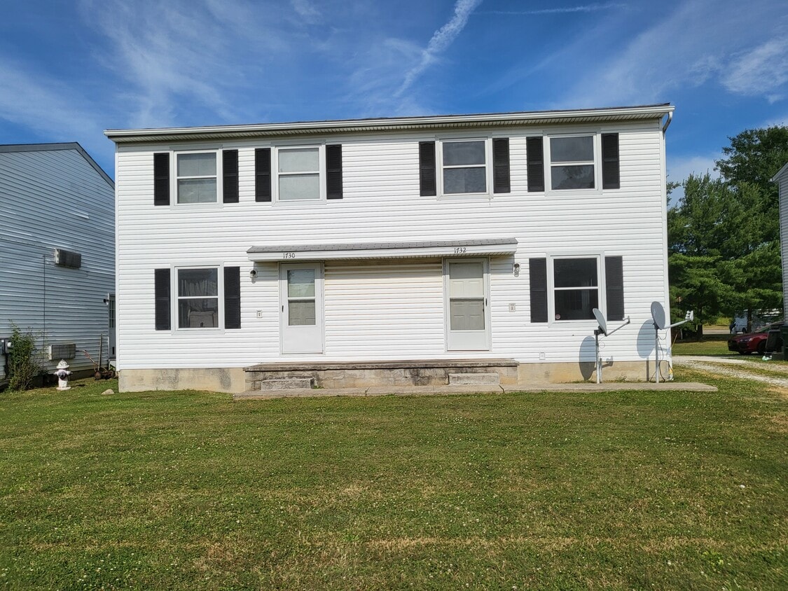
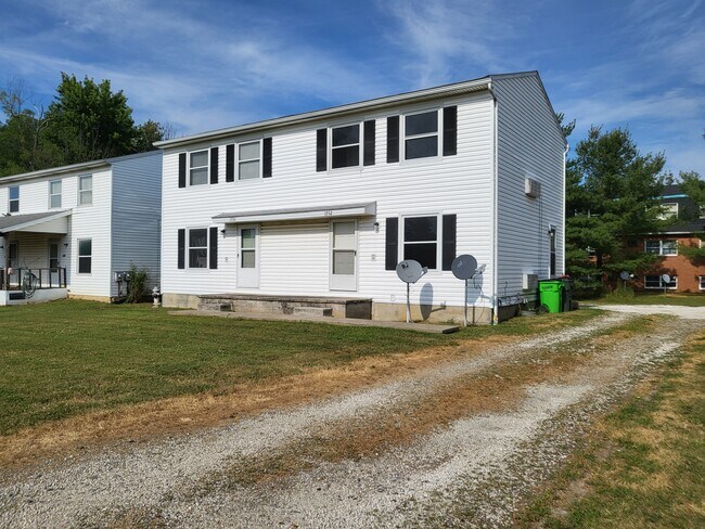
1732-1732 Westwood St
Alliance, OH 44601
Favorites
1732-1732 Westwood St

Favorites
Check Back Soon for Upcoming Availability
| Beds | Baths | Average SF |
|---|---|---|
| 2 Bedrooms 2 Bedrooms 2 Br | 1.5 Baths 1.5 Baths 1.5 Ba | — |
About This Property
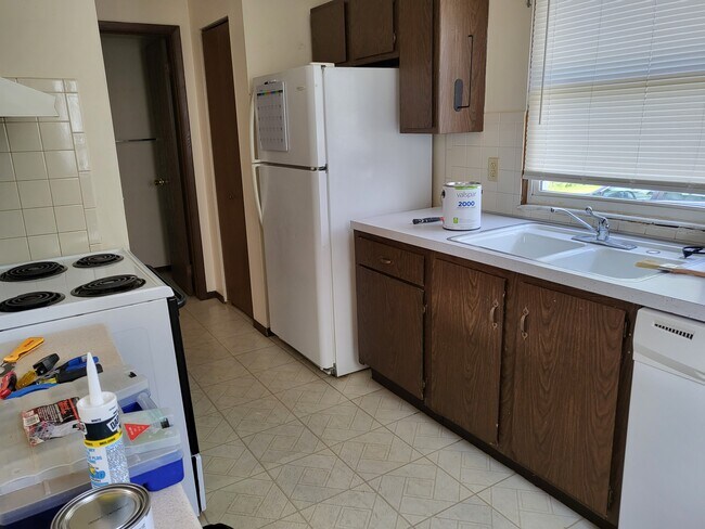
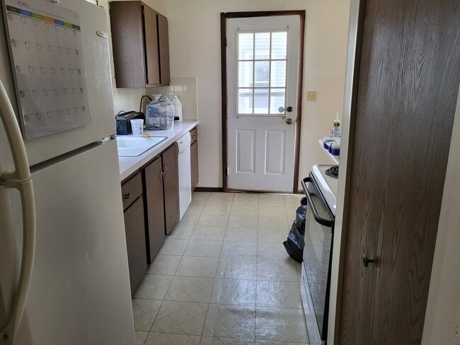
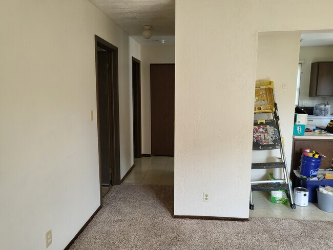
2 bedroom, 1.5 bathroom townhouse with appliances in Alliance. Marlington School District. No Utilities included. Washer/Dryer hookup in the basement. Date Available: Jul 15th 2022. $650/month rent. $650 security deposit required. Please submit the form on this page or contact Jerry Quinn at to learn more. This property is managed by a responsible landlord using Avail landlord software.
1732-1732 Westwood St is a townhome located in Stark County and the 44601 ZIP Code. This area is served by the Alliance City School District attendance zone.
1732-1732 Westwood St,
Alliance,
OH
44601
Alliance sits about 20 miles northeast of Canton in Stark County, shaped by its origins as a railroad and manufacturing hub. Founded in 1854 through the merger of three smaller communities, the city carries that layered history through its pre-war architecture, a walkable downtown, and the University of Mount Union, a private liberal arts college established in 1846 that anchors much of the city's day-to-day energy. Alliance is also Ohio's Carnation City, recognized for its ties to the scarlet carnation, the state flower, which the city celebrates each year with the Greater Alliance Carnation Festival. The downtown core along East State Street offers a compact mix of local dining and retail, while the historic district draws those with an interest in architecture and local heritage. Glamorgan Castle adds a distinct landmark presence to the landscape.
Learn more about living in Alliance
Education
| Colleges & Universities | Distance | ||
|---|---|---|---|
| Colleges & Universities | Distance | ||
| Drive: | 6 min | 2.1 mi | |
| Drive: | 22 min | 13.6 mi | |
| Drive: | 24 min | 14.8 mi | |
| Drive: | 30 min | 20.2 mi |
1732-1732 Westwood St is within 6 minutes or 2.1 miles from Mount Union College. It is also near Walsh University and Malone University.
Schools


Public Elementary School
Grades PK-5
372 Students
Nearby
Public Elementary School
Grades K-5
414 Students
Nearby
Public Elementary School
Grades PK-5
408 Students
Nearby
Public Elementary School
Grades K-5
384 Students
Nearby
Public Middle School
Grades 6-8
572 Students
Nearby
Public High School
Grades 9-12
576 Students
Attendance Zone
Private Elementary School
Grades PK-5
53 Students
Nearby
Private Elementary School
Grades PK-5
119 Students
Nearby
Private Middle & High School
Grades 6-12
379 Students
Nearby
School data provided by
 The GreatSchools Rating helps parents compare schools within a state based on a variety of school quality indicators and provides a helpful picture of how effectively each school serves all of its students. Ratings are on a scale of 1 (below average) to 10 (above average) and can include test scores, college readiness, academic progress, advanced courses, equity, discipline and attendance data. We also advise parents to visit schools, consider other information on school performance and programs, and consider family needs as part of the school selection process.
View GreatSchools Rating Methodology
Data provided by GreatSchools.org © 2026. All rights reserved.
View GreatSchools Rating Methodology
Data provided by GreatSchools.org © 2026. All rights reserved.
Walkability Near 1732-1732 Westwood St Alliance, OH 44601
Getting Around
 What do Walkability, Transit, Drivability, and Bikeability mean?
Walkability measures the walking distance to day-to-day needs.
Transit measures access to public transportation.
Drivability measures congestion, parking availability, and access to major roads.
Bikeability measures the suitability for cycling.
How It Works
What do Walkability, Transit, Drivability, and Bikeability mean?
Walkability measures the walking distance to day-to-day needs.
Transit measures access to public transportation.
Drivability measures congestion, parking availability, and access to major roads.
Bikeability measures the suitability for cycling.
How It Works
Fairly Walkable
Walkability
40
/ 100
Limited Public Transit
Transit
20
/ 100
Exceptionally Drivable
Drivability
100
/ 100
Somewhat Bikeable
Bikeability
30
/ 100
Scores provided by
-
Soundscore™
-
/ 100
Traffic
-Airport
-Businesses
-Scores provided by
HowLoud What is a Sound Score Rating? A Sound Score Rating aggregates noise caused by vehicle traffic, airplane traffic and local sources. How It WorksYou May Also Like
-
Woodlawn Village
2601 Woodlawn Cir NW
Canton, OH 44708
$1,120 - $1,585
2-3 Br 16.2 mi
-
Hidden Pines Townhomes
2509-2533 Meloy Rd
Kent, OH 44240
$560 - $610 Total Monthly Price
4 Br 12 Month Lease 17.7 mi
-
Akron U Townhomes - Student Housing
658 E Buchtel Ave
Akron, OH 44304
$415 - $1,775 Total Monthly Price
5 Br 12 Month Lease 22.1 mi
Similar Rentals Nearby
-
-
1 / 15

-
2 Beds$5993 Beds$6994 Beds+$649Total Monthly Price12 Month LeaseTotal Monthly Price NewPrices include all required monthly fees.
Pets Allowed Dishwasher Refrigerator Kitchen In Unit Washer & Dryer Range
-
1 / 13

-
-
-
4 Beds$6955 Beds$585Total Monthly Price12 Month LeaseTotal Monthly Price NewPrices include all required monthly fees.
-
-
-


What Are Walk Score®, Transit Score®, and Bike Score® Ratings?
Walk Score® measures the walkability of any address. Transit Score® measures access to public transit. Bike Score® measures the bikeability of any address.
What is a Sound Score Rating?
A Sound Score Rating aggregates noise caused by vehicle traffic, airplane traffic and local sources.

1732-1732 Westwood St
Alliance, OH 44601