$3,400 / Month
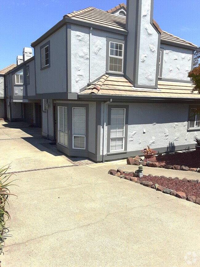
173 Crown Cir
South San Francisco, CA 94080
2 Weeks Ago
Favorites
173 Crown Cir

Favorites
Check Back Soon for Upcoming Availability
| Beds | Baths | Average SF |
|---|---|---|
| 2 Bedrooms 2 Bedrooms 2 Br | 2.5 Baths 2.5 Baths 2.5 Ba | 1,430 SF |
About This Property
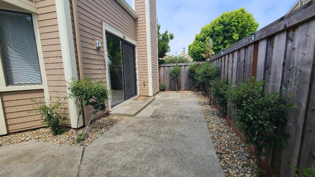
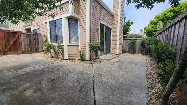
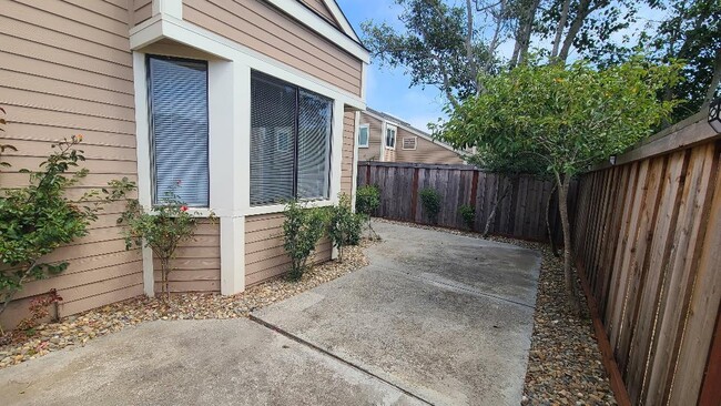
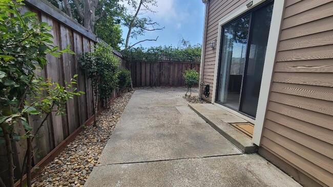
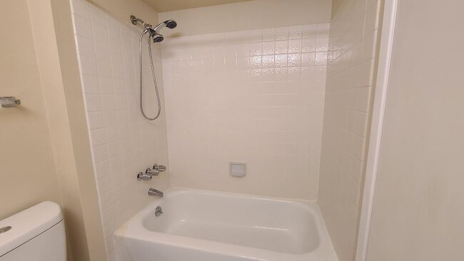
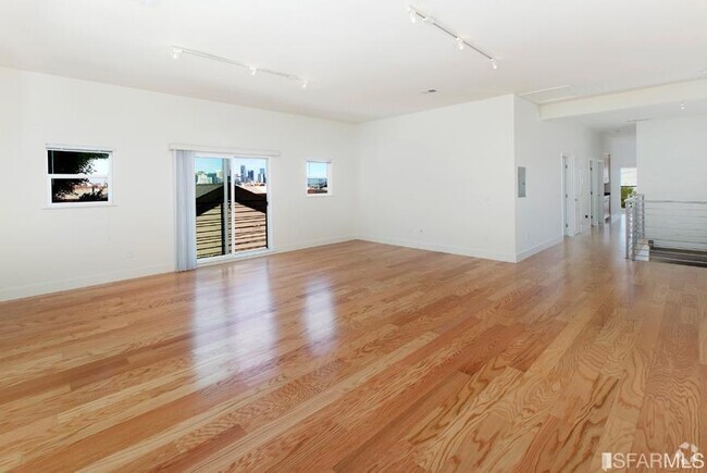
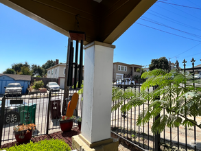
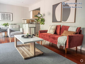
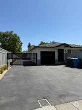
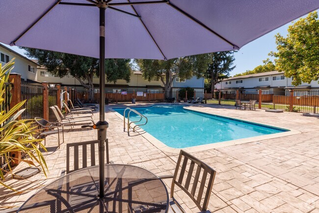
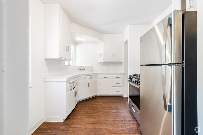
Spacious end unit townhouse in a gated community! Because it's an end unit next to the grounds, you only have neighbors on one side & there is a lot of privacy. There is also so much natural light in the house with all the windows, even on foggy days. 1st floor is the kitchen, dining room, 1/2 bath & step down to a spacious LR w/12 ft ceilings, fireplace & sliding glass door to your private backyard. The 2 bedrooms are upstairs. The primary BR has a large walk-in closet, bathroom w/large shower stall & its own small patio that gets the afternoon sun & overlooks the grounds. The 2nd BR has ample closet space & its own bathroom with shower/tub combo. The set up is perfect for roommates! Central heating & carpeting throughout. 2-car attached garage w/storage shelves, full size washer & dryer, & 2 car driveway. All appliances included. The front door faces east-southeast. Well maintained & manicured complex - quiet, private & gated - with a pool, spa, & tennis court. Convenient location to Highway 280, El Camino, BART, Serramonte Shopping Center, Costco, Trader Joes, Starbucks & so much more!
173 Crown Cir is a townhome located in San Mateo County and the 94080 ZIP Code. This area is served by the South San Francisco Unified attendance zone.
Townhome Features
- Fireplace
- Pool
Fees and Policies
The fees below are based on community-supplied data and may exclude additional fees and utilities.
Location
Get Directions
Folks in South San Francisco have easy access to The City via I-280, the 101, or BART rail service. This fact, coupled with the much lower crime rate and the area’s many excellent schools, makes South San Francisco apartments an appealing option for commuters, particularly those raising families.
Although primarily a residential community, South San Francisco does have a fairly active downtown scene, with much of the dining and entertainment centered around the intersection of Grande Avenue and Linden Avenue and shopping centers on the south side of town.
Many parks and nature preserves are scattered around the area, including the huge Sweeney Ridge and Fairway Park just to the west of the city limits. San Francisco International Airport sits directly south of town, making it highly convenient to travel anywhere.
Learn more about living in South San FranciscoBelow are rent ranges for similar nearby apartments
Amenities
- Fireplace
- Pool
Education
| Colleges & Universities | Distance | ||
|---|---|---|---|
| Colleges & Universities | Distance | ||
| Drive: | 11 min | 4.7 mi | |
| Drive: | 11 min | 5.6 mi | |
| Drive: | 10 min | 6.0 mi | |
| Drive: | 17 min | 8.1 mi |
173 Crown Cir is within 11 minutes or 4.7 miles from Skyline College. It is also near City College of San Francisco and San Francisco State University.
Schools


Public Elementary School
Grades K-5
394 Students
Nearby
Public Elementary School
Grades K-5
574 Students
Attendance Zone
Public Middle School
Grades 6-8
628 Students
Attendance Zone
Public High School
Grades 9-12
1,173 Students
Attendance Zone
Private Elementary & Middle School
Grades PK-8
129 Students
Nearby
Private Elementary, Middle & High School
Grades 3-12
48 Students
Nearby
Private Elementary & Middle School
Grades K-8
Nearby
School data provided by
 The GreatSchools Rating helps parents compare schools within a state based on a variety of school quality indicators and provides a helpful picture of how effectively each school serves all of its students. Ratings are on a scale of 1 (below average) to 10 (above average) and can include test scores, college readiness, academic progress, advanced courses, equity, discipline and attendance data. We also advise parents to visit schools, consider other information on school performance and programs, and consider family needs as part of the school selection process.
View GreatSchools Rating Methodology
View GreatSchools Rating Methodology
Transportation options available in South San Francisco include South San Francisco Station, located 1.2 miles from 173 Crown Cir. 173 Crown Cir is near San Francisco International, located 6.6 miles or 14 minutes away, and Metro Oakland International, located 30.5 miles or 44 minutes away.
| Transit / Subway | Distance | ||
|---|---|---|---|
| Transit / Subway | Distance | ||
|
|
Drive: | 3 min | 1.2 mi |
|
|
Drive: | 5 min | 2.1 mi |
|
|
Drive: | 7 min | 3.7 mi |
|
|
Drive: | 8 min | 3.9 mi |
|
|
Drive: | 9 min | 4.9 mi |
| Commuter Rail | Distance | ||
|---|---|---|---|
| Commuter Rail | Distance | ||
| Drive: | 8 min | 4.0 mi | |
| Drive: | 8 min | 4.1 mi | |
| Drive: | 13 min | 6.9 mi | |
| Drive: | 15 min | 8.7 mi | |
| Drive: | 14 min | 10.0 mi |
| Airports | Distance | ||
|---|---|---|---|
| Airports | Distance | ||
|
San Francisco International
|
Drive: | 14 min | 6.6 mi |
|
Metro Oakland International
|
Drive: | 44 min | 30.5 mi |
Time and distance from 173 Crown Cir.
| Shopping Centers | Distance | ||
|---|---|---|---|
| Shopping Centers | Distance | ||
| Walk: | 7 min | 0.4 mi | |
| Drive: | 4 min | 1.3 mi | |
| Drive: | 5 min | 2.1 mi |
173 Crown Cir has 3 shopping centers within 2.1 miles, which is about a 5-minute walk. The miles and minutes will be for the farthest away property.
| Parks and Recreation | Distance | ||
|---|---|---|---|
| Parks and Recreation | Distance | ||
|
Charles F. Hagar Planetarium
|
Drive: | 12 min | 6.2 mi |
|
San Francisco State Univ. Observatory
|
Drive: | 12 min | 6.2 mi |
|
San Bruno Mountain State Park
|
Drive: | 15 min | 6.3 mi |
|
Pacifica State Beach
|
Drive: | 12 min | 8.0 mi |
|
Candlestick Point State Recreation Area
|
Drive: | 18 min | 10.8 mi |
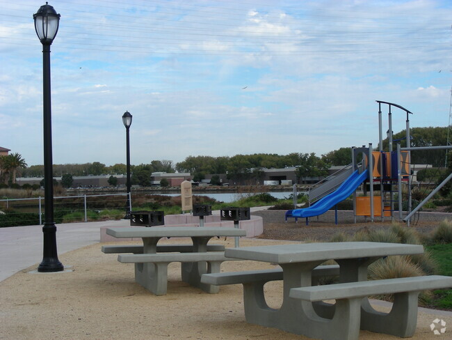
173 Crown Cir has 5 parks within 10.8 miles, including San Bruno Mountain State Park, Charles F. Hagar Planetarium, and San Francisco State Univ. Observatory.
| Hospitals | Distance | ||
|---|---|---|---|
| Hospitals | Distance | ||
| Drive: | 3 min | 1.4 mi | |
| Drive: | 5 min | 2.0 mi | |
| Drive: | 11 min | 7.6 mi |
173 Crown Cir has 3 hospitals within 7.6 miles, the nearest is Kaiser Foundation Hospital - South San Francisco which is 1.4 miles away and a 3 minute drive.
| Military Bases | Distance | ||
|---|---|---|---|
| Military Bases | Distance | ||
| Drive: | 23 min | 10.2 mi | |
| Drive: | 24 min | 10.7 mi |
173 Crown Cir is 10.2 miles from East Fort Miley, and is convenient to other military bases, including West Fort Miley.
You May Also Like
Similar Rentals Nearby
-
-
-
 $4,1002 Beds, 2 Baths, 1,227 sq ftTownhome for Rent
 -
-
-
-
-
-
-

What Are Walk Score®, Transit Score®, and Bike Score® Ratings?
Walk Score® measures the walkability of any address. Transit Score® measures access to public transit. Bike Score® measures the bikeability of any address.
What is a Sound Score Rating?
A Sound Score Rating aggregates noise caused by vehicle traffic, airplane traffic and local sources

173 Crown Cir
South San Francisco, CA 94080