$2,395
/ Month
1715 W Pelican Dr
Chandler, AZ 85286
1 Day Ago
|
Edit
Favorites
732-771-5472
-
Bedrooms
3
-
Bathrooms
3
-
Square Feet
2,057 sq ft
-
Available
Available Now
1715 W Pelican Dr

Favorites
About This Home
$2,395 deposit,
Available Now
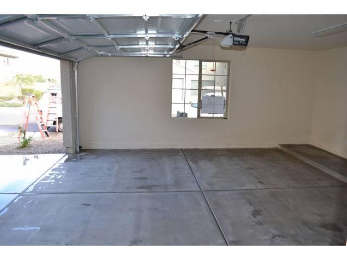
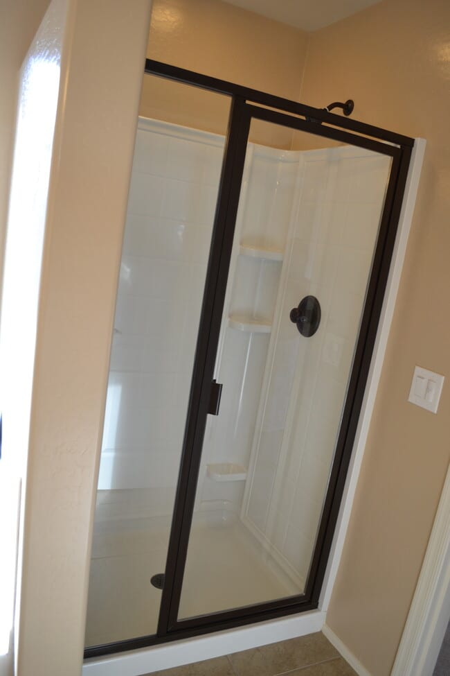
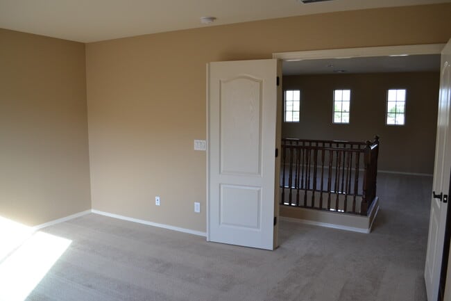
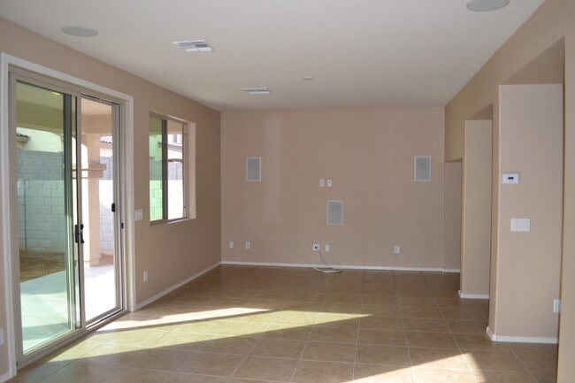
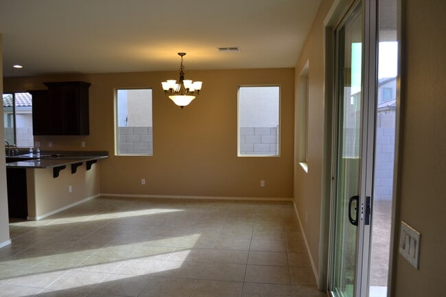
Beautiful single family home, located in Stonefield Colony featuring 1 large master bedroom with walk in closet, 2 guest bedrooms, loft, 2 full baths and 1half bath. Spacious floor plan upgraded cabinets, stainless steel appliances, washer, dryer, gas range, two refrigerators, granite countertops, expanded patio and so much more. Nice association pool and spa just few feet away. Landlord pays for HOA. Close to 101 & 202 Cross Street: Dobson Rd and Germann Rd Shopping: Lots of shopping all around. The area is serving by Fry's, Chandler Fashion Square mall, Costco, Target and many more
1715 W Pelican Dr is a house located in Maricopa County and the 85286 ZIP Code. This area is served by the Chandler Unified District attendance zone.
* Price shown is base rent. Excludes user-selected optional fees and variable or usage-based fees and required charges due at or prior to move-in or at move-out. Price, availability, fees, and any applicable rent special are subject to change without notice.
* Square footage definitions vary. Displayed square footage is approximate.
Fees and Policies
The fees below are based on community-supplied data and may exclude additional fees and utilities.
- One-Time Basics
- Due at Move-In
- Security Deposit - Refundable$2,395
- Due at Move-In
- Dogs
- Allowed
- Cats
- Allowed
Property Fee Disclaimer: Based on community-supplied data and independent market research. Subject to change without notice. May exclude fees for mandatory or optional services and usage-based utilities.
House Features
- Washer/Dryer
- Washer/Dryer Hookup
- Dishwasher
Contact
- Listed by Noona
- Phone Number
- Contact
Location
Get Directions
Amenities
- Washer/Dryer
- Washer/Dryer Hookup
- Dishwasher
Nestled between Downtown Chandler and the Gila River Indian Reservation, South Chandler is a sizeable suburban area brimming with all kinds of modern conveniences. South Chandler residents enjoy easy access to a slew of shopping centers and plazas, many of which are clustered along South Alma School Road and South Arizona Avenue.
South Chandler offers plenty of recreational opportunities at Tumbleweed Park, Chuparosa Park, Snedigar Recreation Center, and Paseo Vista Recreation Area. The expansive San Tan Mountains Regional Park is also just minutes away from South Chandler. A wide variety of golf and country clubs are located in South Chandler as well.
Learn more about living in South Chandler
Education
| Colleges & Universities | Distance | ||
|---|---|---|---|
| Colleges & Universities | Distance | ||
| Drive: | 9 min | 5.1 mi | |
| Drive: | 12 min | 6.4 mi | |
| Drive: | 17 min | 10.3 mi | |
| Drive: | 18 min | 11.4 mi |
1715 W Pelican Dr is within 9 minutes or 5.1 miles from Chandler-Gilbert CC. Sun Lakes. It is also near Chandler-Gilbert C.C., Pecos and Mesa C.C., Southern and Dobson.
Schools


Public Elementary School
Grades PK-6
787 Students
Attendance Zone
Public Middle & High School
Grades 8-12
3,850 Students
Attendance Zone
Public Middle School
Grades 7-8
1,151 Students
Attendance Zone
Private Elementary, Middle & High School
Grades K-12
205 Students
Nearby
School data provided by
 The GreatSchools Rating helps parents compare schools within a state based on a variety of school quality indicators and provides a helpful picture of how effectively each school serves all of its students. Ratings are on a scale of 1 (below average) to 10 (above average) and can include test scores, college readiness, academic progress, advanced courses, equity, discipline and attendance data. We also advise parents to visit schools, consider other information on school performance and programs, and consider family needs as part of the school selection process.
View GreatSchools Rating Methodology
Data provided by GreatSchools.org © 2025. All rights reserved.
View GreatSchools Rating Methodology
Data provided by GreatSchools.org © 2025. All rights reserved.
Transportation options available in Chandler include Price-101 Fwy/Apache Blvd, located 11.1 miles from 1715 W Pelican Dr. 1715 W Pelican Dr is near Phoenix-Mesa Gateway, located 13.9 miles or 22 minutes away, and Phoenix Sky Harbor International, located 19.2 miles or 28 minutes away.
| Transit / Subway | Distance | ||
|---|---|---|---|
| Transit / Subway | Distance | ||
|
|
Drive: | 16 min | 11.1 mi |
|
|
Drive: | 20 min | 11.5 mi |
|
|
Drive: | 17 min | 11.5 mi |
|
|
Drive: | 18 min | 12.2 mi |
|
|
Drive: | 19 min | 13.0 mi |
| Commuter Rail | Distance | ||
|---|---|---|---|
| Commuter Rail | Distance | ||
|
|
Drive: | 29 min | 21.4 mi |
| Airports | Distance | ||
|---|---|---|---|
| Airports | Distance | ||
|
Phoenix-Mesa Gateway
|
Drive: | 22 min | 13.9 mi |
|
Phoenix Sky Harbor International
|
Drive: | 28 min | 19.2 mi |
Time and distance from 1715 W Pelican Dr.
| Shopping Centers | Distance | ||
|---|---|---|---|
| Shopping Centers | Distance | ||
| Walk: | 11 min | 0.6 mi | |
| Walk: | 15 min | 0.8 mi | |
| Walk: | 16 min | 0.9 mi |
1715 W Pelican Dr has 3 shopping centers within 0.9 mile, which is about a 16-minute walk. The miles and minutes will be for the farthest away property.
| Parks and Recreation | Distance | ||
|---|---|---|---|
| Parks and Recreation | Distance | ||
|
City of Chandler Environmental Education Center
|
Drive: | 16 min | 9.9 mi |
|
Pecos Park
|
Drive: | 17 min | 10.4 mi |
|
South Mountain Park
|
Drive: | 22 min | 12.9 mi |
1715 W Pelican Dr has 3 parks within 12.9 miles, including City of Chandler Environmental Education Center, Pecos Park, and South Mountain Park.
| Hospitals | Distance | ||
|---|---|---|---|
| Hospitals | Distance | ||
| Drive: | 4 min | 2.3 mi | |
| Drive: | 9 min | 5.5 mi | |
| Drive: | 11 min | 5.9 mi |
1715 W Pelican Dr has 3 hospitals within 5.9 miles, the nearest is Chandler Regional Medical Center which is 2.3 miles away and a 4 minute drive.
| Military Bases | Distance | ||
|---|---|---|---|
| Military Bases | Distance | ||
| Drive: | 28 min | 19.9 mi | |
| Drive: | 57 min | 44.2 mi | |
| Drive: | 97 min | 80.2 mi |
1715 W Pelican Dr has 3 military bases within 80.2 miles, the nearest is Phoenix Sky Harbor Airport Air Guard Station which is 19.9 miles away and a 28 minute drive.
You May Also Like
Similar Rentals Nearby
-
-
-
-
-
-
-
-
-
1 / 46

-


What Are Walk Score®, Transit Score®, and Bike Score® Ratings?
Walk Score® measures the walkability of any address. Transit Score® measures access to public transit. Bike Score® measures the bikeability of any address.
What is a Sound Score Rating?
A Sound Score Rating aggregates noise caused by vehicle traffic, airplane traffic and local sources

1715 W Pelican Dr
Chandler, AZ 85286