

$1,595
/ Month
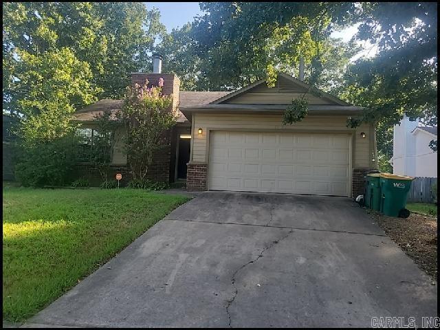
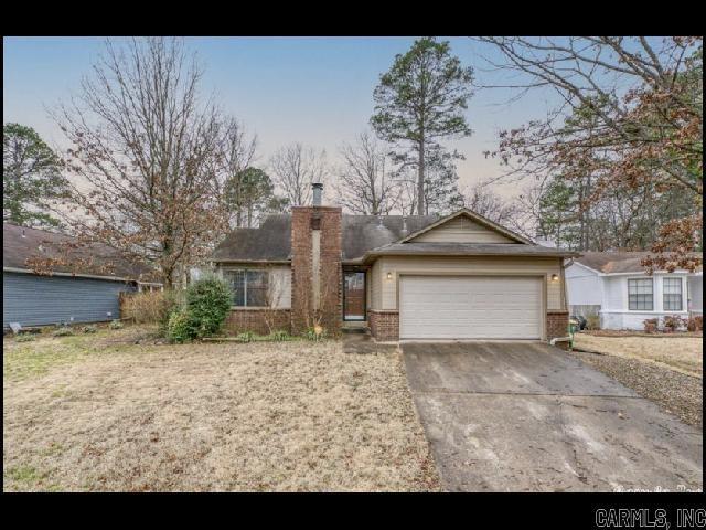
1702 Calgary Trail
Little Rock, AR 72211
2 Weeks Ago
|
Edit
Favorites
1702 Calgary Trail

Favorites
Check Back Soon for Upcoming Availability
| Beds | Baths | Average SF |
|---|---|---|
| 3 Bedrooms 3 Bedrooms 3 Br | 2 Baths 2 Baths 2 Ba | 1,263 SF |
About This Property
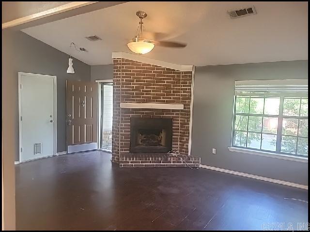
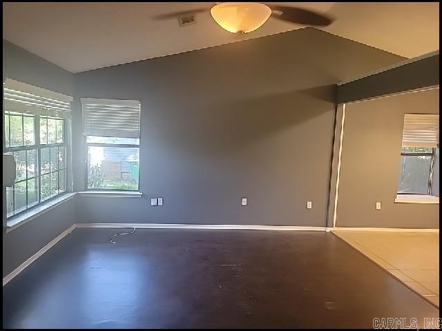
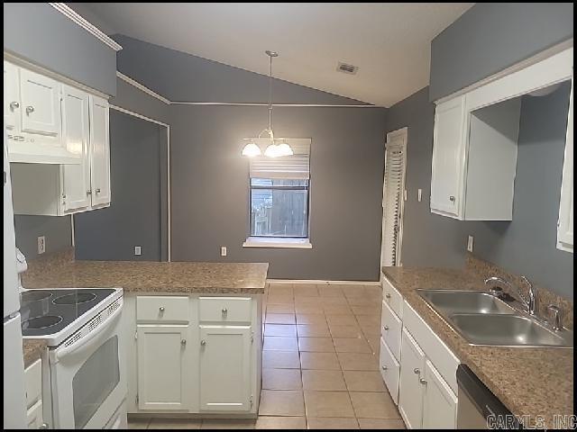
*WEST LITTLE ROCK* GORGEOUS HOME IN POINT WEST SUBDIVISION!! This 3 Bedroom And 2 Bath Home Features 1263 Sqft! Close To All Amenities Including Highway Access! Vaulted Ceiling In Open Living Room With Gas Log Fireplace! Eat-In Kitchen With Breakfast Bar!! Fenced In Backyard! 2 Car Garage For Parking! PET FRIENDLY!! AVAILABLE NOW!!!
1702 Calgary Trail is a house located in Pulaski County and the 72211 ZIP Code. This area is served by the Little Rock attendance zone.
Location
Get Directions
West Little Rock is comprised of a vast swath of land stretching from Interstate 430 out towards Williams Junction and over Lake Maumelle. There’s an incredible variety of neighborhoods, communities, and landscapes in what’s considered West Little Rock, including waterfront communities on the lake, pastoral reprieves of the Arkansas countryside, and the more suburban communities nearing the city center. There’s a little something for everyone in West Little Rock, but most renters will be enticed by the apartment communities and affordable renters just west of the Interstate that mix the serenity of living outside the city while still being close enough to enjoy its amenities.
Learn more about living in West Little RockBelow are rent ranges for similar nearby apartments
Education
| Colleges & Universities | Distance | ||
|---|---|---|---|
| Colleges & Universities | Distance | ||
| Drive: | 13 min | 6.6 mi | |
| Drive: | 13 min | 6.8 mi | |
| Drive: | 14 min | 8.8 mi | |
| Drive: | 25 min | 15.5 mi |
1702 Calgary Trail is within 13 minutes or 6.6 miles from UA Little Rock. It is also near Univ. of Ark. Medical Scis. and Philander Smith College.
Schools


Public Elementary School
Grades K-5
352 Students
Attendance Zone
Charter Middle School
Grades 6-8
997 Students
Nearby
Public Middle School
Grades 6-8
878 Students
Attendance Zone
Charter High School
Grades 9-12
412 Students
Nearby
Private Elementary, Middle & High School
Grades PK-12
1,323 Students
Nearby
Private Elementary School
Grades PK-6
73 Students
Nearby
School data provided by
 The GreatSchools Rating helps parents compare schools within a state based on a variety of school quality indicators and provides a helpful picture of how effectively each school serves all of its students. Ratings are on a scale of 1 (below average) to 10 (above average) and can include test scores, college readiness, academic progress, advanced courses, equity, discipline and attendance data. We also advise parents to visit schools, consider other information on school performance and programs, and consider family needs as part of the school selection process.
View GreatSchools Rating Methodology
Data provided by GreatSchools.org © 2025. All rights reserved.
View GreatSchools Rating Methodology
Data provided by GreatSchools.org © 2025. All rights reserved.
Transportation options available in Little Rock include 2Nd St & Center St, located 9.6 miles from 1702 Calgary Trail. 1702 Calgary Trail is near Bill and Hillary Clinton Ntl/Adams Field, located 13.5 miles or 22 minutes away.
| Transit / Subway | Distance | ||
|---|---|---|---|
| Transit / Subway | Distance | ||
| Drive: | 15 min | 9.6 mi | |
| Drive: | 15 min | 9.6 mi | |
| Drive: | 16 min | 9.9 mi | |
| Drive: | 16 min | 10.0 mi | |
| Drive: | 16 min | 10.3 mi |
| Commuter Rail | Distance | ||
|---|---|---|---|
| Commuter Rail | Distance | ||
|
|
Drive: | 15 min | 8.7 mi |
|
|
Drive: | 50 min | 42.0 mi |
| Airports | Distance | ||
|---|---|---|---|
| Airports | Distance | ||
|
Bill and Hillary Clinton Ntl/Adams Field
|
Drive: | 22 min | 13.5 mi |
Time and distance from 1702 Calgary Trail.
| Shopping Centers | Distance | ||
|---|---|---|---|
| Shopping Centers | Distance | ||
| Walk: | 16 min | 0.9 mi | |
| Drive: | 3 min | 1.1 mi | |
| Drive: | 3 min | 1.2 mi |
1702 Calgary Trail has 3 shopping centers within 1.2 miles, which is about a 3-minute drive. The miles and minutes will be for the farthest away property.
| Parks and Recreation | Distance | ||
|---|---|---|---|
| Parks and Recreation | Distance | ||
|
Little Rock Zoo
|
Drive: | 11 min | 6.0 mi |
|
Central High School National Historic Site
|
Drive: | 13 min | 7.8 mi |
|
Museum of Discovery
|
Drive: | 16 min | 10.1 mi |
|
Pinnacle Mountain State Park
|
Drive: | 25 min | 11.2 mi |
|
Burns Park
|
Drive: | 20 min | 12.6 mi |
1702 Calgary Trail has 5 parks within 12.6 miles, including Little Rock Zoo, Central High School National Historic Site, and Museum of Discovery.
| Hospitals | Distance | ||
|---|---|---|---|
| Hospitals | Distance | ||
| Drive: | 5 min | 2.1 mi | |
| Drive: | 12 min | 6.4 mi | |
| Drive: | 12 min | 6.6 mi |
1702 Calgary Trail has 3 hospitals within 6.6 miles, the nearest is Arkansas Heart Hospital which is 2.1 miles away and a 5 minute drive.
| Military Bases | Distance | ||
|---|---|---|---|
| Military Bases | Distance | ||
| Drive: | 36 min | 19.7 mi | |
| Drive: | 41 min | 27.3 mi | |
| Drive: | 43 min | 27.7 mi |
1702 Calgary Trail has 3 military bases within 27.7 miles, the nearest is Camp Joseph T. Robinson Hill which is 19.7 miles away and a 36 minute drive.
You May Also Like
Similar Rentals Nearby


What Are Walk Score®, Transit Score®, and Bike Score® Ratings?
Walk Score® measures the walkability of any address. Transit Score® measures access to public transit. Bike Score® measures the bikeability of any address.
What is a Sound Score Rating?
A Sound Score Rating aggregates noise caused by vehicle traffic, airplane traffic and local sources
1702 Calgary Trail
Little Rock, AR 72211