$2,695 / Month
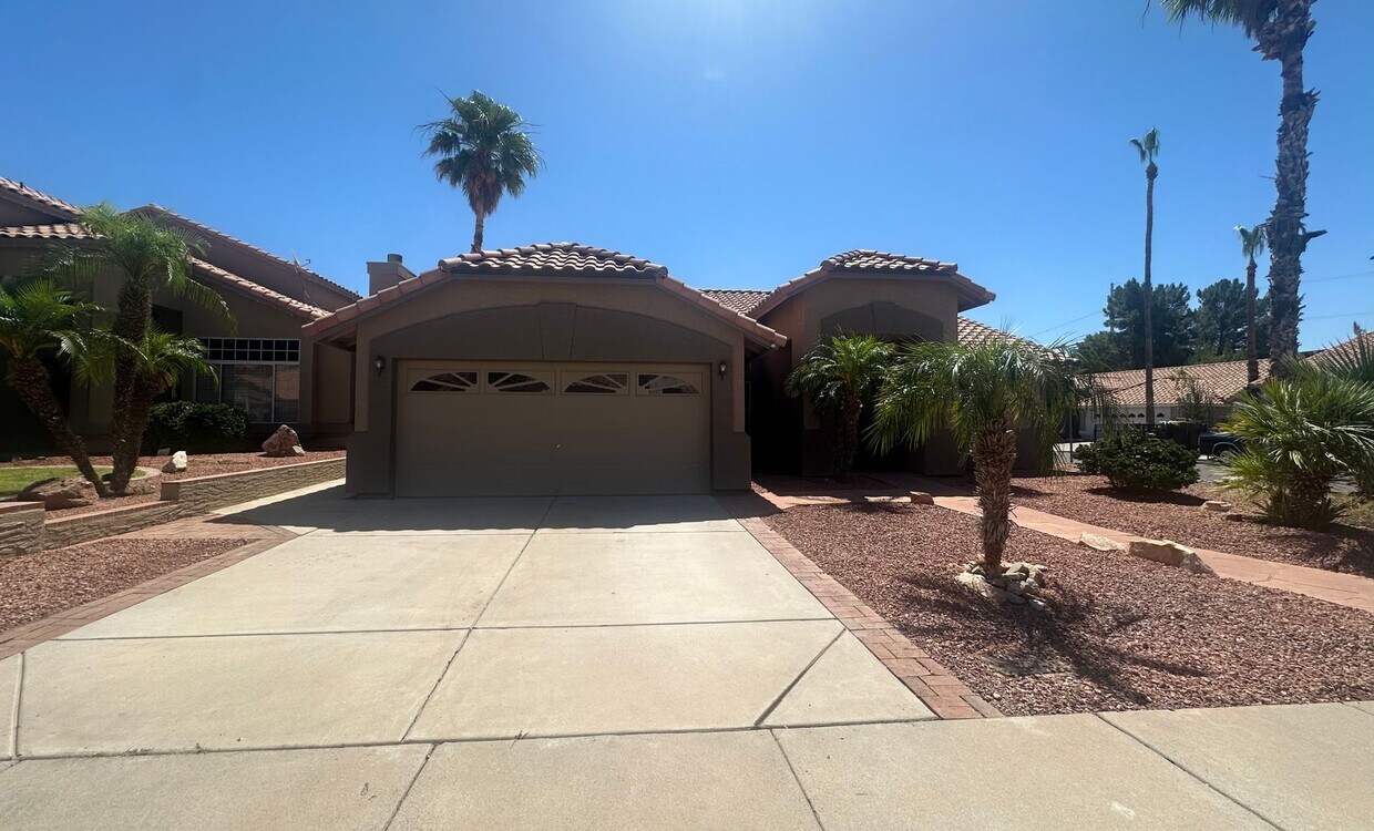
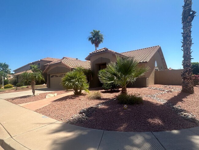
17013 S 30th Way
Phoenix, AZ 85048
2 Weeks Ago
Favorites
-
Bedrooms
4
-
Bathrooms
2
-
Square Feet
1,791 sq ft
17013 S 30th Way

Favorites
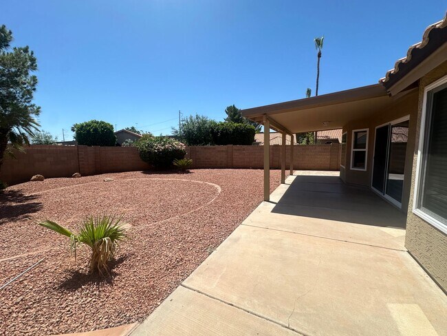
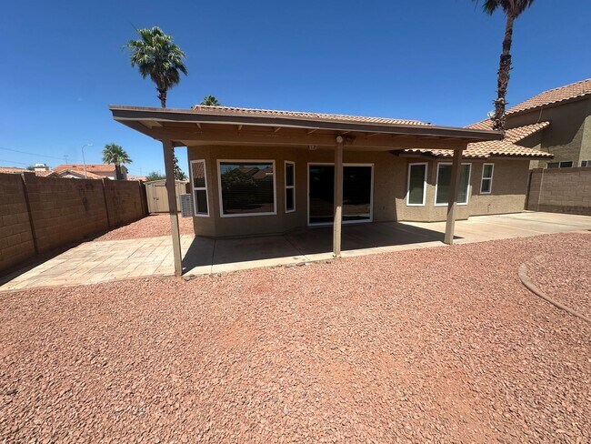
About This Home
$3,000 deposit
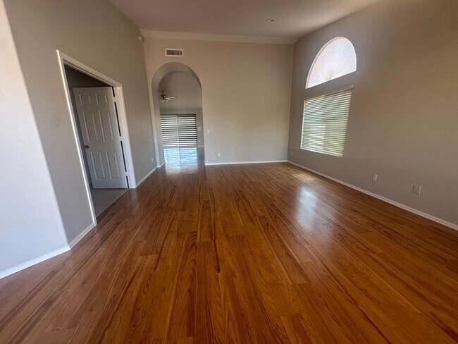
AHWATUKEE/FOOTHILLS SINGLE LEVEL 4 BEDROOM HOME, WALKING DISTANCE TO DESERT VISTA HIGH SCHOOL.
17013 S 30th Way is a house located in Maricopa County and the 85048 ZIP Code.
* Price shown is base rent and may not include non-optional fees and utilities.
Price, availability, fees, and any applicable rent special are subject to change without notice.
* Square footage definitions vary. Displayed square footage is approximate.
House Features
- Dishwasher
Location
Get Directions
Amenities
- Dishwasher
Ahwatukee is your one-stop-shop, housing various retailers, delectable local eateries, and picturesque natural landscapes. This charming neighborhood is situated 13 miles southeast of Phoenix, Arizona, with easy access to major interstates like I-10 and the Phoenix Sky Harbor International Airport.
From Sprouts Farmers Market to PetSmart, Ahwatukee Foothills Towne Center has it all. Try some of the casual bakeries and restaurants such as Nothing Bundt Cakes or RA Sushi after an afternoon of shopping. With numerous shopping centers and various restaurants, you’ll never tire of the available options in Ahwatukee.
Learn more about living in Ahwatukee
Education
| Colleges & Universities | Distance | ||
|---|---|---|---|
| Colleges & Universities | Distance | ||
| Drive: | 19 min | 12.7 mi | |
| Drive: | 21 min | 12.8 mi | |
| Drive: | 21 min | 13.7 mi | |
| Drive: | 21 min | 13.8 mi |
17013 S 30th Way is within 21 minutes or 12.8 miles from South Mountain Comm. Coll.. It is also near Arizona State University and Chandler-Gilbert CC. Sun Lakes.
Transportation options available in Phoenix include Eleventh St/Mill, located 13.3 miles from 17013 S 30th Way. 17013 S 30th Way is near Phoenix Sky Harbor International, located 15.2 miles or 23 minutes away, and Phoenix-Mesa Gateway, located 21.9 miles or 31 minutes away.
| Transit / Subway | Distance | ||
|---|---|---|---|
| Transit / Subway | Distance | ||
|
|
Drive: | 19 min | 13.3 mi |
|
|
Drive: | 19 min | 13.3 mi |
|
|
Drive: | 20 min | 13.6 mi |
| Drive: | 22 min | 15.3 mi | |
| Drive: | 22 min | 15.7 mi |
| Commuter Rail | Distance | ||
|---|---|---|---|
| Commuter Rail | Distance | ||
|
|
Drive: | 28 min | 20.4 mi |
| Airports | Distance | ||
|---|---|---|---|
| Airports | Distance | ||
|
Phoenix Sky Harbor International
|
Drive: | 23 min | 15.2 mi |
|
Phoenix-Mesa Gateway
|
Drive: | 31 min | 21.9 mi |
Time and distance from 17013 S 30th Way.
| Shopping Centers | Distance | ||
|---|---|---|---|
| Shopping Centers | Distance | ||
| Walk: | 19 min | 1.0 mi | |
| Drive: | 3 min | 1.2 mi | |
| Drive: | 4 min | 2.1 mi |
17013 S 30th Way has 3 shopping centers within 2.1 miles, which is about a 4-minute walk. The miles and minutes will be for the farthest away property.
| Parks and Recreation | Distance | ||
|---|---|---|---|
| Parks and Recreation | Distance | ||
|
Pecos Park
|
Drive: | 7 min | 2.9 mi |
|
South Mountain Park
|
Drive: | 16 min | 8.9 mi |
|
Barrios Unidos Park
|
Drive: | 23 min | 16.8 mi |
|
Camelback Mountain Park
|
Drive: | 29 min | 16.9 mi |
|
Nina Mason Pulliam Rio Salado Audubon Center
|
Drive: | 24 min | 17.9 mi |
17013 S 30th Way has 5 parks within 17.9 miles, including Pecos Park, South Mountain Park, and Camelback Mountain Park.
| Hospitals | Distance | ||
|---|---|---|---|
| Hospitals | Distance | ||
| Drive: | 14 min | 9.3 mi | |
| Drive: | 15 min | 9.5 mi | |
| Drive: | 13 min | 10.5 mi |
17013 S 30th Way has 3 hospitals within 10.5 miles, the nearest is Chandler Regional Medical Center which is 9.3 miles away and a 14 minute drive.
| Military Bases | Distance | ||
|---|---|---|---|
| Military Bases | Distance | ||
| Drive: | 22 min | 15.9 mi | |
| Drive: | 45 min | 34.9 mi | |
| Drive: | 96 min | 79.1 mi |
17013 S 30th Way has 3 military bases within 79.1 miles, the nearest is Phoenix Sky Harbor Airport Air Guard Station which is 15.9 miles away and a 22 minute drive.
You May Also Like
Similar Rentals Nearby


What Are Walk Score®, Transit Score®, and Bike Score® Ratings?
Walk Score® measures the walkability of any address. Transit Score® measures access to public transit. Bike Score® measures the bikeability of any address.
What is a Sound Score Rating?
A Sound Score Rating aggregates noise caused by vehicle traffic, airplane traffic and local sources

17013 S 30th Way
Phoenix, AZ 85048