
$2,100
/ Month
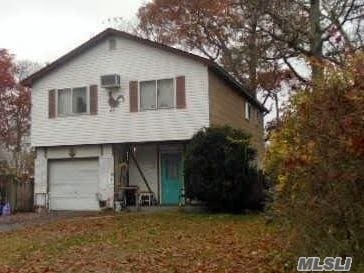
169 Mastic Blvd
Mastic, NY 11950
2 Weeks Ago
|
Edit
Favorites
169 Mastic Blvd

Favorites
Check Back Soon for Upcoming Availability
| Beds | Baths | Average SF |
|---|---|---|
| 3 Bedrooms 3 Bedrooms 3 Br | 1 Bath 1 Bath 1 Ba | — |
169 Mastic Blvd,
Mastic,
NY
11950
Originally called Forge, Mastic is a quiet community situated on Long Island that’s only 20 miles from the beaches along Fire Island. Dense tree-lined streets house both apartment communities and single-family home rentals. In the northern end of the neighborhood along Mastic Road or Montauk Highway, you’ll find diners, ice cream counters, delis, and more. Mastic’s overall vibe belies its proximity to the beach, but that’s what locals like. This quiet community is perfect for Long Island renters who aren’t keen on the buzz of the Big Apple to the west, or who want a relatively affordable suburban community not far from the beach.
Learn more about living in MasticBelow are rent ranges for similar nearby apartments
Education
| Colleges & Universities | Distance | ||
|---|---|---|---|
| Colleges & Universities | Distance | ||
| Drive: | 19 min | 11.3 mi | |
| Drive: | 20 min | 11.5 mi | |
| Drive: | 24 min | 14.9 mi | |
| Drive: | 33 min | 21.7 mi |
169 Mastic Blvd is within 19 minutes or 11.3 miles from St Joseph's Coll., Long Island. It is also near SUNY Suffolk Co., Eastern and SUNY Suffolk Co., Ammerman.
Walkability Near 169 Mastic Blvd Mastic, NY 11950
Getting Around
 What do Walkability, Transit, Drivability, and Bikeability mean?
Walkability measures the walking distance to day-to-day needs.
Transit measures access to public transportation.
Drivability measures congestion, parking availability, and access to major roads.
Bikeability measures the suitability for cycling.
How It Works
What do Walkability, Transit, Drivability, and Bikeability mean?
Walkability measures the walking distance to day-to-day needs.
Transit measures access to public transportation.
Drivability measures congestion, parking availability, and access to major roads.
Bikeability measures the suitability for cycling.
How It Works
Fairly Walkable
Walkability
40
/ 100
Limited Public Transit
Transit
30
/ 100
Very Drivable
Drivability
80
/ 100
Fairly Bikeable
Bikeability
40
/ 100
Scores provided by
-
Soundscore™
-
/ 100
Traffic
-Airport
-Businesses
-Scores provided by
HowLoud What is a Sound Score Rating? A Sound Score Rating aggregates noise caused by vehicle traffic, airplane traffic and local sources. How It WorksYou May Also Like
Similar Rentals Nearby
-

-
 4 Beds, 3 Baths, 2,376 sq ft$35,000Total Monthly PriceTotal Monthly Price NewPrices include all required monthly fees.19 Rogers Ln
 -
 5 Beds, 4 Baths, 4,500 sq ft$60,000Total Monthly PriceTotal Monthly Price NewPrices include all required monthly fees.43 Shore Rd
 -
 6 Beds, 3 Baths, 3,035 sq ft$45,000Total Monthly PriceTotal Monthly Price NewPrices include all required monthly fees.24 N Quarter Rd
 -
 3 Beds, 2 Baths, 1,200 sq ft$3,500Total Monthly PriceTotal Monthly Price NewPrices include all required monthly fees.215 E Lakewood St
 -
 3 Beds, 2 Baths, 2,000 sq ft$40,000Total Monthly PriceTotal Monthly Price NewPrices include all required monthly fees.31 Liberty St
 -
 3 Beds, 1 Bath, 940 sq ft$4,250Total Monthly PriceTotal Monthly Price NewPrices include all required monthly fees.5 Birch Ct
 -
 4 Beds, 3 Baths, 1,823 sq ft$20,000Total Monthly PriceTotal Monthly Price NewPrices include all required monthly fees.9 Ocame Ave
 -
 6 Beds, 5 Baths, 3,500 sq ft$35,000Total Monthly PriceTotal Monthly Price NewPrices include all required monthly fees.38 Pheasant Run
 -
 4 Beds, 3 Baths, 2,222 sq ft$4,800Total Monthly PriceTotal Monthly Price NewPrices include all required monthly fees.3 Thornridge Ln
What Are Walk Score®, Transit Score®, and Bike Score® Ratings?
Walk Score® measures the walkability of any address. Transit Score® measures access to public transit. Bike Score® measures the bikeability of any address.
What is a Sound Score Rating?
A Sound Score Rating aggregates noise caused by vehicle traffic, airplane traffic and local sources.
169 Mastic Blvd
Mastic, NY 11950