
$1,295
/ Month
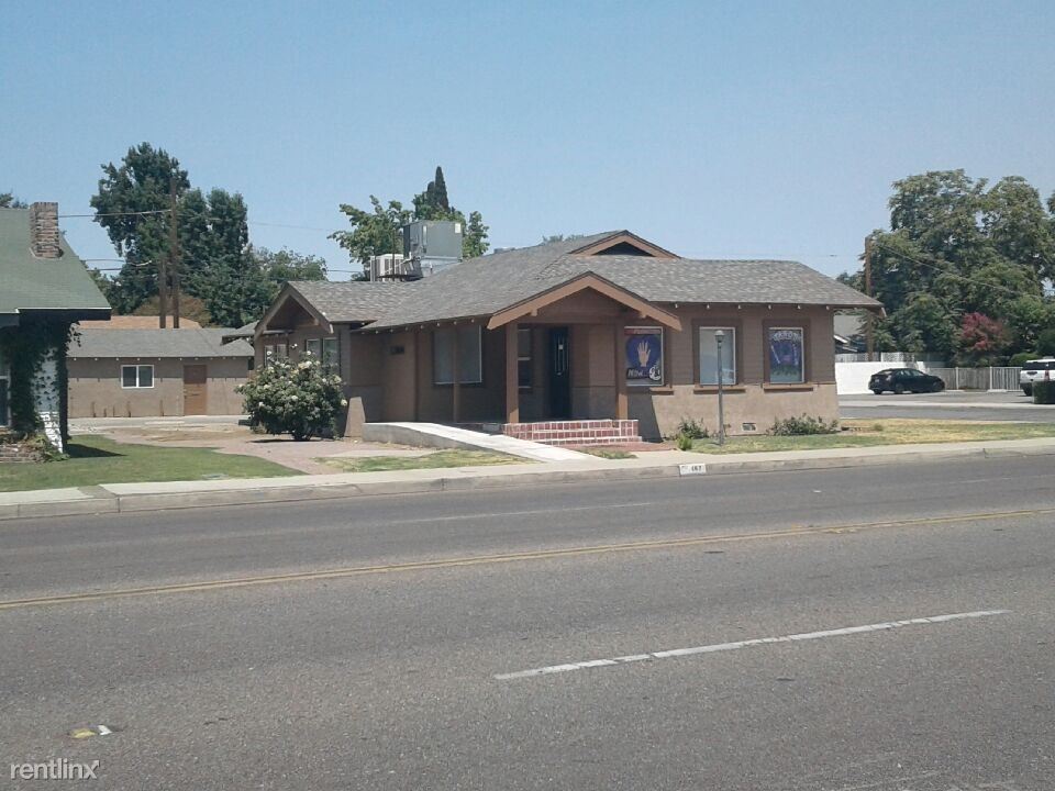
167 H St
Bakersfield, CA
2 Weeks Ago
|
Edit
Favorites
167 H St

Favorites
Check Back Soon for Upcoming Availability
| Beds | Baths | Average SF |
|---|---|---|
| 2 Bedrooms 2 Bedrooms 2 Br | 1 Bath 1 Bath 1 Ba | 1,450 SF |
About This Property
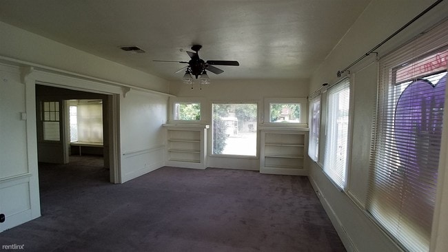
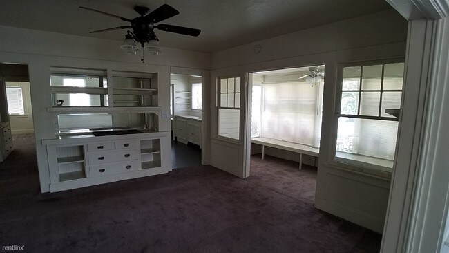
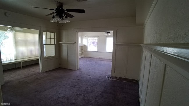
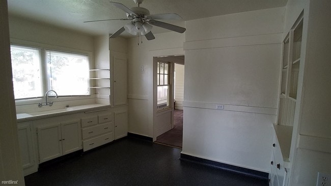
(661) 489-8374 - A Live-In Commercial Building/Office - Property Id: 18525 Live and Operate your business here. Zone C-O (Commercial, office) with over 1450sqft of business space features a great size lobby with a full kitchen, 2 great size office and access to basement for extra storage space. Fantastic location for Art, Gift Shop, Antique Shop, Insurance Office, beauty service/supply, even restaurant, etc... Rent starting at $1295/month plus $1295 deposit Please call (661) 489-8374 for showing. Take a VIRTUAL TOUR of this property by copy and paste the following URL into your address bar: http://www.fivestarmgt.com/Listing/VirtualTour.ashx?listingid=75585800 Apply at TurboTenant: http://rent.turbotenant.com/properties/167-h-st Property Id 18525 (RLNE3423004) Other Amenities - Other- Cooling System: Central. Lease lengths - 12 Months. Pet policies - Small Dogs Allowed, Cats Allowed, Large Dogs Allowed.
167 H St is a house located in Kern County and the ZIP Code. This area is served by the Bakersfield City School District attendance zone.
167 H St,
Bakersfield,
CA
Located less than two miles from downtown, the Oleander/Sunset neighborhood of Bakersfield offers a variety of charming and affordable bungalows, townhomes, and apartments. The neighborhood provides residents with easy access to the Rabobank Arena, a venue for concerts, circuses, and special events such as roller derby matches. Nearby, the Kern River affords beautiful views for locals, and just a few miles upstream, outdoor enthusiasts can enjoy whitewater rafting through Kern River State Park.
Bakersfield High School, which has served the area for over 75 years, and Will Penn Elementary School sit within walking distance of the neighborhood, while Beale Park attracts residents who like to relax outdoors. Locals gather at the collection of restaurants, bars, and entertainment hotspots on the southern and northern borders of the neighborhood, where you’ll find a variety of cuisine to explore.
Learn more about living in Oleander/SunsetBelow are rent ranges for similar nearby apartments
Education
| Colleges & Universities | Distance | ||
|---|---|---|---|
| Colleges & Universities | Distance | ||
| Drive: | 12 min | 5.4 mi | |
| Drive: | 11 min | 6.1 mi |
167 H St is within 12 minutes or 5.4 miles from Cal State Bakersfield. It is also near Bakersfield College.
Schools


Public Elementary School
Grades K-5
728 Students
Nearby
Public Elementary School
Grades K-5
392 Students
Attendance Zone
Public Middle School
Grades 6-8
813 Students
Attendance Zone
Public High School
Grades 9-12
3,069 Students
Attendance Zone
Private Elementary School
Grades K-5
20 Students
Nearby
Private Elementary, Middle & High School
Grades K-12
Nearby
Private Elementary & Middle School
Grades PK-8
343 Students
Nearby
Private Elementary School
Grades PK-5
90 Students
Nearby
School data provided by
 The GreatSchools Rating helps parents compare schools within a state based on a variety of school quality indicators and provides a helpful picture of how effectively each school serves all of its students. Ratings are on a scale of 1 (below average) to 10 (above average) and can include test scores, college readiness, academic progress, advanced courses, equity, discipline and attendance data. We also advise parents to visit schools, consider other information on school performance and programs, and consider family needs as part of the school selection process.
View GreatSchools Rating Methodology
Data provided by GreatSchools.org © 2026. All rights reserved.
View GreatSchools Rating Methodology
Data provided by GreatSchools.org © 2026. All rights reserved.
Walkability Near 167 H St Bakersfield, CA
Getting Around
 What do Walkability, Transit, Drivability, and Bikeability mean?
Walkability measures the walking distance to day-to-day needs.
Transit measures access to public transportation.
Drivability measures congestion, parking availability, and access to major roads.
Bikeability measures the suitability for cycling.
How It Works
What do Walkability, Transit, Drivability, and Bikeability mean?
Walkability measures the walking distance to day-to-day needs.
Transit measures access to public transportation.
Drivability measures congestion, parking availability, and access to major roads.
Bikeability measures the suitability for cycling.
How It Works
Moderately Walkable
Walkability
60
/ 100
Limited Public Transit
Transit
30
/ 100
Exceptionally Drivable
Drivability
90
/ 100
Fairly Bikeable
Bikeability
50
/ 100
Scores provided by
-
Soundscore™
-
/ 100
Traffic
-Airport
-Businesses
-Scores provided by
HowLoud What is a Sound Score Rating? A Sound Score Rating aggregates noise caused by vehicle traffic, airplane traffic and local sources. How It WorksYou May Also Like
-
Charming 3-Bedroom Home in Southwest Bakersfield
9518 Battaglia Dr
Bakersfield, CA 93311
$2,400
3 Br 6.1 mi
-
Spacious 4-Bedroom, 2-Bathroom Home in Southwest Bakersfield
11512 Marazion Hill Ct
Bakersfield, CA 93311
$2,750
4 Br 6.4 mi
-
Beautiful Single Family Home in Bakersfield, CA
10818 Valverde Dr
Bakersfield, CA 93311
$2,450
4 Br 7.1 mi
Similar Rentals Nearby
-
-

-

-

-

-

-
 4 Beds, 2 Baths, 2,213 sq ft$2,745Elegant 3-Bedroom Home in Seven Oaks
 -
 4 Beds, 3 Baths, 2,067 sq ft$2,600Charming 4-Bedroom Home in the Riverlakes Community
 -
 3 Beds, 2 Baths, 1,116 sq ft$2,050Cozy 3-Bedroom, 2-Bathroom Home in North Bakersfield
 -
 3 Beds, 2 Baths, 1,263 sq ft$2,085Cozy 3-Bedroom Home in Northeast Bakersfield
What Are Walk Score®, Transit Score®, and Bike Score® Ratings?
Walk Score® measures the walkability of any address. Transit Score® measures access to public transit. Bike Score® measures the bikeability of any address.
What is a Sound Score Rating?
A Sound Score Rating aggregates noise caused by vehicle traffic, airplane traffic and local sources.

167 H St
Bakersfield, CA