
$2,200
/ Month
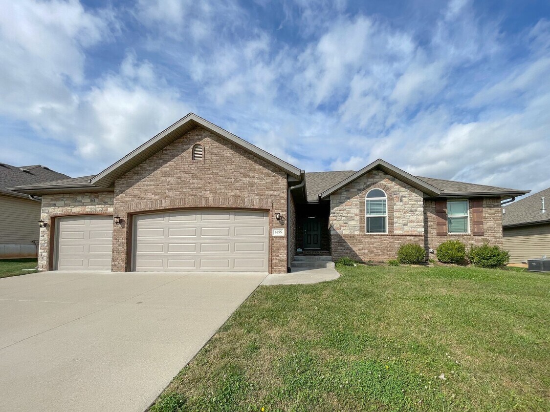
1655 N Eagle Valley Ln
Nixa, MO 65714
Favorites
1655 N Eagle Valley Ln

Favorites
Check Back Soon for Upcoming Availability
| Beds | Baths | Average SF |
|---|---|---|
| 4 Bedrooms 4 Bedrooms 4 Br | 2 Baths 2 Baths 2 Ba | 2,158 SF |
Fees and Policies
The fees listed below are community-provided and may exclude utilities or add-ons. All payments are made directly to the property and are non-refundable unless otherwise specified.
- Dogs Allowed
-
Fees not specified
-
Weight limit--
-
Pet Limit--
About This Property
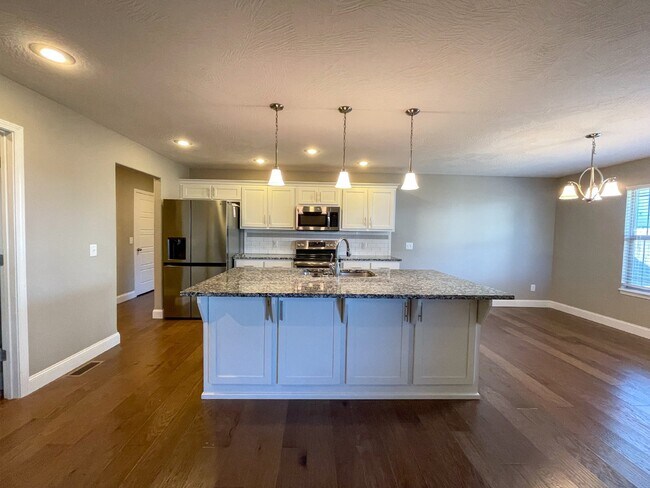
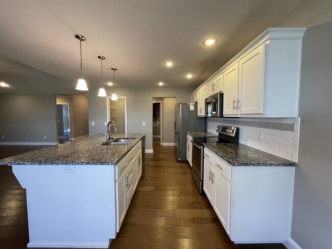
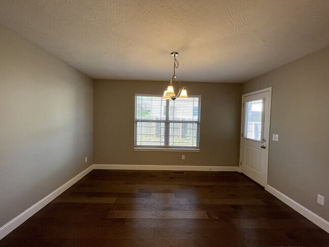
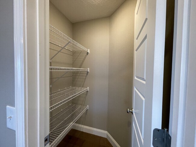
1655 N. Eagle Valley Lane Available now MOVE IN SPECIAL - 1/2 OFF FIRST MONTH'S RENT W/ 18 MO LEASE 4 bedroom, 2 bath, 3 car garage Located in Nixa Approx. 2,158 square foot Tall ceilings Gas fireplace Large kitchen island Nice pantry space Dual master bath sinks Central air and heat Stainless stove, dishwasher, and microwave provided (no fridge) Partially fenced yard Dog friendly with approval (65 lbs and under) – pet fee $25/month per pet Must have Epremium Insurance (covers $500 pet damage per occurrence) 18 month lease Renter’s Insurance Required Suggested-
1655 N Eagle Valley Ln is an apartment community located in Christian County and the 65714 ZIP Code.
Features
- Smoke Free
1655 N Eagle Valley Ln,
Nixa,
MO
65714
Amenities
- Smoke Free
Education
| Colleges & Universities | Distance | ||
|---|---|---|---|
| Colleges & Universities | Distance | ||
| Drive: | 21 min | 10.9 mi | |
| Drive: | 23 min | 12.0 mi | |
| Drive: | 24 min | 12.4 mi | |
| Drive: | 24 min | 15.4 mi |
1655 N Eagle Valley Ln is within 21 minutes or 10.9 miles from Missouri State University. It is also near Drury University and Ozarks Tech. C.C., Springfield.
Walkability Near 1655 N Eagle Valley Ln Nixa, MO 65714
Getting Around
 What do Walkability, Transit, Drivability, and Bikeability mean?
Walkability measures the walking distance to day-to-day needs.
Transit measures access to public transportation.
Drivability measures congestion, parking availability, and access to major roads.
Bikeability measures the suitability for cycling.
How It Works
What do Walkability, Transit, Drivability, and Bikeability mean?
Walkability measures the walking distance to day-to-day needs.
Transit measures access to public transportation.
Drivability measures congestion, parking availability, and access to major roads.
Bikeability measures the suitability for cycling.
How It Works
Somewhat Walkable
Walkability
20
/ 100
Exceptionally Drivable
Drivability
90
/ 100
Somewhat Bikeable
Bikeability
20
/ 100
Scores provided by
-
Soundscore™
-
/ 100
Traffic
-Airport
-Businesses
-Scores provided by
HowLoud What is a Sound Score Rating? A Sound Score Rating aggregates noise caused by vehicle traffic, airplane traffic and local sources. How It WorksYou May Also Like
Similar Rentals Nearby
-
-
-
4 Beds$550Total Monthly PriceTotal Monthly Price NewPrices include all required monthly fees.
-
-
-
-
-
-
 Total Monthly Price New4 Beds$556+Total Monthly Price11 Month LeasePrices include required monthly fees of $6.Base Rent:4 Beds$550+
 -


What Are Walk Score®, Transit Score®, and Bike Score® Ratings?
Walk Score® measures the walkability of any address. Transit Score® measures access to public transit. Bike Score® measures the bikeability of any address.
What is a Sound Score Rating?
A Sound Score Rating aggregates noise caused by vehicle traffic, airplane traffic and local sources.
1655 N Eagle Valley Ln
Nixa, MO 65714