
$3,500 / Month
165 Shaniko Common Unit 38
Fremont, CA 94539
Today
Favorites
408-228-7725
-
Bedrooms
3
-
Bathrooms
2
-
Square Feet
1,214 sq ft
-
Available
Available Now
165 Shaniko Common Unit 38

Favorites
About This Home
Available Now
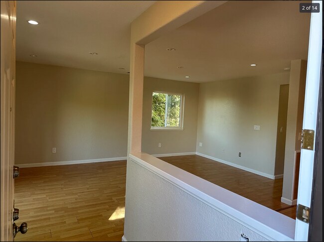
Freshly painted - open floor plan All new Appliances Highly rated Fremont warm springs school district, Walkable distance to Award winning Elementary schools - James Leitch/Warm springs elementary 1.2 miles to Fremont warm springs bart station Easy access to 880 and 680 Freeways Shopping centers and major banks in walkable distance Costco and pacific commons shopping center nearby no pets - no smoking/drugs
165 Shaniko Common is a condo located in Alameda County and the 94539 ZIP Code.
* Price shown is base rent and may not include non-optional fees and utilities.
Price, availability, fees, and any applicable rent special are subject to change without notice.
* Square footage definitions vary. Displayed square footage is approximate.
Condo Features
- Washer/Dryer
- Washer/Dryer Hookup
- Dishwasher
- Balcony
Contact
- Listed by Vijay
- Phone Number
- Contact
Location
Get Directions
Amenities
- Washer/Dryer
- Washer/Dryer Hookup
- Dishwasher
- Balcony
Warm Springs is a neighborhood in southern Fremont, adjacent to the Mission Peak Regional Preserve. Warm Springs is predominately residential with a few neighborhood parks with playgrounds. Totaling over 3,000 acres for recreational use, residents of Warm Springs love visiting Mission Peak for hiking, biking, RC flying, and hang gliding. There a few restaurants, cafes, tea shops, and a grocery store in Warm Springs, but residents typically travel a few minutes north or south for more shopping, dining, and entertainment options.
Conveniently, Warm Springs offers quick access to San Jose. Downtown San Jose is only 20 minutes away, so once you move into your new apartment, you’ll only be a short drive away from major attractions like the Tech Interactive, the San Jose Museum of Art, and Happy Hollow Park & Zoo. Get the best of both cities by finding your new home in Warm Springs today.
Learn more about living in Warm Springs
Education
| Colleges & Universities | Distance | ||
|---|---|---|---|
| Colleges & Universities | Distance | ||
| Drive: | 6 min | 3.3 mi | |
| Drive: | 9 min | 6.1 mi | |
| Drive: | 12 min | 8.1 mi | |
| Drive: | 18 min | 12.8 mi |
165 Shaniko Common Unit 38 is within 6 minutes or 3.3 miles from Ohlone College, Fremont Campus. It is also near Ohlone College, Newark and Palmer College of Chiropractic West Campus.
Transportation options available in Fremont include Warm Springs / South Fremont, located 1.6 miles from 165 Shaniko Common Unit 38. 165 Shaniko Common Unit 38 is near Norman Y Mineta San Jose International, located 12.1 miles or 16 minutes away, and Metro Oakland International, located 25.7 miles or 32 minutes away.
| Transit / Subway | Distance | ||
|---|---|---|---|
| Transit / Subway | Distance | ||
|
|
Drive: | 3 min | 1.6 mi |
|
|
Drive: | 9 min | 6.6 mi |
|
|
Drive: | 9 min | 6.7 mi |
|
|
Drive: | 9 min | 6.8 mi |
| Drive: | 10 min | 7.0 mi |
| Commuter Rail | Distance | ||
|---|---|---|---|
| Commuter Rail | Distance | ||
| Drive: | 12 min | 8.7 mi | |
| Drive: | 12 min | 8.8 mi | |
| Drive: | 13 min | 9.7 mi | |
| Drive: | 17 min | 12.7 mi | |
| Drive: | 18 min | 12.8 mi |
| Airports | Distance | ||
|---|---|---|---|
| Airports | Distance | ||
|
Norman Y Mineta San Jose International
|
Drive: | 16 min | 12.1 mi |
|
Metro Oakland International
|
Drive: | 32 min | 25.7 mi |
Time and distance from 165 Shaniko Common Unit 38.
| Shopping Centers | Distance | ||
|---|---|---|---|
| Shopping Centers | Distance | ||
| Walk: | 7 min | 0.4 mi | |
| Walk: | 9 min | 0.5 mi | |
| Walk: | 11 min | 0.6 mi |
165 Shaniko Common Unit 38 has 3 shopping centers within 0.6 mile, which is about a 11-minute walk. The miles and minutes will be for the farthest away property.
| Parks and Recreation | Distance | ||
|---|---|---|---|
| Parks and Recreation | Distance | ||
|
Central Park (Lake Elizabeth)
|
Drive: | 13 min | 7.6 mi |
|
Mission Peak Regional Preserve
|
Drive: | 23 min | 8.0 mi |
|
Alviso Marina County Park
|
Drive: | 11 min | 8.3 mi |
|
Ed Levin County Park
|
Drive: | 17 min | 8.6 mi |
|
Sunol Regional Wilderness
|
Drive: | 30 min | 15.8 mi |
165 Shaniko Common Unit 38 has 5 parks within 15.8 miles, including Mission Peak Regional Preserve, Central Park (Lake Elizabeth), and Alviso Marina County Park.
| Hospitals | Distance | ||
|---|---|---|---|
| Hospitals | Distance | ||
| Drive: | 11 min | 6.9 mi | |
| Drive: | 12 min | 8.0 mi | |
| Drive: | 14 min | 10.5 mi |
165 Shaniko Common Unit 38 has 3 hospitals within 10.5 miles, the nearest is Kaiser Foundation Hospital - Fremont which is 6.9 miles away and a 11 minute drive.
| Military Bases | Distance | ||
|---|---|---|---|
| Military Bases | Distance | ||
| Drive: | 21 min | 14.9 mi |
165 Shaniko Common Unit 38 is 14.9 miles and a 21 minute drive from Ames Research Center.
You May Also Like
Similar Rentals Nearby


What Are Walk Score®, Transit Score®, and Bike Score® Ratings?
Walk Score® measures the walkability of any address. Transit Score® measures access to public transit. Bike Score® measures the bikeability of any address.
What is a Sound Score Rating?
A Sound Score Rating aggregates noise caused by vehicle traffic, airplane traffic and local sources

165 Shaniko Common
Fremont, CA 94539