
Woodland Park
45 Newell Rd,
East Palo Alto, CA 94303
$1,675 - $4,075 Total Monthly Price
Studio - 4 Beds 12 Month Lease

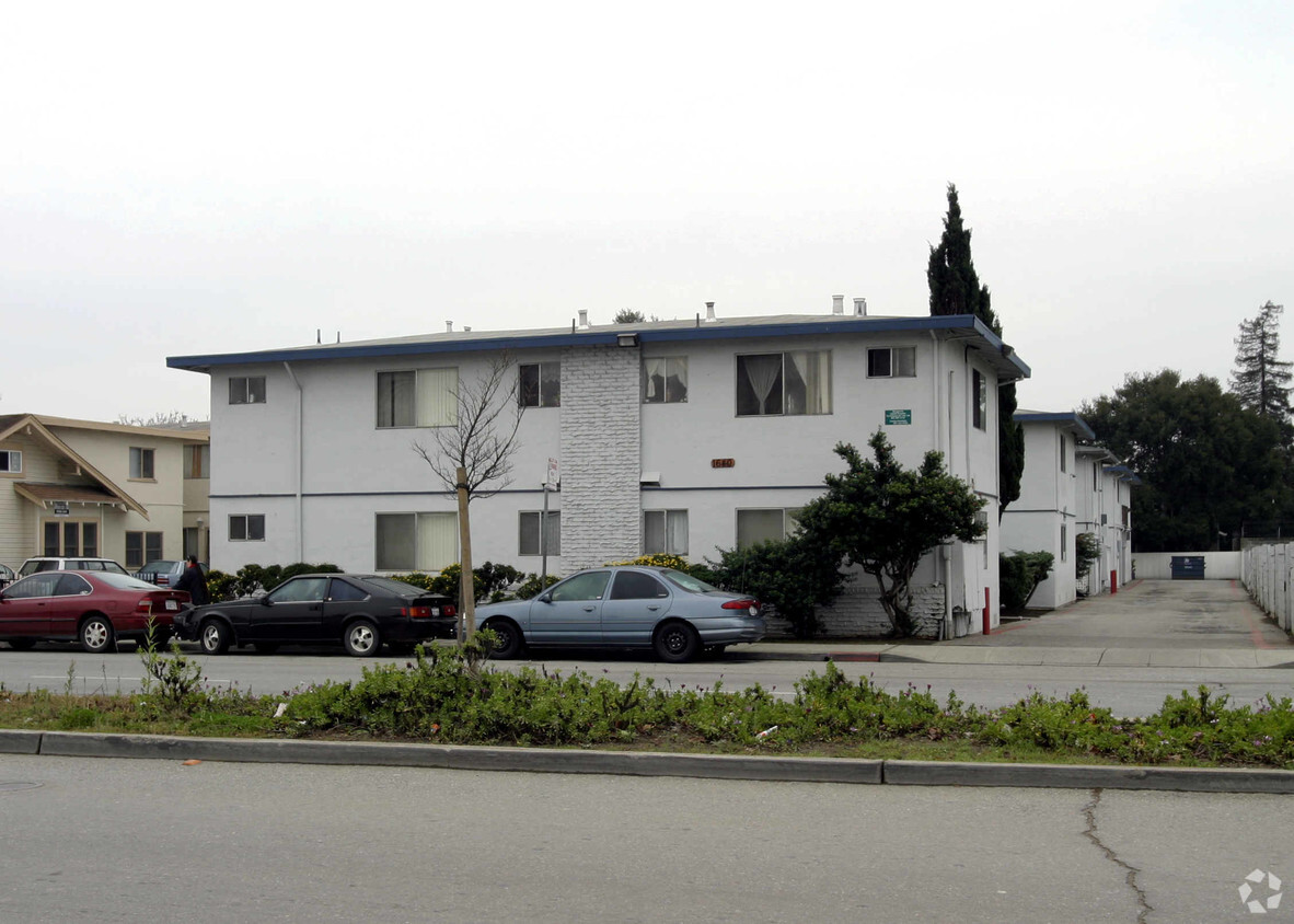
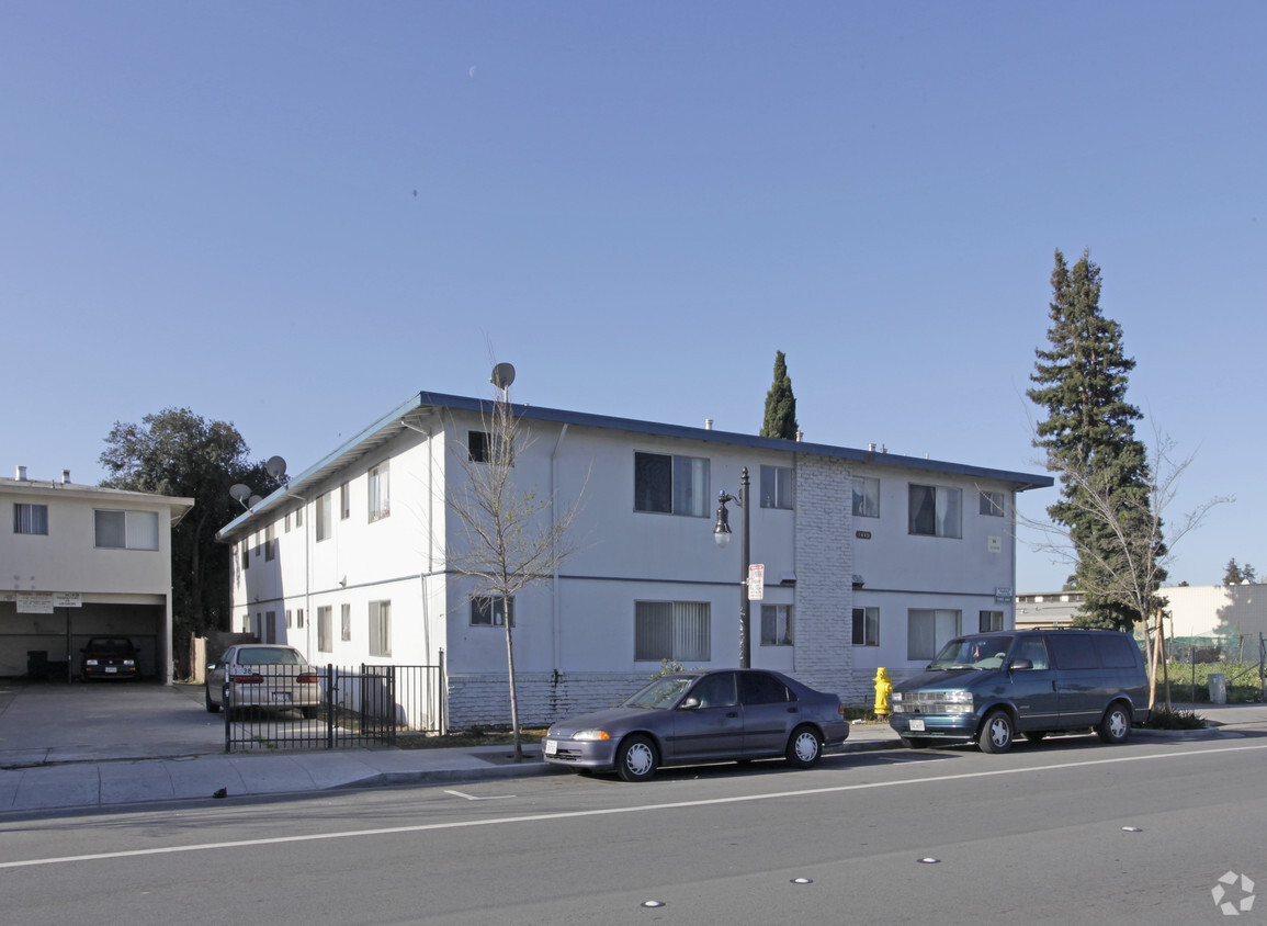
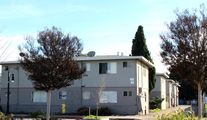

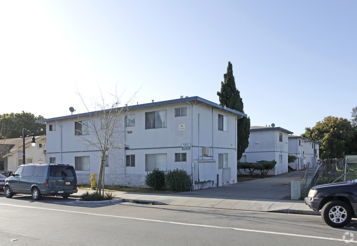
Experience East Palo Alto living at 1640 Bay Rd. The location of this community is in East Palo Alto on Bay Rd. in the 94303 area. Come for a visit to view the available floorplans. At this community, you'll experience a wide variety in options of amenities and features. These include: balconies, smoke free options, and high-speed internet access. Drop by 1640 Bay Rd today.
1640 Bay Rd is an apartment community located in San Mateo County and the 94303 ZIP Code. This area is served by the Cupertino Union School District attendance zone.
East Palo Alto sits at the edge of San Francisco Bay in San Mateo County, positioned almost exactly halfway between San Francisco and San Jose on the Peninsula. That central location puts residents within reach of two major job markets, and the city itself has drawn tech industry investment that continues to reshape its small but dense three-square-mile footprint. Incorporated in 1983, it carries a distinct identity separate from neighboring Palo Alto, though the two cities are divided by little more than San Francisquito Creek. Stanford University sits about five miles to the southwest, reinforcing the area's academic and innovation-driven atmosphere.
The housing mix here runs toward apartment communities and rental homes rather than high-rises, offering options that tend to be more accessible than those in surrounding Peninsula cities. Ravenswood 101 serves as the main commercial corridor, anchoring everyday retail alongside the bay shoreline.
Learn more about living in East Palo Alto| Colleges & Universities | Distance | ||
|---|---|---|---|
| Colleges & Universities | Distance | ||
| Drive: | 14 min | 4.8 mi | |
| Drive: | 11 min | 5.4 mi | |
| Drive: | 12 min | 5.5 mi | |
| Drive: | 20 min | 9.6 mi |


Transportation options available in East Palo Alto include Bayshore Nasa Station, located 7.7 miles from 1640 Bay Rd. 1640 Bay Rd is near Norman Y Mineta San Jose International, located 15.3 miles or 22 minutes away, and San Francisco International, located 19.2 miles or 26 minutes away.
| Transit / Subway | Distance | ||
|---|---|---|---|
| Transit / Subway | Distance | ||
| Drive: | 12 min | 7.7 mi | |
| Drive: | 12 min | 8.1 mi | |
|
|
Drive: | 13 min | 8.3 mi |
|
|
Drive: | 13 min | 8.3 mi |
| Drive: | 13 min | 8.6 mi |
| Commuter Rail | Distance | ||
|---|---|---|---|
| Commuter Rail | Distance | ||
| Drive: | 9 min | 3.0 mi | |
| Drive: | 10 min | 3.8 mi | |
| Drive: | 11 min | 4.7 mi | |
| Drive: | 12 min | 6.2 mi | |
| Drive: | 11 min | 6.2 mi |
| Airports | Distance | ||
|---|---|---|---|
| Airports | Distance | ||
|
Norman Y Mineta San Jose International
|
Drive: | 22 min | 15.3 mi |
|
San Francisco International
|
Drive: | 26 min | 19.2 mi |
Scores provided by
Traffic
ActiveAirport
ActiveBusinesses
ActiveScores provided by
HowLoud What is a Sound Score Rating? A Sound Score Rating aggregates noise caused by vehicle traffic, airplane traffic and local sources. How It WorksTime and distance from 1640 Bay Rd.
| Shopping Centers | Distance | ||
|---|---|---|---|
| Shopping Centers | Distance | ||
| Walk: | 20 min | 1.1 mi | |
| Drive: | 4 min | 1.7 mi | |
| Drive: | 6 min | 2.5 mi |
| Parks and Recreation | Distance | ||
|---|---|---|---|
| Parks and Recreation | Distance | ||
|
Ravenswood Open Space Preserve
|
Walk: | 17 min | 0.9 mi |
|
Seminary Oaks Park
|
Drive: | 6 min | 2.3 mi |
|
Rinconada Park
|
Drive: | 7 min | 2.3 mi |
|
Hopkins Creekside Park
|
Drive: | 6 min | 2.5 mi |
|
The Environmental Volunteers EcoCenter
|
Drive: | 8 min | 3.3 mi |
| Hospitals | Distance | ||
|---|---|---|---|
| Hospitals | Distance | ||
| Drive: | 12 min | 3.9 mi | |
| Drive: | 13 min | 4.5 mi | |
| Drive: | 9 min | 5.6 mi |
| Military Bases | Distance | ||
|---|---|---|---|
| Military Bases | Distance | ||
| Drive: | 15 min | 8.2 mi |
Fitness Center Pool In Unit Washer & Dryer High-Speed Internet Stainless Steel Appliances Package Service
What Are Walk Score®, Transit Score®, and Bike Score® Ratings?
Walk Score® measures the walkability of any address. Transit Score® measures access to public transit. Bike Score® measures the bikeability of any address.
What is a Sound Score Rating?
A Sound Score Rating aggregates noise caused by vehicle traffic, airplane traffic and local sources.
1640 Bay Rd
East Palo Alto, CA 94303


