


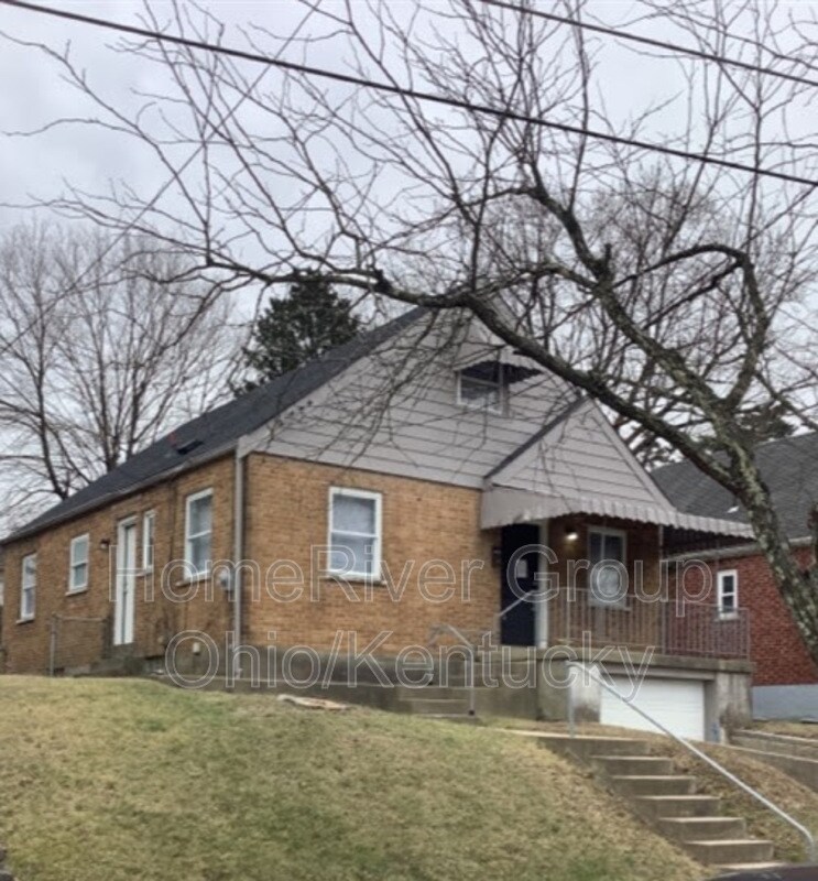
$1,325 / Month
1638 Atson Ln
Cincinnati, OH 45205
2 Weeks Ago
Favorites
1638 Atson Ln

Favorites
Check Back Soon for Upcoming Availability
| Beds | Baths | Average SF |
|---|---|---|
| 3 Bedrooms 3 Bedrooms 3 Br | 1 Bath 1 Bath 1 Ba | 915 SF |
About This Property
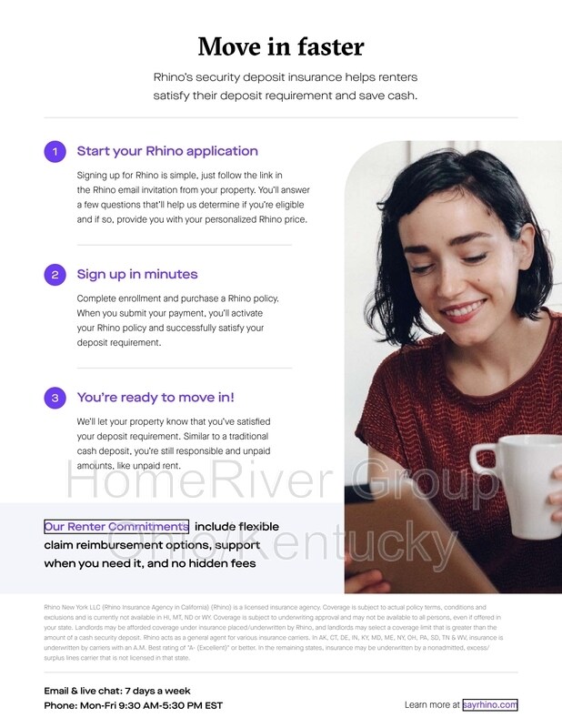
Available Now! Contact us for more information or apply by visiting our website. For showing information, please call . This charming home has 3 carpeted bedrooms, a spacious kitchen with stainless steel fridge and range, granite countertops, and crisp white cabinets! New wood plank and carpet flooring throughout! Pets Accepted! To review our Application Qualifying Criteria and Pet Guidelines prior to applying, click the link below: .
1638 Atson Ln is a house located in Hamilton County and the 45205 ZIP Code. This area is served by the Cincinnati Public Schools attendance zone.
Location
Get Directions
Filled with historic shotgun houses, South Fairmount was first settled in the early 1800s. This large neighborhood is bordered by Mill Creek, directly west of Downtown Cincinnati and minutes from the University of Cincinnati. With just two miles to downtown, residents of South Fairmount enjoy fast access to all of Cincinnati's attractions, including the Cincinnati Zoo, Paul Brown Stadium (home of the Cincinnati Bengals), and the Cincinnati Music Hall.
Apartments in South Fairmount are near the Ohio River and several riverfront parks, including Embshoff Woods and Nature Preserve and the popular Eden Park, home of the Cincinnati Playhouse and the Cincinnati Art Museum.
Learn more about living in South FairmountBelow are rent ranges for similar nearby apartments
Education
| Colleges & Universities | Distance | ||
|---|---|---|---|
| Colleges & Universities | Distance | ||
| Drive: | 11 min | 4.7 mi | |
| Drive: | 12 min | 4.8 mi | |
| Drive: | 13 min | 4.9 mi | |
| Drive: | 13 min | 5.1 mi |
1638 Atson Ln is within 13 minutes or 4.9 miles from Cincinnati State. It is also near University of Cincinnati and College of Mount St. Joseph.
Schools


Public Elementary School
Grades PK-6
503 Students
Attendance Zone
Public Middle & High School
Grades 7-12
897 Students
Attendance Zone
Public Middle & High School
Grades 6-12
1,418 Students
Attendance Zone
Private Elementary & Middle School
Grades PK-8
381 Students
Nearby
Private High School
Grades 9-12
535 Students
Nearby
School data provided by
 The GreatSchools Rating helps parents compare schools within a state based on a variety of school quality indicators and provides a helpful picture of how effectively each school serves all of its students. Ratings are on a scale of 1 (below average) to 10 (above average) and can include test scores, college readiness, academic progress, advanced courses, equity, discipline and attendance data. We also advise parents to visit schools, consider other information on school performance and programs, and consider family needs as part of the school selection process.
View GreatSchools Rating Methodology
Data provided by GreatSchools.org © 2025. All rights reserved.
View GreatSchools Rating Methodology
Data provided by GreatSchools.org © 2025. All rights reserved.
Transportation options available in Cincinnati include Brewery District Station, Elm & Henry, located 3.6 miles from 1638 Atson Ln. 1638 Atson Ln is near Cincinnati/Northern Kentucky International, located 17.4 miles or 32 minutes away.
| Transit / Subway | Distance | ||
|---|---|---|---|
| Transit / Subway | Distance | ||
| Drive: | 9 min | 3.6 mi | |
| Drive: | 9 min | 3.8 mi | |
| Drive: | 9 min | 3.9 mi | |
| Drive: | 10 min | 4.1 mi | |
| Drive: | 11 min | 4.4 mi |
| Commuter Rail | Distance | ||
|---|---|---|---|
| Commuter Rail | Distance | ||
|
|
Drive: | 9 min | 3.9 mi |
| Airports | Distance | ||
|---|---|---|---|
| Airports | Distance | ||
|
Cincinnati/Northern Kentucky International
|
Drive: | 32 min | 17.4 mi |
Time and distance from 1638 Atson Ln.
| Shopping Centers | Distance | ||
|---|---|---|---|
| Shopping Centers | Distance | ||
| Walk: | 17 min | 0.9 mi | |
| Walk: | 17 min | 0.9 mi | |
| Drive: | 3 min | 1.1 mi |
1638 Atson Ln has 3 shopping centers within 1.1 miles, which is about a 3-minute walk. The miles and minutes will be for the farthest away property.
| Parks and Recreation | Distance | ||
|---|---|---|---|
| Parks and Recreation | Distance | ||
|
Imago Earth Center
|
Drive: | 4 min | 1.2 mi |
|
Wilson Commons
|
Drive: | 5 min | 1.9 mi |
|
Museum of Natural History and Science
|
Drive: | 9 min | 3.9 mi |
|
Cincinnati History Museum
|
Drive: | 9 min | 3.9 mi |
|
Embshoff Woods
|
Drive: | 11 min | 4.0 mi |
1638 Atson Ln has 5 parks within 4.0 miles, including Imago Earth Center, Wilson Commons, and Embshoff Woods.
| Hospitals | Distance | ||
|---|---|---|---|
| Hospitals | Distance | ||
| Drive: | 12 min | 4.7 mi | |
| Drive: | 10 min | 4.7 mi | |
| Drive: | 13 min | 5.2 mi |
1638 Atson Ln has 3 hospitals within 5.2 miles, the nearest is Christ Hospital which is 4.7 miles away and a 12 minute drive.
| Military Bases | Distance | ||
|---|---|---|---|
| Military Bases | Distance | ||
| Drive: | 74 min | 55.9 mi | |
| Drive: | 80 min | 60.9 mi | |
| Drive: | 83 min | 64.2 mi |
1638 Atson Ln has 3 military bases within 64.2 miles, the nearest is Gentile Air Force Station which is 55.9 miles away and a 74 minute drive.
You May Also Like
Similar Rentals Nearby


What Are Walk Score®, Transit Score®, and Bike Score® Ratings?
Walk Score® measures the walkability of any address. Transit Score® measures access to public transit. Bike Score® measures the bikeability of any address.
What is a Sound Score Rating?
A Sound Score Rating aggregates noise caused by vehicle traffic, airplane traffic and local sources
1638 Atson Ln
Cincinnati, OH 45205