
Nova by Gomes
1213-1221 Broad St,
Newark, NJ 07114
$2,054 - $3,000
Studio - 2 Beds

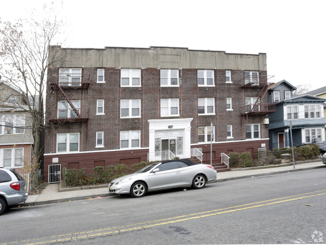

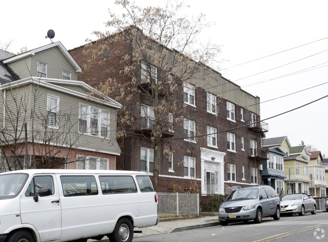
Experience 162-166 Mapes Ave in Newark, NJ. The location of this community is at 162-166 Mapes Ave in the 07112 area of Newark. Be sure to come for a visit to see the available floorplan options. Here at this community, the professional leasing staff is ready to help you find the perfect apartment. It's time to love where you live. Stop by for a visit today.
162-166 Mapes Ave is an apartment community located in Essex County and the 07112 ZIP Code. This area is served by the Team Academy Charter School attendance zone.
Located in the South Ward section of Newark, New Jersey, the neighborhood of Weequahic houses a small suburban residential area along with several parks, medical centers, and a number of commercial businesses. On the eastern border of the town stands Weequahic Park, a beautiful natural reserve that remains the centerpiece of the neighborhood and one of Newark's largest parks. There’s a well-maintained jogging path to enjoy and Weequahic Golf Course, the oldest public golf course in the US.
Weequahic is roughly 3.5 miles from the Newark city center, next to other suburban communities such as Hillside, Irvington, and Elizabeth. The neighborhood also benefits from its close proximity to Newark Liberty International Airport, one of the busiest airports in the area.
This is an active area of New Jersey, and the landscape around Weequahic has plenty to offer in terms of dining and retail. Another plus? New York City is just 40 minutes away.
Learn more about living in WeequahicCompare neighborhood and city base rent averages by bedroom.
| Weequahic | Newark, NJ | |
|---|---|---|
| Studio | $962 | $1,365 |
| 1 Bedroom | $1,087 | $1,611 |
| 2 Bedrooms | $1,359 | $2,024 |
| 3 Bedrooms | $1,688 | $2,121 |
| Colleges & Universities | Distance | ||
|---|---|---|---|
| Colleges & Universities | Distance | ||
| Drive: | 6 min | 3.2 mi | |
| Drive: | 7 min | 3.3 mi | |
| Drive: | 8 min | 3.6 mi | |
| Drive: | 7 min | 3.6 mi |

Transportation options available in Newark include Warren Street, located 3.2 miles from 162-166 Mapes Ave. 162-166 Mapes Ave is near Newark Liberty International, located 5.2 miles or 8 minutes away, and LaGuardia, located 24.5 miles or 43 minutes away.
| Transit / Subway | Distance | ||
|---|---|---|---|
| Transit / Subway | Distance | ||
|
|
Drive: | 6 min | 3.2 mi |
|
|
Drive: | 6 min | 3.2 mi |
|
|
Drive: | 6 min | 3.2 mi |
|
|
Drive: | 6 min | 3.4 mi |
|
|
Drive: | 7 min | 3.4 mi |
| Commuter Rail | Distance | ||
|---|---|---|---|
| Commuter Rail | Distance | ||
|
|
Drive: | 8 min | 2.6 mi |
|
|
Drive: | 8 min | 2.6 mi |
|
|
Drive: | 6 min | 2.8 mi |
|
|
Drive: | 8 min | 3.2 mi |
|
|
Drive: | 10 min | 3.4 mi |
| Airports | Distance | ||
|---|---|---|---|
| Airports | Distance | ||
|
Newark Liberty International
|
Drive: | 8 min | 5.2 mi |
|
LaGuardia
|
Drive: | 43 min | 24.5 mi |
Scores provided by
Traffic
-Airport
-Businesses
-Scores provided by
HowLoud What is a Sound Score Rating? A Sound Score Rating aggregates noise caused by vehicle traffic, airplane traffic and local sources. How It WorksTime and distance from 162-166 Mapes Ave.
| Shopping Centers | Distance | ||
|---|---|---|---|
| Shopping Centers | Distance | ||
| Walk: | 19 min | 1.0 mi | |
| Drive: | 4 min | 1.7 mi | |
| Drive: | 5 min | 2.2 mi |
| Parks and Recreation | Distance | ||
|---|---|---|---|
| Parks and Recreation | Distance | ||
|
Newark Museum and Dreyfuss Planetarium
|
Drive: | 7 min | 3.5 mi |
|
Branch Brook Park
|
Drive: | 11 min | 5.0 mi |
|
Kearny Marsh
|
Drive: | 14 min | 6.6 mi |
|
Edison National Historic Site
|
Drive: | 15 min | 7.2 mi |
|
Stephen Gregg Park
|
Drive: | 14 min | 8.6 mi |
| Hospitals | Distance | ||
|---|---|---|---|
| Hospitals | Distance | ||
| Walk: | 5 min | 0.3 mi | |
| Drive: | 5 min | 2.5 mi | |
| Drive: | 7 min | 3.7 mi |
| Military Bases | Distance | ||
|---|---|---|---|
| Military Bases | Distance | ||
| Drive: | 14 min | 9.0 mi | |
| Drive: | 23 min | 12.0 mi | |
| Drive: | 29 min | 14.7 mi |
What Are Walk Score®, Transit Score®, and Bike Score® Ratings?
Walk Score® measures the walkability of any address. Transit Score® measures access to public transit. Bike Score® measures the bikeability of any address.
What is a Sound Score Rating?
A Sound Score Rating aggregates noise caused by vehicle traffic, airplane traffic and local sources.
162-166 Mapes Ave
Newark, NJ 07112


