$900
/ Month
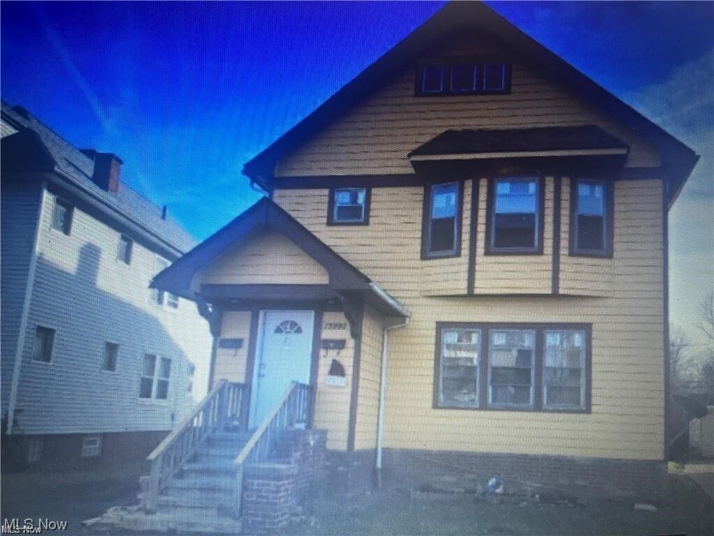
15990 Neladale Rd Unit Upper
East Cleveland, OH 44112
2 Weeks Ago
|
Edit
Favorites
15990 Neladale Rd Unit Upper

Favorites
Check Back Soon for Upcoming Availability
| Beds | Baths | Average SF |
|---|---|---|
| 3 Bedrooms 3 Bedrooms 3 Br | 1 Bath 1 Bath 1 Ba | — |
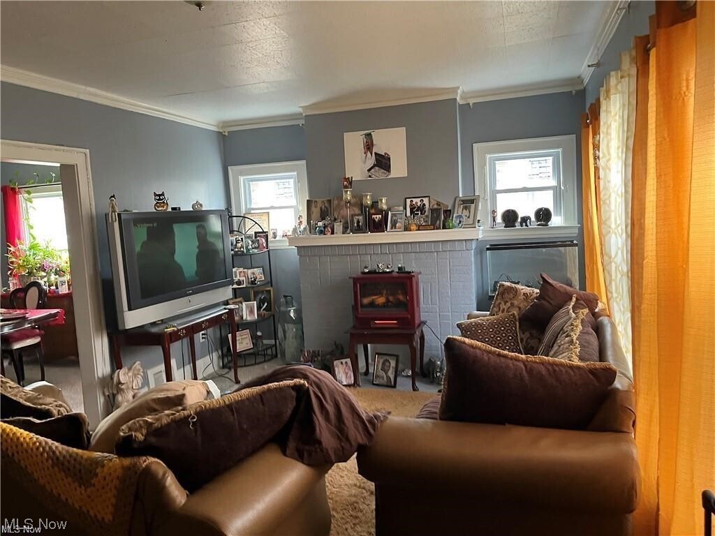
About This Property
Great 3 bedroom upper unit located in East Cleveland close to Cleveland Heights. Just waiting for a new tenant!
15990 Neladale Rd is an apartment community located in Cuyahoga County and the 44112 ZIP Code.
15990 Neladale Rd,
East Cleveland,
OH
44112
East Cleveland sits just east of downtown Cleveland on about four square miles of land, making it one of the more compact cities in Cuyahoga County. Its identity is anchored by Nela Park, the world's first industrial park, which serves as the operating headquarters for GE Lighting and earned a spot on the National Register of Historic Places in 1975. The city also borders Forest Hill Park, a 235-acre green space that was once part of John D. Rockefeller's estate and offers tennis courts, ball fields, and nature trails. Euclid Avenue functions as the main commercial corridor, connecting residents to everyday essentials, local eateries, and bus routes that run toward downtown Cleveland. The Red Line rail provides direct access to Cleveland's core and Hopkins International Airport, making the city a practical base for those who work or study in the broader metro area.
Learn more about living in East Cleveland
Education
| Colleges & Universities | Distance | ||
|---|---|---|---|
| Colleges & Universities | Distance | ||
| Drive: | 8 min | 3.5 mi | |
| Drive: | 8 min | 3.7 mi | |
| Drive: | 11 min | 3.9 mi | |
| Drive: | 9 min | 4.0 mi |
15990 Neladale Rd Unit Upper is within 8 minutes or 3.5 miles from Cleveland Institute of Art. It is also near Case Western Reserve and Notre Dame College.
Transportation options available in East Cleveland include Louis Stokes Station At Windermere, located 1.9 miles from 15990 Neladale Rd Unit Upper. 15990 Neladale Rd Unit Upper is near Cleveland-Hopkins International, located 22.7 miles or 38 minutes away.
| Transit / Subway | Distance | ||
|---|---|---|---|
| Transit / Subway | Distance | ||
|
|
Drive: | 5 min | 1.9 mi |
|
|
Drive: | 5 min | 2.5 mi |
| Drive: | 8 min | 3.5 mi | |
|
|
Drive: | 10 min | 4.5 mi |
|
|
Drive: | 13 min | 5.6 mi |
| Commuter Rail | Distance | ||
|---|---|---|---|
| Commuter Rail | Distance | ||
|
|
Drive: | 19 min | 9.2 mi |
| Drive: | 30 min | 14.9 mi | |
| Drive: | 33 min | 16.7 mi | |
| Drive: | 40 min | 22.6 mi | |
|
Boston Mill
|
Drive: | 45 min | 24.9 mi |
| Airports | Distance | ||
|---|---|---|---|
| Airports | Distance | ||
|
Cleveland-Hopkins International
|
Drive: | 38 min | 22.7 mi |
Walkability Near 15990 Neladale Rd East Cleveland, OH 44112
Getting Around
 What do Walkability, Transit, Drivability, and Bikeability mean?
Walkability measures the walking distance to day-to-day needs.
Transit measures access to public transportation.
Drivability measures congestion, parking availability, and access to major roads.
Bikeability measures the suitability for cycling.
How It Works
What do Walkability, Transit, Drivability, and Bikeability mean?
Walkability measures the walking distance to day-to-day needs.
Transit measures access to public transportation.
Drivability measures congestion, parking availability, and access to major roads.
Bikeability measures the suitability for cycling.
How It Works
Fairly Walkable
Walkability
40
/ 100
Some Public Transit
Transit
40
/ 100
Exceptionally Drivable
Drivability
90
/ 100
Fairly Bikeable
Bikeability
50
/ 100
Scores provided by
-
Soundscore™
-
/ 100
Traffic
-Airport
-Businesses
-Scores provided by
HowLoud What is a Sound Score Rating? A Sound Score Rating aggregates noise caused by vehicle traffic, airplane traffic and local sources. How It WorksTime and distance from 15990 Neladale Rd Unit Upper.
| Shopping Centers | Distance | ||
|---|---|---|---|
| Shopping Centers | Distance | ||
| Drive: | 4 min | 1.4 mi | |
| Drive: | 4 min | 1.7 mi | |
| Drive: | 5 min | 1.9 mi |
15990 Neladale Rd Unit Upper has 3 shopping centers within 1.9 miles, which is about a 5-minute drive. The miles and minutes will be for the farthest away property.
| Parks and Recreation | Distance | ||
|---|---|---|---|
| Parks and Recreation | Distance | ||
|
Euclid Creek Reservation
|
Drive: | 8 min | 3.3 mi |
|
Cleveland Botanical Garden
|
Drive: | 9 min | 3.9 mi |
|
Children's Museum of Cleveland
|
Drive: | 10 min | 4.2 mi |
|
Cleveland Museum of Natural History
|
Drive: | 10 min | 4.2 mi |
|
Nature Center at Shaker Lakes
|
Drive: | 13 min | 5.3 mi |
15990 Neladale Rd Unit Upper has 5 parks within 5.3 miles, including Euclid Creek Reservation, Cleveland Botanical Garden, and Children's Museum of Cleveland.
| Hospitals | Distance | ||
|---|---|---|---|
| Hospitals | Distance | ||
| Drive: | 8 min | 3.7 mi | |
| Drive: | 8 min | 3.7 mi | |
| Drive: | 11 min | 4.7 mi |
15990 Neladale Rd Unit Upper has 3 hospitals within 4.7 miles, the nearest is Rainbow Babies and Childrens Hospital which is 3.7 miles away and a 8 minute drive.
| Military Bases | Distance | ||
|---|---|---|---|
| Military Bases | Distance | ||
| Drive: | 112 min | 91.5 mi |
15990 Neladale Rd Unit Upper is 91.5 miles and a 112 minute drive from Mansfield Lahm Airport Air Guard Station.
You May Also Like
Similar Rentals Nearby


What Are Walk Score®, Transit Score®, and Bike Score® Ratings?
Walk Score® measures the walkability of any address. Transit Score® measures access to public transit. Bike Score® measures the bikeability of any address.
What is a Sound Score Rating?
A Sound Score Rating aggregates noise caused by vehicle traffic, airplane traffic and local sources.

15990 Neladale Rd
East Cleveland, OH 44112