
Urbn Edge
3510 Union St,
Flushing, NY 11354
$3,050 - $4,200 Total Monthly Price
1-2 Beds 12 Month Lease

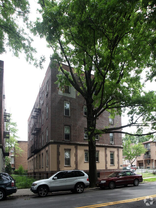

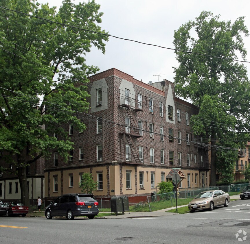
Experience Flushing living at 158-17 Sanford Ave. This community is located in the Murray Hill area of Flushing. From amenities to floor plan options, the professional leasing team will assist you in finding your perfect home. When you choose an apartment at 158-17 Sanford Ave, you'll have access to top features and amenities including: smoke-free options, hardwood floors, and high-speed internet access. Give us a call now to see everything we have to offer.
158-17 Sanford Ave is an apartment community located in Queens County and the 11358 ZIP Code. This area is served by the New York City Geographic District #25 attendance zone.
High Speed Internet Access
Hardwood Floors
Refrigerator
Tub/Shower
The Murray Hill neighborhood sits on the northeast end of the New York City borough of Queens. The neighborhood is full of new restaurants and long-standing delis, as well as convenient stores and more. The growth of the neighborhood and its proximity to Manhattan are the main reasons why apartments in Murray Hill are so popular.
Surrounded by several major roadways and in close proximity to LaGuardia Airport, Murray Hill makes national and international travel a breeze. The neighborhood also sits a few blocks east of Flushing Bay. Families enjoy several parks and botanical gardens in and around the neighborhood as well as the quiet semi-urban streets.
Learn more about living in Murray HillCompare neighborhood and city base rent averages by bedroom.
| Murray Hill | Flushing, NY | |
|---|---|---|
| Studio | $1,953 | $1,767 |
| 1 Bedroom | $1,902 | $2,049 |
| 2 Bedrooms | $2,517 | $2,472 |
| 3 Bedrooms | $4,781 | $2,866 |
| Colleges & Universities | Distance | ||
|---|---|---|---|
| Colleges & Universities | Distance | ||
| Drive: | 7 min | 2.9 mi | |
| Drive: | 7 min | 3.4 mi | |
| Drive: | 8 min | 3.4 mi | |
| Drive: | 12 min | 5.2 mi |


Transportation options available in Flushing include Flushing-Main Street, located 1.4 miles from 158-17 Sanford Ave. 158-17 Sanford Ave is near LaGuardia, located 4.6 miles or 11 minutes away, and John F Kennedy International, located 11.1 miles or 17 minutes away.
| Transit / Subway | Distance | ||
|---|---|---|---|
| Transit / Subway | Distance | ||
|
|
Drive: | 3 min | 1.4 mi |
|
|
Drive: | 5 min | 2.3 mi |
|
|
Drive: | 6 min | 2.9 mi |
|
|
Drive: | 7 min | 3.2 mi |
|
|
Drive: | 12 min | 4.8 mi |
| Commuter Rail | Distance | ||
|---|---|---|---|
| Commuter Rail | Distance | ||
|
|
Walk: | 7 min | 0.4 mi |
|
|
Walk: | 9 min | 0.5 mi |
|
|
Drive: | 3 min | 1.2 mi |
|
|
Drive: | 3 min | 1.4 mi |
|
|
Drive: | 5 min | 2.3 mi |
| Airports | Distance | ||
|---|---|---|---|
| Airports | Distance | ||
|
LaGuardia
|
Drive: | 11 min | 4.6 mi |
|
John F Kennedy International
|
Drive: | 17 min | 11.1 mi |
Scores provided by
Traffic
-Airport
-Businesses
-Scores provided by
HowLoud What is a Sound Score Rating? A Sound Score Rating aggregates noise caused by vehicle traffic, airplane traffic and local sources. How It WorksTime and distance from 158-17 Sanford Ave.
| Shopping Centers | Distance | ||
|---|---|---|---|
| Shopping Centers | Distance | ||
| Drive: | 4 min | 1.3 mi | |
| Drive: | 4 min | 1.8 mi | |
| Drive: | 5 min | 1.9 mi |
| Parks and Recreation | Distance | ||
|---|---|---|---|
| Parks and Recreation | Distance | ||
|
Queens Botanical Garden
|
Drive: | 5 min | 1.8 mi |
|
Kissena Park
|
Drive: | 6 min | 1.9 mi |
|
Crocheron Park
|
Drive: | 7 min | 2.5 mi |
|
Flushing Meadows Corona Park
|
Drive: | 8 min | 2.8 mi |
|
Little Bay Park
|
Drive: | 8 min | 3.6 mi |
| Hospitals | Distance | ||
|---|---|---|---|
| Hospitals | Distance | ||
| Walk: | 14 min | 0.7 mi | |
| Drive: | 8 min | 4.1 mi | |
| Drive: | 11 min | 4.7 mi |
| Military Bases | Distance | ||
|---|---|---|---|
| Military Bases | Distance | ||
| Drive: | 9 min | 3.7 mi | |
| Drive: | 32 min | 15.4 mi |
What Are Walk Score®, Transit Score®, and Bike Score® Ratings?
Walk Score® measures the walkability of any address. Transit Score® measures access to public transit. Bike Score® measures the bikeability of any address.
What is a Sound Score Rating?
A Sound Score Rating aggregates noise caused by vehicle traffic, airplane traffic and local sources.
158-17 Sanford Ave
Flushing, NY 11358


