
Copa Ladeene
23920 Anza Ave,
Torrance, CA 90505
$2,335 - $3,099
1-2 Beds
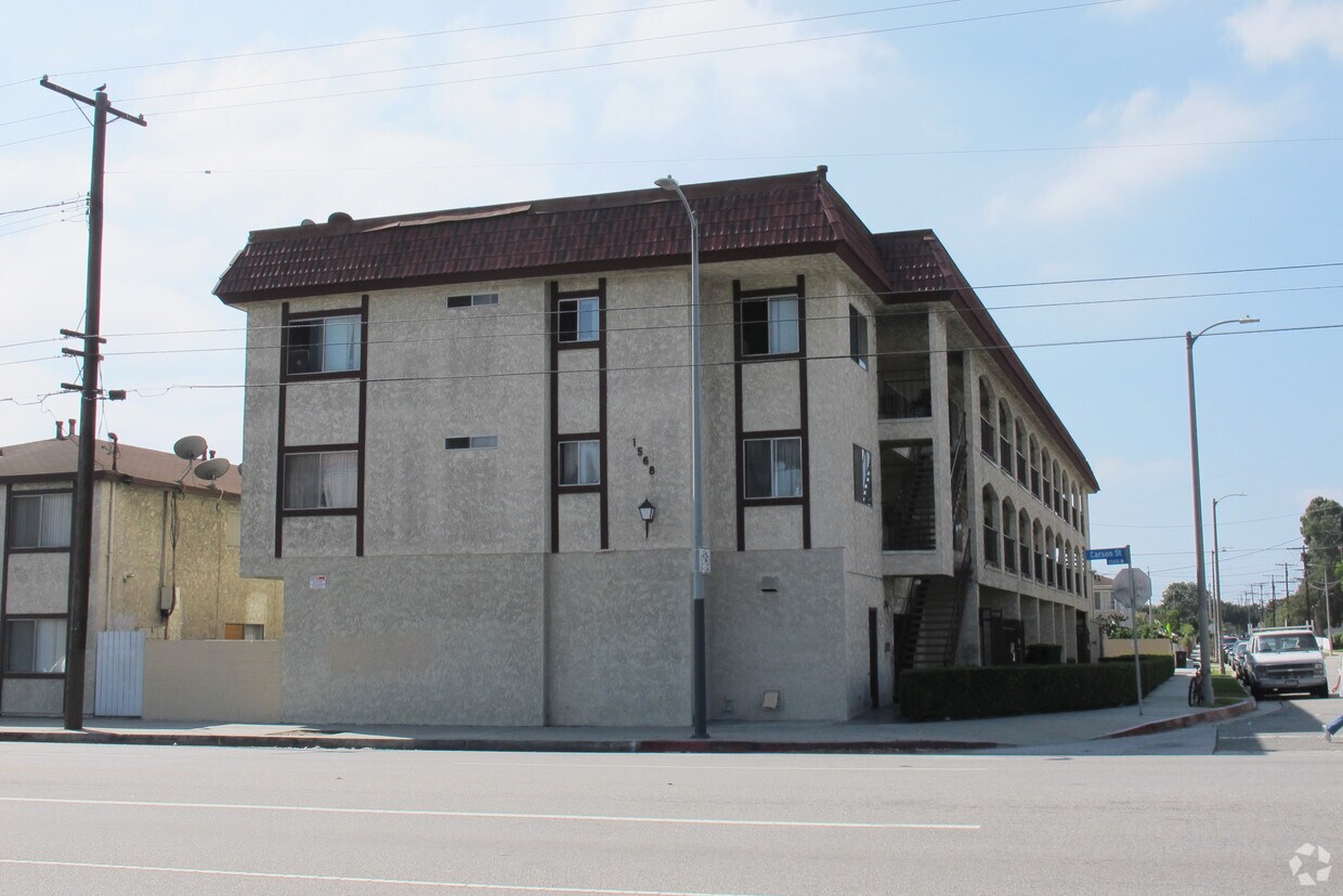
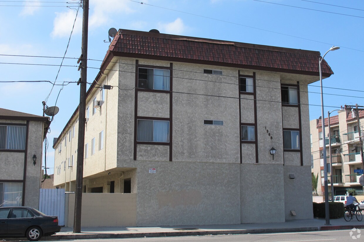

Find your new home at 1568 W Carson St in Torrance. Located at 1568 W. Carson St. in Torrance, this community has so much to offer its residents. Schedule a time to check out the current floorplan options. From amenities to floorplan options, the team of leasing professionals is ready to help you find your perfect new home. Come see 1568 W Carson St today.
1568 W Carson St is an apartment community located in Los Angeles County and the 90501 ZIP Code. This area is served by the Los Angeles Unified Rocp School District attendance zone.
Nestled between Highway 213 and Interstate 110, Harbor is an industrial town 20 miles south of Los Angeles and 12 miles north of coastal beaches like White Point Beach. The northern section of the neighborhood is made up of commercial developments and entertainment options including a trampoline park, bakeries, grocers, pet stores, gyms, and more. But this area is home to more than retail spaces; several offices, distribution centers, and manufacturing plants including Nordstrom Local Omni Hub, Sunrider International, FNS, Inc, and more find their home in Harbor. The other parts of the neighborhood consist of residential areas with an abundance of rental options. Apartments, condos, and a few single-family homes can be found in moderate to upscale prices.
Learn more about living in HarborCompare neighborhood and city base rent averages by bedroom.
| Harbor | Torrance, CA | |
|---|---|---|
| Studio | $1,572 | $1,632 |
| 1 Bedroom | $1,682 | $2,048 |
| 2 Bedrooms | $2,513 | $2,636 |
| 3 Bedrooms | $2,547 | $3,220 |
| Colleges & Universities | Distance | ||
|---|---|---|---|
| Colleges & Universities | Distance | ||
| Drive: | 9 min | 5.1 mi | |
| Drive: | 9 min | 5.3 mi | |
| Drive: | 12 min | 5.9 mi | |
| Drive: | 15 min | 9.3 mi |


Transportation options available in Torrance include Del Amo Station, located 6.7 miles from 1568 W Carson St. 1568 W Carson St is near Long Beach (Daugherty Field), located 9.1 miles or 16 minutes away, and Los Angeles International, located 12.8 miles or 19 minutes away.
| Transit / Subway | Distance | ||
|---|---|---|---|
| Transit / Subway | Distance | ||
|
|
Drive: | 11 min | 6.7 mi |
|
|
Drive: | 10 min | 6.9 mi |
|
|
Drive: | 12 min | 7.0 mi |
|
|
Drive: | 12 min | 8.0 mi |
|
|
Drive: | 15 min | 9.2 mi |
| Commuter Rail | Distance | ||
|---|---|---|---|
| Commuter Rail | Distance | ||
|
|
Drive: | 24 min | 19.0 mi |
|
|
Drive: | 26 min | 19.2 mi |
|
|
Drive: | 29 min | 19.3 mi |
|
|
Drive: | 28 min | 19.9 mi |
|
|
Drive: | 31 min | 20.8 mi |
| Airports | Distance | ||
|---|---|---|---|
| Airports | Distance | ||
|
Long Beach (Daugherty Field)
|
Drive: | 16 min | 9.1 mi |
|
Los Angeles International
|
Drive: | 19 min | 12.8 mi |
Scores provided by
Traffic
-Airport
-Businesses
-Scores provided by
HowLoud What is a Sound Score Rating? A Sound Score Rating aggregates noise caused by vehicle traffic, airplane traffic and local sources. How It WorksTime and distance from 1568 W Carson St.
| Shopping Centers | Distance | ||
|---|---|---|---|
| Shopping Centers | Distance | ||
| Walk: | 2 min | 0.1 mi | |
| Walk: | 2 min | 0.2 mi | |
| Walk: | 3 min | 0.2 mi |
| Parks and Recreation | Distance | ||
|---|---|---|---|
| Parks and Recreation | Distance | ||
|
Madrona Marsh Preserve & Nature Center
|
Drive: | 5 min | 2.5 mi |
|
George F. Canyon Preserve & Nature Center
|
Drive: | 8 min | 4.9 mi |
|
South Coast Botanic Garden
|
Drive: | 10 min | 5.4 mi |
|
Banning Residence Museum
|
Drive: | 9 min | 5.6 mi |
|
Compton Creek Natural Park at George Washington Elementary
|
Drive: | 13 min | 9.0 mi |
| Hospitals | Distance | ||
|---|---|---|---|
| Hospitals | Distance | ||
| Walk: | 13 min | 0.7 mi | |
| Drive: | 5 min | 3.3 mi | |
| Drive: | 7 min | 4.1 mi |
| Military Bases | Distance | ||
|---|---|---|---|
| Military Bases | Distance | ||
| Drive: | 12 min | 8.9 mi | |
| Drive: | 16 min | 9.9 mi | |
| Drive: | 19 min | 12.1 mi |
Pets Allowed In Unit Washer & Dryer Maintenance on site Heat Controlled Access Elevator
What Are Walk Score®, Transit Score®, and Bike Score® Ratings?
Walk Score® measures the walkability of any address. Transit Score® measures access to public transit. Bike Score® measures the bikeability of any address.
What is a Sound Score Rating?
A Sound Score Rating aggregates noise caused by vehicle traffic, airplane traffic and local sources.


")


