
$2,995
/ Month
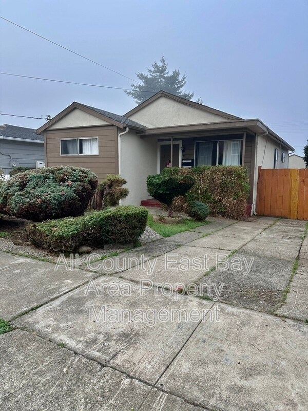
1529 Richmond St
El Cerrito, CA 94530
Today
|
Edit
Favorites
510-900-4839
-
Bedrooms
3
-
Bathrooms
1
-
Square Feet
1,107 sq ft
-
Available
Available Now
1529 Richmond St

Favorites
About This Home
$2,995 deposit,
Available Now
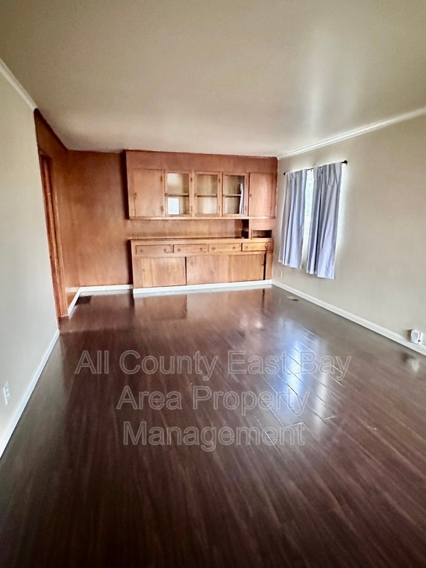
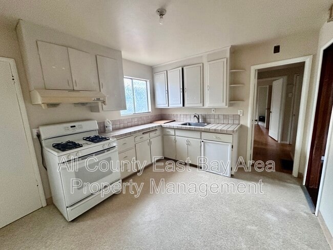
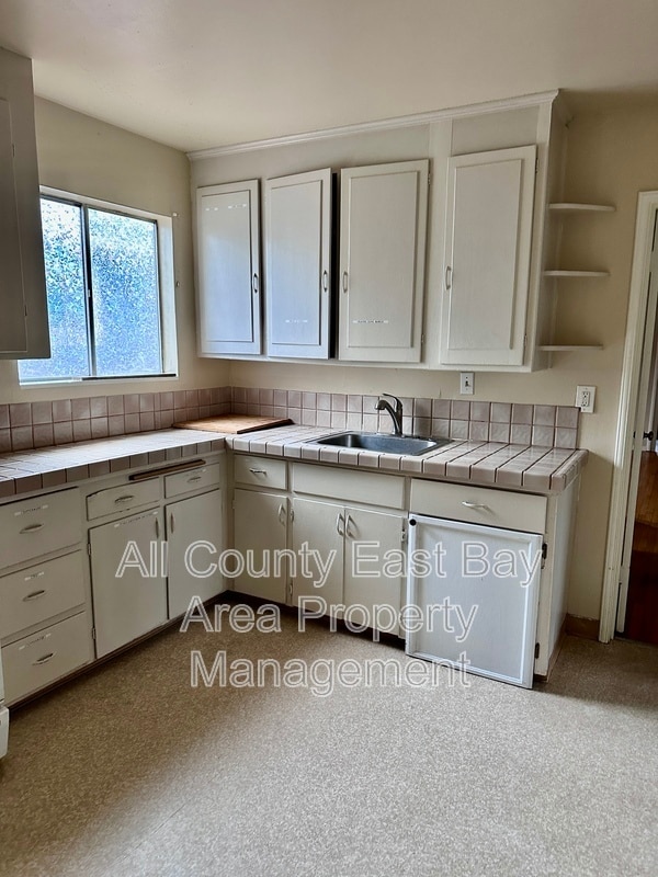
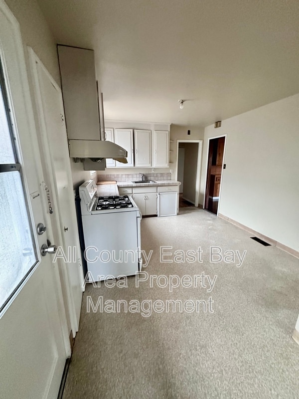
This lovely three-bedroom, one-bath home has just become available! Conveniently located within a half mile of BART, this home offers excellent access to shopping, parks, and major freeways. Enjoy the comfort of hardwood floors throughout most of the home, a spacious driveway with plenty of parking, and a garage perfect for storage or hobbies. Washer and dryer hookups are included for added convenience. This is a wonderful opportunity to live in a quiet, well-connected El Cerrito neighborhood — close to everything you need! Contact us today to schedule a viewing.
1529 Richmond St is a house located in Contra Costa County and the 94530 ZIP Code. This area is served by the West Contra Costa Unified attendance zone.
* Price shown is base rent. Excludes user-selected optional fees and variable or usage-based fees and required charges due at or prior to move-in or at move-out. Price, availability, fees, and any applicable rent special are subject to change without notice.
* Square footage definitions vary. Displayed square footage is approximate.
Fees and Policies
The fees below are based on community-supplied data and may exclude additional fees and utilities.
- One-Time Basics
- Due at Move-In
- Security Deposit - Refundable$2,995
- Due at Move-In
Property Fee Disclaimer: Based on community-supplied data and independent market research. Subject to change without notice. May exclude fees for mandatory or optional services and usage-based utilities.
Contact
- Phone Number
- Contact
Location
Get Directions
El Cerrito is a suburban Bay Area city positioned right between Berkeley and Richmond. Predominately a residential community, the local rental market is huge, and ranges from luxury apartments to condos to single-family homes on quiet neighborhood streets. The area offers ample opportunities to spend quality time outdoors: Hillside Natural Area provides great views of San Francisco Bay, and the sprawling Wildcat Canyon Regional Park is loaded with trails through the unspoiled rolling hills. The close proximity to larger cities like San Francisco and Oakland makes El Cerrito a popular option for commuters, and BART rail service makes it easy to get around the area without having to drive.
Learn more about living in El Cerrito
Education
| Colleges & Universities | Distance | ||
|---|---|---|---|
| Colleges & Universities | Distance | ||
| Drive: | 9 min | 5.3 mi | |
| Drive: | 12 min | 6.6 mi | |
| Drive: | 16 min | 7.6 mi | |
| Drive: | 13 min | 9.2 mi |
1529 Richmond St is within 9 minutes or 5.3 miles from Contra Costa College. It is also near Berkeley City College and UC Berkeley.
Schools


Public Elementary School
Grades K-5
270 Students
Nearby
Public Elementary School
Grades K-6
465 Students
Attendance Zone
Public Middle School
Grades 7-8
681 Students
Attendance Zone
Public High School
Grades 9-12
1,522 Students
Attendance Zone
Private Elementary, Middle & High School
Grades PK-12
Nearby
Private Elementary, Middle & High School
Grades K-11
31 Students
Nearby
Private Elementary, Middle & High School
Grades K-11
Nearby
Private Elementary & Middle School
Grades K-8
189 Students
Nearby
School data provided by
 The GreatSchools Rating helps parents compare schools within a state based on a variety of school quality indicators and provides a helpful picture of how effectively each school serves all of its students. Ratings are on a scale of 1 (below average) to 10 (above average) and can include test scores, college readiness, academic progress, advanced courses, equity, discipline and attendance data. We also advise parents to visit schools, consider other information on school performance and programs, and consider family needs as part of the school selection process.
View GreatSchools Rating Methodology
Data provided by GreatSchools.org © 2025. All rights reserved.
View GreatSchools Rating Methodology
Data provided by GreatSchools.org © 2025. All rights reserved.
Transportation options available in El Cerrito include El Cerrito Del Norte, located 0.5 mile from 1529 Richmond St. 1529 Richmond St is near Metro Oakland International, located 19.6 miles or 27 minutes away, and San Francisco International, located 27.2 miles or 40 minutes away.
| Transit / Subway | Distance | ||
|---|---|---|---|
| Transit / Subway | Distance | ||
|
|
Walk: | 10 min | 0.5 mi |
|
|
Walk: | 10 min | 0.5 mi |
|
|
Drive: | 4 min | 1.6 mi |
|
|
Drive: | 6 min | 3.1 mi |
|
|
Drive: | 11 min | 6.0 mi |
| Commuter Rail | Distance | ||
|---|---|---|---|
| Commuter Rail | Distance | ||
| Drive: | 7 min | 3.3 mi | |
|
|
Drive: | 8 min | 5.2 mi |
|
|
Drive: | 10 min | 7.0 mi |
|
|
Drive: | 16 min | 11.1 mi |
| Drive: | 21 min | 14.8 mi |
| Airports | Distance | ||
|---|---|---|---|
| Airports | Distance | ||
|
Metro Oakland International
|
Drive: | 27 min | 19.6 mi |
|
San Francisco International
|
Drive: | 40 min | 27.2 mi |
Time and distance from 1529 Richmond St.
| Shopping Centers | Distance | ||
|---|---|---|---|
| Shopping Centers | Distance | ||
| Walk: | 12 min | 0.6 mi | |
| Walk: | 14 min | 0.8 mi | |
| Walk: | 18 min | 1.0 mi |
1529 Richmond St has 3 shopping centers within 1.0 mile, which is about a 18-minute walk. The miles and minutes will be for the farthest away property.
| Parks and Recreation | Distance | ||
|---|---|---|---|
| Parks and Recreation | Distance | ||
|
Wildcat Canyon Regional Park
|
Drive: | 6 min | 2.2 mi |
|
Blake Garden
|
Drive: | 6 min | 2.6 mi |
|
Point Isabel Regional Shoreline
|
Drive: | 8 min | 2.9 mi |
|
Marina Park & Green
|
Drive: | 7 min | 3.2 mi |
|
Shimada Friendship Park
|
Drive: | 8 min | 3.7 mi |
1529 Richmond St has 5 parks within 3.7 miles, including Blake Garden, Wildcat Canyon Regional Park, and Point Isabel Regional Shoreline.
| Hospitals | Distance | ||
|---|---|---|---|
| Hospitals | Distance | ||
| Drive: | 15 min | 8.2 mi | |
| Drive: | 13 min | 9.1 mi | |
| Drive: | 12 min | 9.1 mi |
1529 Richmond St has 3 hospitals within 9.1 miles, the nearest is Alta Bates Summit Medical Center - Alta Bates Campus which is 8.2 miles away and a 15 minute drive.
| Military Bases | Distance | ||
|---|---|---|---|
| Military Bases | Distance | ||
| Drive: | 6 min | 2.2 mi | |
| Drive: | 8 min | 4.2 mi | |
| Drive: | 18 min | 10.2 mi |
1529 Richmond St has 3 military bases within 10.2 miles, the nearest is Military Reservation which is 2.2 miles away and a 6 minute drive.
You May Also Like
Similar Rentals Nearby


What Are Walk Score®, Transit Score®, and Bike Score® Ratings?
Walk Score® measures the walkability of any address. Transit Score® measures access to public transit. Bike Score® measures the bikeability of any address.
What is a Sound Score Rating?
A Sound Score Rating aggregates noise caused by vehicle traffic, airplane traffic and local sources

1529 Richmond St
El Cerrito, CA 94530