
$1,700
/ Month
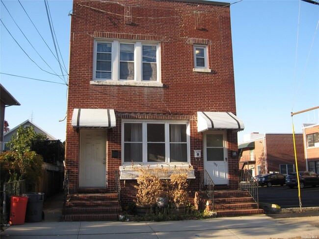
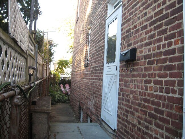
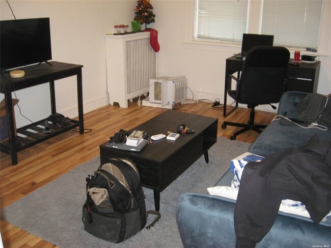
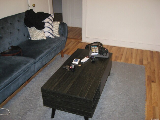
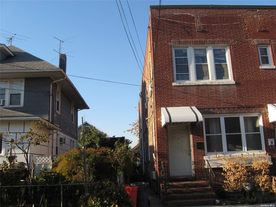
152 Garfield Ave Unit BkLeft
Mineola, NY 11501
2 Weeks Ago
|
Edit
Favorites
152 Garfield Ave Unit BkLeft

Favorites
Check Back Soon for Upcoming Availability
| Beds | Baths | Average SF |
|---|---|---|
| 1 Bedroom 1 Bedroom 1 Br | 1 Bath 1 Bath 1 Ba | 435 SF |
About This Property
Newly Renovated First Floor One bedroom Apt with Separate Entrance on Left Side of Building,Eat in Kitchen New Appliances,New Hardwood Floors Living Room and Bedroom,Good Location,Close to All Transportation Buses,L.I.R.R.,30 Minutes to N.Y.C. Shopping,Schools and Hospitals,Close to Winthrop/NYU Langone and Northwell/North Shore University Hospital Based on information submitted to the MLS GRID as of [see last changed date above]. All data is obtained from various sources and may not have been verified by broker or MLS GRID. Supplied Open House Information is subject to change without notice. All information should be independently reviewed and verified for accuracy. Properties may or may not be listed by the office/agent presenting the information. Some IDX listings have been excluded from this website. Prices displayed on all Sold listings are the Last Known Listing Price and may not be the actual selling price.
152 Garfield Ave is an apartment community located in Nassau County and the 11501 ZIP Code.
152 Garfield Ave,
Mineola,
NY
11501
Mineola carries real weight for such a compact place — it serves as the county seat of Nassau County, placing government offices, courthouses, and civic infrastructure at its center on Long Island, about 25 miles east of New York City. The village covers just two square miles, yet that small footprint houses a dense, active community with a well-established healthcare corridor anchored by NYU Langone Hospital–Long Island. Its position along the Long Island Rail Road's Main Line makes commuting into Manhattan or out toward the east end of the island genuinely straightforward.
The housing stock reflects a range of options, from traditional two-story homes to mid-rise apartment communities suited for those who want walkable access to the village core. Jericho Turnpike and Mineola Avenue form the main commercial spines, lined with locally rooted restaurants, service businesses, and shops.
Learn more about living in Mineola
Education
| Colleges & Universities | Distance | ||
|---|---|---|---|
| Colleges & Universities | Distance | ||
| Drive: | 7 min | 2.7 mi | |
| Drive: | 8 min | 3.9 mi | |
| Drive: | 8 min | 4.2 mi | |
| Drive: | 10 min | 4.8 mi |
152 Garfield Ave Unit BkLeft is within 7 minutes or 2.7 miles from Adelphi University. It is also near SUNY Nassau Community College and Hofstra University.
Transportation options available in Mineola include Jamaica-179 Street, located 8.7 miles from 152 Garfield Ave Unit BkLeft. 152 Garfield Ave Unit BkLeft is near John F Kennedy International, located 14.3 miles or 25 minutes away, and LaGuardia, located 16.1 miles or 27 minutes away.
| Transit / Subway | Distance | ||
|---|---|---|---|
| Transit / Subway | Distance | ||
|
|
Drive: | 16 min | 8.7 mi |
|
|
Drive: | 17 min | 9.1 mi |
|
|
Drive: | 19 min | 9.6 mi |
|
|
Drive: | 18 min | 9.7 mi |
|
|
Drive: | 19 min | 10.1 mi |
| Commuter Rail | Distance | ||
|---|---|---|---|
| Commuter Rail | Distance | ||
|
|
Walk: | 9 min | 0.5 mi |
|
|
Drive: | 3 min | 1.3 mi |
|
|
Drive: | 4 min | 2.1 mi |
|
|
Drive: | 5 min | 2.1 mi |
|
|
Drive: | 5 min | 2.2 mi |
| Airports | Distance | ||
|---|---|---|---|
| Airports | Distance | ||
|
John F Kennedy International
|
Drive: | 25 min | 14.3 mi |
|
LaGuardia
|
Drive: | 27 min | 16.1 mi |
Walkability Near 152 Garfield Ave Mineola, NY 11501
Getting Around
 What do Walkability, Transit, Drivability, and Bikeability mean?
Walkability measures the walking distance to day-to-day needs.
Transit measures access to public transportation.
Drivability measures congestion, parking availability, and access to major roads.
Bikeability measures the suitability for cycling.
How It Works
What do Walkability, Transit, Drivability, and Bikeability mean?
Walkability measures the walking distance to day-to-day needs.
Transit measures access to public transportation.
Drivability measures congestion, parking availability, and access to major roads.
Bikeability measures the suitability for cycling.
How It Works
Exceptionally Walkable
Walkability
90
/ 100
Strong Public Transit
Transit
80
/ 100
Fairly Drivable
Drivability
40
/ 100
Fairly Bikeable
Bikeability
50
/ 100
Scores provided by
Busy
Soundscore™
67
/ 100
Traffic
BusyAirport
CalmBusinesses
ActiveScores provided by
HowLoud What is a Sound Score Rating? A Sound Score Rating aggregates noise caused by vehicle traffic, airplane traffic and local sources. How It WorksTime and distance from 152 Garfield Ave Unit BkLeft.
| Shopping Centers | Distance | ||
|---|---|---|---|
| Shopping Centers | Distance | ||
| Drive: | 3 min | 1.4 mi | |
| Drive: | 4 min | 1.5 mi | |
| Drive: | 5 min | 2.0 mi |
152 Garfield Ave Unit BkLeft has 3 shopping centers within 2.0 miles, which is about a 5-minute drive. The miles and minutes will be for the farthest away property.
| Parks and Recreation | Distance | ||
|---|---|---|---|
| Parks and Recreation | Distance | ||
|
Clark Botanic Garden
|
Drive: | 5 min | 2.5 mi |
|
Long Island Children's Museum
|
Drive: | 7 min | 3.3 mi |
|
Old Westbury Gardens
|
Drive: | 7 min | 3.5 mi |
|
Hofstra University Arboretum
|
Drive: | 9 min | 4.7 mi |
|
Queens County Farm Museum
|
Drive: | 11 min | 5.9 mi |
152 Garfield Ave Unit BkLeft has 5 parks within 5.9 miles, including Clark Botanic Garden, Long Island Children's Museum, and Old Westbury Gardens.
| Hospitals | Distance | ||
|---|---|---|---|
| Hospitals | Distance | ||
| Walk: | 10 min | 0.5 mi | |
| Drive: | 9 min | 4.3 mi | |
| Drive: | 10 min | 5.1 mi |
152 Garfield Ave Unit BkLeft has 3 hospitals within 5.1 miles, the nearest is NYU Langone Hospital - Long Island which is 0.5 mile away and a 10 minute walk.
| Military Bases | Distance | ||
|---|---|---|---|
| Military Bases | Distance | ||
| Drive: | 19 min | 10.7 mi | |
| Drive: | 38 min | 23.1 mi | |
| Drive: | 47 min | 24.6 mi |
152 Garfield Ave Unit BkLeft has 3 military bases within 24.6 miles, the nearest is Fort Totten US Govt Reservation which is 10.7 miles away and a 19 minute drive.
You May Also Like
Similar Rentals Nearby


What Are Walk Score®, Transit Score®, and Bike Score® Ratings?
Walk Score® measures the walkability of any address. Transit Score® measures access to public transit. Bike Score® measures the bikeability of any address.
What is a Sound Score Rating?
A Sound Score Rating aggregates noise caused by vehicle traffic, airplane traffic and local sources.
152 Garfield Ave
Mineola, NY 11501