$2,395
/ Month
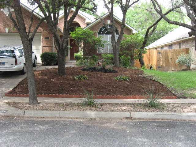
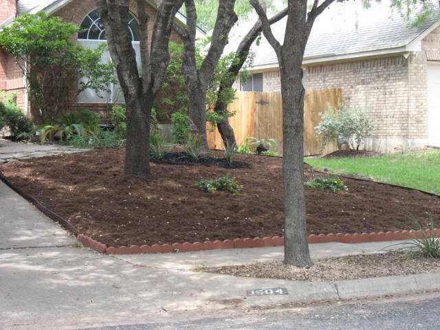
1504 Visalia Ln
Austin, TX 78727
2 Weeks Ago
|
Edit
Favorites
1504 Visalia Ln

Favorites
Check Back Soon for Upcoming Availability
| Beds | Baths | Average SF |
|---|---|---|
| 3 Bedrooms 3 Bedrooms 3 Br | 2 Baths 2 Baths 2 Ba | 1,599 SF |
Fees and Policies
The fees below are based on community-supplied data and may exclude additional fees and utilities.
- Dogs Allowed
-
Fees not specified
-
Weight limit--
-
Pet Limit--
About This Property
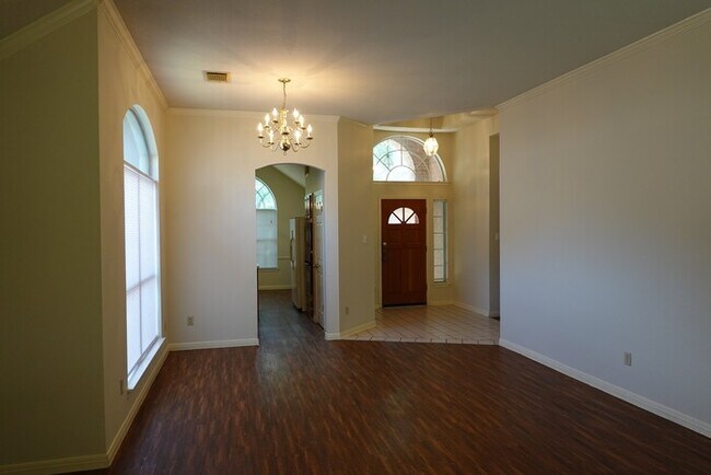
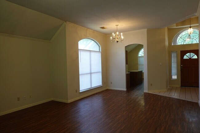
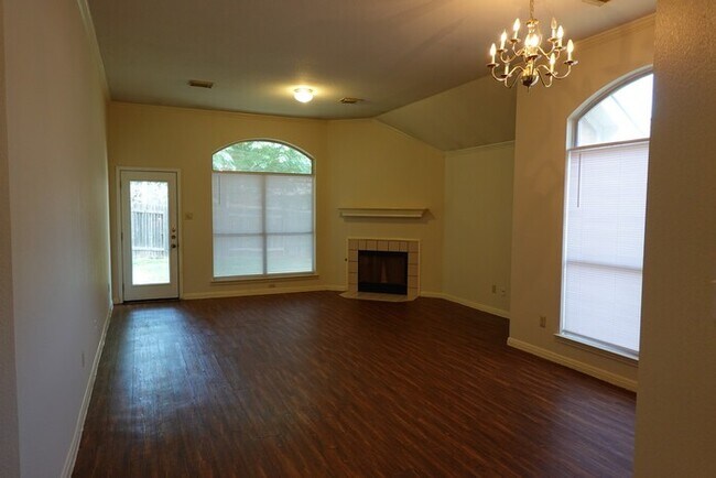
MAKE YOUR APPOINTMENT TODAY!! THIS SCOFIELD FARM 3 BED / 2 BATH HOME IS IN A FANTASTIC LOCATION WITH ACCESS TO IH 35 / PARMER LANE / MOPAC. LOVELY HOME WITH NICE SIZED KITCHEN FOR ENTERTAINING. MOTHER-IN-LAW PLAN, GREAT COMMUNITY WITH SUPER NEIGHBORHOOD ACTIVITIES - COMMON GROUNDS, PLAY GROUND AND JOGGING/BIKING PATH BRING YOUR CLIENTS - HURRY! THIS PROPERTY WILL NOT LAST LONG - BRING YOUR FAMILY! Contact us to schedule a showing.
1504 Visalia Ln is a house located in Travis County and the 78727 ZIP Code. This area is served by the Pflugerville Independent attendance zone.
Location
Get Directions
Located roughly midway between Downtown Austin and Round Rock, Lamplight Village is a tranquil suburban community accessible to both I-35 and the MoPac Expressway. Lamplight Village is predominantly residential, offering an array of apartments and houses for rent along tree-lined streets.
In addition to its many residences, Lamplight Village provides easy access to numerous shopping centers, including Parmer Crossing, the Shops at Tech Ridge, and the Domain. Lamplight Village is also just a short drive away from scenic outdoor destinations like Scofield Farms Neighborhood Park, Katherine Fleischer Park, and Walnut Creek Metropolitan Park. The community’s close proximity to major employers like Saint David’s North Austin Medical Center, Austin Community College Northridge Campus, and the Domain affords many Lamplight Village residents short commute times.
Learn more about living in Lamplight VillageBelow are rent ranges for similar nearby apartments
Education
| Colleges & Universities | Distance | ||
|---|---|---|---|
| Colleges & Universities | Distance | ||
| Drive: | 5 min | 2.0 mi | |
| Drive: | 10 min | 5.5 mi | |
| Drive: | 16 min | 10.8 mi | |
| Drive: | 23 min | 14.3 mi |
1504 Visalia Ln is within 5 minutes or 2.0 miles from Austin C.C., Northridge Campus. It is also near The Art Institute of Austin and University of Texas at Austin.
Schools


Public Elementary School
Grades PK-5
456 Students
Attendance Zone
Public Middle School
Grades 6-8
718 Students
Attendance Zone
Public High School
Grades 9-12
1,663 Students
Attendance Zone
Private Elementary, Middle & High School
Grades PK-12
187 Students
Nearby
Private Elementary School
Grades PK-6
9 Students
Nearby
School data provided by
 The GreatSchools Rating helps parents compare schools within a state based on a variety of school quality indicators and provides a helpful picture of how effectively each school serves all of its students. Ratings are on a scale of 1 (below average) to 10 (above average) and can include test scores, college readiness, academic progress, advanced courses, equity, discipline and attendance data. We also advise parents to visit schools, consider other information on school performance and programs, and consider family needs as part of the school selection process.
View GreatSchools Rating Methodology
Data provided by GreatSchools.org © 2025. All rights reserved.
View GreatSchools Rating Methodology
Data provided by GreatSchools.org © 2025. All rights reserved.
Transportation options available in Austin include Kramer Station, located 3.2 miles from 1504 Visalia Ln. 1504 Visalia Ln is near Austin-Bergstrom International, located 22.3 miles or 35 minutes away.
| Transit / Subway | Distance | ||
|---|---|---|---|
| Transit / Subway | Distance | ||
| Drive: | 7 min | 3.2 mi | |
| Drive: | 7 min | 3.4 mi | |
| Drive: | 8 min | 3.5 mi | |
| Drive: | 12 min | 6.5 mi | |
| Drive: | 12 min | 7.8 mi |
| Commuter Rail | Distance | ||
|---|---|---|---|
| Commuter Rail | Distance | ||
|
|
Drive: | 21 min | 13.5 mi |
|
|
Drive: | 35 min | 25.1 mi |
| Airports | Distance | ||
|---|---|---|---|
| Airports | Distance | ||
|
Austin-Bergstrom International
|
Drive: | 35 min | 22.3 mi |
Time and distance from 1504 Visalia Ln.
| Shopping Centers | Distance | ||
|---|---|---|---|
| Shopping Centers | Distance | ||
| Walk: | 11 min | 0.6 mi | |
| Walk: | 12 min | 0.7 mi | |
| Walk: | 17 min | 0.9 mi |
1504 Visalia Ln has 3 shopping centers within 0.9 mile, which is about a 17-minute walk. The miles and minutes will be for the farthest away property.
| Parks and Recreation | Distance | ||
|---|---|---|---|
| Parks and Recreation | Distance | ||
|
Walnut Creek Park
|
Drive: | 3 min | 1.6 mi |
|
Balcones District Park
|
Drive: | 7 min | 3.2 mi |
|
Copperfield Nature Trail and Park
|
Drive: | 7 min | 3.6 mi |
|
The Stephen F. Austin Planetarium
|
Drive: | 9 min | 4.5 mi |
|
Jourdan-Bachman Pioneer Farms
|
Drive: | 10 min | 5.2 mi |
1504 Visalia Ln has 5 parks within 5.2 miles, including Walnut Creek Park, Copperfield Nature Trail and Park, and Balcones District Park.
| Hospitals | Distance | ||
|---|---|---|---|
| Hospitals | Distance | ||
| Drive: | 5 min | 2.2 mi | |
| Drive: | 10 min | 5.3 mi | |
| Drive: | 11 min | 6.6 mi |
1504 Visalia Ln has 3 hospitals within 6.6 miles, the nearest is North Austin Medical Center which is 2.2 miles away and a 5 minute drive.
| Military Bases | Distance | ||
|---|---|---|---|
| Military Bases | Distance | ||
| Drive: | 79 min | 63.2 mi | |
| Drive: | 94 min | 77.6 mi |
1504 Visalia Ln is 63.2 miles from Fort Hood, and is convenient to other military bases, including Randolph Air Force Base.
You May Also Like
Similar Rentals Nearby


What Are Walk Score®, Transit Score®, and Bike Score® Ratings?
Walk Score® measures the walkability of any address. Transit Score® measures access to public transit. Bike Score® measures the bikeability of any address.
What is a Sound Score Rating?
A Sound Score Rating aggregates noise caused by vehicle traffic, airplane traffic and local sources

1504 Visalia Ln
Austin, TX 78727