
WOODSIDE VILLAGE
2547 Temple Ave,
West Covina, CA 91792
$1,867 - $2,886
Studio - 2 Beds

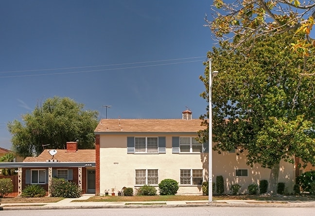
At 149 S Bandy Ave in West Covina, experience fine living. The address for this community is at 149 S. Bandy Ave in West Covina. Come for a visit to check out the apartment floorplan options. Here at this community, the professional leasing staff is ready to match you with your new apartment. Visit 149 S Bandy Ave today.
149 S Bandy Ave is an apartment community located in Los Angeles County and the 91790 ZIP Code. This area is served by the West Covina Unified School District attendance zone.
Welcome to West Covina, a suburban community in the San Gabriel Valley, located 19 miles east of downtown Los Angeles. The city offers various housing options throughout its established neighborhoods. The South Hills district features scenic mountain views, while the Plaza West Covina area serves as the city's main retail destination with its extensive shopping and dining options.
West Covina's central location makes it convenient for both work and leisure. The West Covina Sportsplex, spanning 315 acres, offers tennis courts, baseball fields, and walking trails. Commuters benefit from public transportation options, including the Go West shuttle service connecting to major transit hubs. The city, incorporated in 1923, has grown from its agricultural roots into a modern suburban community. Local landmarks include Plaza West Covina mall and Big League Dreams Sports Park.
Learn more about living in West CovinaCompare neighborhood and city base rent averages by bedroom.
| San Gabriel Valley | West Covina, CA | |
|---|---|---|
| Studio | $1,674 | $1,575 |
| 1 Bedroom | $1,876 | $2,015 |
| 2 Bedrooms | $2,247 | $2,473 |
| 3 Bedrooms | $2,694 | $3,048 |
| Colleges & Universities | Distance | ||
|---|---|---|---|
| Colleges & Universities | Distance | ||
| Drive: | 12 min | 6.1 mi | |
| Drive: | 13 min | 6.4 mi | |
| Drive: | 11 min | 6.9 mi | |
| Drive: | 12 min | 8.1 mi |


Transportation options available in West Covina include Irwindale Station, located 5.2 miles from 149 S Bandy Ave. 149 S Bandy Ave is near Ontario International, located 21.0 miles or 27 minutes away, and Long Beach (Daugherty Field), located 28.6 miles or 38 minutes away.
| Transit / Subway | Distance | ||
|---|---|---|---|
| Transit / Subway | Distance | ||
| Drive: | 10 min | 5.2 mi | |
| Drive: | 10 min | 5.3 mi | |
| Drive: | 14 min | 6.4 mi | |
| Drive: | 15 min | 8.4 mi | |
| Drive: | 16 min | 9.8 mi |
| Commuter Rail | Distance | ||
|---|---|---|---|
| Commuter Rail | Distance | ||
|
|
Drive: | 7 min | 3.4 mi |
|
|
Drive: | 7 min | 3.6 mi |
|
|
Drive: | 11 min | 7.5 mi |
|
|
Drive: | 16 min | 9.4 mi |
|
|
Drive: | 16 min | 12.2 mi |
| Airports | Distance | ||
|---|---|---|---|
| Airports | Distance | ||
|
Ontario International
|
Drive: | 27 min | 21.0 mi |
|
Long Beach (Daugherty Field)
|
Drive: | 38 min | 28.6 mi |
Scores provided by
Traffic
-Airport
-Businesses
-Scores provided by
HowLoud What is a Sound Score Rating? A Sound Score Rating aggregates noise caused by vehicle traffic, airplane traffic and local sources. How It WorksTime and distance from 149 S Bandy Ave.
| Shopping Centers | Distance | ||
|---|---|---|---|
| Shopping Centers | Distance | ||
| Walk: | 5 min | 0.3 mi | |
| Walk: | 7 min | 0.4 mi | |
| Walk: | 9 min | 0.5 mi |
| Parks and Recreation | Distance | ||
|---|---|---|---|
| Parks and Recreation | Distance | ||
|
Covina Park
|
Drive: | 6 min | 2.7 mi |
|
Galster Wilderness Park Nature Center
|
Drive: | 7 min | 3.0 mi |
|
Santa Fe Dam Recreation Area
|
Drive: | 18 min | 6.0 mi |
|
Santa Fe Dam Nature Center
|
Drive: | 18 min | 6.0 mi |
|
Schabarum Regional Park
|
Drive: | 16 min | 7.7 mi |
| Hospitals | Distance | ||
|---|---|---|---|
| Hospitals | Distance | ||
| Drive: | 4 min | 1.8 mi | |
| Drive: | 6 min | 3.0 mi | |
| Drive: | 6 min | 4.4 mi |
| Military Bases | Distance | ||
|---|---|---|---|
| Military Bases | Distance | ||
| Drive: | 40 min | 30.6 mi | |
| Drive: | 43 min | 35.2 mi | |
| Drive: | 53 min | 38.5 mi |
Pets Allowed Fitness Center Pool In Unit Washer & Dryer Clubhouse Balcony
What Are Walk Score®, Transit Score®, and Bike Score® Ratings?
Walk Score® measures the walkability of any address. Transit Score® measures access to public transit. Bike Score® measures the bikeability of any address.
What is a Sound Score Rating?
A Sound Score Rating aggregates noise caused by vehicle traffic, airplane traffic and local sources.
149 S Bandy Ave
West Covina, CA 91790


