
$3,000
/ Month
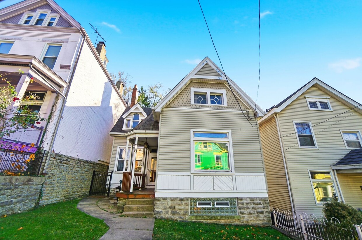
149 Parker St
Cincinnati, OH 45219
1 Day Ago
|
Edit
Favorites
513-386-9526
-
Bedrooms
5
-
Bathrooms
2.5
-
Square Feet
1,384 sq ft
-
Available
Available Aug 1, 2026
149 Parker St

Favorites
About This Home
$3,000 deposit,
Available Aug 1, 2026
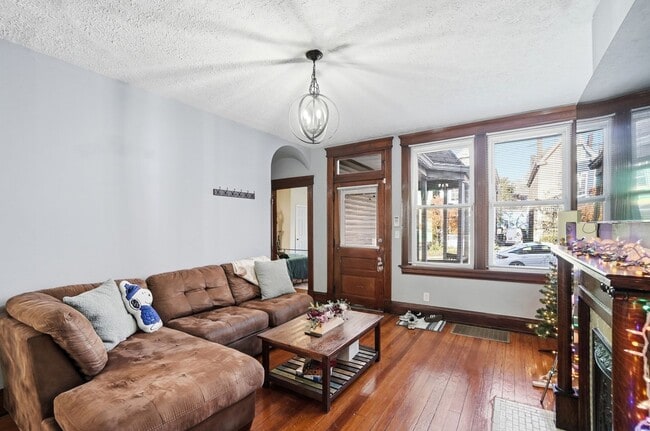
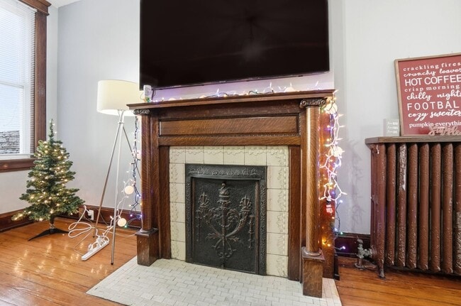
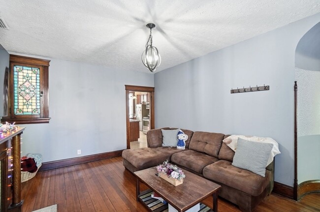
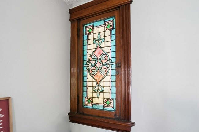
Welcome to 149 Parker St., a spacious and well-appointed home located in the vibrant city of Cincinnati, OH. This property boasts five generously sized bedrooms and 2.5 bathrooms, offering ample space for comfortable living. Perfectly situated in a convenient location, this home is ideal for those seeking proximity to the UC campus. As a bonus, it is also an excellent choice for college housing. With its blend of comfort, space, and prime location, 149 Parker St. is a fantastic choice for those who value convenience and accessibility. Experience the best of Cincinnati living at 149 Parker St.
Unique Features
- close to uc campus
- Trash and Sewage
- college housing
- convenient location
149 Parker St is a house located in Hamilton County and the 45219 ZIP Code. This area is served by the Cincinnati Public Schools attendance zone.
* Price shown is base rent. Excludes user-selected optional fees and variable or usage-based fees and required charges due at or prior to move-in or at move-out. Price, availability, fees, and any applicable rent special are subject to change without notice.
* Square footage definitions vary. Displayed square footage is approximate.
Fees and Policies
The fees below are based on community-supplied data and may exclude additional fees and utilities.
- One-Time Basics
- Due at Move-In
- Security Deposit - Refundable$3,000
- Due at Move-In
Property Fee Disclaimer: Based on community-supplied data and independent market research. Subject to change without notice. May exclude fees for mandatory or optional services and usage-based utilities.
Contact
- Listed by Gibson Property Group | Gibson Property Group
- Phone Number
- Contact
Location
Get Directions
Amenities
- close to uc campus
- Trash and Sewage
- college housing
- convenient location
In Clifton there’s plenty to do and see. The rolling hills, lush parks and green spaces, hip shopping, and affordable apartments create a vibrancy in Clifton that can’t be ignored.
In addition to its active art scene, the neighborhood is encompassing of Mount Storm Park, Edgewood Grove Park, and the Cincinnati State Technical and Community College. Locals enjoy the direct access to Interstate 75, making commutes in and around the city a breeze.
Clifton is just north of the 90-acre Burnet Woods Park and the University of Cincinnati campus. When you have a craving for something sweet or savory, head on over to the Clifton Gaslight District for every kind of cuisine imaginable. Clifton sits atop a hill overlooking the Northside, and Ludlow Avenue has been dubbed Cincinnati’s first “Main Street.
Learn more about living in Clifton
Education
| Colleges & Universities | Distance | ||
|---|---|---|---|
| Colleges & Universities | Distance | ||
| Drive: | 3 min | 1.5 mi | |
| Drive: | 4 min | 1.6 mi | |
| Drive: | 9 min | 3.2 mi | |
| Drive: | 11 min | 3.7 mi |
149 Parker St is within 3 minutes or 1.5 miles from University of Cincinnati. It is also near Univ. of Cincinnati, Medical and Cincinnati State.
Schools


Public Elementary School
Grades PK-6
236 Students
Attendance Zone
Public Elementary, Middle & High School
Grades 5-12
2,582 Students
Attendance Zone
Public Middle & High School
Grades 7-12
1,155 Students
Attendance Zone
Private Elementary & Middle School
Grades PK-8
195 Students
Nearby
Private Elementary, Middle & High School
Grades K-12
131 Students
Nearby
School data provided by
 The GreatSchools Rating helps parents compare schools within a state based on a variety of school quality indicators and provides a helpful picture of how effectively each school serves all of its students. Ratings are on a scale of 1 (below average) to 10 (above average) and can include test scores, college readiness, academic progress, advanced courses, equity, discipline and attendance data. We also advise parents to visit schools, consider other information on school performance and programs, and consider family needs as part of the school selection process.
View GreatSchools Rating Methodology
Data provided by GreatSchools.org © 2025. All rights reserved.
View GreatSchools Rating Methodology
Data provided by GreatSchools.org © 2025. All rights reserved.
Transportation options available in Cincinnati include Brewery District Station, Elm & Henry, located 0.6 mile from 149 Parker St. 149 Parker St is near Cincinnati/Northern Kentucky International, located 15.8 miles or 31 minutes away.
| Transit / Subway | Distance | ||
|---|---|---|---|
| Transit / Subway | Distance | ||
| Walk: | 11 min | 0.6 mi | |
| Walk: | 12 min | 0.7 mi | |
| Walk: | 14 min | 0.8 mi | |
| Walk: | 16 min | 0.9 mi | |
| Drive: | 3 min | 1.2 mi |
| Commuter Rail | Distance | ||
|---|---|---|---|
| Commuter Rail | Distance | ||
|
|
Drive: | 6 min | 2.1 mi |
| Airports | Distance | ||
|---|---|---|---|
| Airports | Distance | ||
|
Cincinnati/Northern Kentucky International
|
Drive: | 31 min | 15.8 mi |
Time and distance from 149 Parker St.
| Shopping Centers | Distance | ||
|---|---|---|---|
| Shopping Centers | Distance | ||
| Drive: | 4 min | 1.4 mi | |
| Drive: | 5 min | 1.8 mi | |
| Drive: | 5 min | 2.1 mi |
149 Parker St has 3 shopping centers within 2.1 miles, which is about a 5-minute drive. The miles and minutes will be for the farthest away property.
| Parks and Recreation | Distance | ||
|---|---|---|---|
| Parks and Recreation | Distance | ||
|
William H. Taft National Historic Site
|
Drive: | 4 min | 1.3 mi |
|
Trailside Nature Center
|
Drive: | 4 min | 1.4 mi |
|
Burnet Woods
|
Drive: | 4 min | 1.7 mi |
|
Duke Energy Children's Museum
|
Drive: | 6 min | 2.1 mi |
|
OMNIMAX Theater
|
Drive: | 6 min | 2.1 mi |
149 Parker St has 5 parks within 2.1 miles, including William H. Taft National Historic Site, Trailside Nature Center, and Burnet Woods.
| Hospitals | Distance | ||
|---|---|---|---|
| Hospitals | Distance | ||
| Drive: | 3 min | 1.2 mi | |
| Drive: | 4 min | 1.5 mi | |
| Drive: | 4 min | 1.7 mi |
149 Parker St has 3 hospitals within 1.7 miles, the nearest is Christ Hospital which is 1.2 miles away and a 3 minute drive.
| Military Bases | Distance | ||
|---|---|---|---|
| Military Bases | Distance | ||
| Drive: | 71 min | 52.5 mi | |
| Drive: | 77 min | 57.5 mi | |
| Drive: | 79 min | 60.8 mi |
149 Parker St has 3 military bases within 60.8 miles, the nearest is Gentile Air Force Station which is 52.5 miles away and a 71 minute drive.
You May Also Like
Similar Rentals Nearby


What Are Walk Score®, Transit Score®, and Bike Score® Ratings?
Walk Score® measures the walkability of any address. Transit Score® measures access to public transit. Bike Score® measures the bikeability of any address.
What is a Sound Score Rating?
A Sound Score Rating aggregates noise caused by vehicle traffic, airplane traffic and local sources

149 Parker St
Cincinnati, OH 45219